Scan the QR code and open PeakVisor on your phone
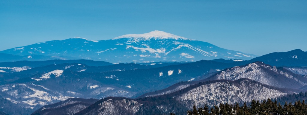
The Horná Orava Protected Landscape Area (PLA) is one of 14 PLAs in Slovakia. The name Horná Orava means Upper Orava in Slovak, as it encompasses the sandstone mountain ranges of the country’s Orava Region. Hiking and bird-watching are two popular activities in the PLA. There are 184 named mountains in CHKO Horná Orava. The highest and most prominent mountain is Babia Góra / Babia Hora (1,725 m / 5,659 ft), which literally translates to Old Wives or Witches Mountain.
Horná Orava PLA (Slovak: Chránená krajinná oblasť Horná Orava) is one of 14 PLAs in Slovakia and is located in the Námestovo and Tvrdošín districts of the Orava Region.
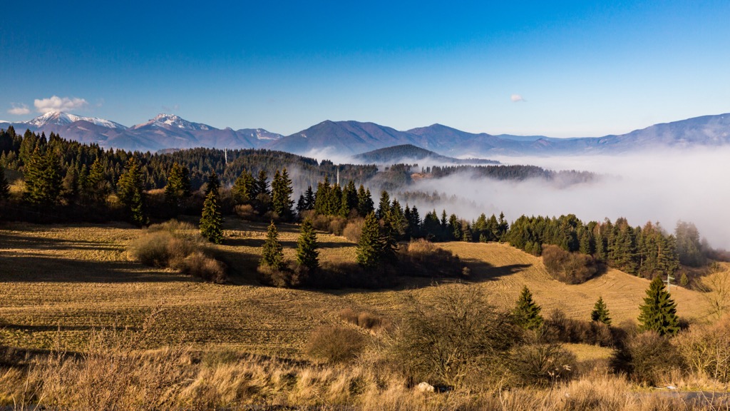
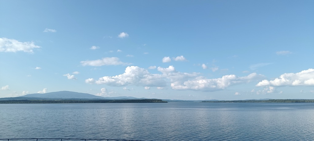
The majestic Babia Hora Mountain guards over the region’s dense forests, peat bogs, traditional villages, and "Sea of Orava" water reservoir. The PLA includes the Oravská Magura, Podbeskydská vrchovina, and Oravské Beskydy mountains, as well as the Orava Basin and Orava Dam.
Formed in 1979, Horná Orava spans 587.38 sq. km (226.81 sq. mi) and has its administration based in Námestovo. The Horná Orava PLA is divided into four zones with varying levels of protection, including the Horná Orava Protected Bird Area and Natura 2000 areas.
Specific local nature reserves within the PLA include Babia Hora, Sosnina, Pilsko, Klinské Raselinisko, Tisovnica, and Paráč, while natural monuments include Hviezdoslavova aleja, Slanický Ostrov, and Váčí Ostrov.
Neighboring areas include Babiogórski Park Narodowy, Bielska Skala, Malá Fatra National Park Protection Zone, Beskidu Śląskiego Landscape Park, Orava River and its tributaries, Tatra National Park, Tatrzański Park Narodowy, and others.
The Horná Orava PLA hosts parts of Oravská Magura, Orava Beskids, Orava Depression, and Basin.
Horná Orava includes flysch mountains, predominantly composed of Magura flysch rocks like sandstones and claystone, which have undergone significant folding over time.
The Orava Depression is primarily situated on the Magura flysch unit of the Outer Western Carpathians. The area's geological layers were formed during the Upper Eocene to Oligocene.
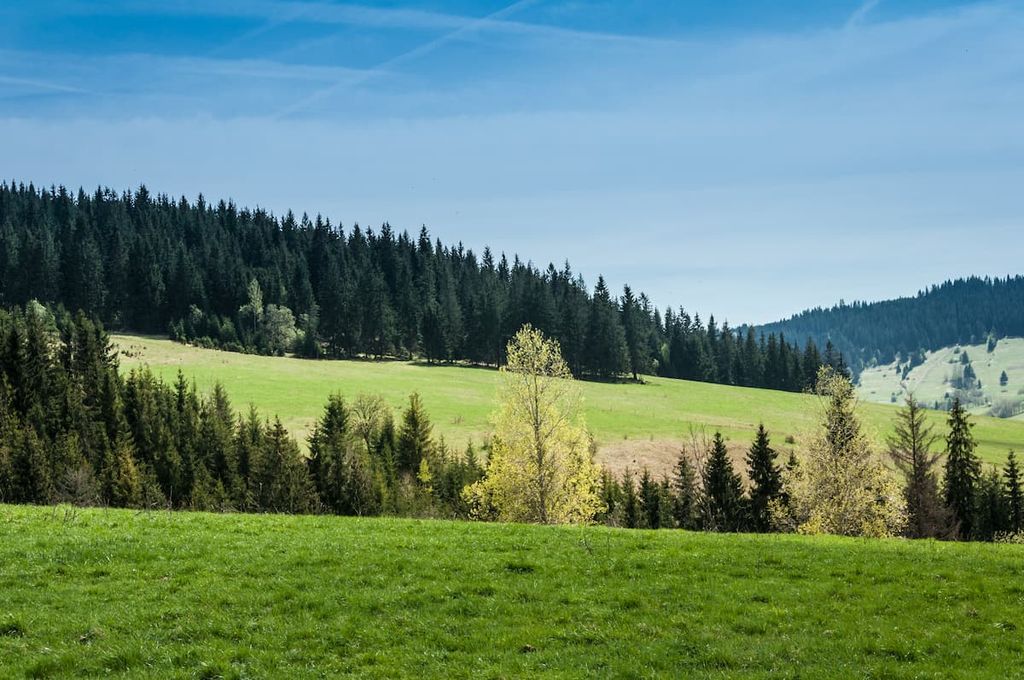
Almost half of the Horná Orava PLA is cloaked by forests. These forests mainly consist of beech-fir vegetation with spruce. However, in areas like Baba Hora, Pilsk, and Paráč peaks, the forests comprise a mix of spruce and mountain ash, while the highest elevations feature alpine meadows.
Horná Orava's fauna is equally rich. Large, elusive mammals like bears, wolves, and lynx inhabit the area, along with more common species like deer, roe deer, and wild boar.
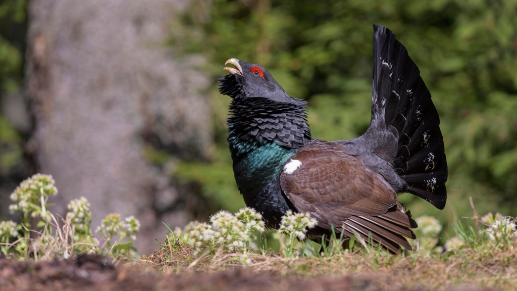
The region is also known for its diverse avifauna and is a top bird-watching destination in Slovakia. Forest birds include grouse, wood grouse, and capercaillie. Birds of prey like the bald eagle, mountain buzzard, and black raven also nest here. The black stork has recently expanded its nesting range into the area, and the Orava Dam lake is a vital habitat for fish and birds.
A notable aspect of the area's vegetation is the diverse peat communities, which include rare and endangered plants such as marsh sedge, white thistle, round-leaved sundew, flooded sedge, pointed sedge, and blueberry willow.
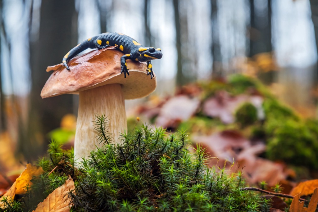
Peat and marsh areas support various reptiles and amphibians, such as Fire salamanders. The area is also home to rare and endangered fish like the blue-eyed yellowtail.
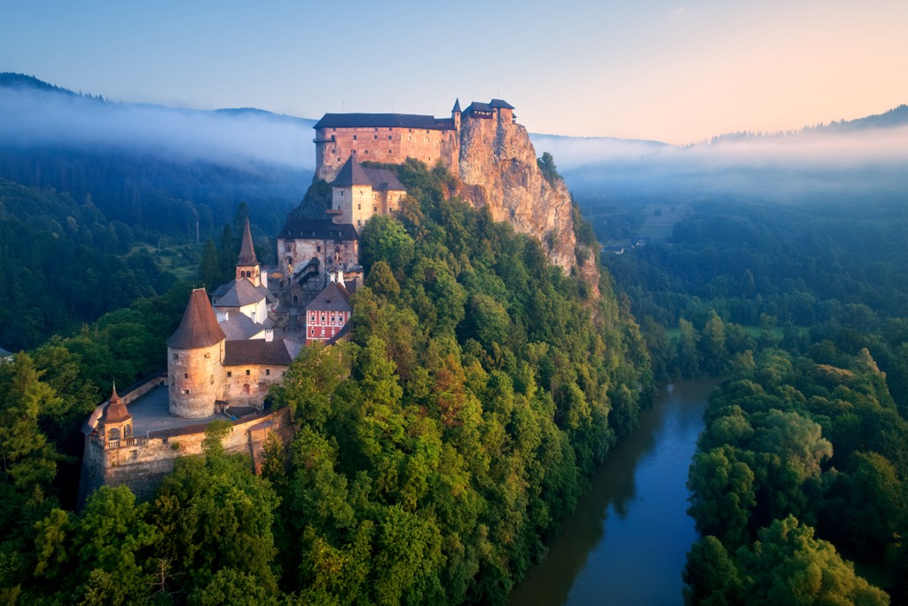
The Horná Orava PLA contains numerous historical monuments, including Orava Castle, one of the best-preserved castles in Slovakia. The region also boasts many churches, chapels, and other sacred monuments.
Orava Castle (Slovak: Oravský hrad) sits on a high rock above the Orava River in Oravský Podzámok. It was built in the Kingdom of Hungary, and its oldest parts date back to the thirteenth century. Originally, Orava Castle replaced a wooden fortification built after the Mongol invasion of Hungary in 1241. The castle has been used to film movies, including scenes from the 1922 film Nosferatu, a German vampire film lauded as one of cinema’s enduring classics.
Agriculture has always been a primary driver of the economy. Meanwhile, tourism and hiking have become elements of the local economy since the nineteenth century. Generally, hiking in the Horná Orava PLA is more accessible for all fitness levels than in the Alps.
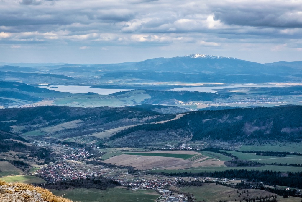
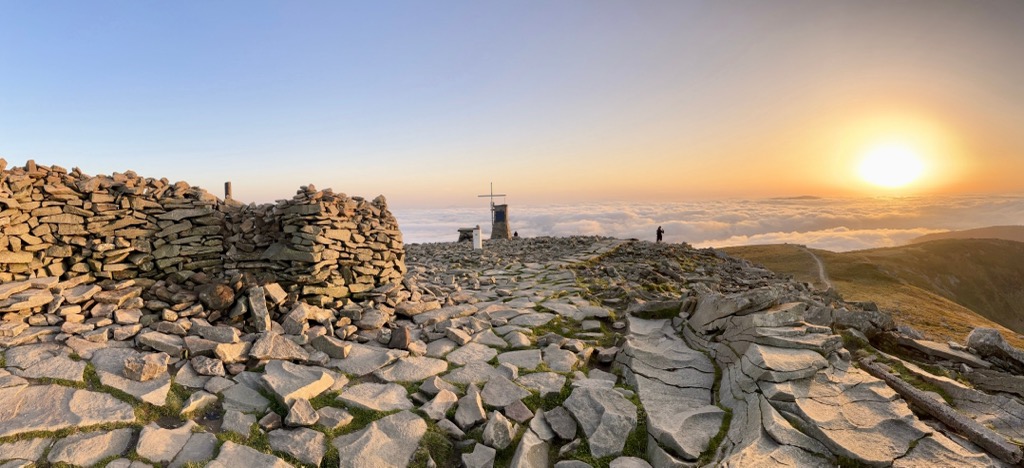
Babia Hora is a popular hiking destination located on the Polish-Slovak border. You can take the yellow trail, known as Perć Akademików, or the red Main Beskid Trail. Babia Hora is renowned for its distinctive shape, reaching 1,725 m (5,659 ft). From the south, its slopes descend sharply to the Orava-Nowy Targ Basin. The mountain is known for severe weather; its local nickname is 'the mother of bad weather.' Come prepared!
This 4.3 km (2.7 mi) trail has 34 stops with signposts describing forestry, local and natural history, and conservation. There are benches and even restrooms along the trail.
The best place to start is near the elementary school in Oravská Lesná. The nature trail, with an elevation gain of only 120 m (394 feet), is educational for both adults and children. If you don't want to walk the entire trail, try the shorter sections, which are 1,300 m (0.8 mi) and 1,700 m (1.1 mi) long.
The Kazimierz Sosnowski Main Beskid Trail is a long-distance hiking trail stretching from Ustroń in the Silesian Beskids to Wołosate in the Bieszczady Mountains. At approximately 496 km (308 mi), it is the longest trail in the Polish mountains, just across the border from Horná Orava.

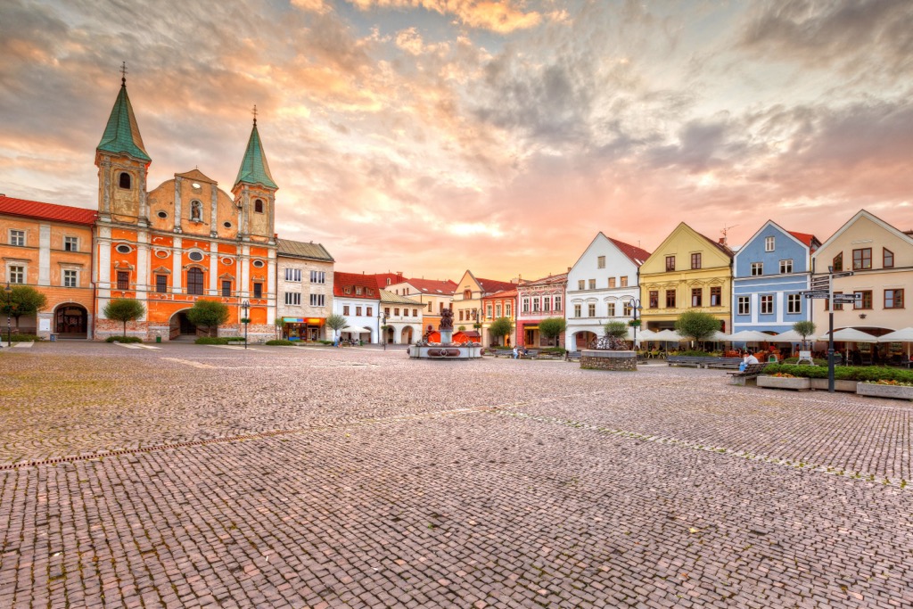
Žilina is a vibrant city in northern Slovakia with a population of around 80,000. It lies at the confluence of the Váh and Kysuca Rivers. The city is known for the Church of St. Stephen the King and the Mariánske Námestie square.
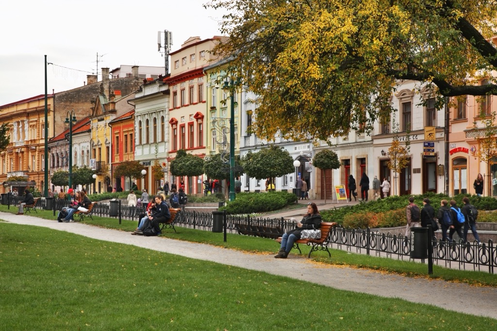
Located in eastern Slovakia, Prešov has a population of about 90,000. The city features notable sites such as the St. Nicholas Cathedral and Hlavná ulica.
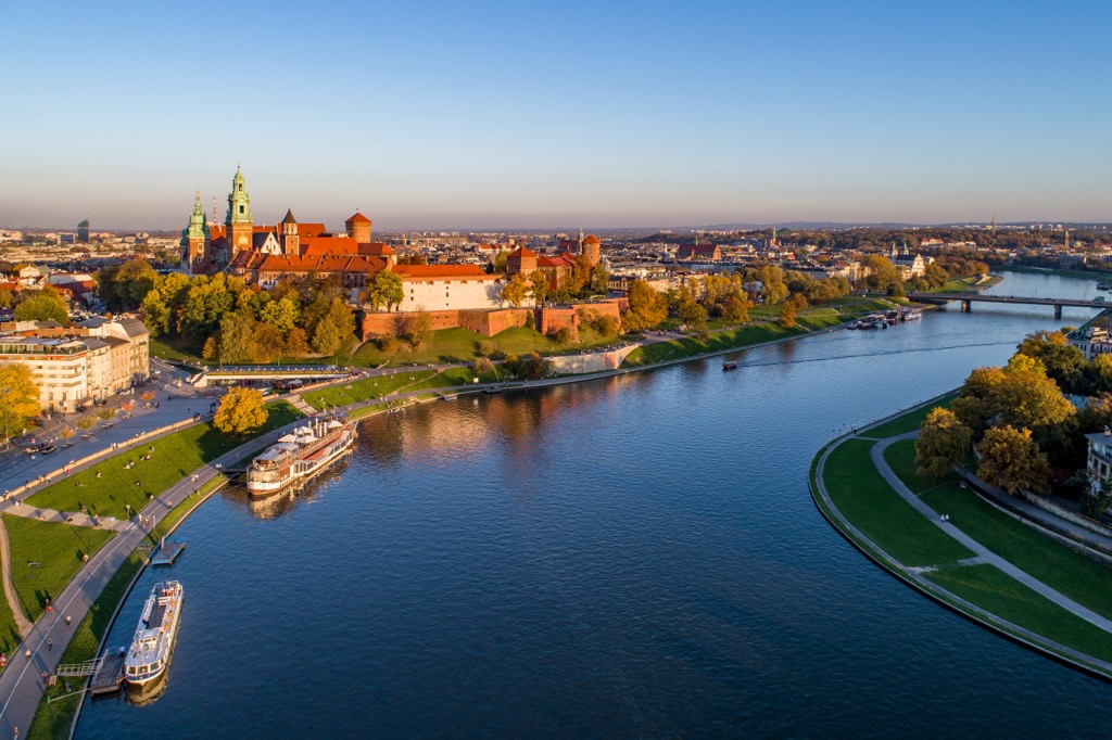
Krakow is one of Poland's oldest and most beautiful cities, with a population of approximately 780,000. It is renowned for its medieval architecture, including the Wawel Castle, and has become popular with tourists in recent years. The city is situated on the Vistula River and features biking and walking paths along its banks.