
Scan the QR code and open PeakVisor on your phone
Ballons des Vosges Regional Nature Park has 597 named peaks. The highest is Grand Ballon at 1,424 m. Other notable peaks include Storkenkopf, Hohneck and Kastelberg.
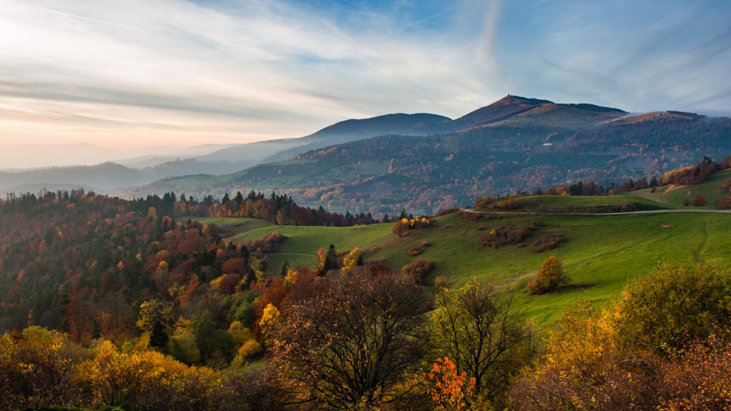
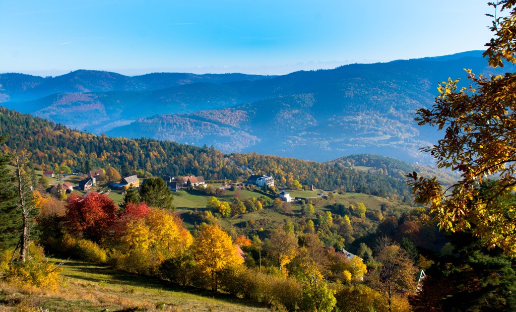
Scale the highest summits in the Vosges Mountains at France's Ballons des Vosges Regional Nature Park. There are 597 named mountains in Ballons des Vosges Regional Nature Park. The highest and most prominent mountain is Grand Ballon (1,424 m/4,672 ft).
Ballons des Vosges Regional Nature Park (Parc Naturel Régional des Ballons des Vosges) is France's largest regional nature park.
It encompasses an area of approximately 2,921 sq km (1,128 sq mi) within the regions of Grand Est and Bourgogne-Franche-Comté. With a population of over 250,000 people, Ballons des Vosges Regional Nature Park is also France's most populated regional nature park.
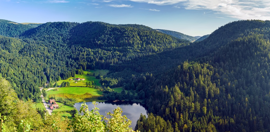
The park stretches from the Sainte-Marie-aux-Mines Valley in the north to the city of Belfort in the south. Ballons des Vosges Regional Nature Park centers around areas of protected woodlands, wetlands, and grasslands within the Vosges Mountains. This area includes the 220 sq km (85 sq mi) Thousand Ponds Plateau (Plateau des Mille Étangs).
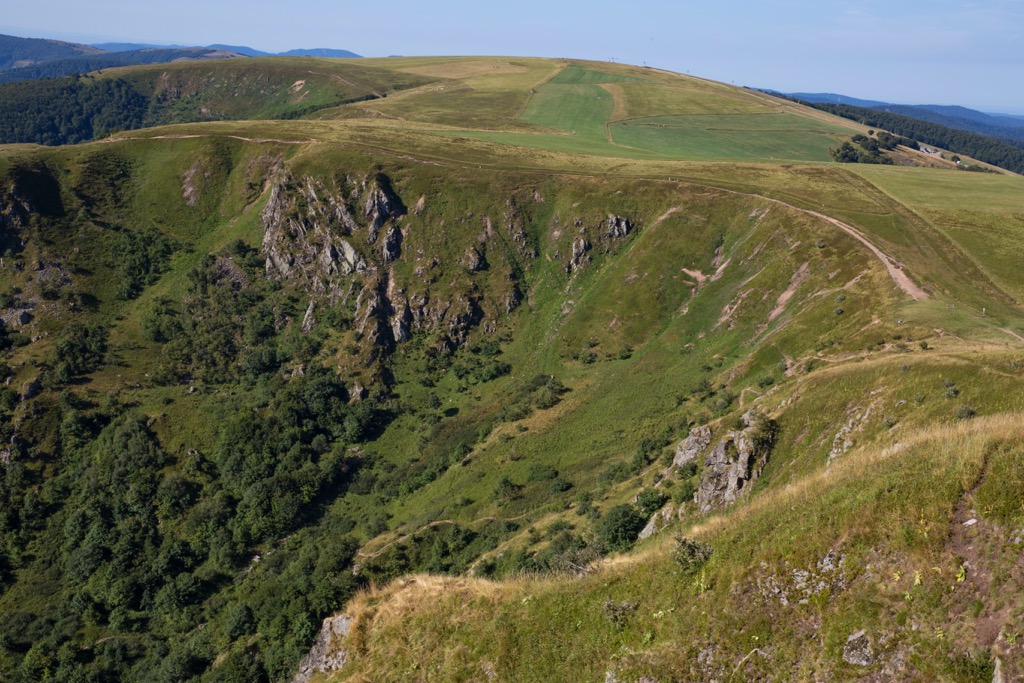
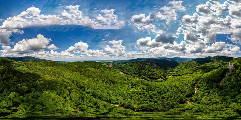
Approximately 1,600 sq km (617.7 sq mi) of Ballons des Vosges Regional Nature Park is forested, accounting for 61 percent of the park's area. Additionally, roughly 280 peat bogs cover an area of 13 sq km (5 sq mi). Other notable environments include limestone lawns, high-altitude meadows, and glacial cirques.
Ballons des Vosges Regional Nature Park contains several national nature reserves, including Ballons Comtois National Nature Reserve (Réserve Naturelle des Ballons Comtois), Ventron Massif National Nature Reserve (Réserve Naturelle du massif du Grand Ventron), and Tanet-Gazon du Faing National Nature Reserve (Réserve Naturelle de Tanet-Gazon du Faing).
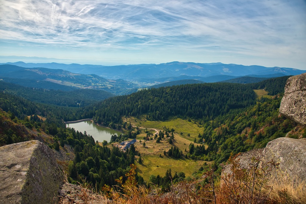
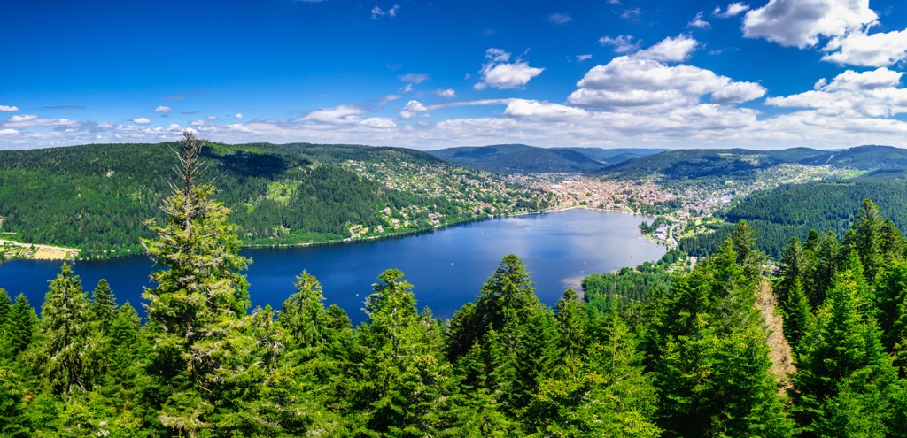
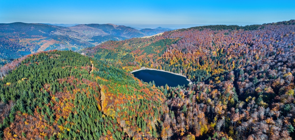
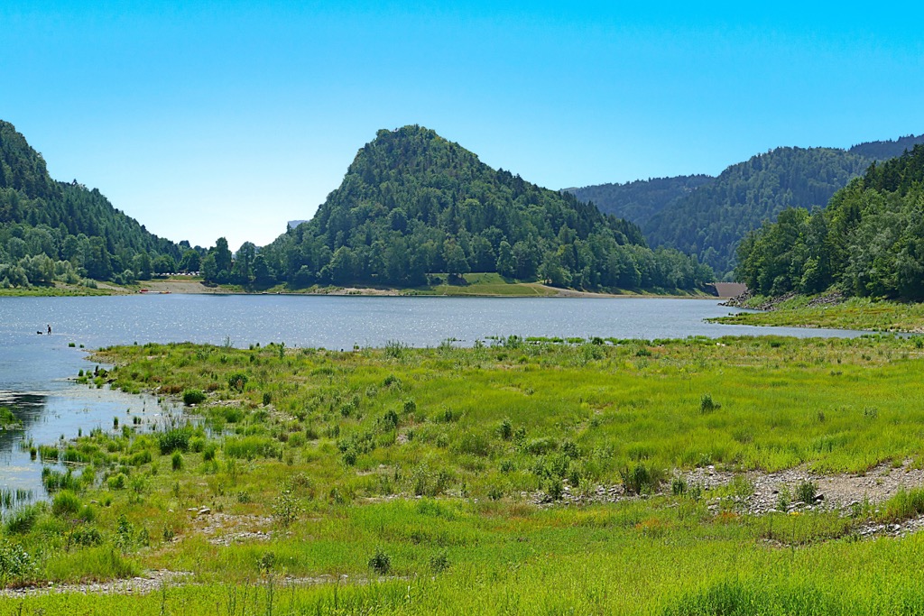
The Vosges Massif contains more than 30 lakes and 670 streams. The largest body of water in Ballons des Vosges Regional Nature Park is Gérardmer Lake (Lac de Gérardmer), which covers an area of 1.16 sq km (0.44 sq mi). In addition, Gérardmer Lake is the biggest lake in the Vosges Mountains.
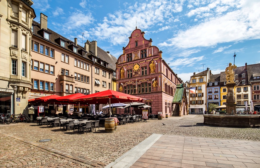
Ballons des Vosges Regional Nature Park contains four French departments: Haut-Rhin, Haute-Saône, Vosges, and Territoire de Belfort. Major settlements in and around Ballons des Vosges Regional Nature Park include Mulhouse, Colmar, Belfort, and Saint-Dié-des-Vosges. The park's headquarters are located in Munster.
Ballons des Vosges Regional Nature Park encompasses the Hautes Vosges, the high mountains of the Vosges Massif. The park is geologically diverse, with its bedrock composed of gneisses to the north, sedimentary rocks to the south, and granites in the center.
These rocks are remnants of the Hercynian mountain belt, a 400 to 500-million-year-old mountain range that once stretched across western Europe from Ireland to Poland. The Hercynian mountain belt was created by the Hercynian orogeny, a mountain-building event caused by the collision of the supercontinents Euramerica and Gondwana.
The current structure of the Hautes Vosges is much newer, created by the raising of basement rocks during the formation of the Alps. However, these old mountains collapsed at the beginning of the Alpine Orogeny due to a major fault line, creating the Rhineland Rift.
The Rhineland Rift separates two geologically similar areas, the Hautes Vosges in France and the Black Forest in Germany. Erosion and glaciation formed the mountains, valleys, and cirques across the modern Vosges Mountains.
The Rhineland Rift is a graben, a depression between two normal faults. The Vosges Mountains and the Black Forest were formed by tectonic uplift due to the formation of the Rhineland Rift.
Today, Ballons des Vosges Regional Nature Park contains the highest peaks in the Vosges Mountains, including Grand Ballon (1,424 m/4,672 ft). Other notable summits include Storkenkopf (1,366 m/4,481 ft), Hohneck (1,363 m/4,471 ft), and Le Grand Ventron (1,204 m/3,950 ft)
Ballons des Vosges Regional Nature Park is of great ecological importance. Over 22 percent of the park is designated as part of the Natura 2000, a European network of endangered or threatened landscapes.
Read on to learn about Ballons des Vosges Regional Nature Park's wildlife.
There are approximately 70 mammal species inhabiting Ballons des Vosges Regional Nature Park, including chamois, European wildcats, red deer, pine martens, and Eurasian beavers.
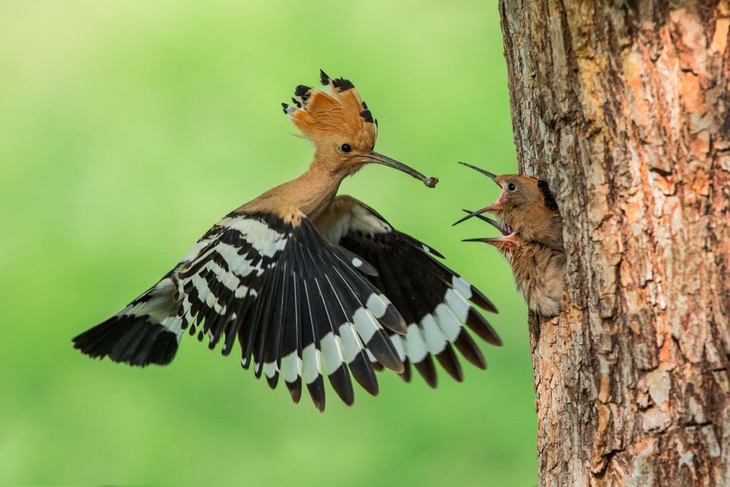
Over 250 bird species have been spotted within the park's boundaries. Avid bird watchers might be lucky and spot peregrine falcons, black woodpeckers, meadow pipits, boreal owls, whinchats, hoopoes, and western capercaillies.
The insect species of the Hautes Vosges are numerous and varied, including over 125 butterfly species and 60 dragonfly species. Notable insect species present in Ballons des Vosges Regional Nature Park include emerald damselflies, Niobe fritillaries, common hawkers, green mountain grasshoppers, and black darters.
Over two dozen amphibian and reptile species have been identified in Ballons des Vosges Regional Nature Park, including common lizards, alpine newts, and spotted salamanders.
Many aquatic species lurk below the surface of the Ballons des Vosges Regional Nature Park's many waterways, ponds, and lakes, such as pond loaches, brown trout, lake pikes, barbels, and red-clawed crayfish.
Lush forests cover most of Ballons des Vosges Regional Nature Park. The Composition of these forests differs depending on elevation and climate.
Beech-fir forests dominate the landscape between 500 m (1,640 ft) and 1,000 m (3,280 ft) in elevation, where the temperature is cooler. Fir trees which are sensitive to frost, struggle in the colder weather above 1,100 m (3,608 ft). Beech, ash, and maple are the most common trees at this height.
The soil is richer and deeper in the foothills and lowland areas of Ballons des Vosges Regional Nature Park. To the west, beech forests monopolize the forests due to heavy rainfall.
On the Alsatian side of the Vosges Mountains, where rain is less frequent, sessile oaks tower above the competition. In poor soil areas, Scots pines are prevalent. Other common trees in Ballons des Vosges Regional Nature Park include alders, willows, and spruces.
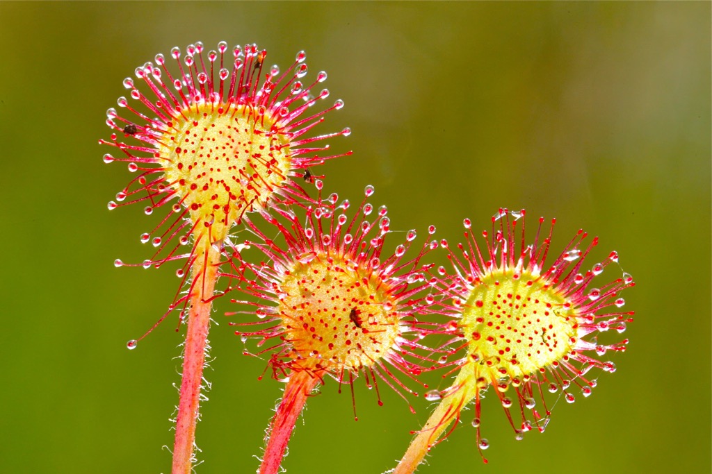
Over 1,300 flora species grow within Ballons des Vosges Regional Nature Park. Notable examples include Vosges pansies, mountain arnica, sundews, fringed pinks, and cranberries. Over 500 of these plant species grow across the park's limestone lawns, including 15 orchid species.
Humans began permanently inhabiting the Vosges Mountains during the Neolithic Period, approximately 5,500 years ago. The Roman Empire conquered the region along with the rest of France around 125 BCE.
The Vosges Mountains are home to many ancient monasteries and abbeys due to the influence of Saint Columbanus, an Irish monk and missionary. With the support of King Guntram of Burgundy, Saint Columbanus was granted land to build a school and helped quickly colonize the most remote Vosges Mountains.
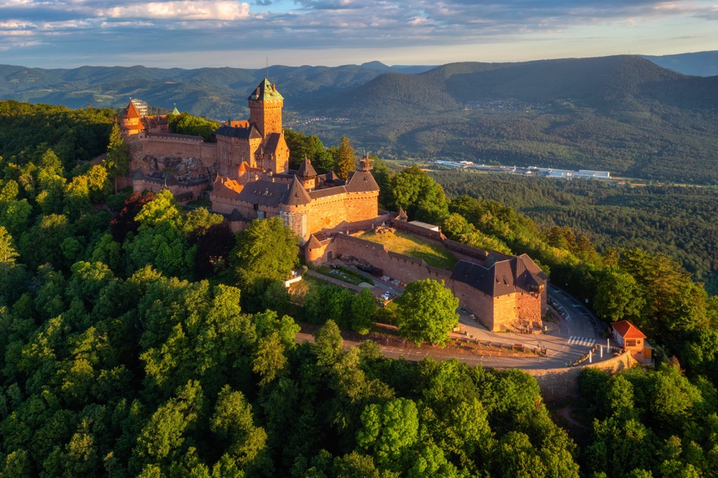
The Vosges Mountains sat on the border of the Duchy of Lorraine, the westernmost part of the Holy Roman Empire. Much of this border region was hotly contested, with many castles built and fortifications built near the border, such as the twelfth-century Château du Haut-Kœnigsbourg.
The outbreak of the Thirty Years War saw the Vosges Mountains cut off from the Germanic world. The Treaty of Westphalia in 1648 meant the French protected the region from attack.
After the Dutch War in 1678, the region of Franche-Comté, a part of the Holy Roman Empire for 650 years, became an official part of France. In 1766, following the death of the Duke of Lorraine, Stanisław Leszczyński, Lorraine also became a part of France.
The Vosges Mountains lost their political influence when départements were created in 1790. Decision-making powers moved to major settlements like Belfort and Colmar. Following the Franco-Prussian War, Alsace became a part of Germany and remained so until the end of World War I.
Monks returned to the Vosges again in the nineteenth and twentieth centuries, opening the land up to agriculture, as well as the mining and textile industries. Today, the Vosges Mountains are a popular tourist destination and an agricultural hub. Ballons des Vosges Regional Nature Park was established in 1989.
You won't be short of hiking opportunities during your visit to Ballons des Vosges Regional Nature Park. The Federation of Club Vosges (Fédération du Club Vosgien) has marked over 18,000 km (11,184 mi) of trails in the Vosges Mountains.
Ensure you're well-prepared before setting out on a hike in France's largest regional nature park. Bring a GPS, appropriate equipment, and plenty of food and water.
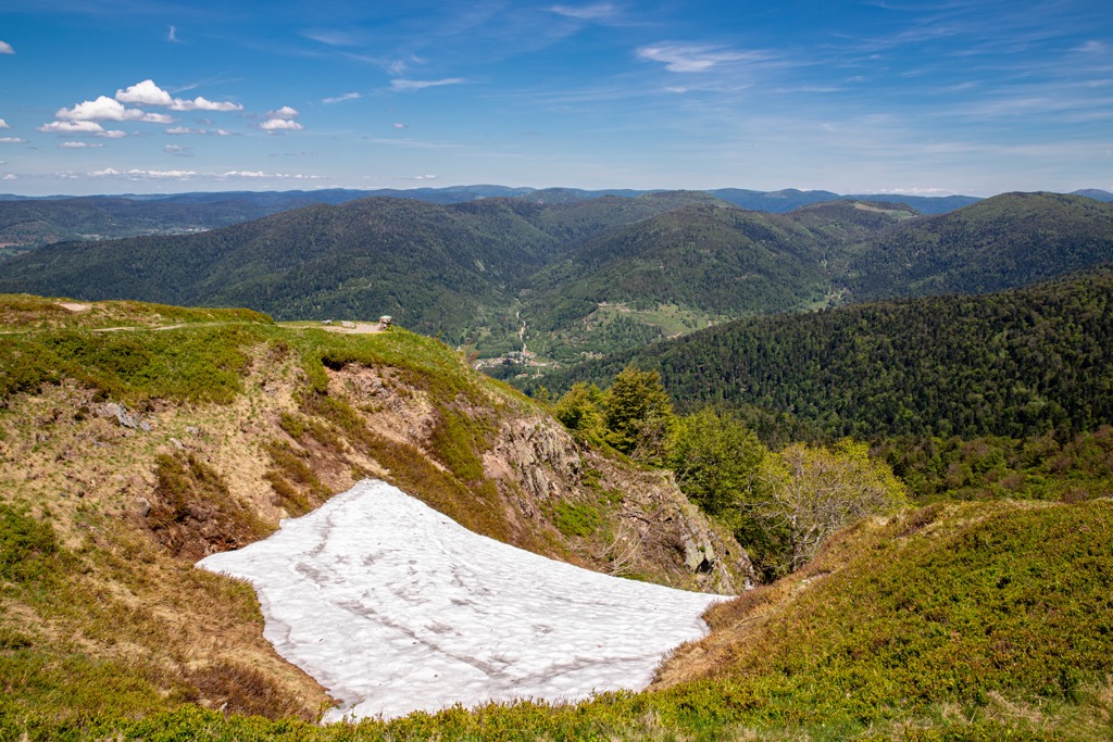
Map out your route, check the weather forecast, and inform others of your intended itinerary. Note that many of Ballons des Vosges Regional Nature Park mountain trails are closed or inaccessible during winter.
Read on to learn about some of the best hikes in Ballons des Vosges Regional Nature Park.
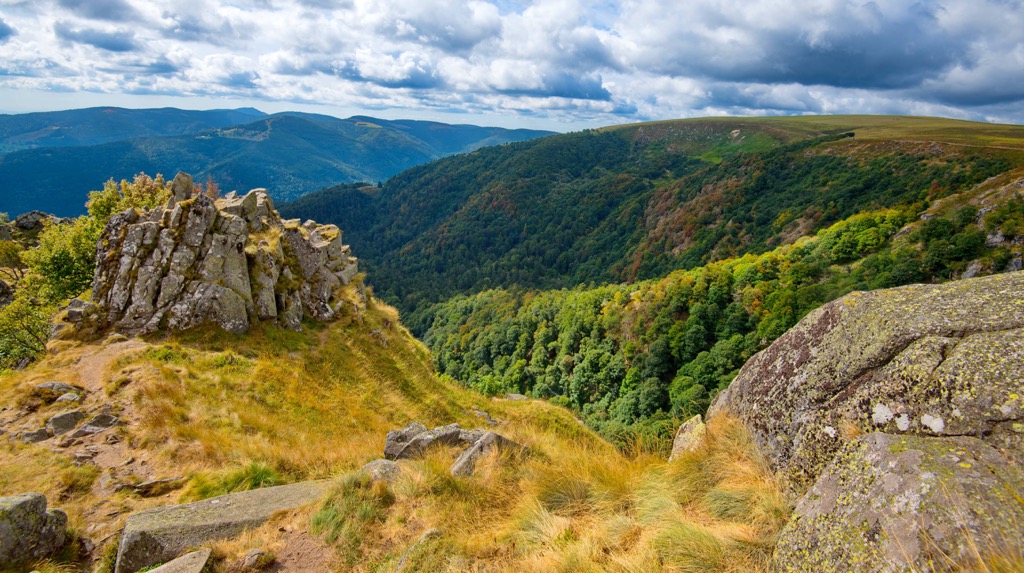
The Sentier des Roches, or the Rock Trail, is the most famous route in Ballons des Vosges Regional Nature Park. Not for the faint-hearted, the Sentier des Roches leads up steep staircases and along narrow mountain passes with sheer drops into the valley below.
The perils of this trail, combined with its spectacular views, make this a must for any experienced hiker visiting Ballons des Vosges Regional Nature Park. It's the perfect way to explore the Frankenthal – Missheimle Nature Reserve (Réserve Naturelle du Frankenthal-Missheimle).
Along the trail, you'll pass over the Cirque du Frankenthal and the Col de la Schlucht, both of which offer some of the finest panoramas in the Hautes Vosges. The Sentier des Roches also passes over the summit of Le Petit Hohneck (1,290 m/4,232 ft).

The Sentier des Roches starts and ends at Parking Col de la Schlucht. The trail is approximately 5.9 km (3.6 mi) in length.
It's also possible to reach the summit of Hohneck (1,363 m/4,471 ft), the third-highest peak in the Vosges Mountains, via the Sentier des Roches.
After passing the Cirque du Frankenthal, the trail heads to the Frankenthal Inn (Auberge du Frankenthal), following the red triangles markers toward Col du Schaeferthal (1,228 m/4,038 ft). You'll then head to Rocher de la Bloy for excellent views of the Cirque du Frankenthal.
The follow the red rectangle signs to the summit of Hohneck. From the summit, you'll be able to spot the Swiss Alps, the Jura Mountains, and the snow capped peak of Grand Ballon.
This trail starts and ends at Parking Col de la Schlucht. This trail is approximately 10.2 km (6.3 mi) in length.
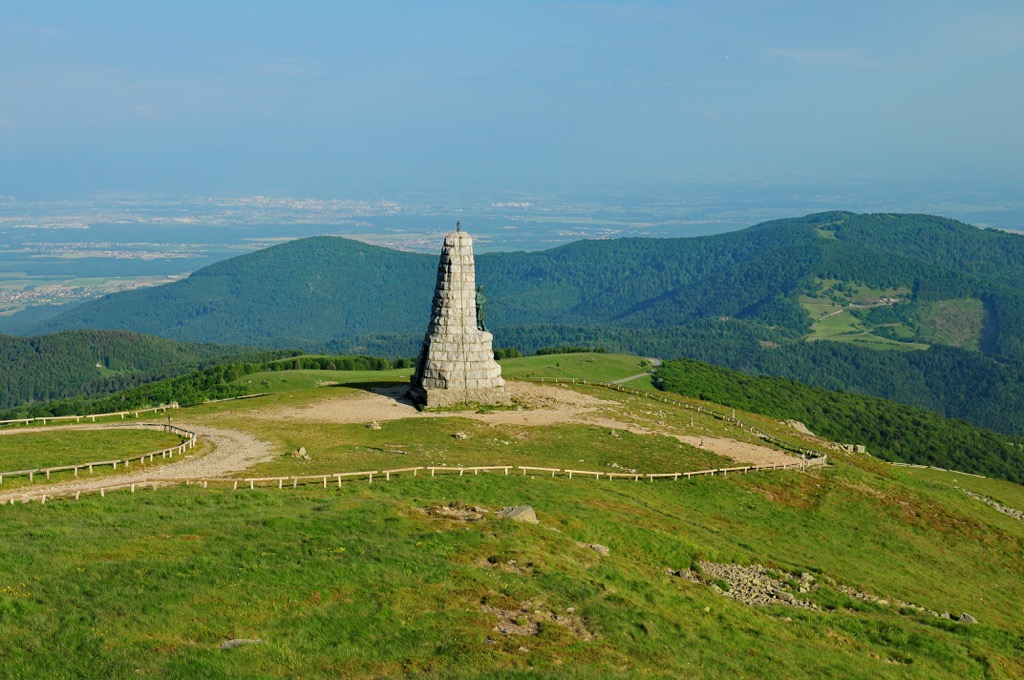
A hike to the highest summit in the Vosges Mountains and Grand Est is one of several classic climbs in Ballons des Vosges Regional Nature Park. Grand Ballon is arguably the toughest trek in the Vosges Mountains but affords unmatched views of the surrounding countryside.
You'll forget all about your arduous journey once you see the view from the summit. From atop Grand Ballon, you'll be able to see the peaks of the Black Forest, the Alps, and the Bernese Oberland. Mont Blanc (4,810 m/15,781 ft) is even visible on a clear day.
One way of scaling Grand Ballon is from the mountain's south side. This trail will take you towards the Col du Haag (1,233 m/4,045 ft) before forking off and following the blue triangle-marked trail.
The trail then follows a section of the Grande Randonnée (GR) 5 and climbs the mountain's southern flank. You'll pass the Diables Bleus monument on your way to the summit.
This trail starts and ends at the hiker's car park in Geishouse. The walk is approximately 13.7 km (8.5 mi) in length.
An alternative route is from the Firstacker (955 m/3,133 ft) pass underneath Le Sudelkopf (1,012 m/3,320 ft). This trail leads to Grand Balloon via the Chalet Hôtel Du Grand Ballon before looping back to your starting point via the Abri Oberer Sattel (1,150 m/3,773 ft) hut near the summit of Sattelfels (1,161 m/3,809 ft). This trail is approximately 11 km (6.8 mi) in length.
If you're looking for the shortest walking route to the summit of Grand Ballon, drive along the scenic Route des Crêtes to the Chalet Hôtel Du Grand Ballon. Then follow the short 600 m (1,968 ft) long path to the summit.

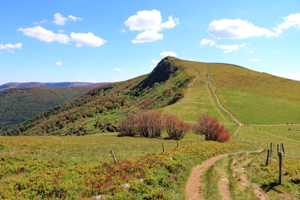
With its flat, bald summit, Le Grand Ventron is one of the finest viewpoints in the Vosges Mountains. Atop Le Grand Ventron is an orientation table that points out the direction of nearby mountains. The mountain is located at the heart of the Grand Ventron Massif Nature Reserve (Réserve Naturelle du massif du Grand Ventron).
One of the best ways to scale Le Grand Ventron is on a circuit trail that leads to the top of the neighboring peak, Petit Ventron (1,155 m/3,789 ft). This trail is popular as it also leads past the picturesque Bockloch Waterfall (Cascade du Bockloch).
From the Bockloch Waterfall, the trail heads uphill, following the GR531 first to Le Grand Ventron and then Petit Ventron. Then, it returns you to your starting point with a scenic walk along the western shores of Kruth Wildenstein Lake (Lac de Kruth Wildenstein). From atop Le Grand Ventron are beautiful vistas of the lake and the nearby peaks.
This route starts and ends at Bockloch Waterfall. The trail is approximately 11.3 km (7 mi) in length.
Ballon d'Alsace (1,247 m/4,091 ft) and Ballon de Servance (1,216 m/3,989 ft) form part of one of the finest crests in the Hautes Vosges du Sud. Ballon d'Alsace and its slightly smaller twin overshadow landscapes of Lorraine, Alsace, and Franche Comté, with views as far as Mont Blanc on a clear day.
One of the best ways to scale these sister peaks is on the circular trail that starts on the Rue de Lorraine in Saint-Maurice-sur-Moselle. The trail begins by following GR 533 and then GR 7. The path nears the summit of Ballon de Servance before continuing onto the Col du Luthier (1,100 m/3,608 ft) and Col du Stalon (962 m/3,156 ft).
Before reaching Ballon d'Alsace's summit, the trail passes near the Ballon d'Alsace Inn (Auberge du Ballon d'Alsace). The summit affords 360-degree views, with Hohneck and Grand Drumont (1,223 m/4,012 ft) to the north and Grand Ballon to the northeast.
From the Joan of Arc Statue (Statue Jeanne d'Arc), you'll have an excellent view of the Moselle Valley. This trail is approximately 15.7 km (9.7 mi) in length.
Rainkopf (1,305 m/4,281 ft) and Rothenbachkopf (1,316 m/4,317 ft) are two of the highest mountains in the Vosges, offering outstanding views of the surrounding valleys and mountains.
The two mountains are less than 1 km (0.6 mi) apart, making them popular to climb one after another. The Route des Crêtes runs near the summit of Rainkopf and Rothenbachkopf.
You can climb these two mountains from the Kolben car park in Mittlach. This circular route starts by skirting the edge of d'Altenweiher Lake (Lac d'Altenweiher) before heading onto the Col du Firstmiss (1,292 m/4,238 ft).
After reaching the summit of Rainkopf, the trail descends onto the Col du Rothenbach (1,205 m/3,953 ft). Then you'll immediately climb to the Rainkopf's taller neighbor, Rothenbachkopf. With its cornices and rugged summit, Rothenbachkopf is nicknamed the "Matterhorn of the Vosges."
From the summit of Rothenbachkopf, you'll have one of the best possible views of the Munster Valley towards Colmar. The route descends the mountain via the Steinwasen Inn (Auberge du Steinwasen). This trail is approximately 10.2 km (6.3 mi) in length.
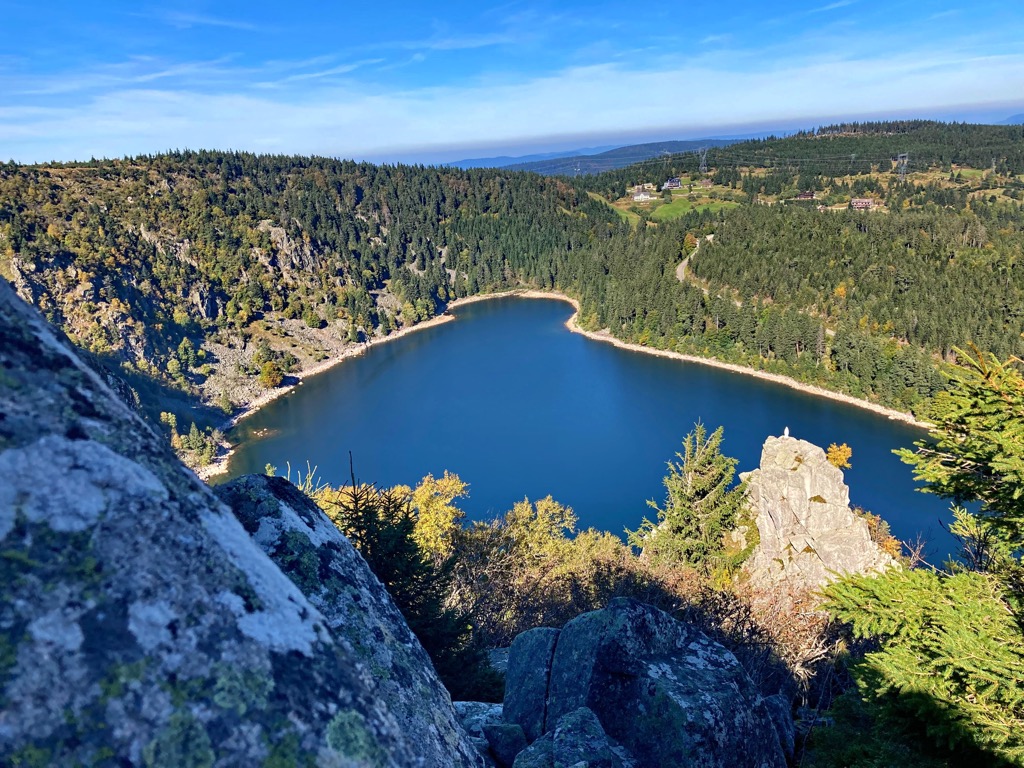
Lac Noir and Lac Blanc sit at the northern end of the Hautes Vosges, in the shadow of the range's most northerly summit over 1,300 m, Gazon du Faing (1,306 m/4,285 ft). From the Belmont Observatory (L'Obeservatoire Belmont) above Lac Noir, there are incredible vistas of the Orbey Valley.
The best way to explore this area is on the circular trail from the Lac Noir car park. The trail starts by following the Grand Tour du Lac Noir towards the Source du Lac Noir, passing near the summit of Gazon du Faing.
After following the blue disc markings for 3.6 km (2.2 mi), you'll reach the Belmont Observatory. Further down the trail at the Lac Blanc dyke are gorgeous views of Rocher Hans (1,144 m/3,753 ft) and Lac Blanc.
Then, you'll pass the Col du Calvaire (1,144 m/3,753 ft) on the way to the Blancrupt Inn-Refuge (Auberge du Blancrupt). The final viewpoint on this route is the Balcon du Lac before returning to Lac Noir. This trail is approximately 12.4 km (7.7 mi) in length.
Picturesque riverside cities and charming historic towns await hikers visiting Ballons des Vosges Regional Nature Park. Read on to find out about Ballons des Vosges Regional Nature Park's main cities and towns.
Mulhouse is the largest city in Haut-Rhin and the second-largest in Alsace. Mulhouse is a prominent industrial city home to Cité du Train and Cité de l'Automobile, the world's largest train and automobile museums.
Away from its industrial heritage Mulhouse offers a range of family-friendly attractions like the Zoological and Botanical Park of Mulhouse (Parc Zoologique et Botanique de Mulhouse) and the nineteenth-century Temple Saint-Étienne.
Mulhouse is the nearest major city to Ballons des Vosges Regional Nature Park, with Grand Ballon located approximately 40 km (25 mi) away. Popular hotels in Mulhouse include La Maison Hotel, Hotel Bristol, and Hotel du Parc.
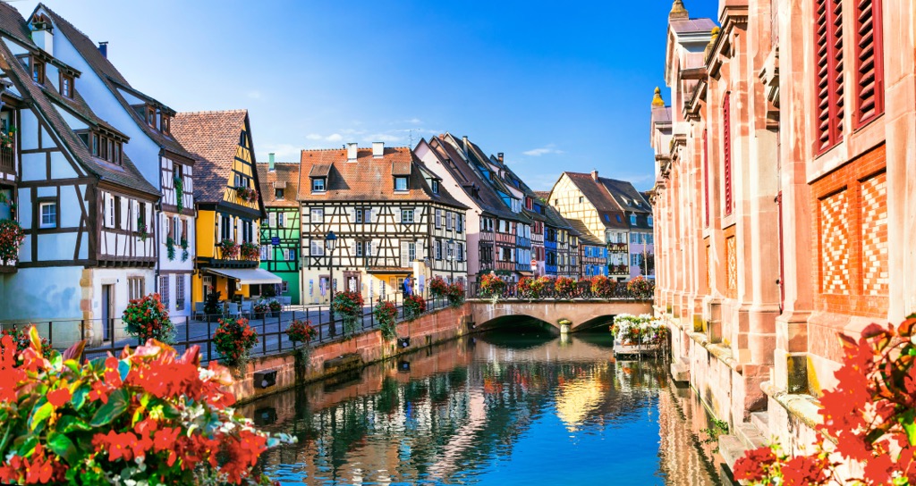
Sat on Ballons des Vosges Regional Nature Park's western boundary is the city of Colmar. Colmar is hugely popular with tourists as it sits on the Alsatian Wine Route and is nicknamed the "capital of Alsatian wine."
One of the city's highlights is Little Venice (La Petite Venise), a section of the Lauch River lined with half-timbered houses and high-end eateries. Just outside the city is Château du Hohlandsbourg, a ruined thirteenth-century mountaintop castle that offers captivating views of Colmar.
Popular hotels in Colmar include Colmar Hotel, Hôtel Turenne, and Hotel Primo.
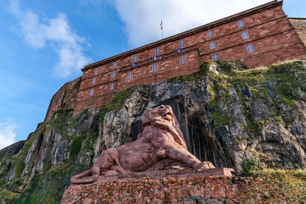
Belfort is the primary city in the department of Territoire de Belfort. It marks the southern border of Ballons des Vosges Regional Nature Park and is an excellent base for exploring the Vosges Mountains. Belfort is a historic city, with the area constantly inhabited by humans since Gallo-Roman times.
Belfort has some unique attractions like the Lion of Belfort, an 11 m (36 ft) tall sandstone statue by Frédéric Auguste Bartholdi, sculptor of the Statue of Liberty. The statue sits below the Belfort Citadel, a pentagonal fortress built on a promontory overlooking the city.
Belfort is close to some popular hiking spots, with Ballon d'Alsace located less than 30 km (18.5 mi) to the north. Popular hotels in Belfort include Hotel Restaurant Les Capucins, Mercure Belfort, and Kyriad Belfort.
Tucked away in the Vosges Mountain's Meurthe Valley, Saint-Dié-des-Vosges is a popular vacation destination. Saint-Dié's architecture is unique, with most of the town's buildings constructed from local red sandstone. This includes Saint-Dié's biggest attraction, the eighteenth-century Saint-Dié Cathedral (Cathédrale Saint-Dié de Saint-Dié-des-Vosges).
Located at the northern end of the Ballons des Vosges Regional Nature Park, Saint-Dié is less than 50 km (31 mi) from Hohneck and the Tanet-Gazon du Faing Nature Reserve (Réserve Naturelle de Tanet-Gazon du Faing).
Popular hotels in Saint-Dié include Hôtel Restaurant Le Régal and ibis Saint-Die.
Munster is one of the principal towns of Ballons des Vosges Regional Nature Park. It's home to the Munster Valley Tourist Office (Office de Tourisme de la Vallée de Munster), where you can learn more about local hikes.
Munster itself is a historic settlement named after the seventh-century Munster Abbey. The town is famed for its Muenster cheese, and fromage fans can tour The Cheese House (Musée de la Maison du Fromage), a historic cheese factory.
Munster is located less than 15 km (9 mi) from the Tanet-Gazon du Faing
Nature Reserve. Popular hotels include Brit Hotel Grand Hotel Munster, Hotel Restaurant & Spa Verte Vallée, and Hôtel Restaurant La Cigogne.


The highest peak in Ballons des Vosges Regional Nature Park is Grand Ballon, at 1,424 m.
Notable peaks in Ballons des Vosges Regional Nature Park include Grand Ballon, Storkenkopf, Hohneck, Kastelberg and Klinzkopf.


