
Scan the QR code and open PeakVisor on your phone
Ontario’s first provincial park, Algonquin Provincial Park is home to a spectacular array of flora and fauna, stunning lakes, beautiful scenery, and fantastic outdoor recreation opportunities. The park contains 7 named high points, the highest and most prominent of which is Manitou Mountain (512m/1,680ft).
Algonquin Provincial Park is located along a transition point between the southern and northern regions of the Canadian province of Ontario. It is situated almost entirely within the Unorganized South Nipissing District, with the exception of the southern tip of the park, which is in Haliburton County.
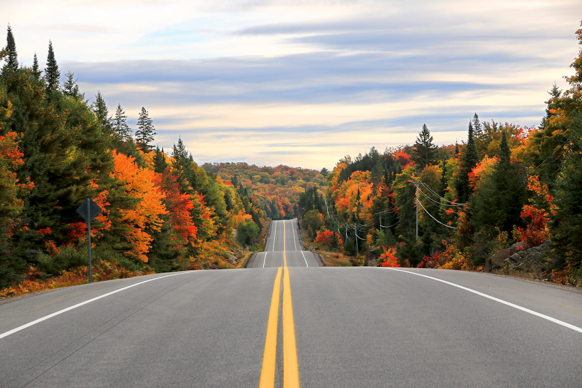
The park spans some 7,653.45 square kilometres (2,955.01 sq. mi), which makes it the third largest provincial park in Ontario after Polar Bear Provincial Park and Wabakimi Provincial Park. However, it is larger than both Quetico Provincial Park and Opasquia Provincial Park and it is easily the most accessible of Ontario’s major provincial parks due to its great road connections.
Although Algonquin Provincial Park dominated much of the landscape in the region, it is surrounded by a whole host of other provincially and federally-protected areas.
In particular, it is located to the north of Kawartha Highlands Signature Site, Petroglyphs Provincial Park, Balsam Lake Provincial Park, Queen Elizabeth II Wildlands Provincial Park, Bon Echo Provincial Park, Bigwind Lake Provincial Park, Hardy Lake Provincial Park, Awenda Provincial Park, and Georgian Bay Islands National Park, as well as to the west of Gatineau Park in Quebec.
Moreover, Algonquin Provincial Park is situated to the south of ZEC Saint-Patrice, ZEC Dumoine, and ZEC Pontiac in Quebec on the other side of the Ottawa River, and Samuel de Champlain Provincial Park in Ontario along the Mattawa River. Finally, it is located to the east of Grundy Lake Provincial Park, South Bay Provincial Park, and Restoule Provincial Park.
From a geological perspective, Algonquin Provincial Park is located within a region known as the Grenville Province. In particular, it is situated within the Central Gneiss Belt of the province, which dates back to the Precambrian.
Within the park, the landscape is underlain by predominantly metamorphosed intrusive igneous rocks, though the structural geology of the region is particularly complex. Moreover, there are also large deposits of sand, gravel, and other sediments in the park that are remnants of the last major glaciation.
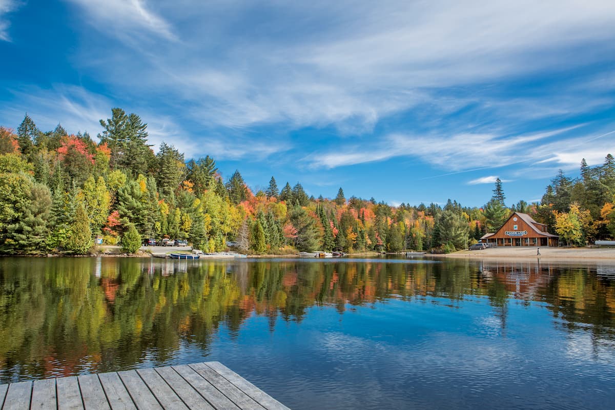
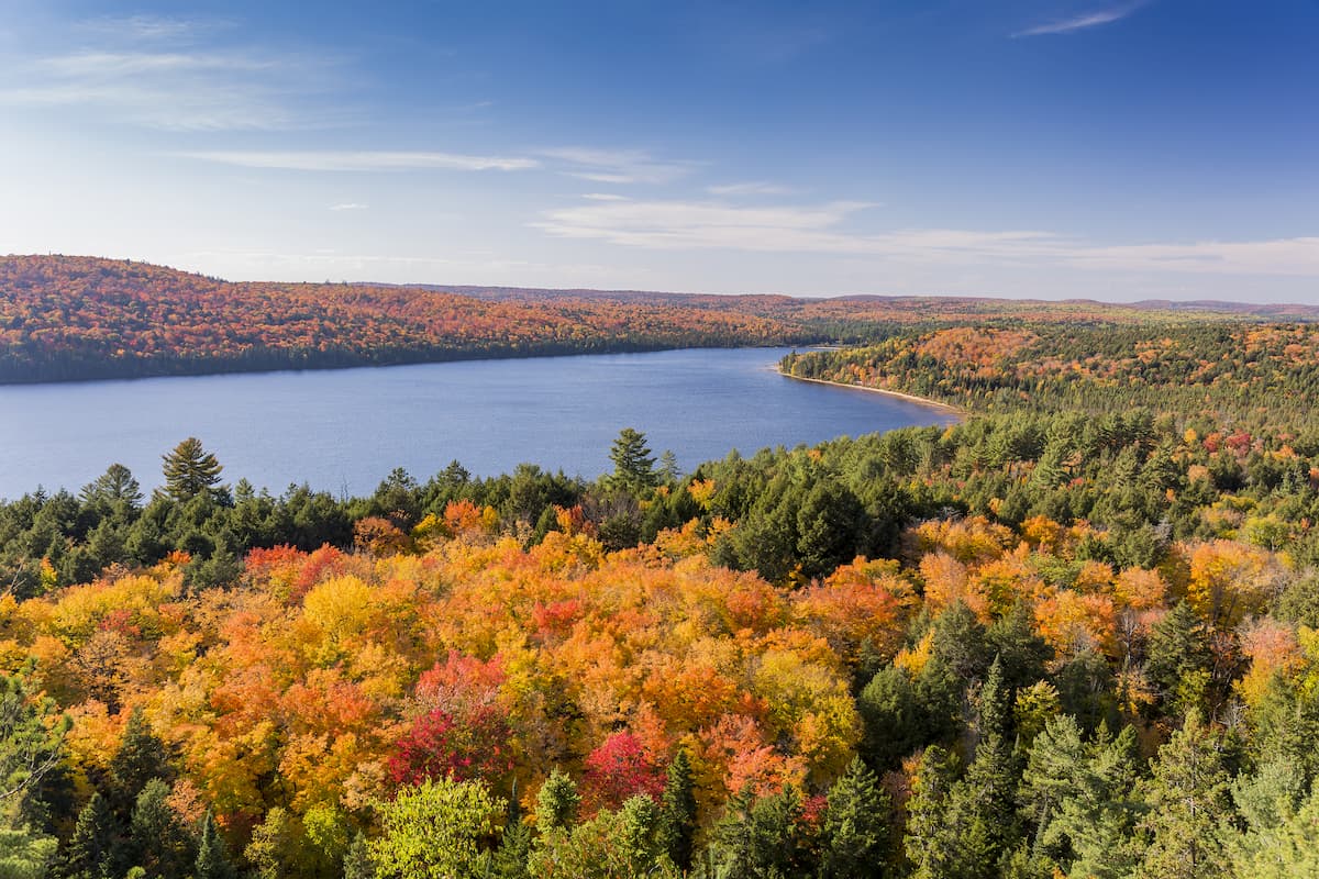
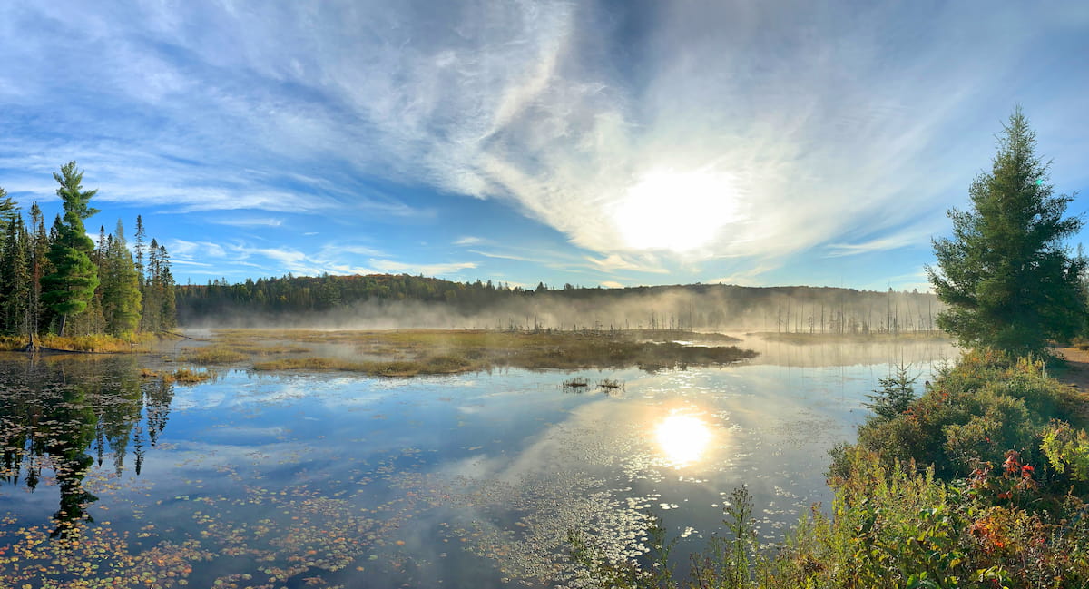
While Algonquin Provincial Park isn’t exactly known for its mountainous terrain, it does boast a fantastic collection of lakes, rivers, and streams. In fact, the park contains over 2,400 different lakes and thousands of kilometres of streams, most of which formed as a result of the widespread ice cover that took place in the region during the height of the Pleistocene glaciation.
Other major glacially-formed features in the park include eskers, kame moraines, drumlins, kettle lakes, outwash plains, and boulder deposits.
Additionally, Algonquin Provincial Park is home to a unique geological feature known as the Brent Crater, which happens to be one of the most famous impact craters on the planet. It’s believed that the crater formed on impact from a large meteorite sometime during the Middle Devonian.
Notable high points in Algonquin Provincial Park include Manitou Mountain, Gibraltar Rock, Brent Crater, Pentawa Hills, and Ball Mountain.
For the most part, Algonquin Provincial Park is located within the eastern forest-boreal transition ecoregion, which covers a large span of Ontario and Quebec in Canada, as well as part of the northern region of the US state of New York in the Adirondack Mountains.
Within this ecoregion, the particular plant and tree communities that you’ll find depends greatly on the soil conditions of a given location and its elevations. In lower-lying regions, such as those found in Algonquin Provincial Park, tree species such as sugar maple, yellow birch, and hemlock are quite common.
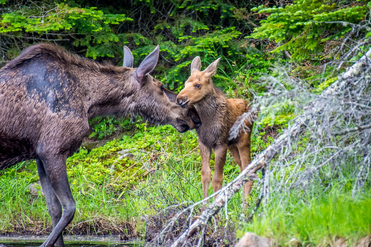
As far as wildlife goes, there are hundreds of species that can be found in the park. Some of the most notable mammal species include moose, white-tailed deer, foxes, black bears, and even the eastern wolf. There are also hundreds of bird species, though some of the most easily identifiable residents include Canada jays, blue jays, and great grey owls.
Like the rest of what is now Canada, humans have lived in and around the region now called Algonquin Provincial Park for thousands of years. Some of the many First Nations in the region who conconsider the park to be part of their traditional homelands include the Anishinabek Nation (including the Nipissing First Nation) the Huron-Wendat Nation, and the Algonquins of Ontario.
The first person of European descent to visit the region was likely Étienne Brûlé of France, who was sent by Samuel de Champlain in 1610 to venture beyond what is now called the Saint Lawrence River into interior Canada. During his travels, it is likely that Brûlé visited the majority of the Great Lakes as well as Lake Nipissing, which is located to the west of the modern boundaries of Algonquin Provincial Park.
During the 17th and 18th centuries, the fur trade was particularly important to French trappers in the region. The voyageurs often used the Ottawa River to access regions further inland and the section of the river near what is now Deux-Rivières was on the northern edge of Algonquin Provincial Park was particularly well-known for its difficulty of navigation due to the region’s rapids.
By the 19th century, however, the region became better known for its timber industry as the Ottawa River provided excellent access to the area’s large forests of white and red pine. During this time, the timber trade skyrocketed and large log rafts could be seen floating down the river toward pulp, paper, and saw mills near the region’s many ports.
Around the same time, a sizable number of homesteaders and farmers also made their way to the land around the Ottawa River, in the hopes of finding arable land to work on. Meanwhile, some of the region’s naturalists and conservationists started to take note of the beauty of the landscape.
As a result, the provincial government of Ontario established a commission to survey the various conflicting interests in the region in the late 19th century. The commission eventually recommended that the government establish a park in the area, which it did in 1893.
Interestingly, Algonquin Provincial Park was initially called “Algonquin National Park of Ontario,” though it has always been directly managed by the provincial government of Ontario. By this point, there were no other provincial parks in Canada, though Banff National Park had just been established in Alberta in 1885, so it’s likely that this interesting nomenclature was simply a byproduct of the large national parks movement of the era.
That being said, the park’s name was officially changed in 1913 to Algonquin Provincial Park, thereby alleviating any potential sources of confusion.
In the years since the park’s establishment, it has grown in size as the government annexed nearby townships and tracts of land. The next major event in the park's history was the construction of the O.A. & P.S. Railway (Ottawa, Arnprior and Parry Sound Railway) just a few yeast after the park’s creation helped significantly improve access to the region.
The improved access to Algonquin Provincial Park caused by the construction of the railway also helped spur the development of a number of tourist lodges and hotels in the region.
Although the railway fell into disuse by the mid-20th century, it was exceptionally important to the park’s tourism industry during its early years. After rail service to the park ended, however, visitor numbers continued to increase, particularly during the 1950s and 1960s.
These days, Algonquin Provincial Park continues to be a year-round destination for outdoor recreation. The park maintains over 1,200 different campsites in its 8 campgrounds and offers seemingly endless possibilities for adventure in its backcountry regions, which are accessible by foot, on horseback, by ski, or by canoe.
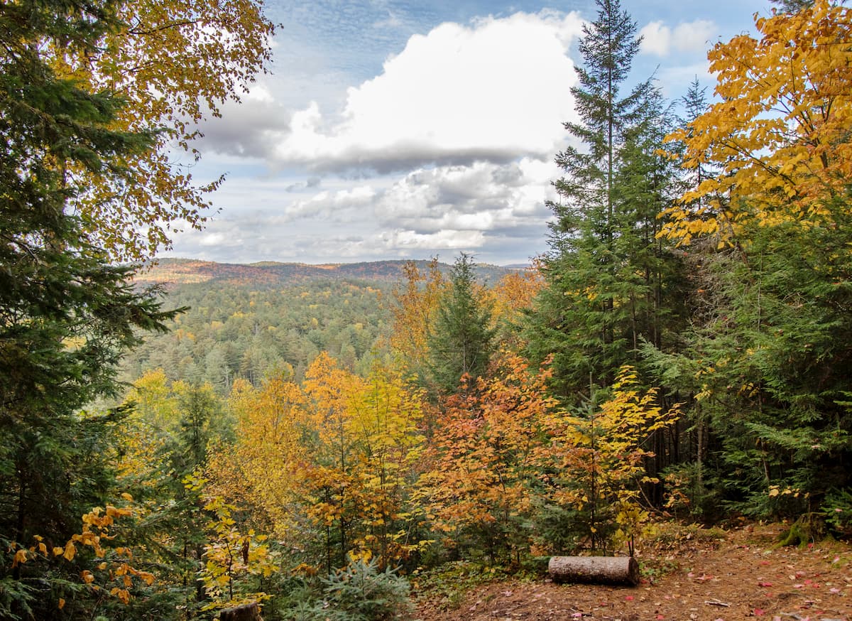
As one of Ontario’s premier outdoor recreation destinations, there are plenty of great hikes to check out in Algonquin Provincial Park. Alternatively, if paddling is your passion, the park also contains a great network of navigable lakes and rivers, which allow for nearly 2,000 kilometres (1,200 miles) of potential canoe routes.
Here are some of the best places to check out in the park:
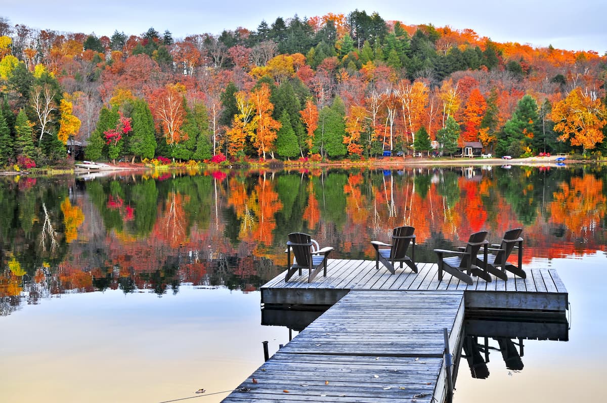
The 10.4km (6.5mi) long Centennial Ridges hike takes visitors on a hilly traverse of a number of Algonquin Provincial Park’s major high points. It offers some of the best views of the park, particularly during the fall foliage peak during the autumn months when the landscape is dotted in trees boasting stunning red, orange, and yellow colors.
Short, but sweet, the Spruce Bog Boardwalk is a 1.5km (0.9mi) long hike that provides a nice quick walk along some of the park’s signature bogs. Thanks to the trail’s minimal elevation gain, it’s a nice hike for the whole family.
At 10.8 kilometres (6.7 mi) long, the Mizzy Lake Trail is a great option for a full day of adventure. The trail itself meanders through the forest, offering excellent vistas of the park’s many picturesque lakes. Completing the Mizzy Lake Trail in the morning also offers some great opportunities to spot wildlife during your hike.
A great family adventure, the 2.0 km (1.2 mi) Brent Crater Trail is a scenic hike that leads to a viewing tower that overlooks the Brent Crater. From the top of the platform, hikers can gaze out over some spectacular Algonquin Provincial Park scenery before heading down into the crater itself.
Need a place to stay before or after your visit to Algonquin Provincial Park? Here are some of the best cities and towns to check out:
The capital of Canada, the city of Ottawa is located to the east of Algonquin Provincial Park near Ontario’s border with Quebec. Ottawa is home to just around 1 million people, which makes it Canada’s fourth largest city.
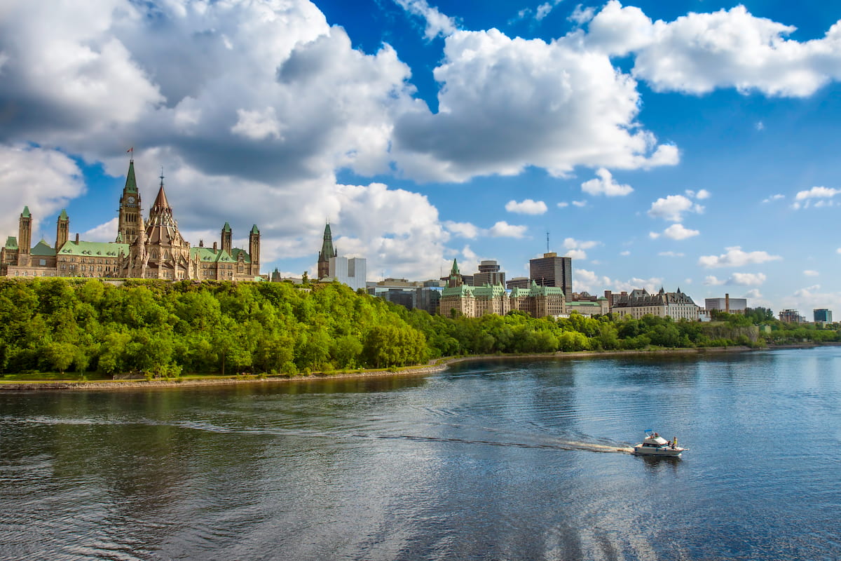
Ottawa is known for its unique architecture, festivals, museums, and other historic sites, which make it an excellent place to visit if you’re in the region. The city also has a major international airport, which is the second busiest in the province.
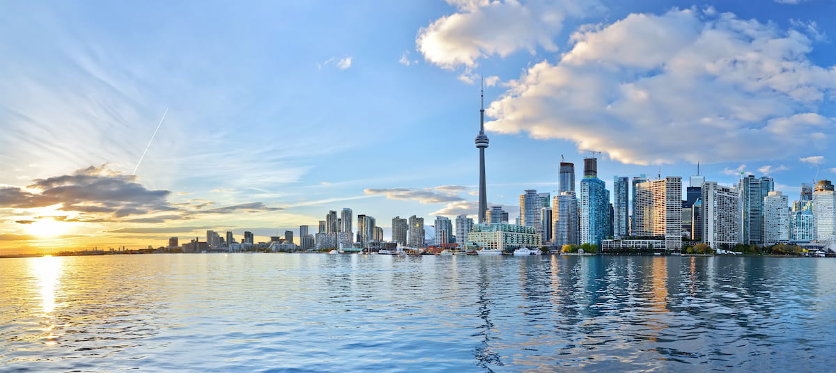
Located due south of Algonquin Provincial Park, the city of Toronto has over 2.7 million residents, which makes it the most populous city in Canada. Toronto is a cultural, financial, and educational hub for both Canada and the province of Ontario and it is one of the most ethnically diverse areas in the country.
Plus, Toronto is home to Canada’s largest airport, which also happens to be one of the busiest in the world. It also offers great transportation links within the city and the province, as well as to the United States.
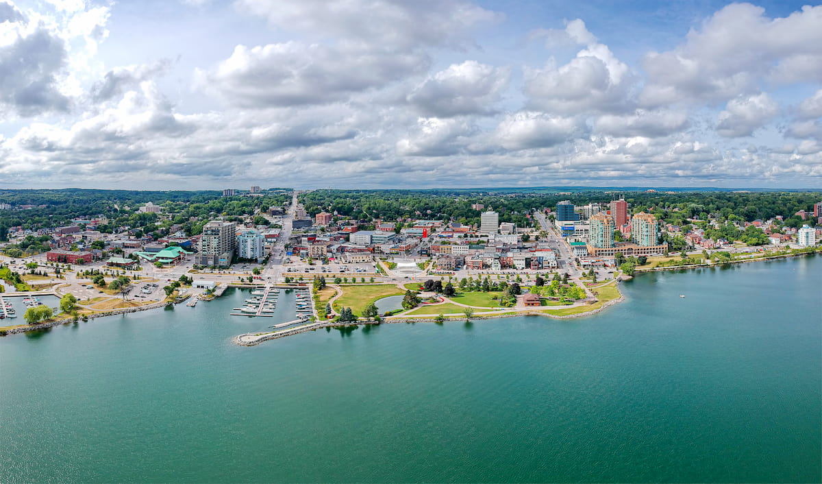
Barrie is a city of some 141,000 residents that’s located to the south of Algonquin National Park. It is a major commuter community for folks who work in Toronto due to its much more affordable housing costs and daily public transportation service to the Greater Toronto Area.
Situated to the northeast of the park, the city of North Bay is located on the shores of Lake Nipissing. It is home to about 50,000 residents and is often considered a gateway to Northern Ontario. North Bay is also a popular tourist destination in its own right, thanks to its fantastic scenery.


