Effective today the PeakVisor app becomes free. No need to spend a lot of time researching whether the app is a good fit for your outdoor adventures. Everyone can download the app and try it without paying anything.
PeakVisor app provides exceptional features for all things outdoors:
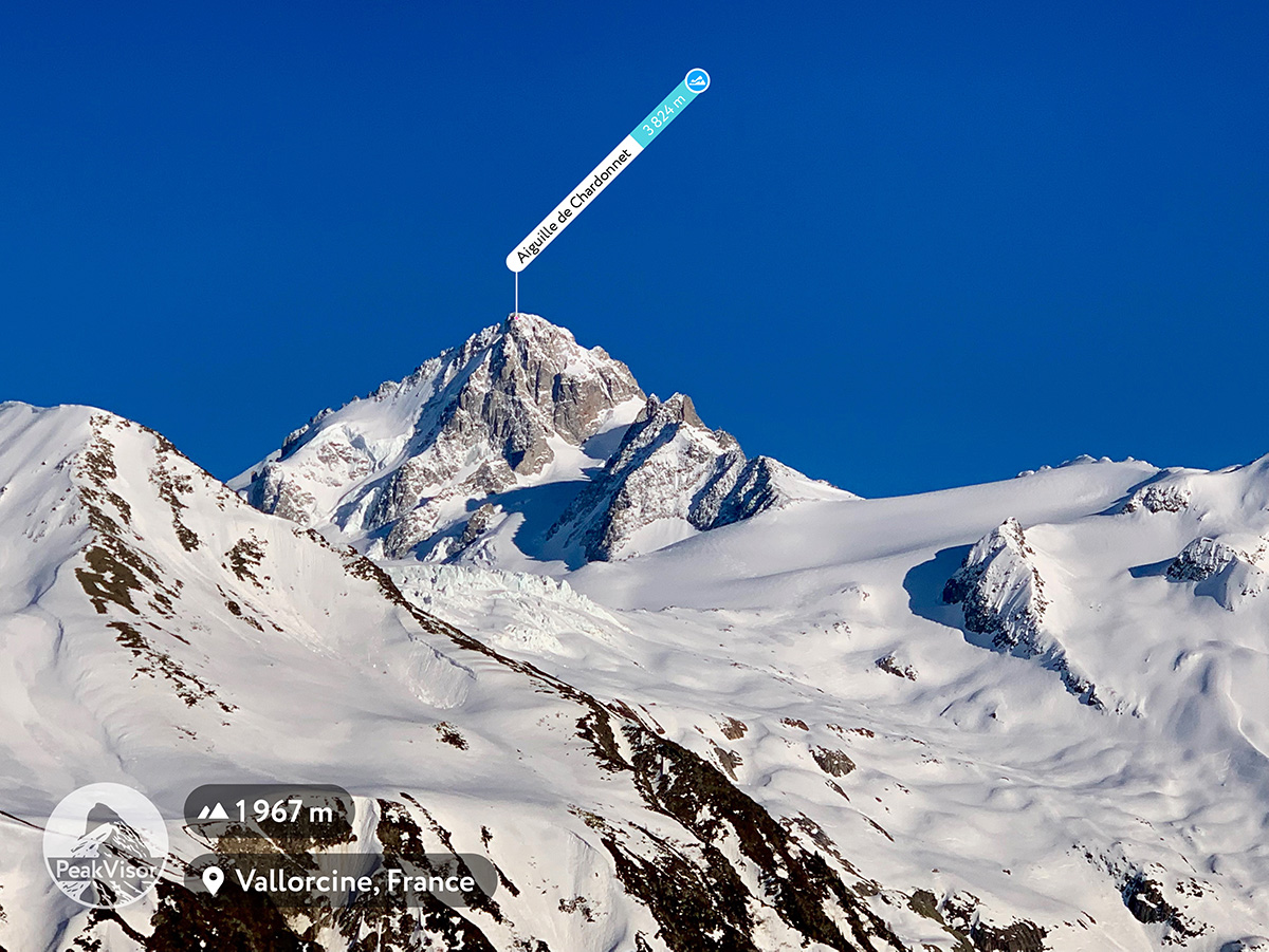
- Identify mountains in your camera using Augmented Reality
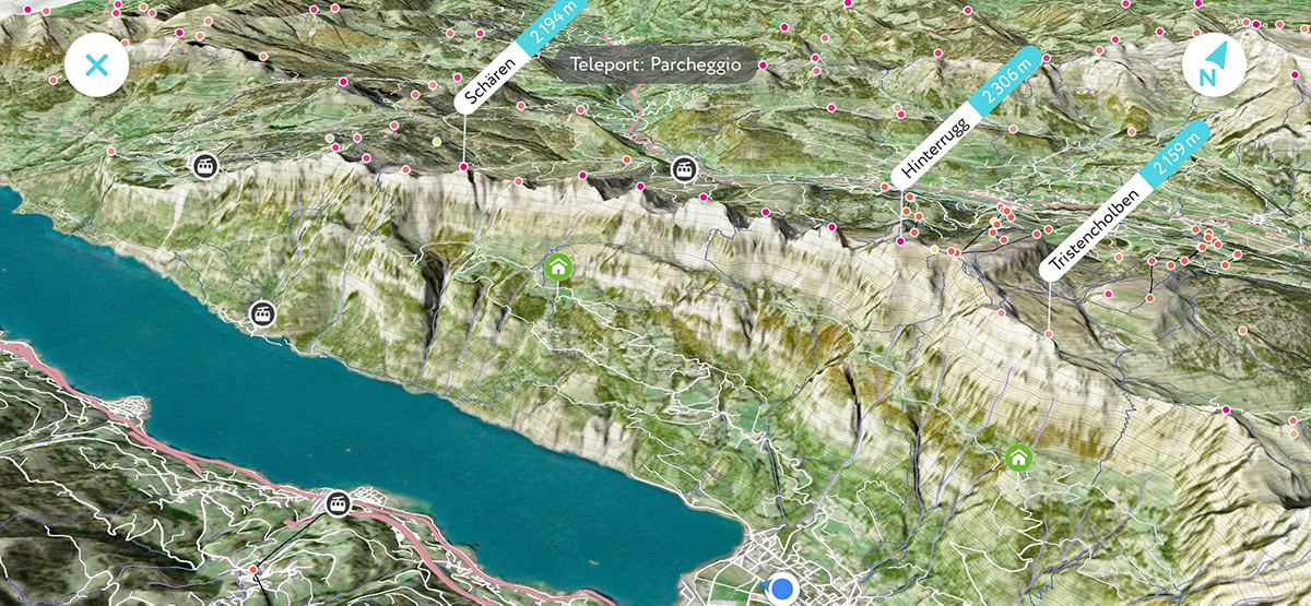
- Plan and enjoy scenic hikes with satellite 3D maps
- Tag mountains in photos
- Teleport to any location to explore your future travels in a 3D world
Now you don’t need to pay anything to use all the power of PeakVisor tech, as long as you stay online.
We are also introducing a Premium subscription for advanced hikers which includes:
- Unlimited Offline Capabilities (3D Maps, Peaks Identification)
- Custom Trails (import of GPX trails and other advanced features)
- Professional Photography Tools (sunlight emulation, photo planning)
All new users will have Premium capabilities enabled for 1 week, so you have plenty of time (and hopefully a couple of hikes) to decide whether it’s worth the small investment. The Premium subscription is just a cup of coffee (or two depending on the region) a month. It's almost nothing compared to everyday outdoor activity related expenses.
We appreciate all app supporters who bought the app in the early stages of the product. All the existing features will remain enabled forever without any additional cost. Nothing is taken away from your app. We will also continue improving the app and adding new features. There will be several brand new features which will be a part of a premium subscription (and you will have at least one year of free access to these features):
- Offline use of Satellite Imagery in the 3D maps (sorry, we don't have our own satellites yet)
- Custom Trails
- Professional Photography Tools
We're making this change so that we can dedicate all of our time and effort to the PeakVisor technology, without needing to seek out a side gig to feed ourselves and our families between new release sprints. In a nutshell, we are dedicated to making the best outdoor app for you and are asking for the equivalent to a cup of coffee each month to support this journey.