An Ascent of Acatenango: A Story of Fire on the Volcán de Fuego, Dreamy Cloud Forest, and New Travel Companions
Guatemala is a magical and severely underrated travel destination. Its raw beauty, mountainous terrain, and over 14,000 years of human existence have created a land brimming with culture and authentic human connection.
The landscape harkens me back to my home in British Columbia, Canada. Both have rugged coastlines, pristine lakes, and towering mountains. Yet, one distinct difference is that Guatemala is home to a diverse array of volcanoes, several of which are still active today.
Deep in the heart of Guatemala’s Sierra Madre de Chipas Range lies one of Central America's most frequently summited volcanoes, Acatenango. Although this volcano is impressive in its own right, standing at 3,976 m (13,045 ft), most visitors embark on this journey with the hopes of seeing something even greater: to catch a glimpse of the neighbouring Volcán de Fuego erupting into the night sky.
The Acatenango and Fuego hike is not for the faint of heart. To complete the entire trifecta like we did will take you through 20+ km (12.4 mi) and over 2,000 m (6,562 ft) of elevation gain in a mere 24 hours.
Throughout this journey, you’ll encounter complex trail conditions, howling winds, rain, possible altitude sickness, and, as you ascend to the upper reaches of the mountain, near 0°C temperatures. Nevertheless, standing in awe of Mother Nature's fury, witnessing a volcanic eruption from less than a kilometer away will stir up some powerful feelings.
For me, this adventure came to be about something far deeper than chasing lava. It became a discovery about how the right people, met by chance on a trail, can turn even the toughest journey into something unforgettable. Whether you aim to tackle this fiery mountain in a day or take a guided overnight tour like I did, this might be one of the most remarkable experiences of your life.
Acatenango Trip Planning
As my time around the area was short and I was travelling solo, I opted for an overnight guided tour. When selecting a tour operator, I went by word of mouth and learned Soy Tours had a stellar online reputation, comfortable cabins, good food, and hotel pick-ups. Neither I nor PeakVisor has any affiliation with Soy Tours; however, as you’ll come to read, the experience was nothing short of incredible.
Your footwear choice will be the most critical decision you can make on this trek. Seasoned hikers can get away with a pair of trail runners. Otherwise, a solid pair of lightweight hiking boots will give you the support you need over the 20+ km round-trip.
The weather here is highly unpredictable, and during the rainy season (April-October), thunderstorms are frequent. Meteorology reports are almost always off the mark, so you’ll want to pack like it’s going to be wet and cold. Multiple layers and a waterproof shell will prepare you for below-freezing temperatures and even possible snow or otherwise mixed frozen precipitation.
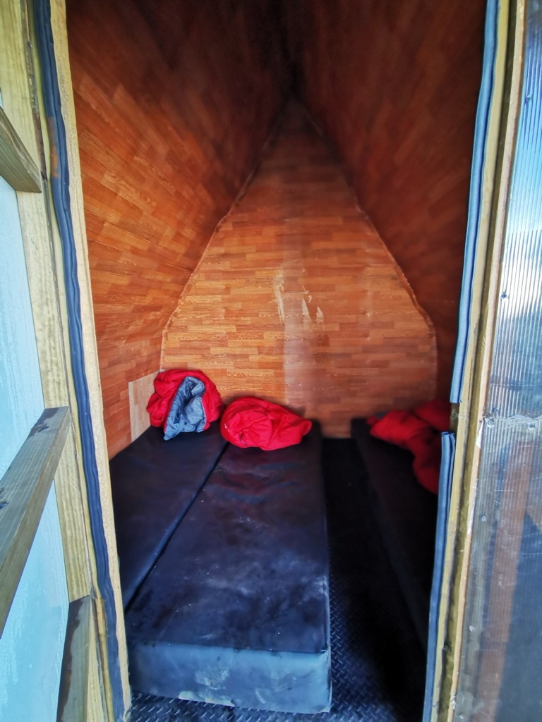
The obvious advantage of a guided tour is that everything will be sorted for you. Three hot meals, warm clothes, shelter, and sleeping gear are all included. Bring a backpack large enough for 4-5 L of water, snacks, and clothing. Even if you lack the basics, tour companies rent backpacks, hiking poles, headlamps, and even hiking boots.
Remember to pack smart, as each pound will add up. Nevertheless, an entire economy has sprung up around the mountain and there are even porters you can hire to carry your bag!
Here’s a list of everything I brought.
- Backcountry Shell Jacket
- Midlayer
- Hiking Pants
- Gloves
- Ball Cap
- Toque
- 5 L of water / Gatorade
- Snacks
- 3 pairs of socks
- Headlamp
- Wipes
- Face Buff (neck gaiter)
- Flip flops
- Sun screen
- Toiletries
By far, the most important thing we were told to bring was an open and optimistic attitude. That turned out to be the most beneficial piece of advice. Being friendly and outgoing created an opportunity for solo travellers to unite in the shared struggle and celebrate the highs of this experience together.
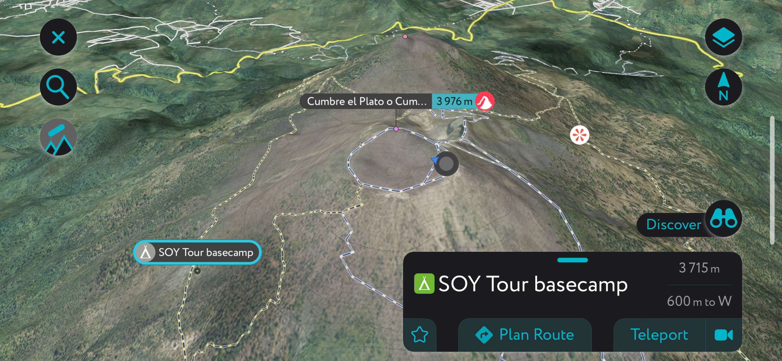
Using the PeakVisor App
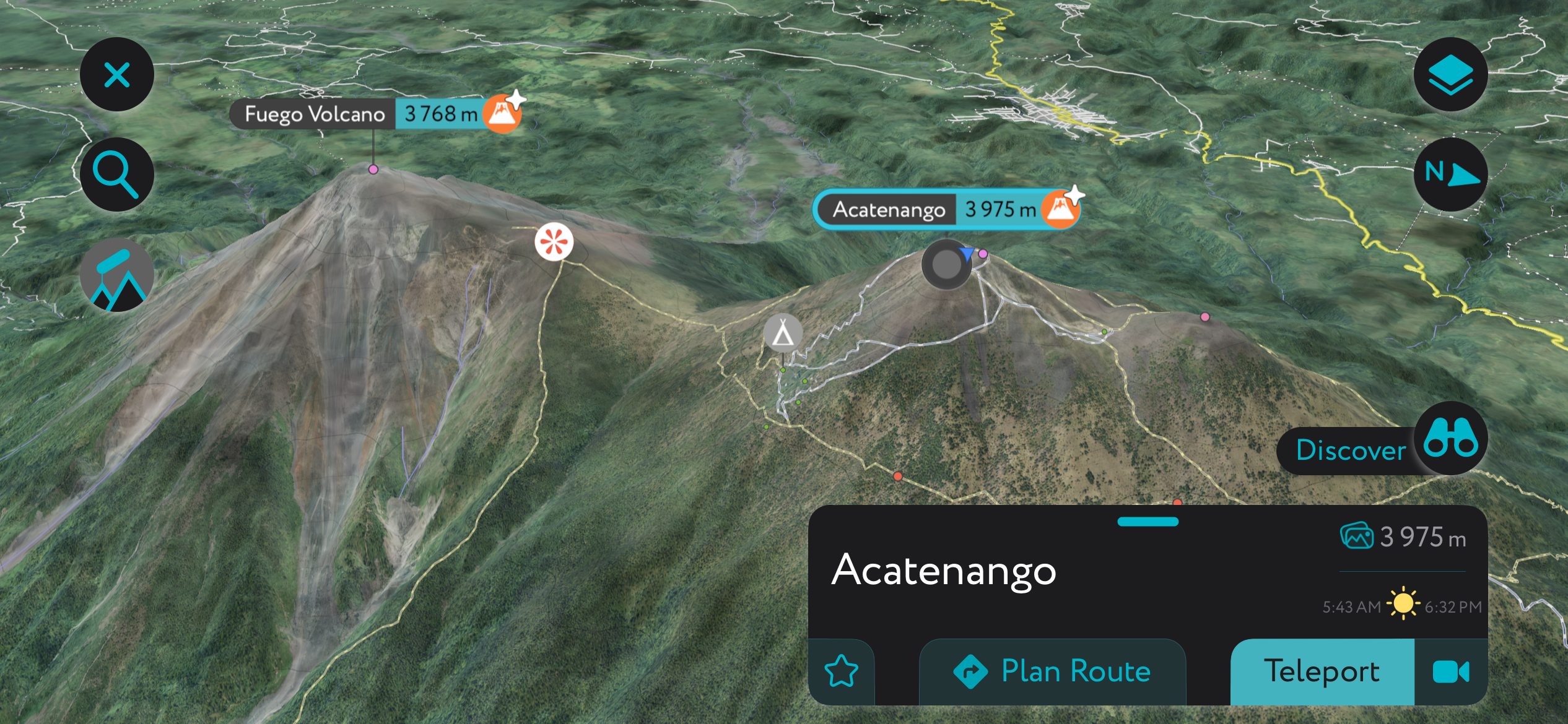
Acatenango on our mobile app
You can plan and track your Acatenango adventure on our mobile app. When planning a trip, you can view all the statistics for each hike, including vertical gain, length, and estimated time to completion. You can also use our desktop planner to explore on the big screen, seamlessly saving routes to your profile on the mobile app.
Even if you use a guiding company, like I did, it’s still fun to keep track of your hikes and pinpoint your location on the mountain at any given time.
The app is a trove of information with thousands of routes, trails, peaks, cabins, and parking areas worldwide. It’s all on here. In addition to planning your own route, you can also upload .gpx files if we don't have a trail on our servers. The PeakVisor app is available for iOS and Android; give it a shot and discover our visually stunning 3D Maps, adding a new dimension to your alpine adventures.
Getting to Acatenango
The Acatenango trailhead is located in the small town of La Soledad, Guatemala. It’s 73 km (45 mi) west and roughly a 2-hour drive from Guatemala City, the capital.
However, travellers usually flock to the historic colonial town of Antigua, only 25 km (16 mi) away. This city is bustling with Spanish influence and stunning scenery; it’s worth hanging out here for a few days. And at less than an hour from the trailhead, it’s the preferred starting location.
I made my way to Antigua from Guatemala City using one of the many shuttle companies available. From there, I settled in for a few days and prepared for the hike.
Trail Overview
The Acatenango hike can technically be a three-stager, especially if you opt to stay up here for a night. Each leg we did goes as follows.
From the trailhead to camp on Acatenango (7 km / 4.4 mi), from camp to Fuego Ridge round-trip (6.2 km / 3.9 mi), and finally, from camp to the summit round-trip (2 km / 1.2 mi). Our time for each section was about 5 hours to camp, with several breaks, 4 hours round-trip to Fuego, and 1.5 hours round-trip to the summit. The descent only took 2.5 hours with two stops.
The hike is considered difficult, with each stage progressively harder than the last. The unique combination of distance, elevation, thin air, exposure, sandstorms, and weather adds to the challenge. If it rains up here, the trail surface can become very slippery.
The trail is a mixture of semi-maintained single track through jungle, exposed hard-packed sand above the treeline, and a punchy scramble up sharp volcanic rocks to both Fuego Ridge and Acatenango Summit. The latter two will require some scrambling up and down eroded igneous rock fields. Tread carefully here, as even the slightest slip can leave a hefty scratch from serrated volcanic stone.
As it’s a popular hike, you’ll run into groups of tourists on the way up, with a bit of a rush hour coming back from Fuego Ridge. It’s all entirely manageable; we really only ran into traffic coming down from Fuego Ridge, and as we caught up with groups about halfway down the following morning.
Day 1
The tour bus arrived at 7:30 a.m. sharp. I eagerly climbed aboard and quickly realized I was the only person on the bus. More people piled into the bus as it stopped at multiple spots around Antigua before heading to the office in La Soledad, and I had an opportunity to meet and mingle with other solo travellers.
The one-hour drive from Antigua twists and climbs over 1,000 m (3000) from the Guatemala Highlands through the Sierra Madre mountain range. You’ll pass numerous coffee plantations, corn fields, and squash terraces, which beautifully dot the mountainside.
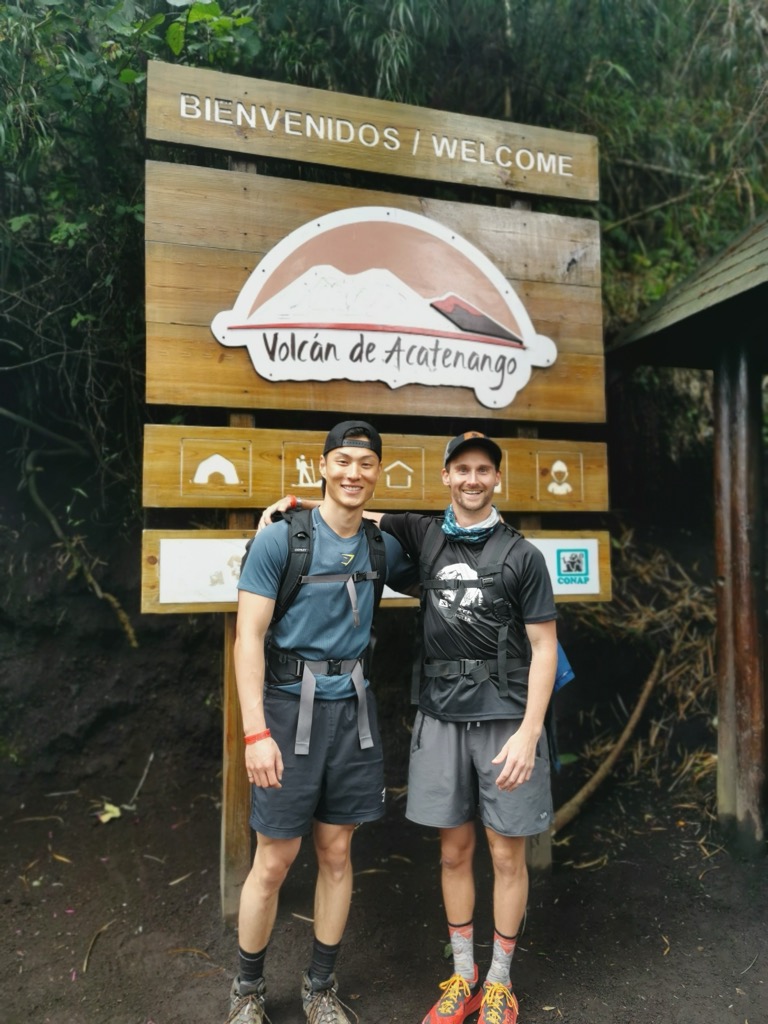
After arriving at the office, I grabbed warm clothes and befriended other travellers. We were introduced to our guides and briefed for the trek. A group of over 30 guests and several guides set off down the paved road, and a mere five minutes later, we reached the trailhead.
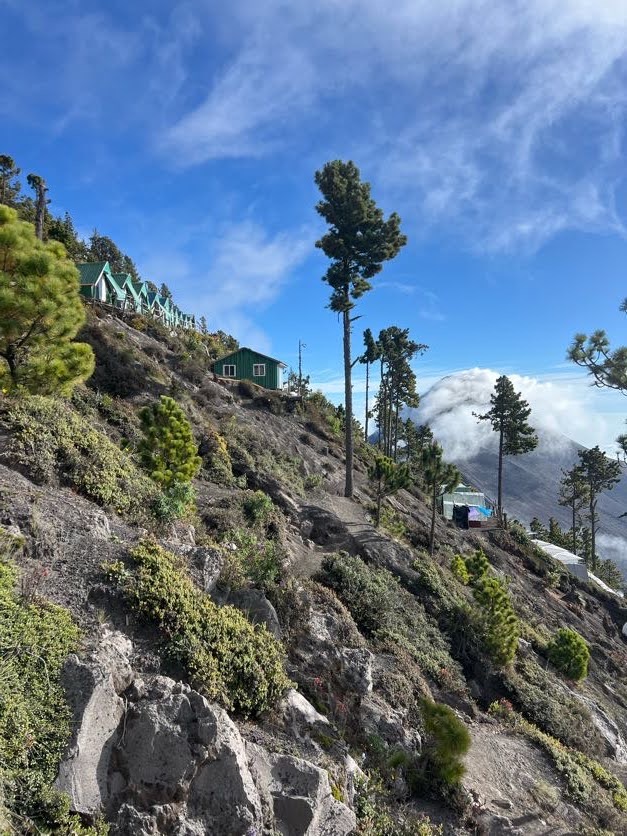
The Ascent to Camp at 3,756 m
The 7 km (4.3 mi) trail starts steeply as you get tossed right into the experience. A wide dirt trail cuts through farmland, which quickly increases in grade. Guides set a manageable pace. We each found our rhythm as seasoned hikers made their way to the front.
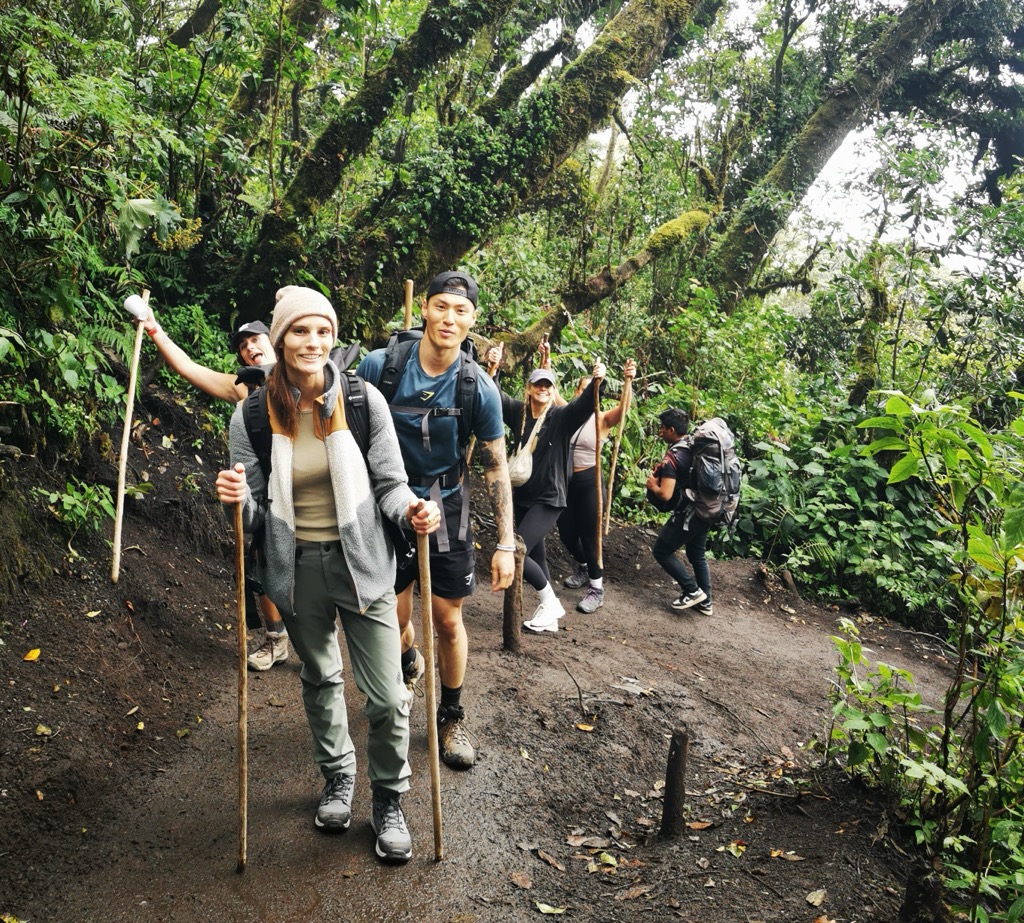
Hiking alongside a fellow Canadian, we swapped travel stories and discussed our many adventures back home. With both of us tackling Central America solo, it was nice to discover a new friend.
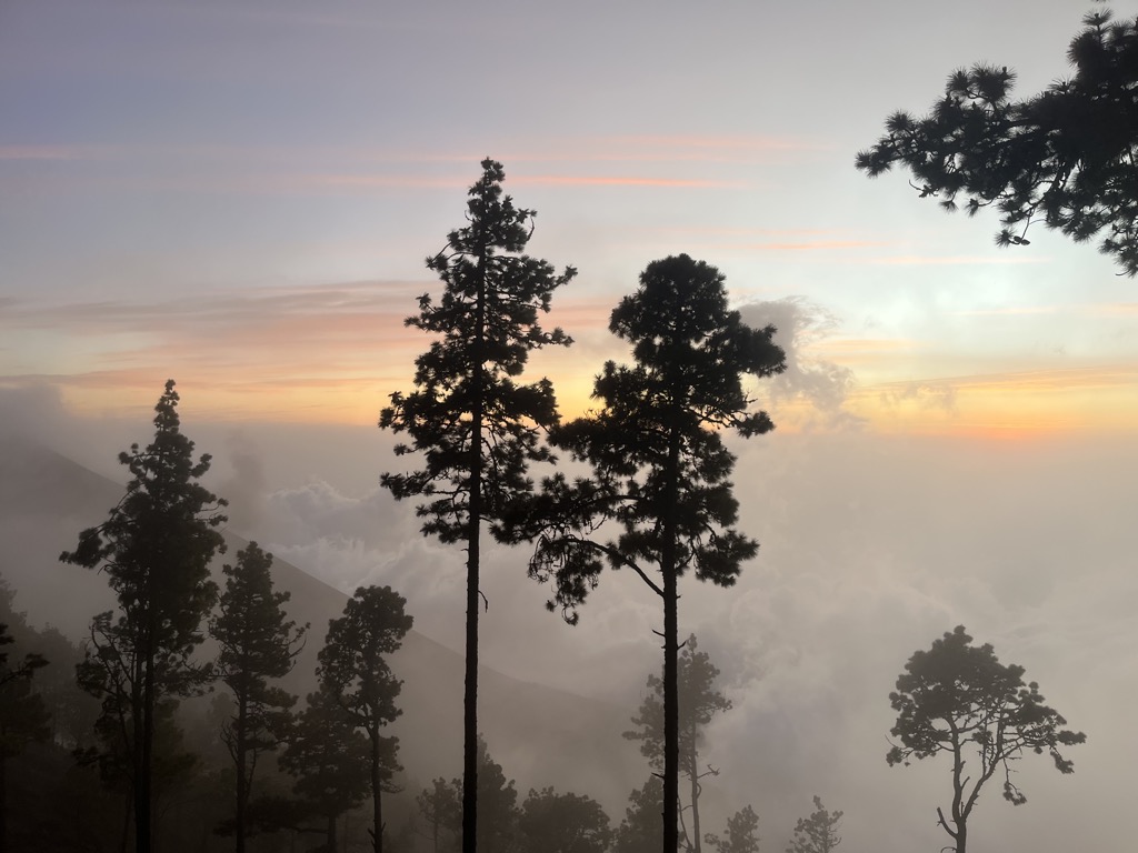
After about an hour, dusty fields disappeared and the trail entered a lush rainforest. Tall moss-draped pines and cooler temperatures offered a welcome relief. Although this section wasn’t as steep as the farmland, scattered showers made for a few slippery sections.
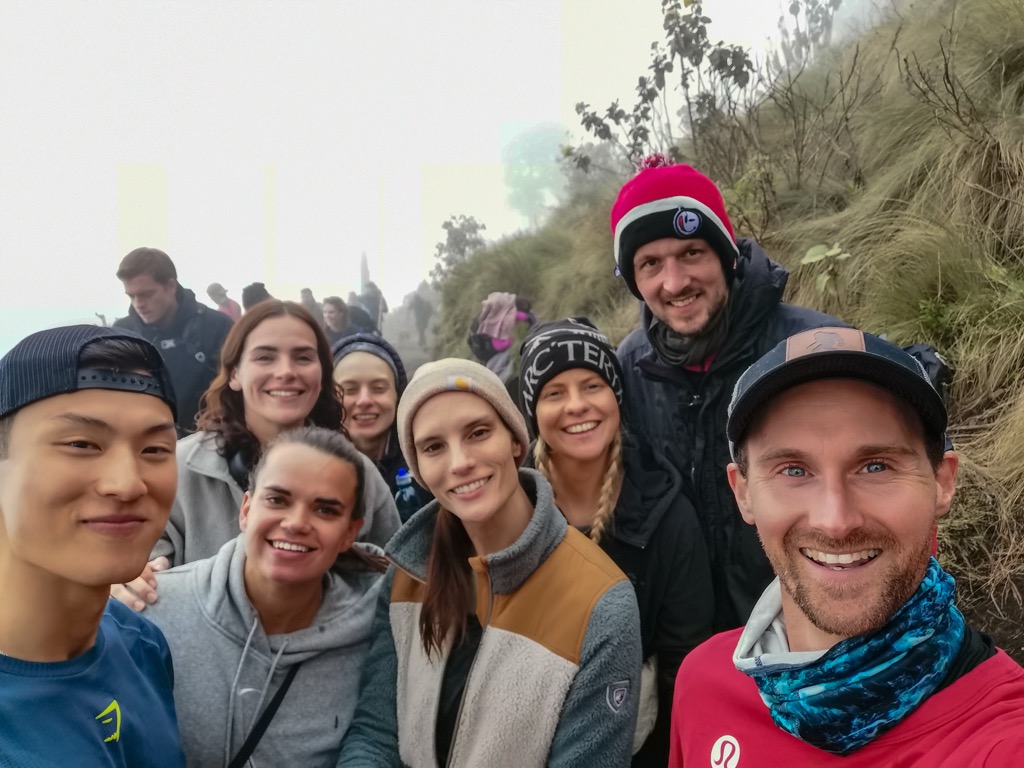
One friend quickly turned into several from around the world, and good vibes were spreading. The excitement of a growing crew and engaging conversation quickly extinguished any hints of fatigue.
We pushed on through the rainforest, passing small vendors selling drinks and snacks along the trail (like I said, there’s an entire economy around this hike), before stopping for lunch at a rest area around the 3 km (1.8 mi) mark.
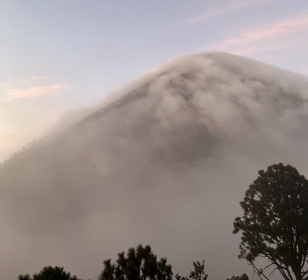
Cold bodies and tight muscles met us as we ventured back on the trail post lunch. Still deep in the underbrush, fog blanketed the cloud forest, and visibility lowered significantly. It was an eerie, surreal experience with clouds whipping through vivid greenery.
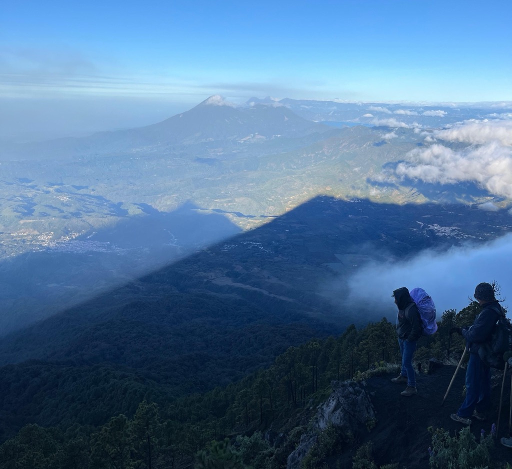
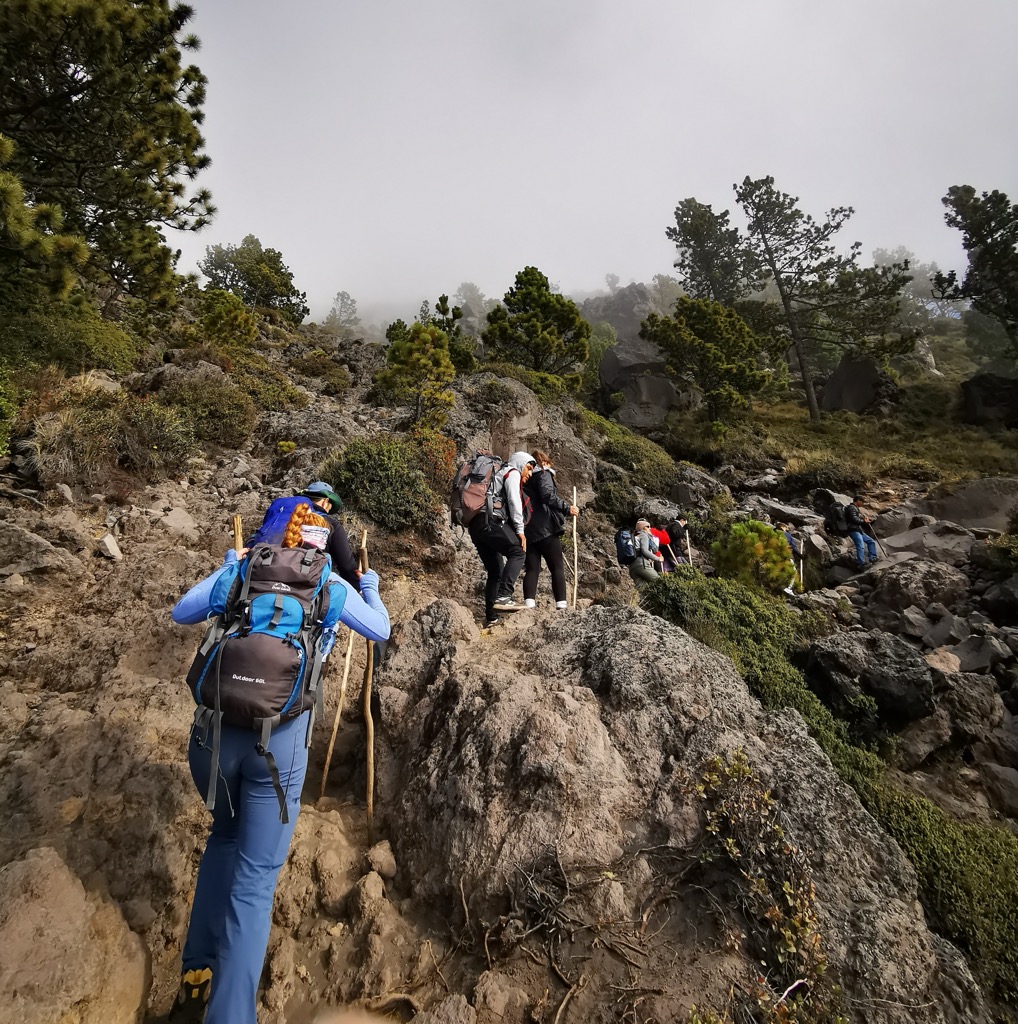
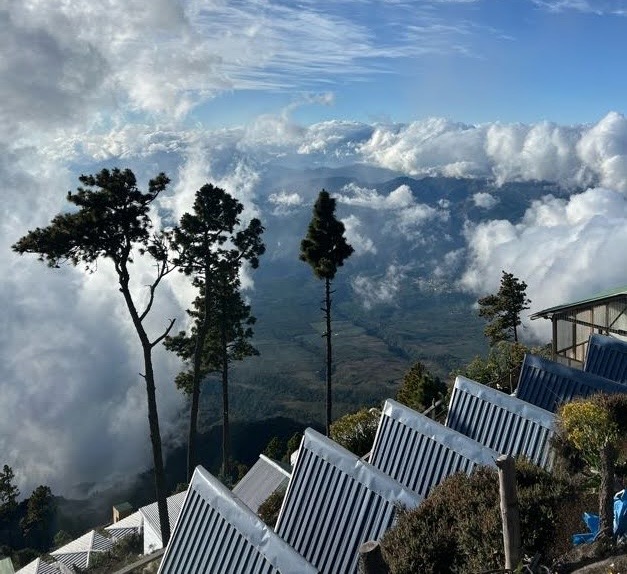
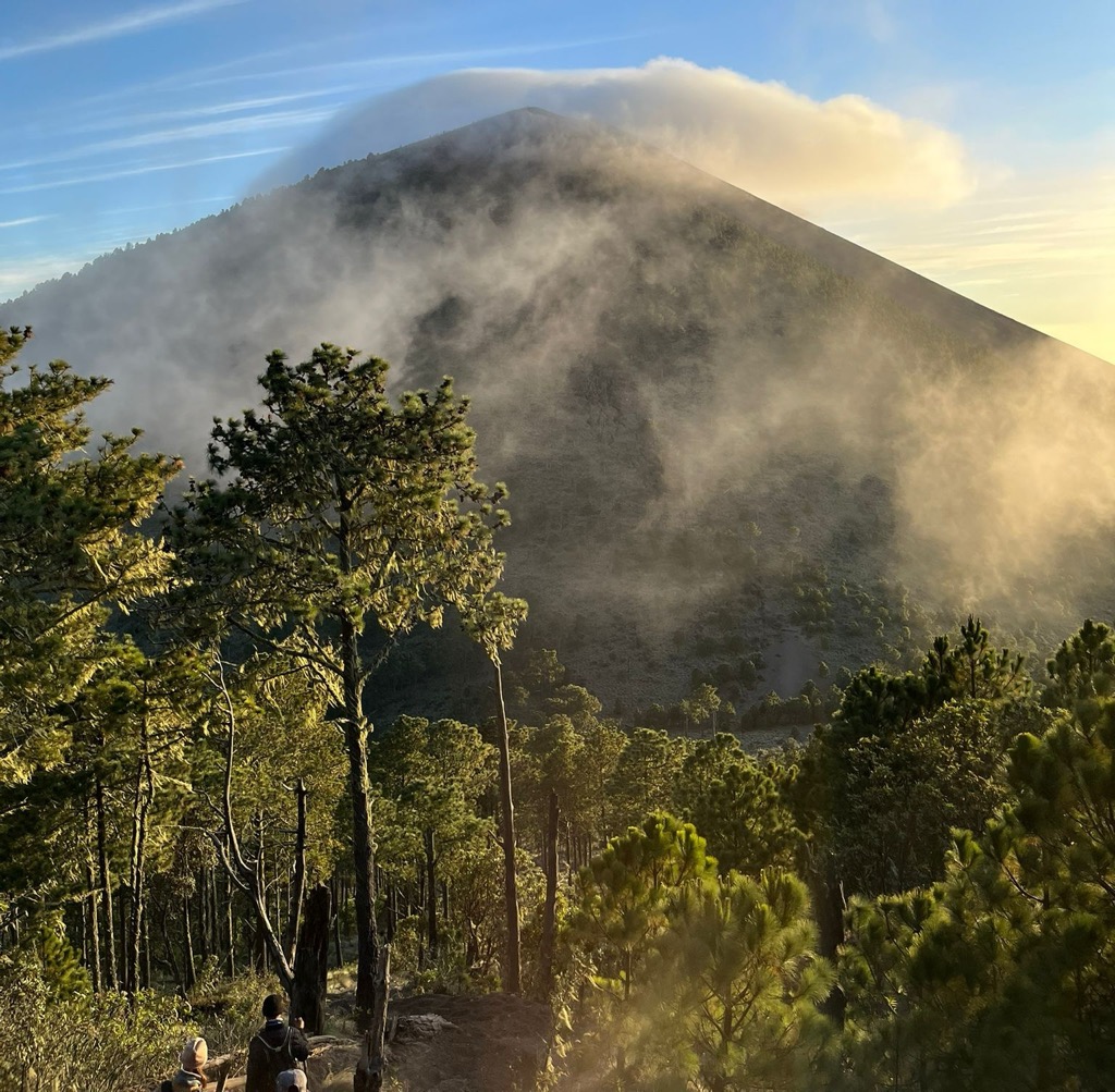
The final few kilometres become a test. An increasing grade awaited as we ascended further up Acatenango and broke into the alpine. Trees began to thin, and our surroundings shifted from vegetation to a desolate landscape of volcanic gravel and barren rock obscured by clouds. Faint outlines of broken lava fields and landslide paths appeared as we navigated the steep trail through the fog. We had entered an entirely different world.
As we pushed past the 3,700 m mark, heavy winds started to siphon off the clouds, and the sun warmed our cold and wet bodies. Looks of awe set in as our surroundings became fully apparent to us. High on the side of Acatenango, we peered down at the villages far below and then across to Fuego, which was finally coming into view. A feeling of relief and excitement swept over our group as we realized we had a chance to witness an eruption.
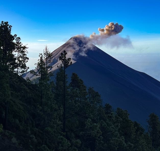
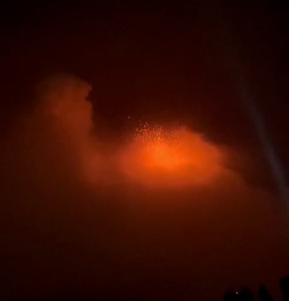
So what’s an eruption like? With camp visible up ahead, thick black smoke suddenly rose above the parting clouds, and a deep volcanic rumble reverberated through our bodies. Our first eruption!
Fatigue seemed to melt away, and we were giddy with excitement. Energized with optimism and an appreciation for the power locked inside these fiery mountains, I knew I wanted to get closer, and luckily, there was an opportunity for just that.
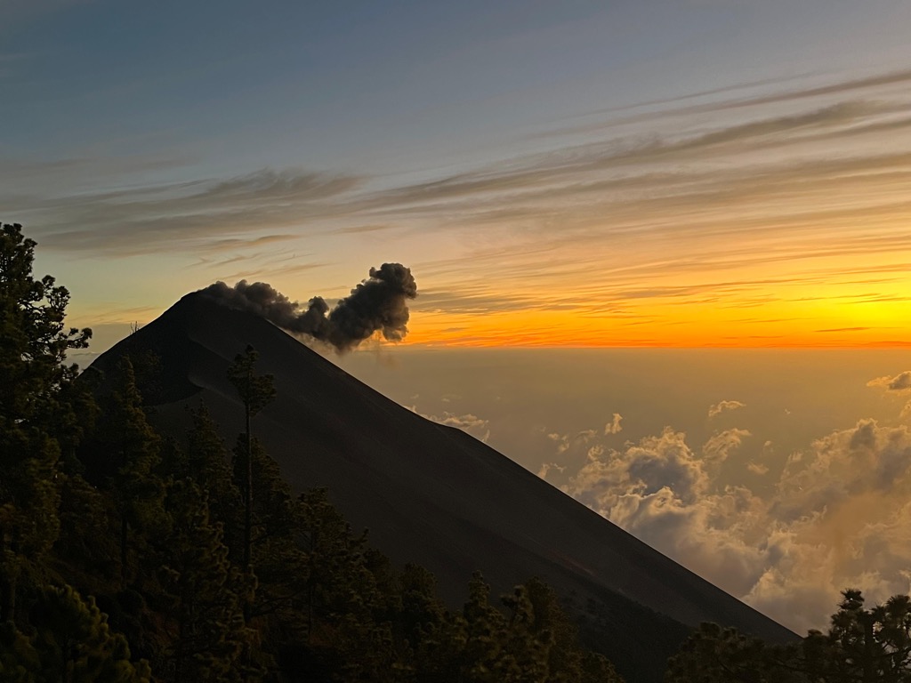
Our clearest view of Fuego erupting.
Photo: Myriam Breu
To Fuego Ridge
Although I didn’t initially plan on hiking Fuego Ridge, most of the crew we formed on the way up was eager to tackle it, even with the clouds rolling in.
With a few playful jabs from peers, I knew it would be a lifelong regret if I didn’t say yes. Of course, the chance of seeing an eruption up close outweighed any imagined comforts of spending a relaxing evening at camp.
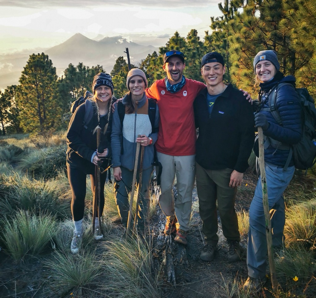
A handful of us set off on the 5.4 km round-trip, which included almost 700 m of combined elevation gain and an average grade of 24%, all on top of what we had just done. Brimming with enthusiasm, our group aimed to hit the valley between the volcanoes for sunset. We moved surprisingly fast. Even the guides were in high spirits and laughing as they loved our faster pace and “Soy Tours” chant.
What started as stepping down a steep rocky trail in the alpine quickly turned into hard-packed volcanic dirt that crossed the thin pine forest to the valley. The first 1.6 km (1 mi) blew by as 416 m of elevation melted away. We entered the valley for a short rest, took some photos, and embraced sunset as the alpine ignited in alpenglow.
Energized to reach the ridge, we put our heads down and funneled up the steepest section of the day. This trail, carved through volcanic sand and stone, was cut by a mixture of foot traffic and rainwater and was seriously steep. Well over a 30% grade and one wrong step could send you rolling into jagged boulders below.
The weather quickly cooled, and rainclouds rolled in. Our pace dipped, and chatter quieted. A long day, thin air, deteriorating visibility, and wet clothing hit hard. Fatigue was setting in. With moral support from our group and guides, we pushed on and remained optimistic that the clouds would clear.
As we crested Fuego ridge, the slope eased and Fuego’s silhouette emerged through swirling clouds and a darkening night sky. Relief at last, we had made it. After a full day’s effort, we now stood less than a kilometre away from one of the most active volcanoes in the world. This had been a huge goal, and though unspoken, we all knew we’d been driving each other forward the whole way.
We planned to hang out on the ridge and see if we could catch an eruption, but the temperature was dropping fast. The clouds were thick, whipped by the howling winds that also cut through our wet clothing. Suddenly, a glow of orange illuminated the sky as lava shot through the clouds, followed by a sonorous boom seconds later.
I watched silently as waves of lava fell almost in slow motion back to earth and crashed onto the mountainside. A mixture of euphoria, joy, and primal fear pulsed through my body. I felt so alive in a way I’ll never forget.
There were smiles, laughter, and joy at the success we achieved, given the conditions. Relief washed over the group as we knew anything more was a treat. Smaller eruptions continued as thick clouds glowed orange, shielding us from a full view. It didn’t matter; we got our show.
The guides rounded us up for the return trip as we peered into the darkness, hoping for one more burst of fury from the mountain. Was it selfish to ask for one more?
Well, that evening on the ridge, we got our final show. With a quick break in the clouds, Fuego thundered and exploded not once, but twice. Steady walls of molten rock erupted hundreds of metres into the sky for almost a minute. We had just witnessed the largest eruption of the evening.
Emotionally satiated, but unable to feel my fingers, our guides wrangled us with their cheerful “Soy Tours! Vamos Chicas Chicos”. It was time to do what we had just done, but this time in reverse and in full darkness. Carefully climbing down Fuego ridge to the valley, hands on rocks supported slippery terrain and big steps. Fatigue was real, and an eagerness to reach camp was building.
I longed for a hot meal and to get off my feet. Luckily, our group of friends kept the energy afloat and provided the distraction we all needed. We trundled across the valley and back up the 416 m ascent to Acatenango. Once the lights from camp came into view above us, one final push brought us to our destination.
What a feeling it was. To sit down beside a warm fire, connect over the experience, and scoff down a tasty hot meal prepared by our caring guides. Dinner concluded and everyone quickly disappeared to their huts to sleep, but I stayed up. I’ve always enjoyed being the last one up on an overnight. There’s a certain peace that comes with sitting alone after a big day and reflecting on the experience.
With the stars out and a glow of villages far below, I sat and peered across to the faint outline of Fuego Ridge, where I had stood hours ago. The night sky began to light up, and Fuego let loose another massive eruption with a thunderous crack seconds later. What a surreal way to finish the day, I thought.
Day 2
To the Summit at 3,976 m (13,044 ft)
Our morning started with a bang at 4:30 A.M.
Not from Fuego, who, unlike us, was sleeping peacefully, but from our guides smacking the sides of our tin hut to rally those interested in summiting Acatenango for sunrise.
I popped my head out of the tin shelter only to be blasted by cold, wet air from the rain cloud we were currently stuck in. Every ounce of me wanted to snuggle back in my sleeping bag, but I told myself to dig deep, say yes, and hit the summit.
I threw on every layer I had, left the warmth of the hut, and greeted the morning at 3,756 m (12,322 ft).
Given the conditions, our guides said there might not be much to see at the summit this morning, and a clear sunrise wasn’t in the cards. Hearing this, the majority of the tour group disappeared back into their shelters to slumber for a few more hours, like groundhogs accepting the continuation of winter.
A dozen or so of us ventured out into the early morning darkness on the 2 km round-trip to the summit. This section of trail was by far the steepest of the entire hike. 300 m of elevation gain in under a kilometer equated to punchy sections and scrambles that did not let up.
The alpine trail was cut from a mixture of hardened volcanic dust, sharp rocks, and boulders. On a good morning, this would’ve been a challenge. Throw in howling winds, rain, near 0°C temps, and limited visibility, and you’ve got one hell of a situation.
About halfway up, our guides informed us that continuing further would expose us to the full brunt of the deteriorating weather. The already slippery rock trail would worsen. There would be no chance of seeing anything at the summit, and we should consider turning back. My heart sank. To get this far and be so close was something I did not want to digest. Luckily, neither did a few of the other seasoned hikers from our crew the day before.
We caught each other's glances in the light of our headlamps, a tacit acknowledgement that we would summit. The five of us caught the attention of our three guides, signalled to our group, and pointed up. The guides discussed amongst themselves until one of them walked over, smiled, and shouted through the deafening wind: “Vamos Chicos!”
That was our green light. And so, while the others turned back, our group set off knowing that in 20 minutes at most, we’d be at the summit. Whether it was the adrenaline pumping through our bodies or the deeply penetrating cold, we tackled that last stretch at a blistering pace.
As we neared the summit, the trail leveled out and Mother Nature welcomed us to what life on top of a volcano at 3,976 m (13,1044 ft). The cold wind roared; You could lean over at a 45° angle and be supported by it. The rain flew sideways across the peak and the volcanic dust blasted my face, giving it a much-needed exfoliation. We couldn’t see anything, but we’d made it and we let out a roar of excitement, which was quickly carried off by the wind. For all of us, this was the highest point on earth we’d ever been.
One of the guys busted out a single shot of Quezalteca Tamarindo and downed it. I kissed the cross at the top, sank my hands into the dust, and thanked the volcano for the experience. We snapped photos. Once the excitement settled, the cold set in and we quickly set off back down the volcano to camp.
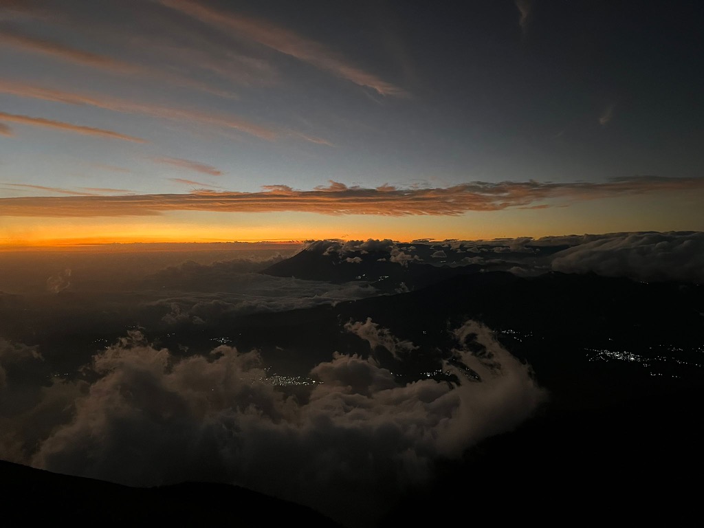
Our descent was fast and quiet. As the surreal light of a new day glowed on the horizon, the clouds dissipated and visibility improved, exposing the faint outline of Fuego. The earth rumbled, and Fuego woke with a massive early morning eruption that lit up the still-dark sky, splashing lava down the mountainside. We all shouted in excitement as this was the biggest eruption we’d seen so far. A small reward for our gruelling early morning efforts.
A few tears of joy streamed down my cheeks. I think it was at this time that it all just hit me. A genuine connection to the land, my fellow adventurers, and myself brought me to this exact moment. It was simply perfect.
The clouds continued to clear, and as the sun broke through, we made it back to camp, where a warm fire and breakfast welcomed us. We detailed our experience to the others who looked at us with a mixture of awe and lunacy for what we pulled off.
The Return Trip
After scarfing down the traditional Guatemalan breakfast and locally grown coffee our guides had prepared, the time had come for us to bid farewell to our volcanic home. A final eruption puffed smoke and ash into the skies one last time before clouds rose up the mountainside and Fuego disappeared out of sight. The guides gathered everyone and we began the trip home.
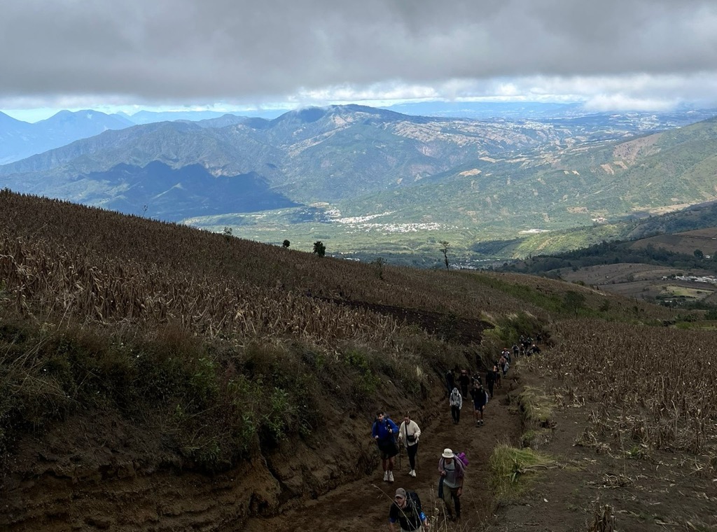
The 7 km (4.4 mi) descent felt like a dream. With clearer skies, we could truly see the landscape we’d climbed through. Barren alpine zones, tall pines, lush cloud forests, and farmland communities carved into the valleys below. The trail that had challenged us the day before now passed in a blur of conversation, shared reflection and wry jokes about our friends who now had to carry their own bags down. Although the path was well maintained, the rain-soaked volcanic dirt made for some interesting steps, especially on steep switchbacks and narrow chutes. Even with the sketchy conditions, the kilometres seemed to melt away.
Finally, the snackstands came into view; what a welcome sight they were! Fresh local fruit, sugary drinks, hot coffee, and even warm soup enticed those who had run out of food or needed some extra comforts.
As we neared the final kilometer of our hike, almost 24 hours from when we started, the trail jammed up with new tour groups passing by. We exchanged glances and coy smiles as a few newcomers asked about our experience, which we quickly detailed by downplaying what lies ahead. Twenty-four hours in, and we were the veterans of the mountains!
With the main road in sight, feelings of completion and success spread. We passed through the final farmfield, and once our feet hit the pavement, cheers rang out.
Back at the office, we gave back our wet clothing, enjoyed a drink, exchanged contacts, and snapped final photos of our fantastic crew.
Conclusion
On paper, Acatenango was simply a strenuous overnight trek, but to stand on Fuego Ridge watching molten lava streak across the sky, you realize it’s about something deeper.
Two volcanoes set the stage where nature's raw power met perseverance, where strangers became friends, and where our perceived limits were left in the valley far below. Through the storms, the cold, and the relentless climb, none of it could overshadow what we witnessed or the laughs and solidarity that carried us through it.
I left empowered, with a full heart and gratitude for Earth’s wild beauty. Guatemala offered me a great challenge. At the end of the tunnel was not just magnificent landscapes. The nation showed me her soul—something in short supply in our age of technology and AI—and it will forever summon me back.