Wake up, no makeup, it is early morn and feels like hiking? What are the mountains near? Which mountains are close enough to hike? With a staggering number of over a million mountains across the globe, the PeakVisor app is best positioned to answer your question!
Let us show you how you can find all the mountains near you and plan adventures exploring them. In fact, we present not 1 but 3 ways to do the job!
1. Local Mountains Directory
PeakVisor app for any location in the world composes a list of peaks, mountain passes, and lakes in the area. The list might be thousands of objects long or relatively brief but it is almost impossible to find a place on Earth where there are no summits at all. We bet you’ll be surprised how many of them are virtually a stone throw away from your cosy house.
You can find all the surrounding mountains using the Local Search menu item. All the mountains are listed there and sorted by elevation. Also, you can apply filters to find the one you are looking for. Tap on the list to get detailed information as demonstrated in the screenshots below. From the detailed information popup you can instantly teleport to the summit to evaluate the view from the top. Comes in handy given the recent restrictions on travelling.

Depending on the settings of your PeakVisor app, the directory will contain mountains in the radius of either 120, 160, or 200 km (80, 100, 120 miles).
2. Mountains Explorer
PeakVisor website provides a powerful mountain exploration tool. Open Mountain Explorer and use the Search Bar at the top to find your list. It might be a country, a region, or a small county, the size does not matter. You can even enter GPS coordinates to teleport to particular places and see whether there are any mountains in sight.
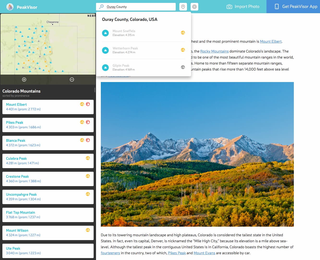
Using the search feature, you’ll find all administrative regions, protected areas, and national parks worldwide. For your convenience, we have meticulously counted all the summits in a given area so that you can easily find out how many mountains there are in some area. For example, Pierce County in Washington features 238 peaks with Mount Rainier being the most famous, the highest and the most prominent of them all. Also, there’s an interactive map with all the peaks and the list allowing you to teleport to any mountain.
This approach is particularly useful when you are preparing for a hike and doing research on a desktop.
3. 3D Maps
What can be better for exploring the mountains than realistic 3D maps?! PeakVisor 3D map presents a high-precision terrain model with satellite imagery at your current location unless you teleport far away.
Whenever at a new place, I always check the 3D map to get a better understanding of the mountains around me and hiking opportunities. Satellite imagery in 3D presentation allows an intuitive understanding of the terrain and it is easy to spot all the hiking trails. Oftentimes, I look for the highest mountain reachable via a sensible route that will still blow your mind away with staggering scenery. Depending on your preferences, you’ll be able to find an ideal mountain for your hike and plan the journey.
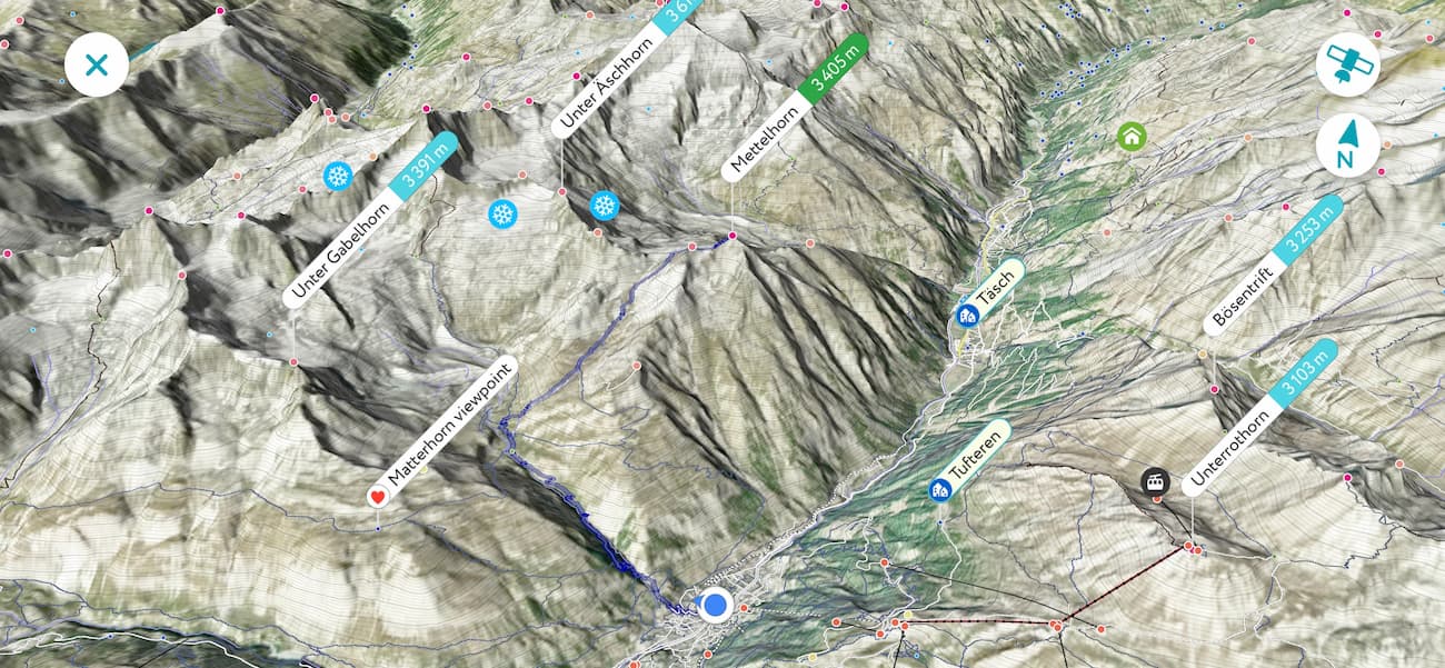
This one is especially popular among map geeks like we are in PeakVisor :-) Try it, you might fall in love with our 3D maps!
Here's a demo video that shows using Mountains Explorer and mobile 3D maps to find out all the mountains around:
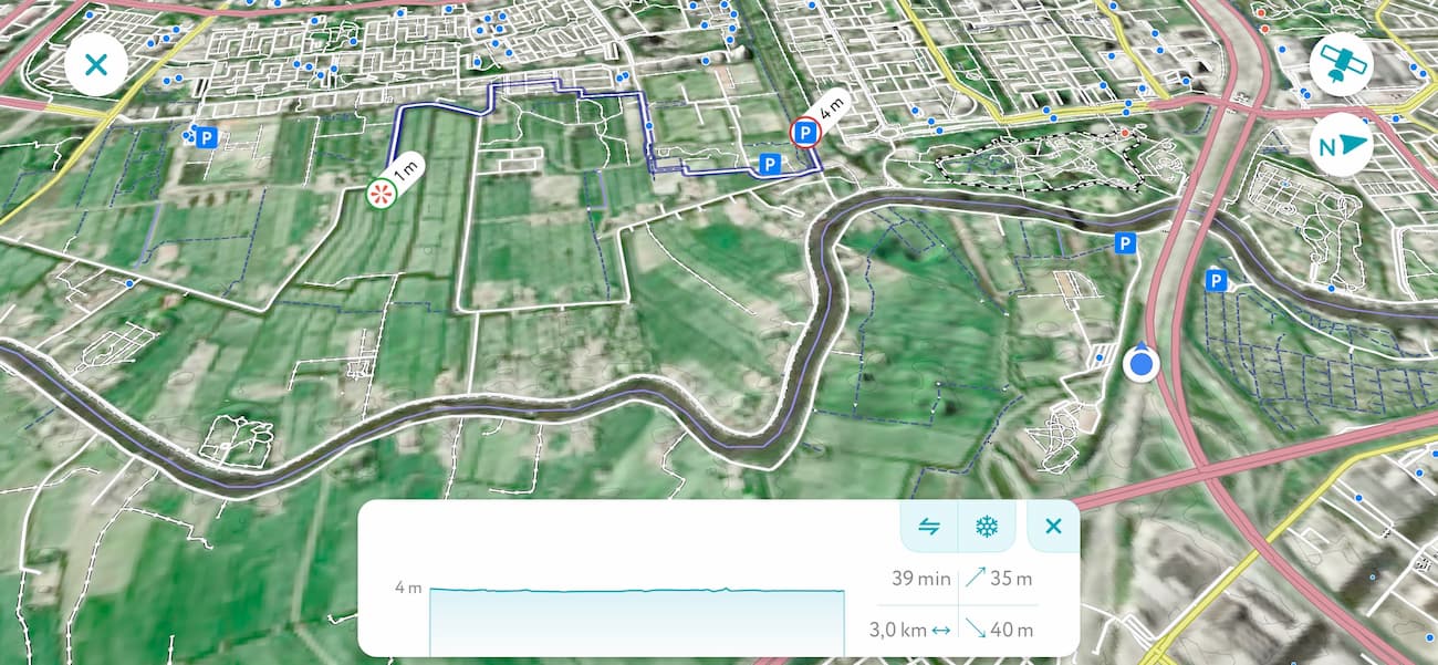
In the end, let me add that if there’s a vast plain around, you might still find amazing hiking opportunities by following the walking paths and viewpoints in the 3D Maps. For example, in a perfectly flat Amsterdam, you’ll find scenic viewpoints and walking (cycling, more likely) paths leading to them.
What tool would you prefer to use to find the mountains near you? What improvements would you like to see? Please let us know. Here at PeakVisor, we are thinking all the time about making these tools better and your feedback helps us greatly!
