Exploring A Delightful Regional Park in the Heart of the Alps
Most people lucky enough to visit the French Alps funnel through resort factories like Tignes, Val Thorens, or Chamonix. All of these places are exceptional, but there’s oh-so-much more to the story. Peel back the layers of the Alps and you’ll find paradise after paradise of lesser-known, but more culturally intact regions.
The Hautes-Alpes is a national treasure, as far as I’m concerned. The diversity of villages, cultures, landscapes, mountainscapes, small cities, and climates…it’s a lot to pack into one department, let alone the third least populated of France’s 83 departments. If you care to traverse the average square kilometer, expect to come across just 26 souls; that’s the official population density, though tourism swells in the winter and summer.
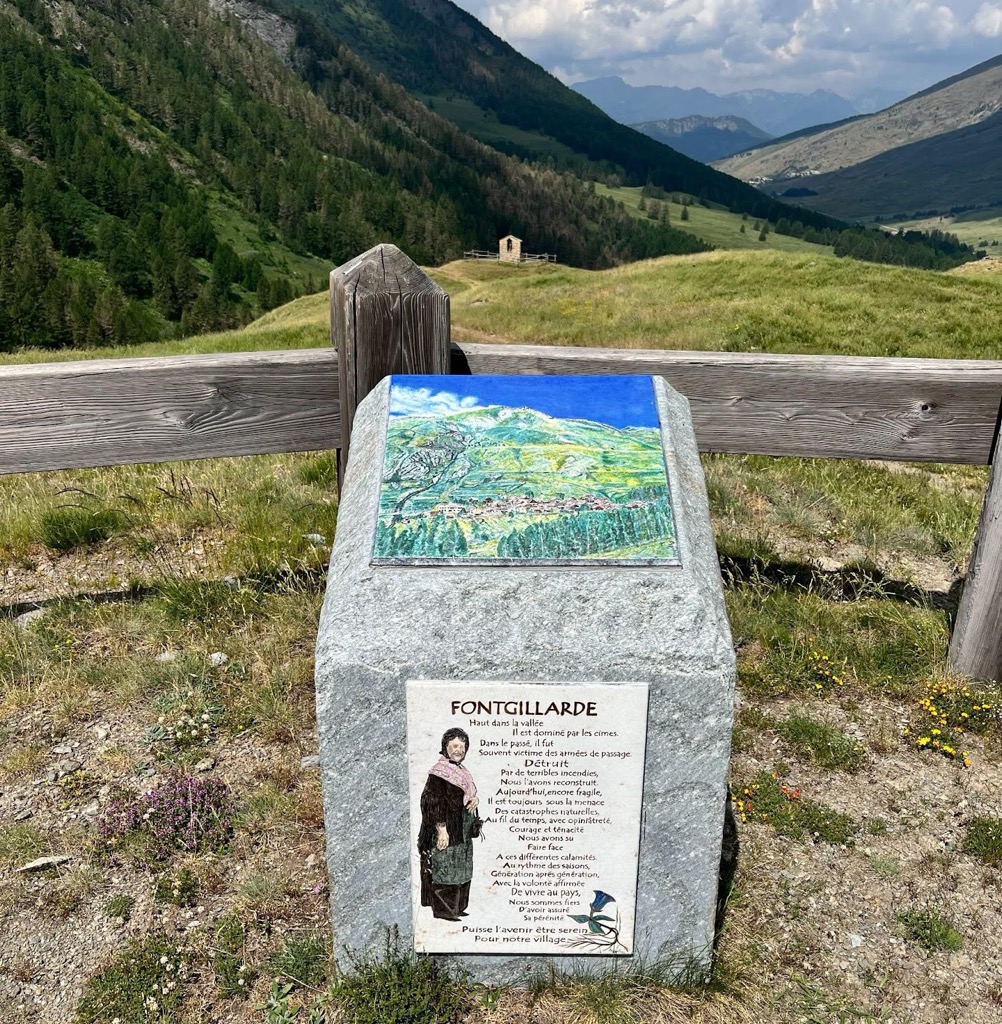
The Parc Naturel Régional du Queyras occupies the distant shores of Hautes-Alpes, snuggled up against the Italian border. However, I doubt traditional French alpine culture has survived better anywhere else in the department, though I’ve yet to explore every one of Hautes-Alpes' 162 communes.
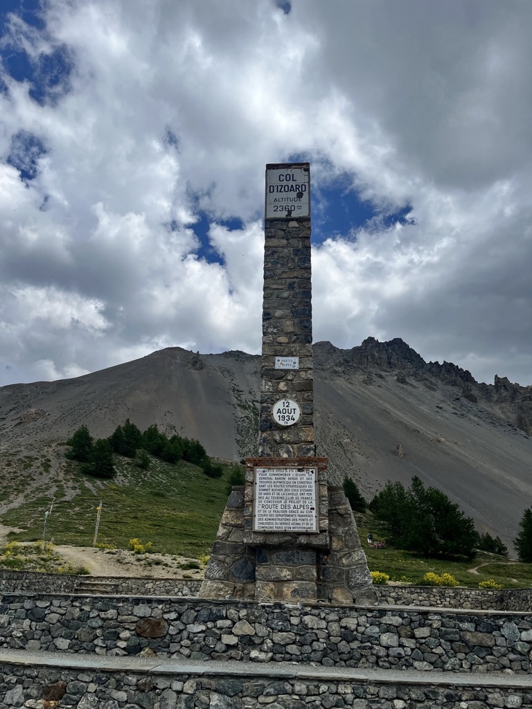
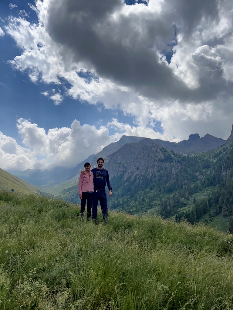
On this adventure, I was accompanied by my mother, who was excited to be visiting her son in France. Where to go on this trip? I made the call that we would journey to the distant land of the Queyras. We started our journey from La Grave, crossed the Col du Lautaret, descended into Briançon, ascended back up over the Col d’Izoard—where Napoleon crossed the Alps—descended back down into the Guil Valley, only to climb once more to the commune of Molines-en-Queyras, specifically the hamlet of Pierre Grosse.
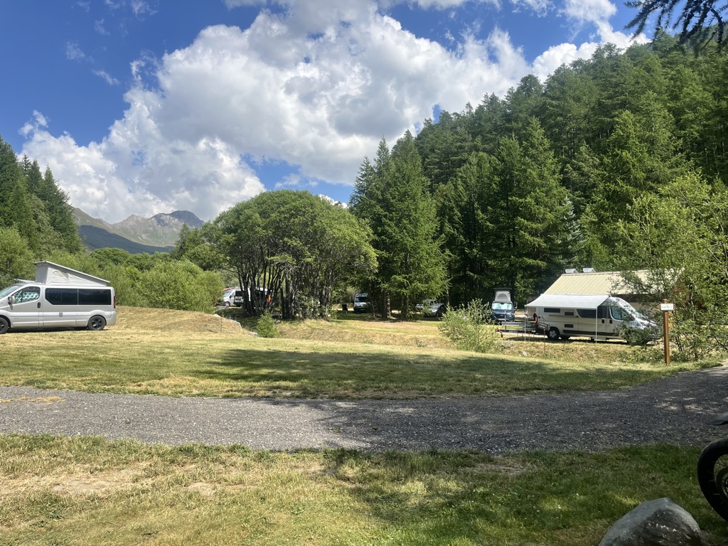
It’s here that you’ll find the magical Camping de Chanterane, our home for the next four nights. We set up camp a few meters from the river, which lulled us to sleep each night without fail.
Camping de Chanterane is a perfect base for all kinds of hikes in the Queyras. It’s centrally located, though it takes a while to drive anywhere because you have to navigate through the valleys. There are loads of great hikes starting right from camp. And, best of all, it’s at 1,900 meters, so temperatures will be moderate, even during the record-setting heat wave baking Europe while we were there (nearby Saint-Veran is the highest commune in France, at ~2,050 m).
Where to Hike?
There are so many great hikes in the Queyras but here are the ones we did (directly from our camping). There’s nothing better than not having to get into the car to go on an adventure!
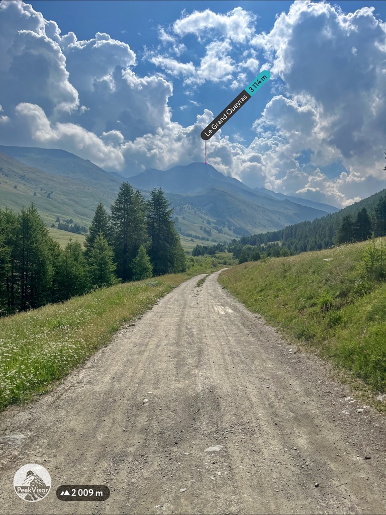
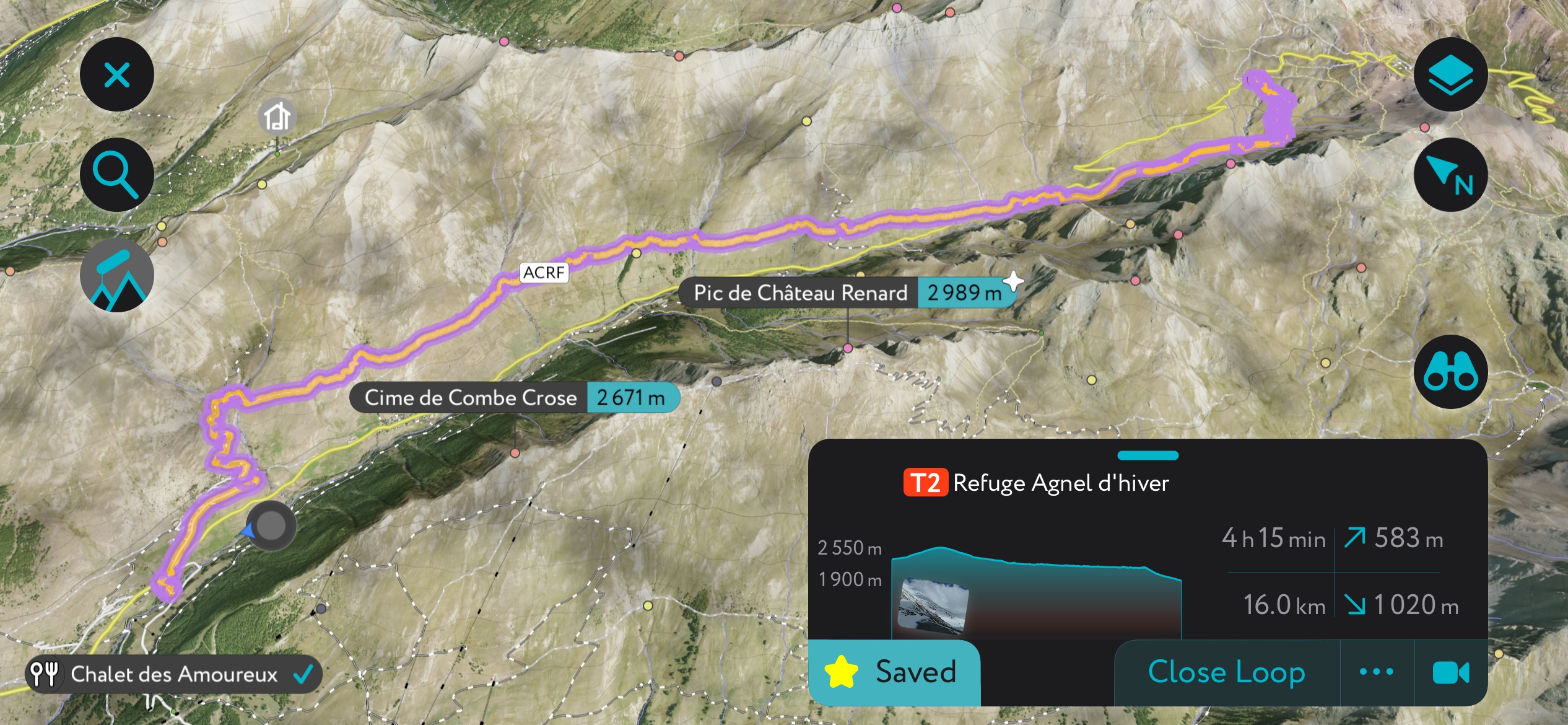
Col du Longet
This can be completed in a nice loop from the campground if you link some access roads along the ski resort.
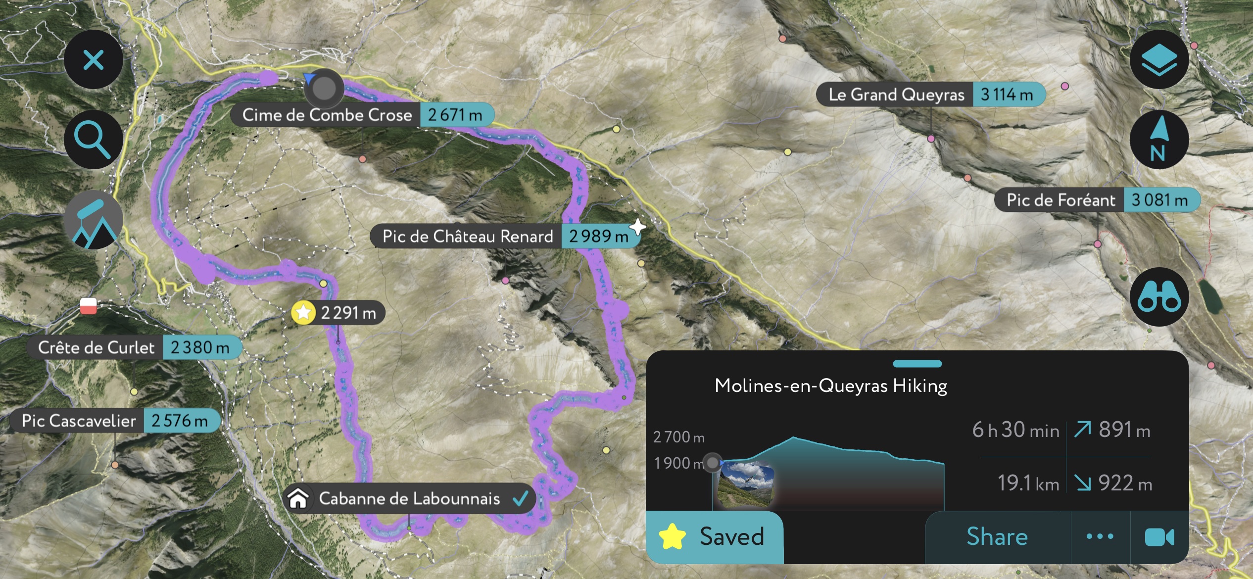
Click here to see our route. We started from Pierre Grosse (Camping de Chanterane) and headed along a gravel road to the Col du Longet ascent. That was a punchy 700-meter (2,300 ft) climb, but with rewarding views at the summit. There are a few peaks you can summit from the col if you so desire.
We then followed an access road down to one of the old canal trails, which brought us to the village of Saint-Veran, where we waited out a thunderstorm in the old church. We then followed roads back around the mountain to Pierre Grosse.
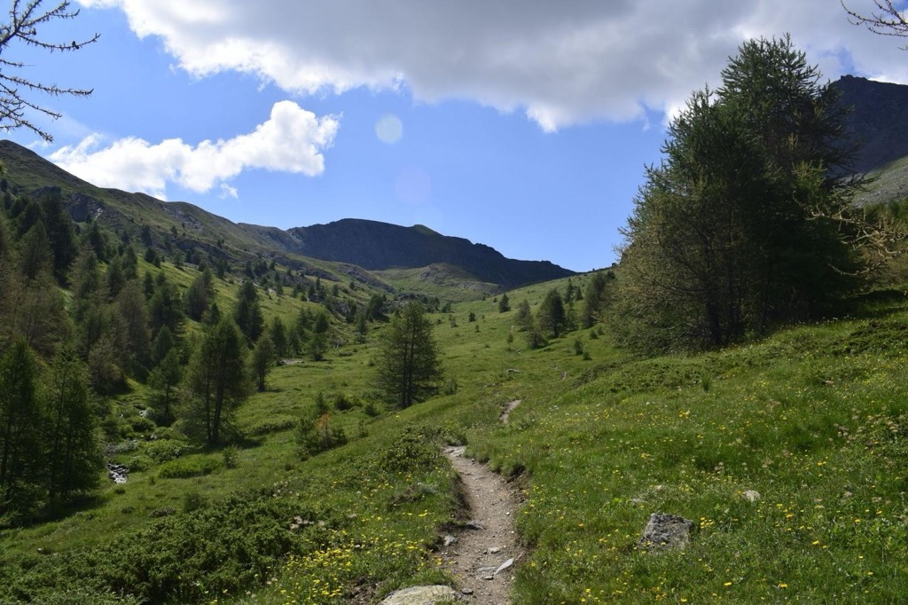
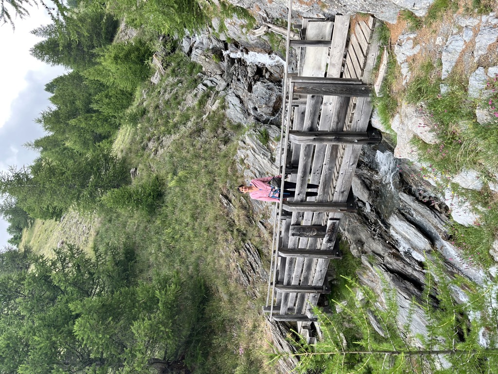
Canal Trails
One unique aspect of the Queyras is the abundance of old canals. There’s one leading down from the Col Agnel to Le Coin with an array of informative art installations (shown below). There’s also one leading to Saint-Veran from higher up in that valley, as well as another in the village of Celliac.
The best thing about these trails? They’re flat. You don’t have to do too much elevation, a rarity for these mountains. They pass through beautiful wildflower meadows and alpine grasslands, home to thousands of marmots and other creature. We also found that there was absolutely nobody on these trails. One thing is for sure; there are way more marmots than people in this valley.
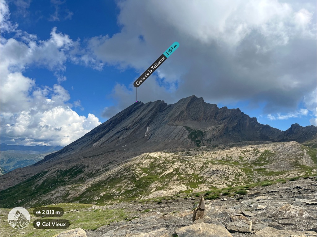
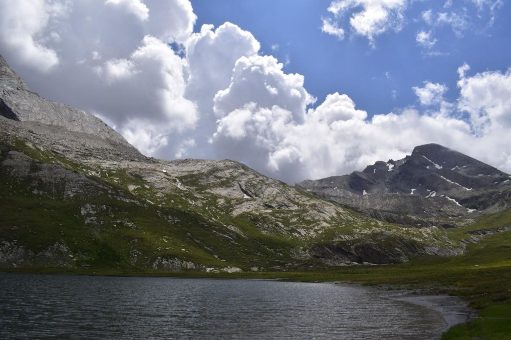
Col Vieux, Lac Forèant
The Col Vieux is a great hike because you start high—near the top of the Col Agnel—and only have to ascend a couple of hundred meters if you drive to the parking lot. Otherwise, you can take the canal trail shown above, though that will make it quite a demanding day in total.
From the Col Vieux, there are numerous options. You can head to the classic Pain de Sucre for a more committing adventure, or you can just descend to the Lac Foréant for a repose by the scenic shores, as we did. Click here to see our route.
Where to Eat? La Lobio
By the time we completed the drive to the Queyras and set everything up, several hours had passed. It was time for some supper, and I wasn’t about to cook something on our small backpacking stove. Not tonight. Fortunately, upon arriving, our lovely hosts also gave us the best restaurant recommendation, well…ever? I mean, it might actually have been my favorite restaurant in France.
Welcome to Hôtel Restaurant La Lobio. Located up the hill in the hamlet of Le Coin, this place requires a 100-meter ascent to get to dinner, but it’s worth it to prepare you for the meal. The building, constructed in 1699, was so cozy that I was wondering if I had lived there in a past life. We started with some local Hautes-Alpes wine, gazing out at the alpine meadows, craggy peaks, and mélèze forests from the hotel's vast veranda.
We moved inside for dinner. Nearly everything we ate was a local specialty prepared with local ingredients, but not in a pretentious way. More in a “where else would we get it” kind of way. Tortons (small dumplings, a local specialty), pied de couchon (pigs trotters), homemade vanille and raspberry ice cream…it was a meal for the books. And quite easy on the wallet. I couldn’t recommend a restaurant more highly.
Going to Italy
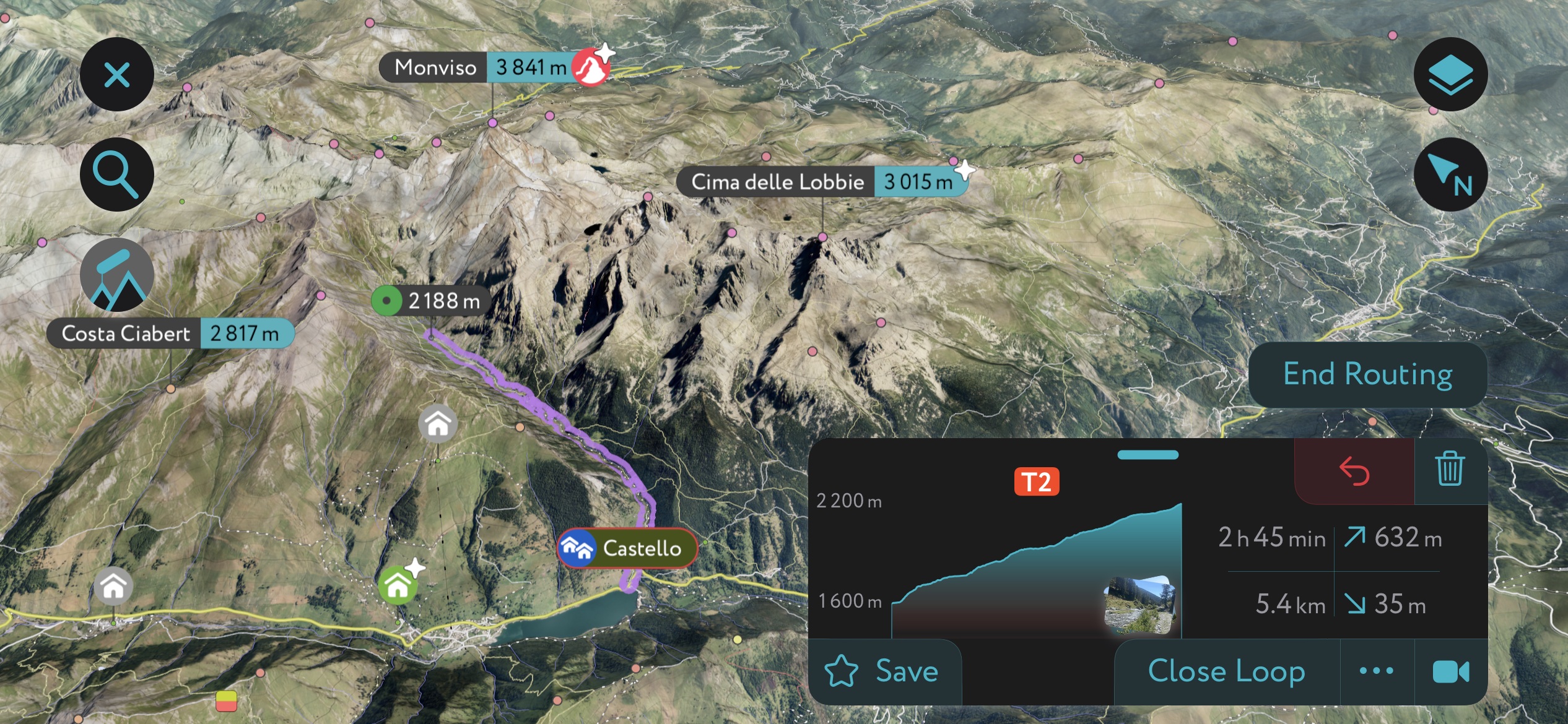
No trip to this region is complete without a drive up over the Col Agnel into Italy. The drive is beautiful, but the Italian villages on the other side are even more so.
Stop at the first village you come across, Chianale. It’s exquisite, an open air museum, like all the best parts of Italy. Arrive before 2 p.m. if you’re hoping to get lunch, but either way, stop at the small “alimentare” grocery store for a delicious soft serve ice cream. It’s not gelato; it comes out of a machine, but it is so good!
If you continue down the road, you’ll pass the small ski village of Pontechianale. At the dam, there’s a small hamlet called Castello. Here, you can access the Monviso Natural Park for the best hiking around. If it’s sunny, you’ll get views of the famous Monviso (3,841 m), which, as the last high peak of the southern Alps, is visible from all around, including from the PeakVisor office near Milano.
If it’s hot, you can scramble down to the river and bask in some of the best swimming holes on planet Earth. The water is very cold, so you need to have a warm day. There’s obviously a lot of flood hazard in these tight gorges, so be aware of weather conditions!
Using the PeakVisor App
At PeakVisor, we love information. That’s why we write articles like this one.
While we always recommend a backup paper map, the world is becoming an increasingly digital place, and having a good map on your phone makes everything easier. Check out the PeakVisor app for 3D maps, and record your hikes across the Alps with our tracking features to share later with your friends.
It doesn’t stop there; we have even more information on thousands of additional hikes, ski tours, and ski resorts across the world. In fact, we’ve compiled information on all publicly maintained walking tracks worldwide, formatted onto our 3D maps.
Other PeakVisor Tools
PeakVisor started as a peak identification tool—you’ll have noticed the photos throughout this article—but we’ve evolved into purveyors of the finest 3D maps available. We continue to expand our offerings. You can track your hikes directly on the app, upload pictures for other users, and keep a diary of all your outdoor adventures.
Most recently, the PeakVisor App has included up-to-date weather reports, including snow depths, at any destination. We've also been hard at work adding the details of hundreds of mountain huts, including information on overnight accommodation, dining options, and opening hours. You can also use our Hiking Map on your desktop to create .GPX files for routes to follow later on the app.
Gallery