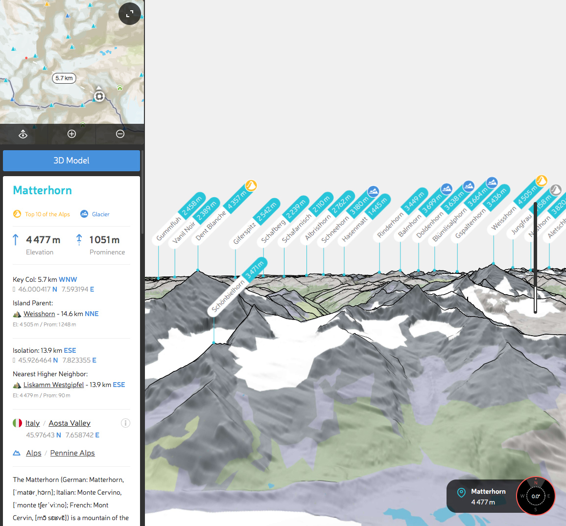
Topographic prominence is one of the most important measures for a mountain (or a hill). Only the elevation might challenge its importance. That’s why for any peak in the world we carefully calculate prominence and present it everywhere next to the elevation. If you’d like to brush up your knowledge on the topic then please read our article on the topographic prominence.
In the latest release of our Prominence Calculator, we switched to using 1 arc-second Digital Elevation Model files (~30 meters grid) and added more detailed output of the prominence parameters. Additional data are presented in the Mountain Profile sidebar on our website.

Detailed prominence data is divided into two blocks: Key Col and Isolation. Here are some easy straightforward descriptions of these terms.
Key Col
Key Col is the lowest point on the ridge to the topographic parent (on the website, we provide Island Parent for this purpose).
For example, Swiss Matterhorn Key Col is located ~5km northwest on the ridge to Weisshorn (which is also a gem of a mountain!).
Isolation
Isolation is the distance to the nearest higher point. This point is also called Isolation Limit Point.
The Nearest Higher Neighbor is the closest higher mountain, oftentimes abbreviated as NHN.
In our example with Matterhorn, the Nearest Higher Neighbor is Liskamm Westgipfel, a subpeak of the Monte Rosa massif. The southeast direction to NHN and Isolation Limit Point is completely the opposite of Matterhorn’s Key Col direction (northwest)!
PeakVisor Mountain Profile allows interactive exploring of these parameters. Click on the Key Col or Isolation Limit Point coordinates to see them on the map with measured distance. This way you can better understand the topography of complex mountain ranges and the relationship between the peaks.
By the time you’re reading this article, all these data is already available in PeakVisor mobile app both for iOS and Android, so you can see them exactly on the spot with spectacular peaks in the background.

