

Share

Scan the QR code and open PeakVisor on your phone
Scan the QR code and open PeakVisor on your phone
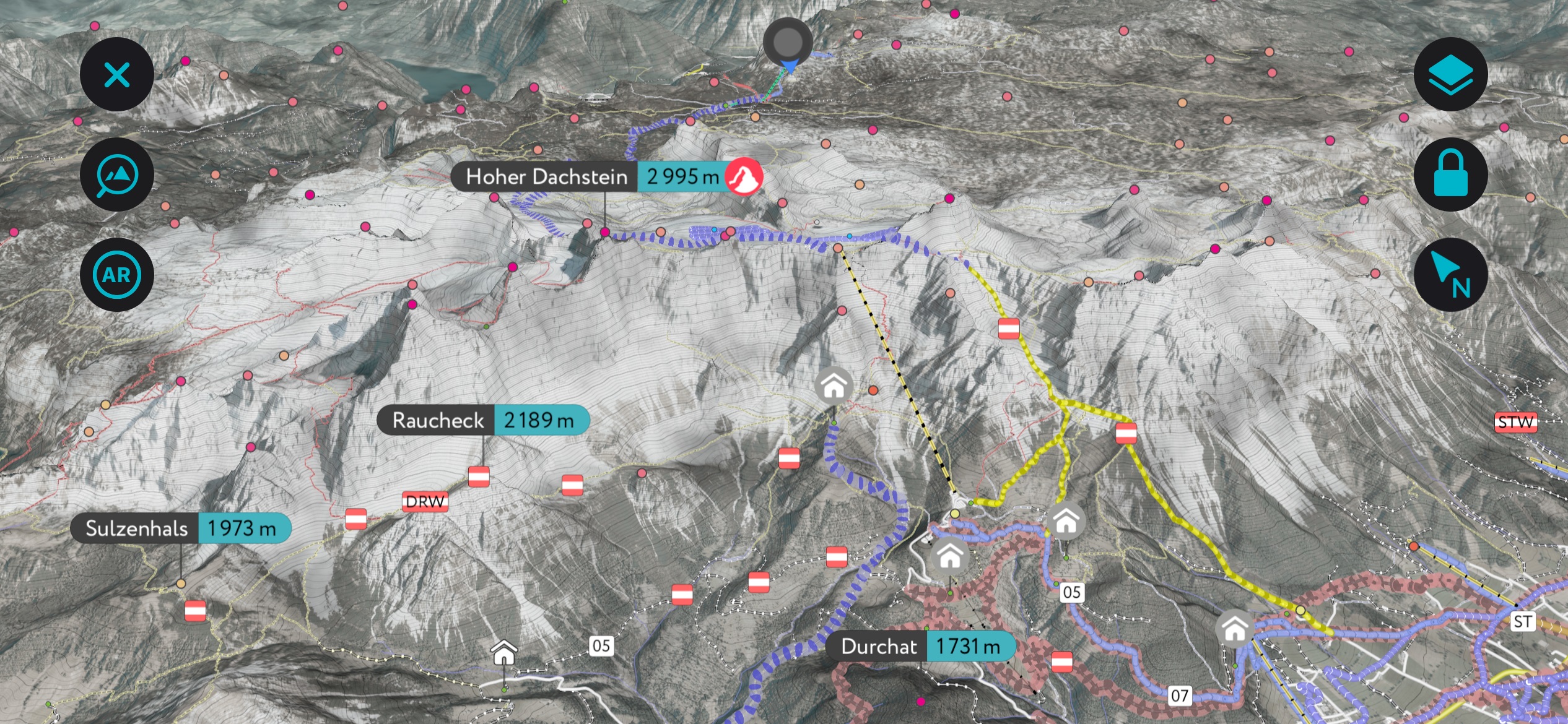
The Dachstein Mountains of Austria extend along the border of Upper Austria, Styria, and into Salzburg. The Dachstein Massif, which includes dozens of peaks over 2,500 m (8,200 ft), is part of the Salzkammergut and Upper Austria Alps and consists of 439 named peaks. Hoher Dachstein is the tallest (2995 m / 9,826 ft) and most prominent, rising 2,139 m (7,018 ft) from its surroundings.
The Dachstein Mountains are found in Austria along the boundary of Upper Austria, Styria, and Salzburg and are part of the Salzkammergut and Upper Austria Alps. The range spans three states; the Dachstein is sometimes called the drei-länder-berg or the “three-state mountain.” It’s protected as a Natura 2000 area – a European initiative conserving high-ecological areas.
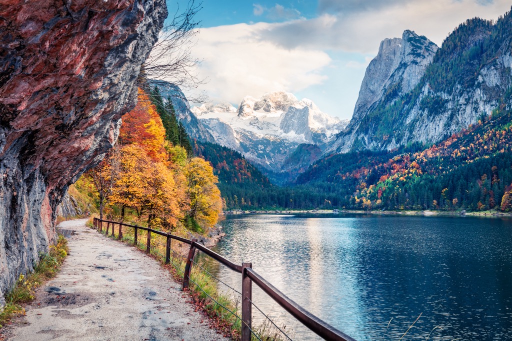
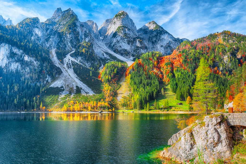
The mountains lie within the Salzkammergut Lake district. They are a top destination, with numerous peaks towering over 2,500 m (8,200 ft), glaciers, icefields, picturesque lakes, mountain meadows, the Dachstein West winter resort, hiking trails, and via ferratas.
But more than just impressive mountains and nature, the massif is part of the UNESCO Hallstatt-Dachstein /Salzkammergut Cultural Landscape. The designation celebrates human activity in the region dating back thousands of years, largely due to salt mining. Salt mines first appeared during the Bronze Age, peaked during the Hallstatt Period around 800 to 400 BC, and remained a precious resource for the Habsburg empire.
The foundation of the Dachstein Mountains dates back more than 200 million years. Around this time, Pangea began to split along the Eurasian and African plates, creating a shallow seaway known as the Tethys Sea, where sediment and shells collected on the ocean floor.
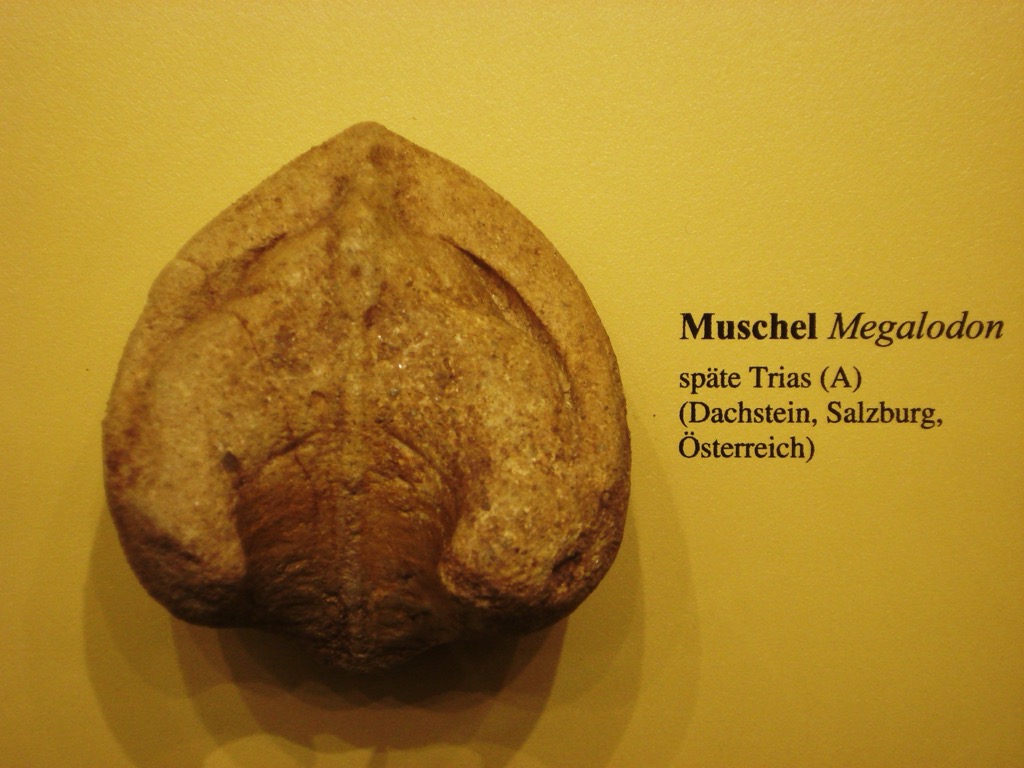
During the early Cretaceous era, around 140 million years ago, the African plate drifted north, pushing sediment and folding deposits on the ocean floor over each other. This process formed Dachstein and Hallstatt limestone. Dachstein limestone contains many fossils from the ancient sea, particularly the bivalve megalodons, whose fossils resemble a cloven cow track.
The Alpine orogeny raised the Alps when the African and Eurasian plates collided. The collision has been ongoing since Cretaceous times. The majority of mountain building occurred between 65 and 2.5 million years ago. The uplift no longer outpaces the rate of erosion, so the Alps are not considered a growing range.
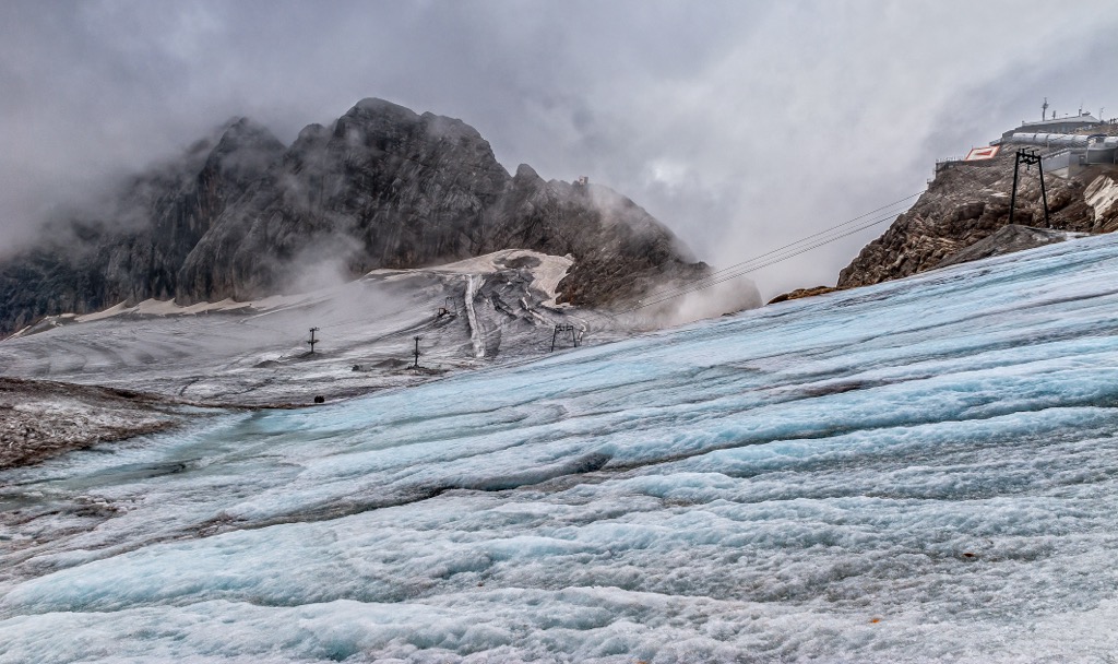
During the Ice Age, glaciers extended down to the base of the mountains and along valley floors. They formed distinct U-shaped valleys as they retreated. Today, high peaks still host a few glaciers and icefields, although these are rapidly shrinking and at risk of disappearing entirely over the next century. Glaciers in the area include the Hallstatt Glacier (Hallstätter Gletscher), the Great Gosau Glacier (Großer Gosaugletscher), and the Schladming Glacier (Schladminger Gletscher).
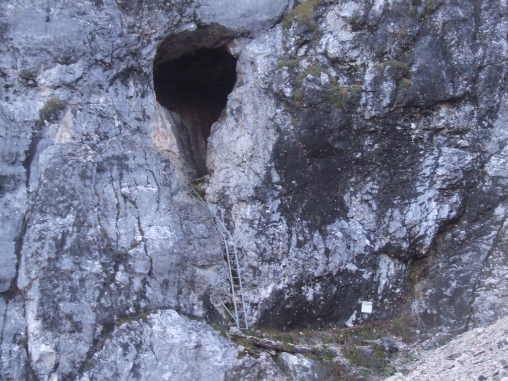
The range is marked by karst features, including some of the largest cave systems in Austria. Among the best-known caves are Mammuthöhle and Hirlatzhöhle. The region has a history of salt mining dating back thousands of years; salt reserves developed as the ancient shallow sea dried up.
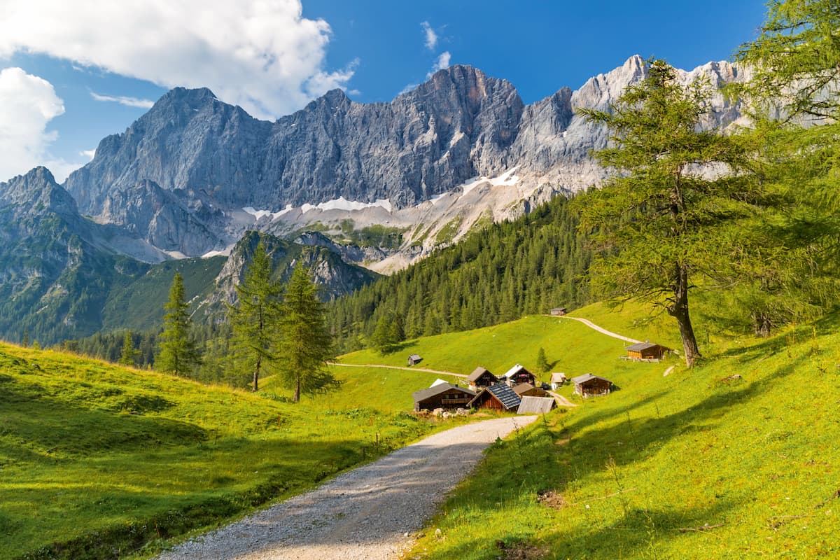
Within the Dachstein mountains, mixed deciduous-conifer forests are typical up to about 1,450 m (4,760 ft) in elevation. Ash grows in lower valleys, common beech thrives throughout this zone, and sycamore and mountain ash appear as the elevation increases. Conifer species include spruce, larch, and occasionally fir.
Over 1,650 m (5,415 ft), larch begins to dominate, and deciduous trees such as green alder appear. Forests are increasingly interspersed at higher elevations with stone pine, dwarf pine, and alpine rose. Keep an eye out for monkshood, often with purple flowers, which can cause a rash after contact.
Higher altitudes give way to rocky landscapes, alpine meadows, dwarf pines, low brush, and the occasional solitary stone pine.
Golden eagles, several species of owls, woodpeckers, and other forest and rock-dwelling birds live in the mountains. Chamois, ibex, foxes, and ermines are a few common mammals. Marmots live around alpine zones and, well-adapted to the extreme environment, hibernate for over half the year.

The Dachstein massif is part of a UNESCO cultural landscape site for its natural beauty and the human history that has existed in the region for thousands of years, mainly fueled by salt mining. The first salt mines date back to the Bronze Age and experienced peak production from 800 to 400 BC. This era is known as the Hallstatt Period.
Following this high period, the Romans moved into the region, staying until the collapse of the Roman Empire around the 5th century AD. Salt mining continued during their occupation of the area but, following their departure, came to a near stop.
The mines were revived during the 14th century when the Habsburgs claimed the Kammergut as their own. Over the following centuries, salt mining and the socio-economic dynamic underwent several fluxes triggered by new trade routes and religious conflict. The salt mines necessitated a timber industry to supply the mines and process the salt via evaporation.
Friedrich Simony and Johann Wallner were the first to summit the Dachstein Massif east to west in 1842 and the first to cross the Dachstein glacier in winter. The region, with its picturesque villages and alpine meadows long used for summer grazing, caught the eye of writers and artists in the early 1800s. As the area’s reputation grew and with the arrival of the railway in the mid-1800s, tourism took off. The Dachstein Massif was declared a World Heritage site in 1997.
The Dachstein mountains are a hotspot for outdoor enthusiasts, offering extensive hiking trails between villages and mountain huts, the Dachstein West ski resort, via ferratas, and tours into the Karstic mountain caves.
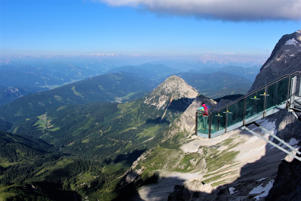
Among a few unique highlights are the highest suspension bridge in Austria, a glass gondola for a unique vantage point of the mountains, and the Notgasse gorge with approximately 2,000-year-old petroglyphs. With many options for putting together your time in the Dachstein Mountains, here are a few ideas to get started.

The Dachstein West ski resort spans the villages of Russbach, Gosau, and Annaberg, with 51 km (31.7 mi) of slopes via 19 lifts. A large freestyle snow park welcomes freestylers of all levels. The Panoronda, a 44 km (27 mi) long ski circuit featuring prepared slopes and panoramic views, is another highlight of the Dachstein region.
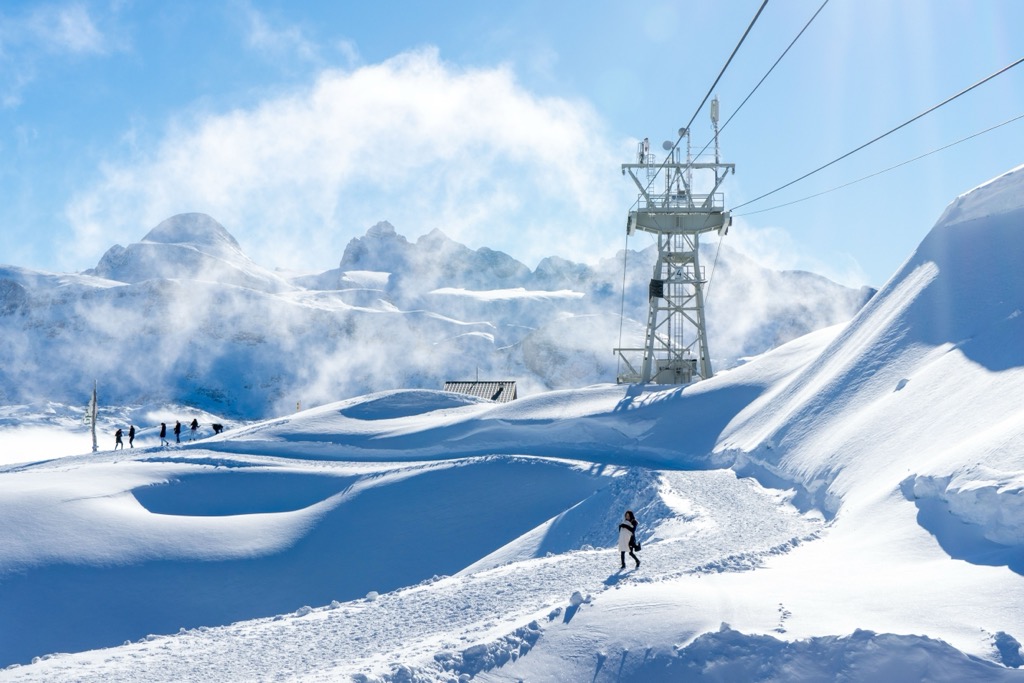
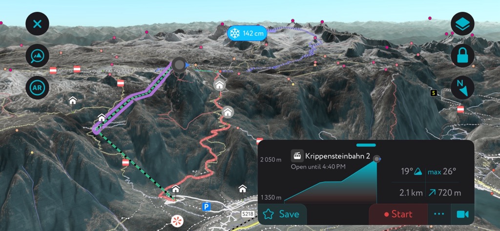
On the backside of Dachstein, the cable car at Krippenstein accesses a vast tract of off-piste terrain. Krippenstein caters to freeriders and backcountry skiers; there is only one groomed piste, so skiers looking for groomers and sun should stick to the Dachstein.

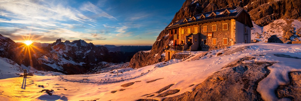
Adamekhütte is a great spot to situate yourself if you want to access some of the longer trails and ski tours in the Dachstein mountains. The hut sits below the Gosaugletscher, the glacier below Hoher Dachstein, and offers sweeping views of the Gosauseen, Hohe Tauern, Bischofsmütze, and lakes in the valley below.
Hikers along the Nordalpenweg, a long-distance trail along the Northern Alps, often use the hut. It is part of the UNESCO World Heritage region that includes Hallstatt - Dachstein/ Salzkammergut. The Linzer Weg is a two-hour trail from Adamekhütte to Oberhofalm with great views. Along the way, it may be possible to spot bivalve megalodon fossils that look like cattle tracks.
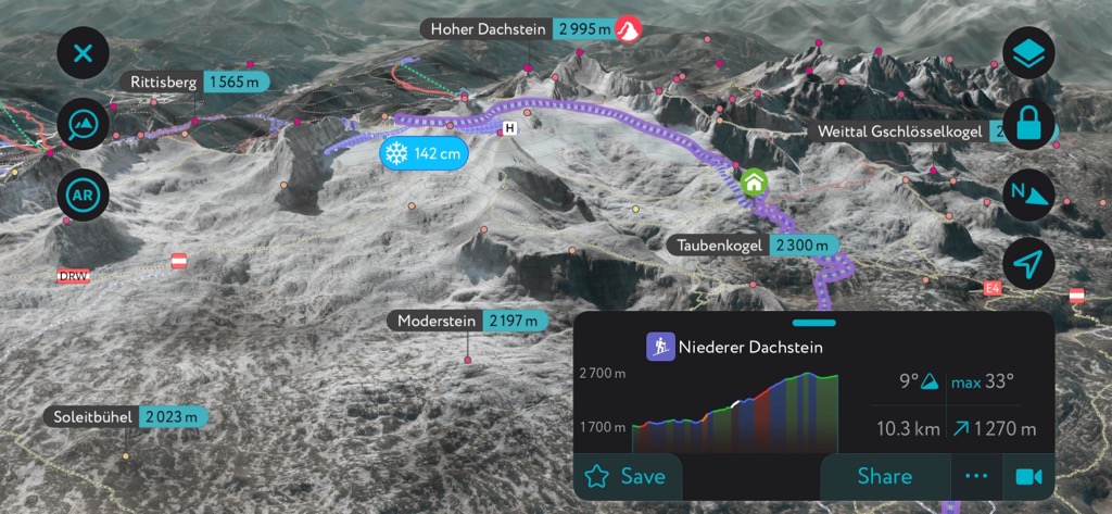
From the hut, a glacial tour runs to Simonyhütte along a narrow gap called Steinerscharte between Hoher Dachstein and the Niederer Dachstein. This route requires proper equipment and experience crossing ice and snow.
And, of course, there is the option to summit Hoher Dachstein, the tallest peak in the state of Styria, with a challenging four-hour climb, including steep trails, exposed ridges, and fixed rope routes.
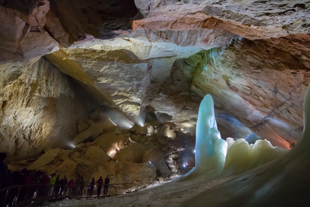
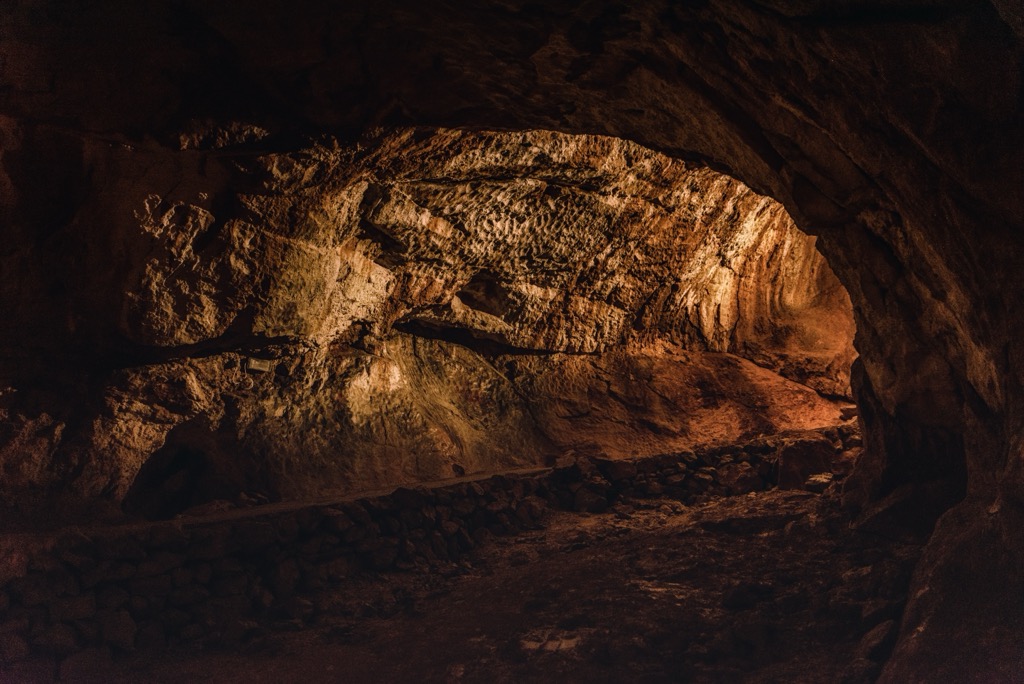
The Mammut Cave, one of the largest karst caves in the world, lets visitors glimpse the interior of the Dachstein massif. Over 70 km (43.5 mi) have been explored within the cave system, and about one km (0.6 mi) is open to visitors on a guided tour. General tours are one hour, but those looking for more adventure can schedule a half or full-day tour that goes off the beaten path and deeper into the cave system.
Dachstein is a popular area for climbing. A few of the best-known routes are Schulter-Anstieg along the east ridge, Randkluft-Anstieg along the northeast face, and the approach from the west ridge. Those looking for a more exciting route may want to check out Steinerweg (V) and Prichiweg (IV) on the south face.
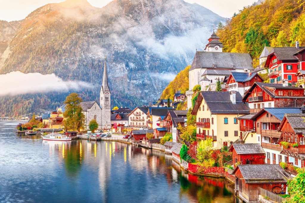
Historic small towns are scattered around the Dachstein Mountains. Among the best-known villages are Bad Ischl, Hallstatt, St. Wolfgang, St. Gilgen, and Mondsee (The Sound of Music was famously shot here). Mountain huts provide shelter and food for multi-day trips. The historic city of Salzburg is only about 1.5 hours away by car. The larger cities of Innsbruck, Vienna, and Munich are several hours away.
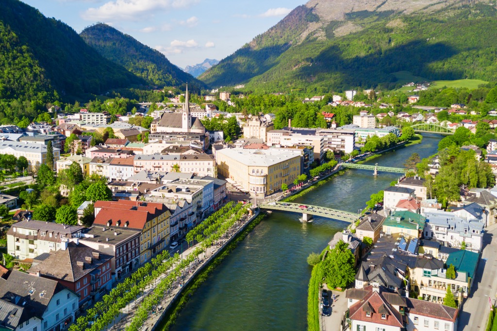
Bad Ischl has a population of slightly over 14,000 people. This elegant and picturesque spa town is the gateway to the Salzkammergut region. Centrally located, buses and trains run regularly from Bad Ischl to other villages. It is the biggest town in the area with a wide variety of accommodation options, including for travelers on a budget.
The town once served as the summer home of Habsburg emperor Franz Joseph l, and the emperor’s former residence, the Kaiservilla, is open for tours. The guided tours are often lengthy and best if you have more than one day in town.
Other local attractions include the City Museum, highlighting the Bad Ischl’s history and the town’s thermal spa. The Katrin cable car runs to the top of Katrin, where a restaurant offers local dishes with seasonal ingredients. You can also hike up or down in lieu of the cable car.
Its central location makes Bad Ischl an excellent base for day trips to the mountains and other villages. Hallstatt, a UNESCO World Heritage Site, is a popular destination for its location on Lake Hallstatt, access to hiking trails, and proximity to the Dachstein Ice Cave and the Mammut Cave.
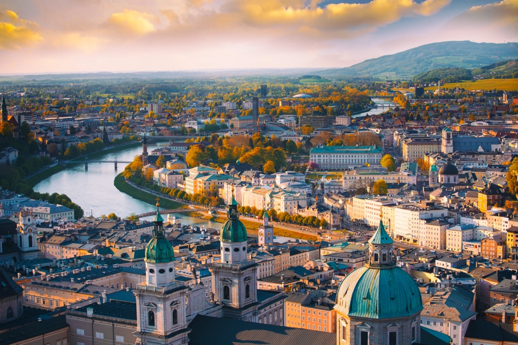
Salzburg is Austria’s fourth largest city and home to just over 150,000 people. It has an international airport and is a UNESCO World Heritage Site. With a well-preserved historic center, festivals throughout the year, and surrounded by mountains and clear lakes, the city draws many tourists each year.
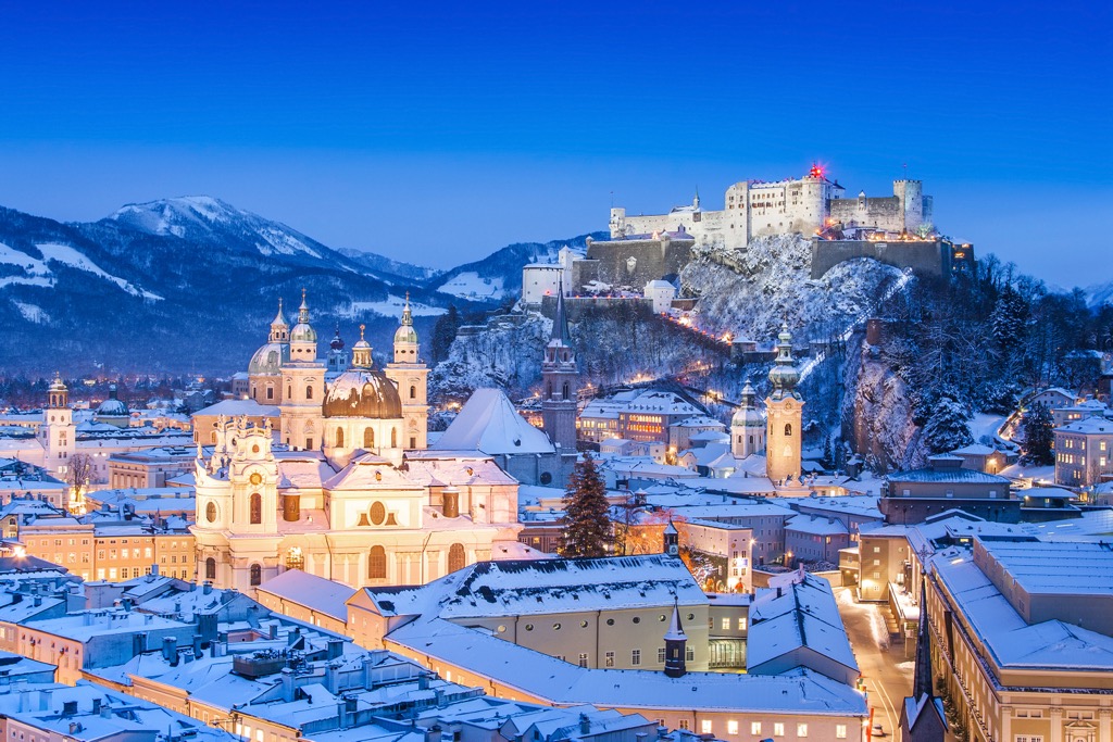
Upon arriving, you can orient yourself to town with a guided or self-guided tour. A few must-see historical sites include the Salzburg Cathedral, the medieval Hohensalzburg Fortress, and Mozart’s home.
The city hosts numerous festivals, including the Salzburg Festival in July and August and Mozart Week in January. Several elaborate gardens are worth visiting. In just over an hour, visitors can reach the scenic village of Hallstatt on the banks of Lake Hallstatt for a day trip. Salzburg’s proximity to the mountains and its urban amenities offer visitors a cultural experience while working as a base for day hikes or a kick-off point for longer treks.
Salzburg’s downtown is pedestrian-friendly. The city is well connected to the region via buses and trains, making it easy for visitors to get from the urban center into smaller mountain towns.

Explore Dachstein Mountains with the PeakVisor 3D Map and identify its summits.


