
Scan the QR code and open PeakVisor on your phone
The Qinling Mountains include 751 named peaks. The highest is Ye'erpu Gang at 4,968 m. Other notable peaks include Ani Zhihai Shan, Cuò Měi Fēng and Gamari Gang.
Known as the “dragon’s vein” of China, the Qinling Mountains (秦岭) occupy a unique place in Chinese history and culture. There are 751 named peaks in the mountains. They highest of them is Cuomei Feng (措美峰, 4,920 m/ 16,142 ft) and the most prominent peak is Taibai Shan (太白山, 3,767 m/ 12,359 ft).
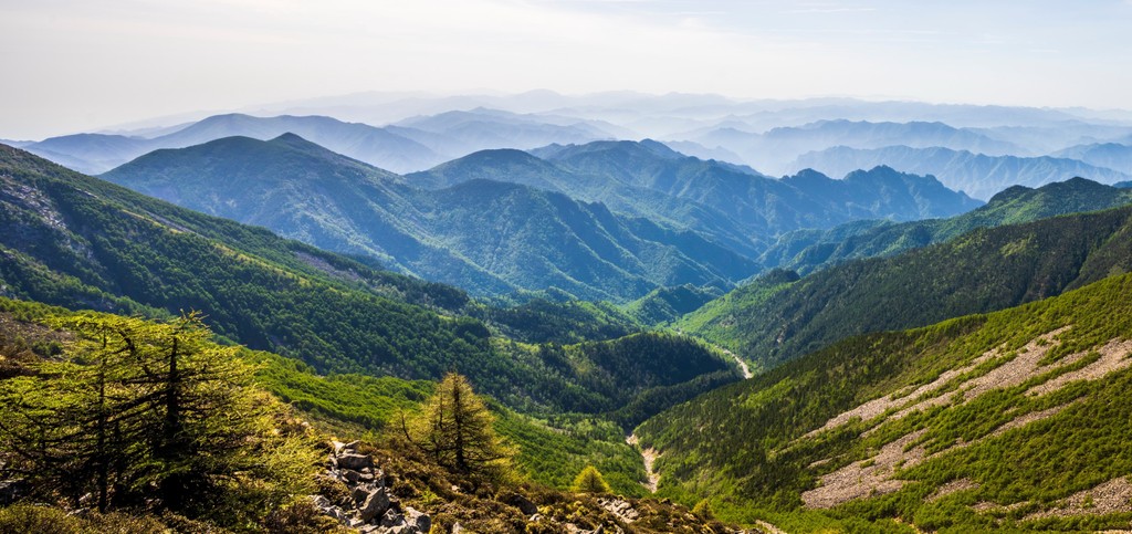
Extending over 1,600 km (992 mi) in Central China, the Qinling Mountains span across the provinces of Gansu (甘肃), Shaanxi, (陕西), Henan (河南) and Anhui (安徽). They run in an east-west direction roughly between the latitudes of 32°N and 34°N.
The western end of Qinling lies in the mountainous part of China, with the Kunlun Mountains (昆仑山) to the west and the Qilian Mountains (祁连山) to the northwest. The eastern end borders on flat lands where the Huai River (淮河) extends from the mountains to the sea.

Qinling and the Huai River forms the “Qin-Huai Line” (秦淮线), which has long been regarded as the natural divide between the northern and southern parts of China. It acts as a barrier that shields the south from cold northern winds and prevents moist southern air from entering the north.
Qinling separates the humid subtropical climate in the south from the dry temperate climate in the north. It also forms the watershed between the two largest rivers in the country – the Yellow River in the north and the Yangtze River in the south.
Qinling formed as a result of the interaction between the North China Plate and South China Plate. The area used to be an ancient sea before repeated continental convergence and divergence which lasted over a prolonged period.
The mountains’ formation started over 200 million years ago and accelerated when India rammed into Asia about 50 million years ago.

The mountain range displays a highly asymmetrical structure, as the northern side has much steeper and shorter slopes than the southern side. The crust is characterized by extensive thrust–fold deformation and granitic intrusions.
Qinling contains rich deposits of minerals such as gold, silver, aluminum and coal. It has the world’s largest known deposit of molybdenum, a silvery-white metal that is highly corrosion resistant. The mountains also produce the prized Lantian jade, which is named after the county of Lantian (蓝田) on the northern slopes.
Mining has been a major economic activity in the area, though many sites have closed down recently in an attempt to restore the natural environment.
Because of differences in the climate, the southern side of Qinling is dominated by evergreen subtropical forests while the northern side is covered with mostly deciduous temperate forests.
The vegetation also displays vertical zonation. Trees in the foothills include various types of oak, elm, maple, ash and chestnut. Even though those trees are common in European and North American forests as well, they are much more taxonomically diverse in central China.
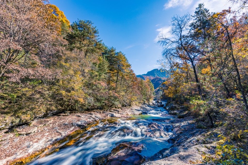
The middle elevations are a mixture of birch, hornbeam, conifers such as Armand pine and more oaks, transitioning to a subalpine zone with larch, fir, rhododendron and arrow bamboo as elevation increases. At the top, alpine bush-meadows above 3,000 m (9,843 ft) harbor some relict flora and medicinal plants.
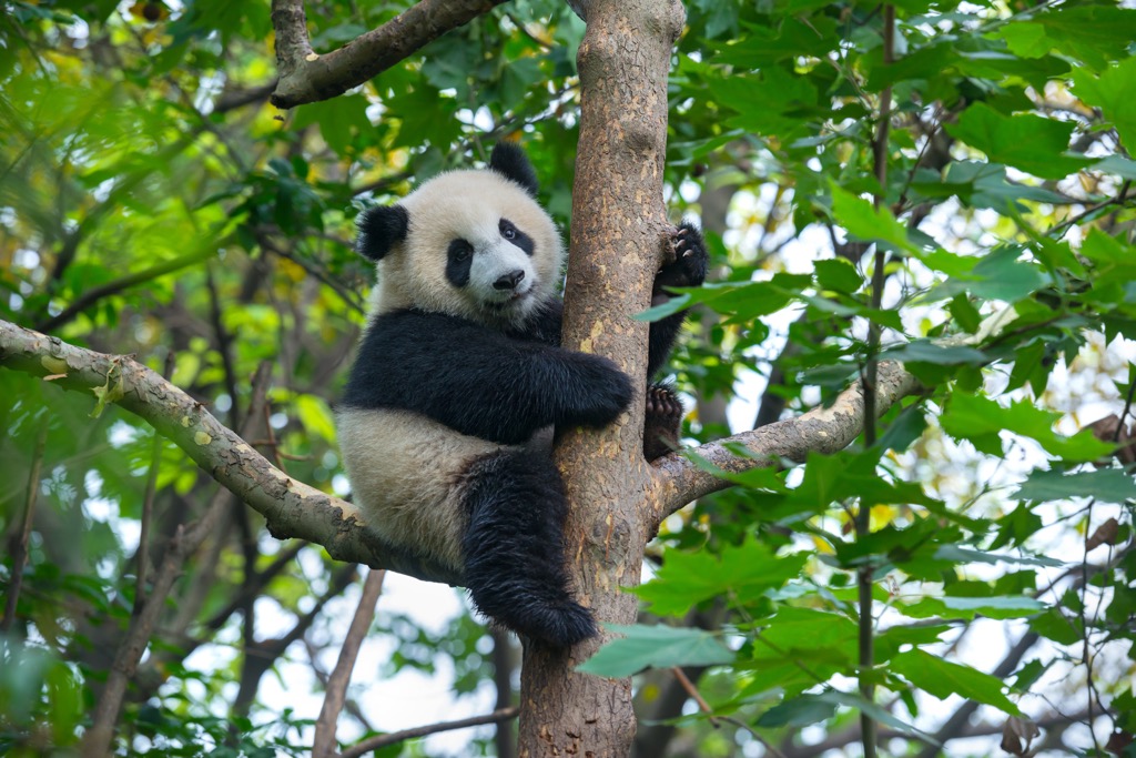
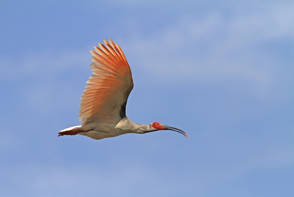
In terms of wild animals, the mountains are known for the “Four Treasures of Qinling”—the takin, giant panda, golden monkey and crested ibis. The takin is a large muscular ungulate with a thick shaggy coat.
The giant pandas in Qinling were recognized as a subspecies in 2005. Compared to their cousins in Sichuan province, the only other natural home for giant pandas, the Qinling pandas are slightly smaller with dark brown and light brown fur instead of black and white.
Likewise, the golden monkeys in Qinling are a subspecies of their counterparts in Sichuan. The primate’s upturned nose protects it from frostbite, and its special blood vessels maximize their oxygen uptake in the high altitudes. Its hair can grow up to a foot (30 cm) long.
The elegant crested ibis was once thought to be extinct until seven individuals were found in Qinling in 1981. Thanks to decades of vigorous conservation efforts, the bird has a current population of more than four thousand.
Other rare birds in Qinling include the golden pheasant, black stork and Temminck's tragopan. Other flagship mammals include the clouded leopard, red panda and Asiatic black bear.
The grasslands on the northern foothills of Qinling, in what is now Lantian County (蓝田县), were inhabited by the oldest known Homo erectus in East Asia, the Lantian Man (蓝田人). Based on fossil specimens found there, Lantian Man is estimated to date to about 1.1 million years ago.
The mountains loom large in Chinese civilization, hence the epithet “dragon’s vein”. The city of Xi’an (西安), formerly Chang’an (长安, which includes Lantian County), preserves the remains of a 6,000 year-old prehistoric city, the oldest one found in China.
As the capital of thirteen Chinese dynasties, including the powerful Han and Tang dynasties, Xi’an/ Chang’an is one of the country’s “Four Great Ancient Capitals”. It was also the first city in the world to have a population of one million, which happened at around 750 AD.
As the eastern departure point of the ancient Silk Road, the city was a hub for international trade and cultural exchange. It was a major religious center for Taoism, Buddhism and Islam.
In 1974, farmers digging a well near Xi’an found some clay figures that turned out to be fragments of a mega mausoleum of Emperor Qin Shi Huang (秦始皇, 259-210 BC) complete with a life-size army of terracotta warriors and horses.
There are over 8,000 terracotta warriors, each with unique facial features, who were supposed to protect the emperor in his afterlife. The tomb is so big that a good part of it is still unexcavated, including the portion containing the emperor’s remains.
380 km (236 mi) east of Xi’an, Luoyang (洛阳) is another ancient capital that rivaled Xi’an in historical significance. Luoyang had a great tradition of literary culture, especially Confucian scholarship. The old Luoyang dialect was recognized as standard Chinese from roughly 300 BC to 1300 AD.
The climatic and geographical divide formed by Qinling has also led to cultural differences between southern China and northern China. For example, the staple food is rice in the south but wheat in the north. The most common means of transport used to be boats in the south and horses in the north.
Located 120 km (74 mi) east of Xi’an, Huashan/ Mount Hua (华山) is one of the Five Great Mountains of China. It is a single block of granite consisting of a cluster of five peaks between 1,615 m (5,299 ft) and 2,155 m (7,070 ft) in height.
Huashan is legendary for being steep and rugged. According to an old Chinese saying, “there has been only one path up Huashan since ancient times”. That path is a thousand-year-old trail with near vertical steps in some sections.
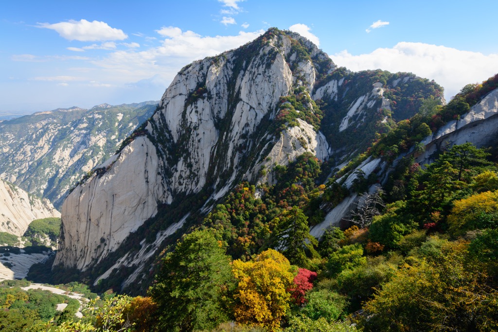
Nowadays, hikers may opt for a shorter and easier trail built in the 1990s. Alternatively, a cable car zips all the way up to the North Peak. Visitors may also rent a harness and step on the notorious plank walk, a foot-wide wooden trail built into a cliff face.
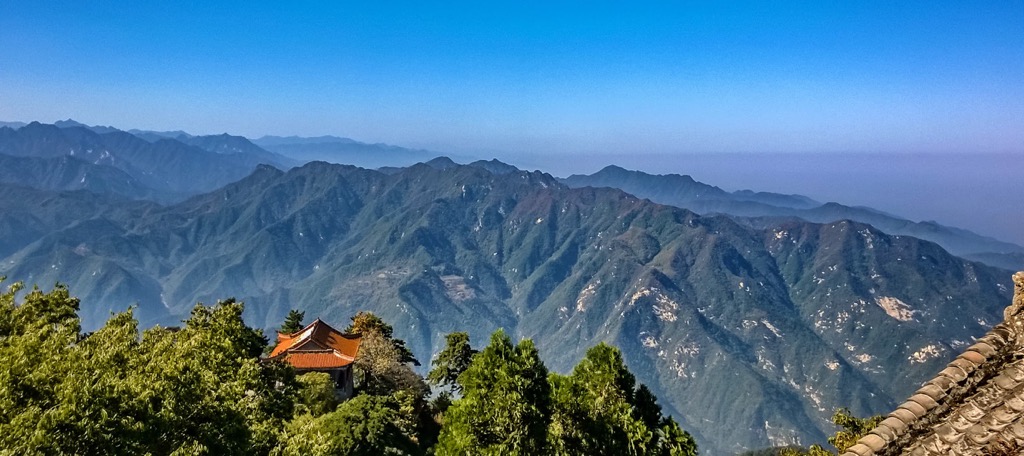
Taibai Shan (太白山 3,767 m/ 12,359 ft) in the city of Baoji (宝鸡), Shaanxi, is considered the main peak of Qinling even though it is not the highest. The mountain boasts a thick forest cover interspersed with waterfalls and capped with snow.
The mountain is part of the Taibai Shan National Forest Park, which has the highest altitude among all the forest parks in China. The sights are connected by 40 km (25 mi) of roads and 28 km (17 mi) of walking trails.

Right within the city of Xi’an, Zhongnan Shan (终南山 2,580 m / 8,465 ft) is a cradle for Taoism and a few important Chinese cultural values such as filial piety. There are many age old temples, including Louguangtai (樓觀台) where Laozi (老子), the founder of Taoism, was reputed to give lectures 2,500 years ago.
The idyllic, verdant landscape was a magnet for hermits and poets, and continues to be a perfect getaway from city life. Moreover, it is geologically significant as it is an amalgamation zone between the North China Plate and South China Plate.
Many cities in the proximity of Qinling are served by high-speed rail. The most convenient gateway cities are Xi’an and Luoyang.
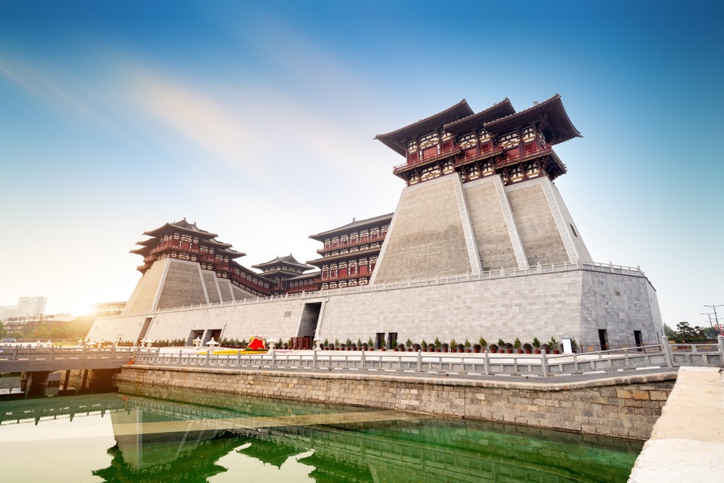
Xi’an (西安), the provincial capital of Shaanxi, is a sprawling metropolis of 12 million people. Even though its days as the center of the Chinese empire are long gone, countless well-preserved historic monuments make it easy to get a feel of its past glory.
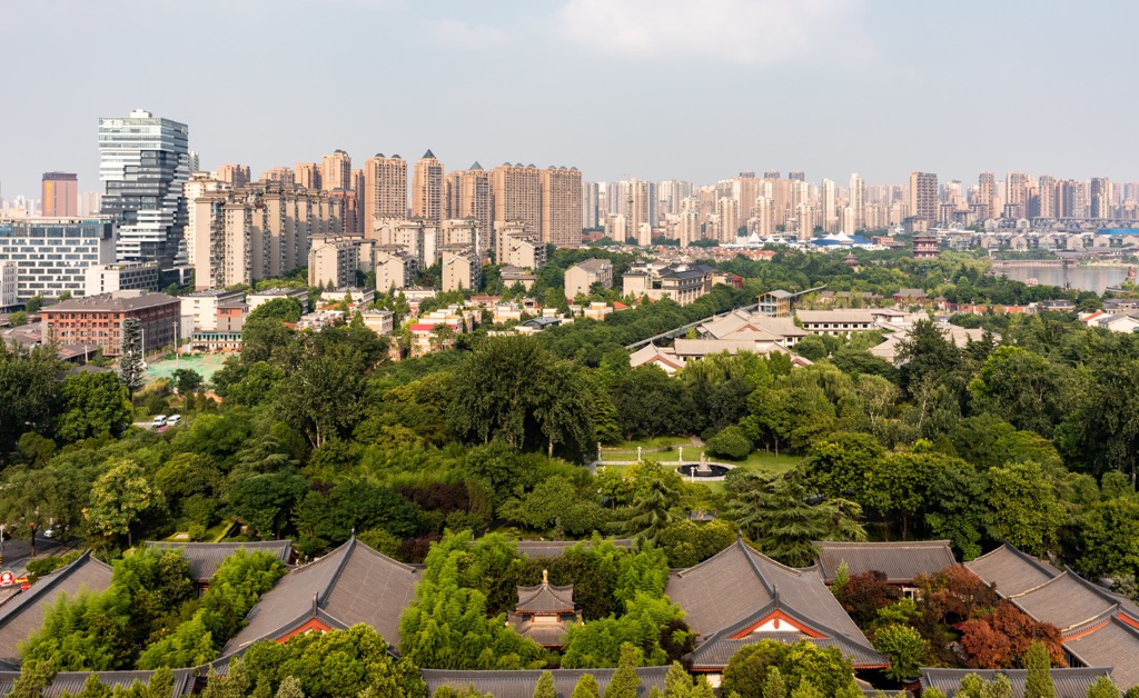
Apart from the world-renowned Terracotta Army (兵马俑), attractions in Xi’an include the landmark Bell and Drum Towers in the city center, the City Wall, the Muslim Quarter and numerous museums.
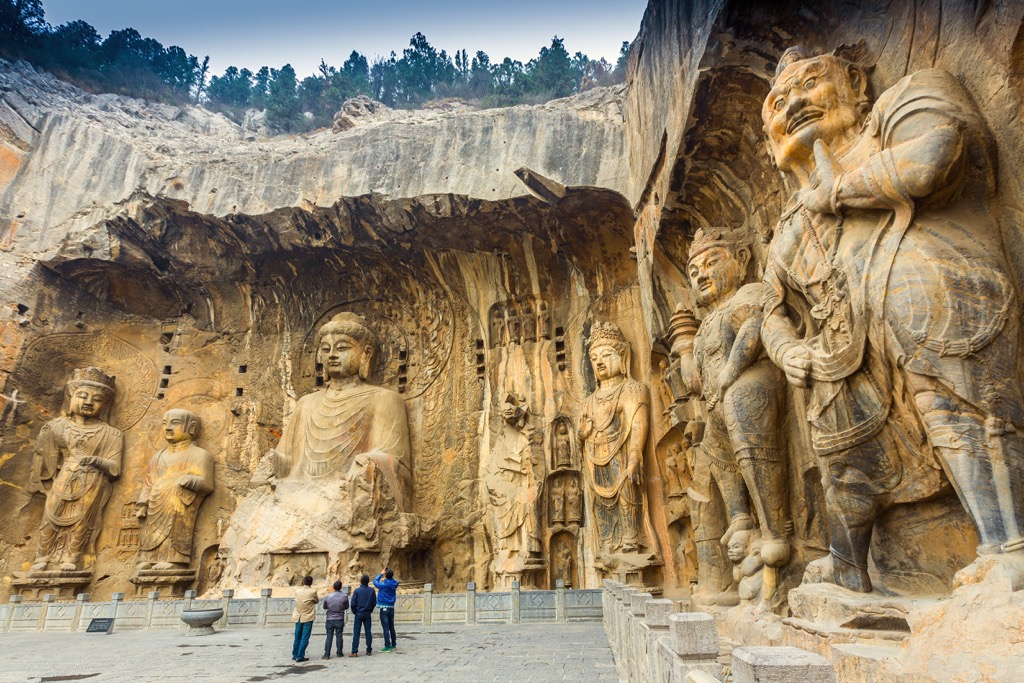
Luoyang (洛阳), a city of 6.5 million in Henan province, is famous for the Longmen Grottoes (龙门佛窟) which contain more than 100,000 Buddhist stone statues in 2,300 caves and niches carved into limestone cliffs. Most of the art dates from the late 5th to the mid-8th centuries.
The White Horse Temple (or Baima Temple 白马寺), established in 68 AD in Luoyang, is the first Buddhist temple in the country. Luoyang is also known as the land of peonies, which bloom in gardens all over the city in late spring.


The highest peak in the Qinling Mountains is Ye'erpu Gang, at 4,968 m.
The Qinling Mountains have 751 named peaks.


