
Scan the QR code and open PeakVisor on your phone
The Lyngen Alps include 828 named peaks. The highest is Jiehkkevárri at 1,834 m. Other notable peaks include Kveita, Fugldalsfjellet and Holmbukttinden.
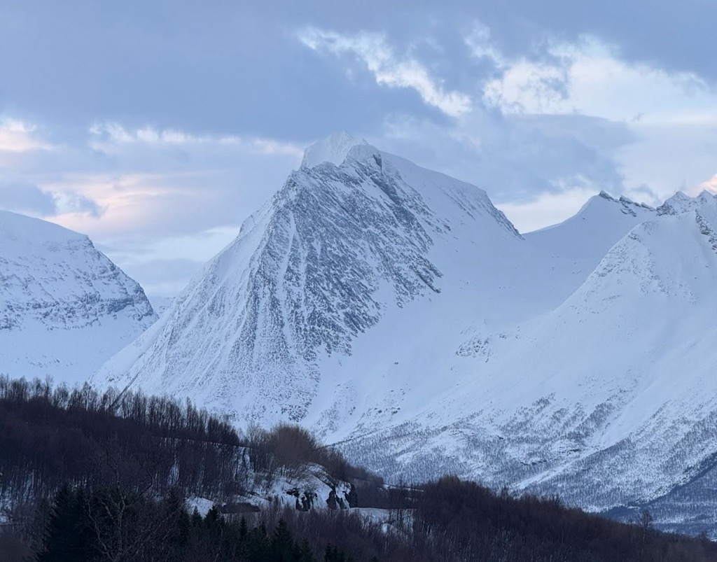
The Lyngen Alps (Norwegian: Lyngsalpene) are the centerpiece of Norway’s mountainous Troms og Finnmark region. The Lyngen Alps deserve their “Alps” title, with jagged peaks and glaciers on par with the European Alps. Like other parts of Norway, including the Lofoten Alps, the Lyngen Alps also feature extraordinarily deep fjords. The mountain chain is only 90 kilometers (50 miles) long, but is a growing playground for hikers and backcountry skiers, especially amongst international visitors. Despite its compact nature, there are still 828 named peaks in Lyngen Alps; the highest and most prominent is Jiehkkevárri (1,834 m / 6,017 ft).
The Lyngen Alps are located on the Lyngen Peninsula, just north of Tromsø, flanked by the Ullsfjord to the west and the Lyngenfjord to the east. The range stretches from Tromsø in the south to Kåfjord in the north. Despite their relatively small area, the Lyngen Alps are quite prominent; they rise sharply from sea level to over 1,800 meters (6,000 ft). The Lyngsalpan Protected Landscape is the administrative region protecting this range.
The range’s highest peak is Jiehkkevárri at 1,833 meters (6,017 ft), which is also the highest point in Troms og Finnmark. Other notable peaks include Store Lenangstind (1,624 m), Daltinden (1,533 m), and Rørnestinden (1,041 m).
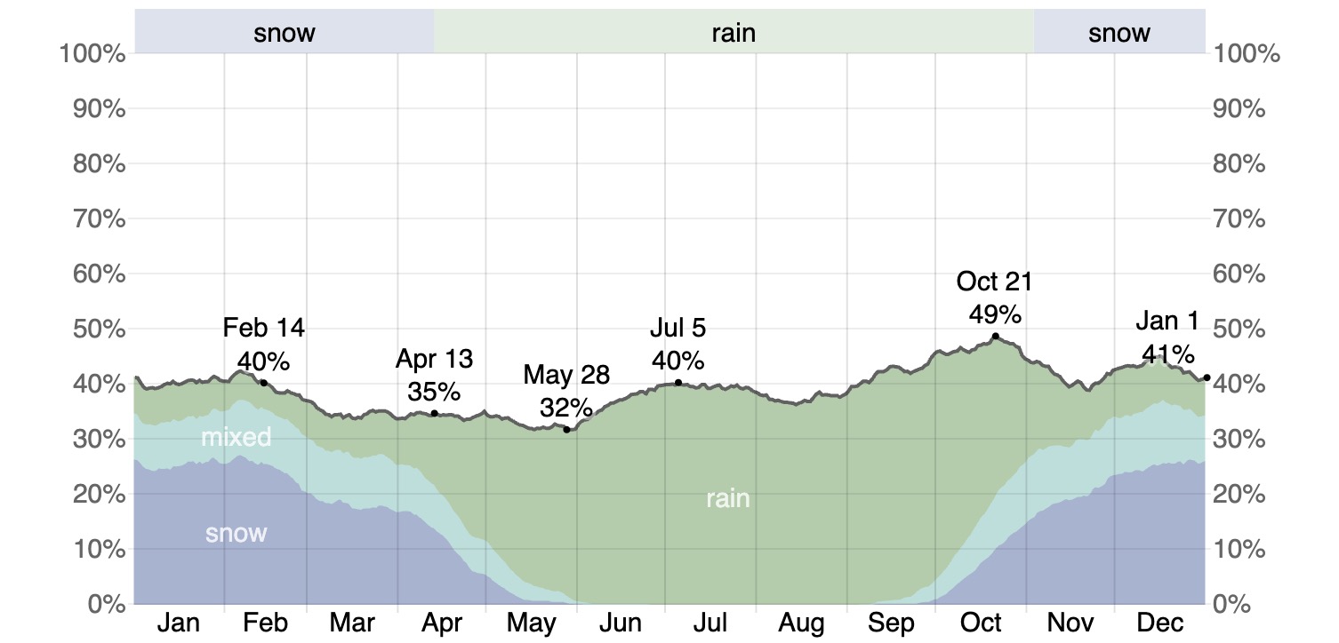
The Lyngen Alps are well north of the Arctic Circle, occupying approximately 69-70°N latitude (the Arctic Circle starts at 60°N). As a result, summers bring 24-hour daylight, while winters endure polar night from November to February. The Gulf Stream tempers the climate from what it would typically be at this latitude, and it’s common to see rain at sea level, even in mid-winter. However, the high mountains are subject to a constant barrage of moisture, most falling as snow, hence the Lyngen Alps’ large ice fields.
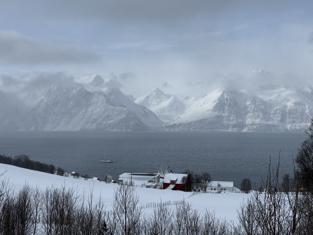
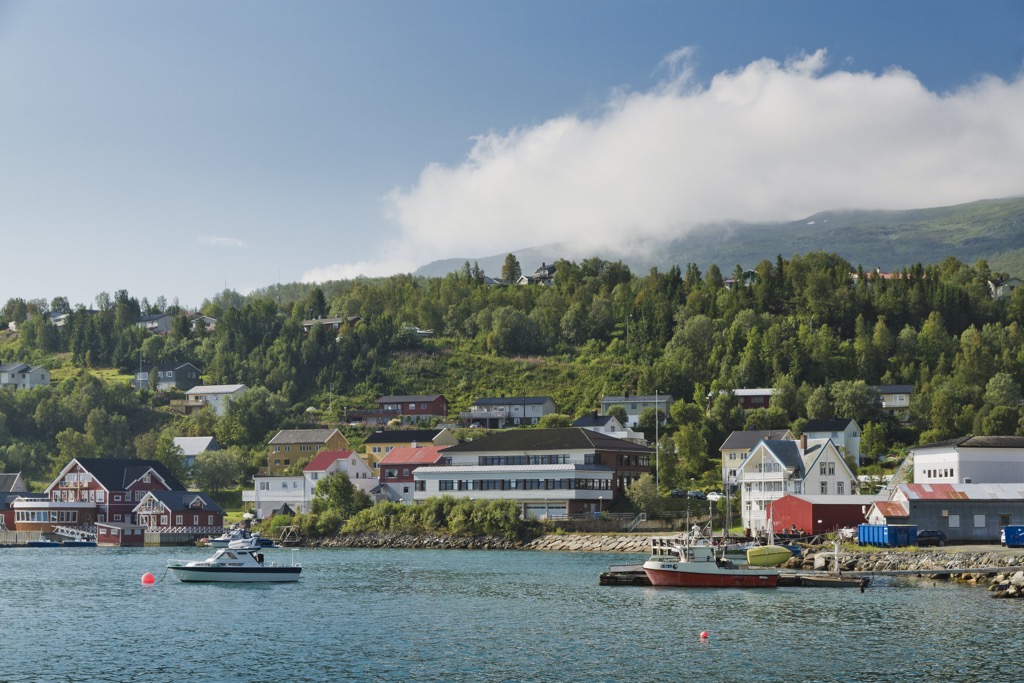
The Lyngen Alps are also defined by their coastal geography. Narrow sea channels separate the Lyngen Peninsula from nearby islands and the mainland. Most villages are dependent on ferry connections.
There are few trees on the Lyngen Peninsula, and only at low elevation. Above a few hundred meters, the slopes quickly become alpine tundra, featuring shrubs and hearty grasses. South-facing slopes tend to be drier and receive more sunlight, supporting more vegetation. The result is that much of the hiking doesn’t follow designated trails. It’s relatively easy to blaze your own route up many of the popular mountains.
The Lyngen Alps owe their existence to a geological history involving ancient bedrock and more recent glacial sculpting. The mountains are composed of metamorphic rocks like gneiss and schist, formed hundreds of millions of years ago. The initial uplift of the Lyngen Alps occurred during the Caledonian Orogeny, about 400 million years ago.
If you’re an astute reader, you may be wondering, “How are these mountains so old and yet so rugged?” Typically, older ranges like the Lyngen Alps are rounded by millions of years of erosion and weathering, while younger ranges, yet unaffected by Earth’s erosive processes, retain a jagged structure. The answer lies “frozen in time”; the landscape as we see it today was heavily shaped during the last series of Ice Ages, particularly the Weichselian glaciation.
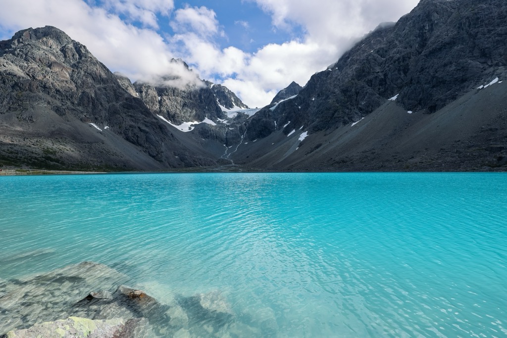
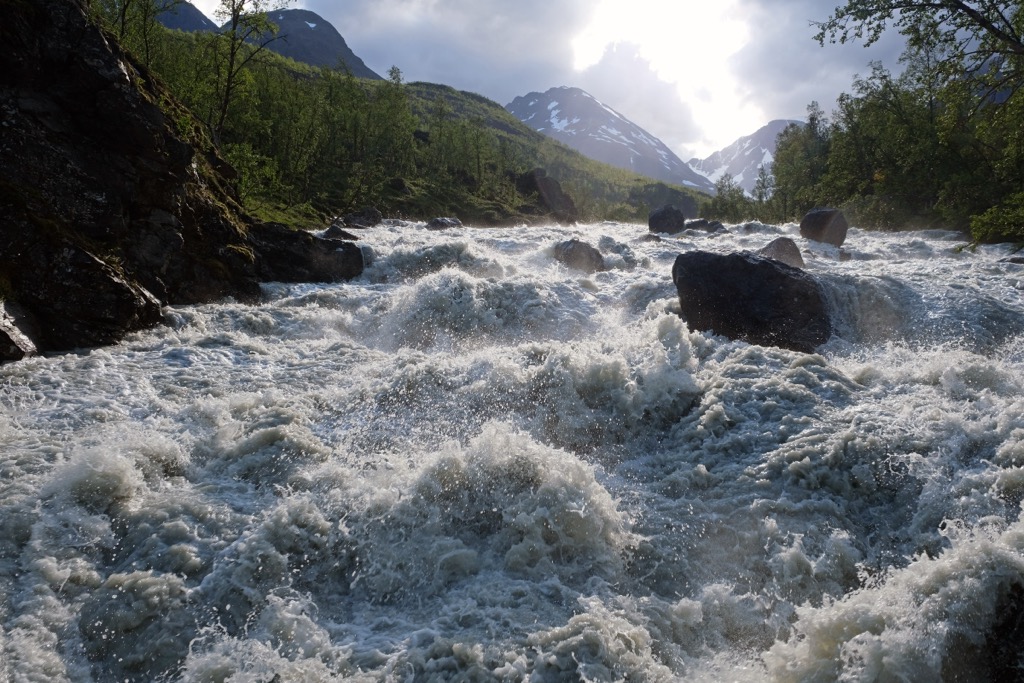
Powerful, sprawling glaciers carved out the deep U-shaped valleys and left behind cirques, hanging valleys, moraines, and lakes. Blåisvatnet, the blue lake mentioned above, is a product of these retreating glaciers. The glaciers remain today—the Strupbreen, Sørbreen, and Jiehkkevárri Glaciers are all impressive and beautiful, though they are retreating rapidly due to a warming climate. Notably, the climate is warming much faster in the Arctic than at the median latitudes, further endangering the Lyngen Alps’ remaining glaciers.
Like other Arctic climes, the Lyngen Alps are somewhat inhospitable to extensive biodiversity. Conditions are harsh; snow covers the range for much of the year, and polar night engulfs the region for over two months each winter. However, hearty ecosystems have developed around these conditions, many of which are rare and susceptible to human interference.
Birch forests and heather-dominated heathlands cover the valleys and foothills at lower elevations. These give way to alpine tundra higher up, with bare rock, snowfields, and glaciers dominating the upper mountains.
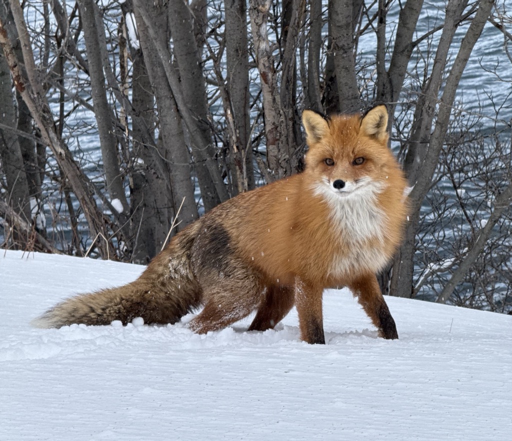
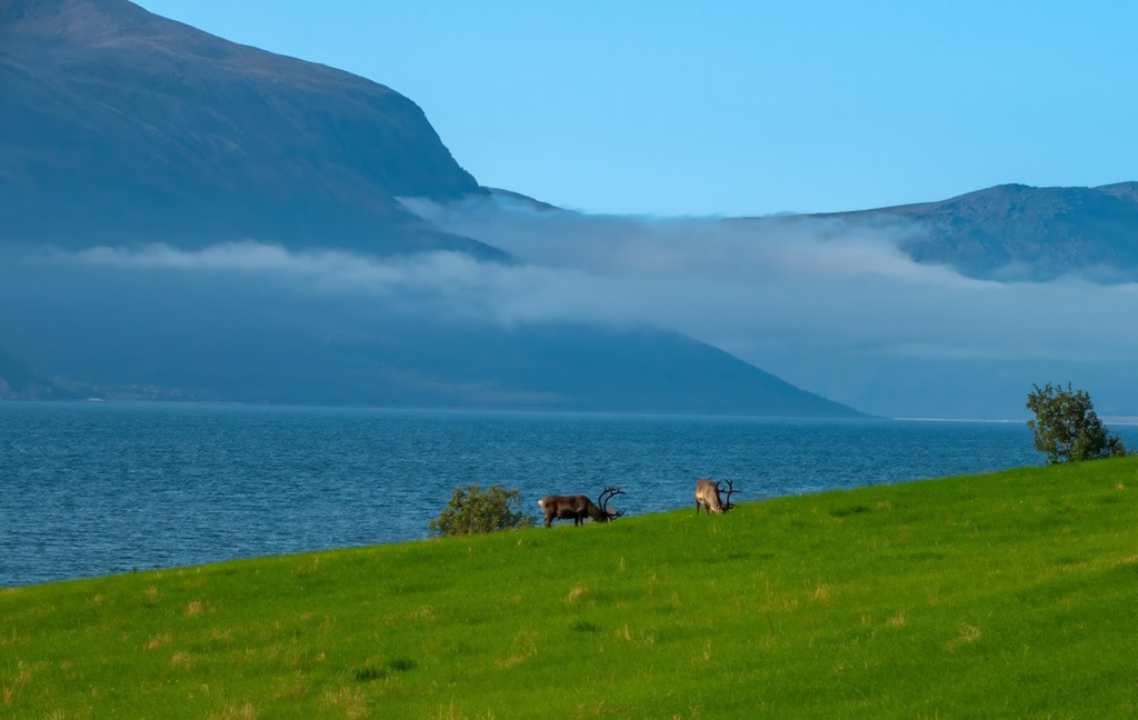
Wildlife in the Lyngen Alps includes moose, Arctic foxes, red foxes, lynx, and reindeer—both wild and domesticated by Sámi herders. Golden eagles, ptarmigans, and rough-legged buzzards are birds to watch out for, especially in summer. Rivers and streams host salmon and Arctic char, while the surrounding fjords are home to Orca whales and seals, among many other creatures.
Flora is adapted to short growing seasons and poor soils. Mosses, lichens, and alpine flowering plants like mountain avens and Arctic poppies are able to colonize the high terrain. Lower slopes are somewhat more fertile, with crowberries, bilberries, and dwarf birch contributing to the understory in summer.
Climate change poses a significant threat to the region’s ecology. Melting glaciers and rising snowlines are altering habitat ranges, most notably for Atlantic salmon, which require cold, oxygen-rich waters to thrive. On the other hand, the vegetation zone has slowly crept higher, suggesting the Lyngen Alps will be more biologically productive in a warmer climate, at least on land.
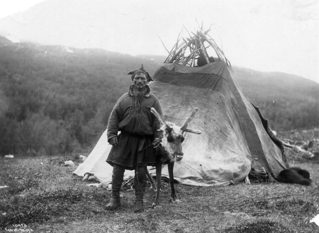
The Troms og Finnmark region has been inhabited for over 10,000 years, with archaeological evidence showing continuous settlement since the Mesolithic, though the Lyngen Alps have likely been settled more recently. The harsh climate and unforgiving topography meant that most ancient tribes avoided permanent settlement in the region until the Sámi People arrived about 3,000 years ago.
Sámi are Uralic peoples, having migrated up the Volga River basin through Northwestern Russia. Compared to the rest of Norway, the Lyngen Alps (and the greater Troms og Finnmark region) have a high concentration of Sámi.
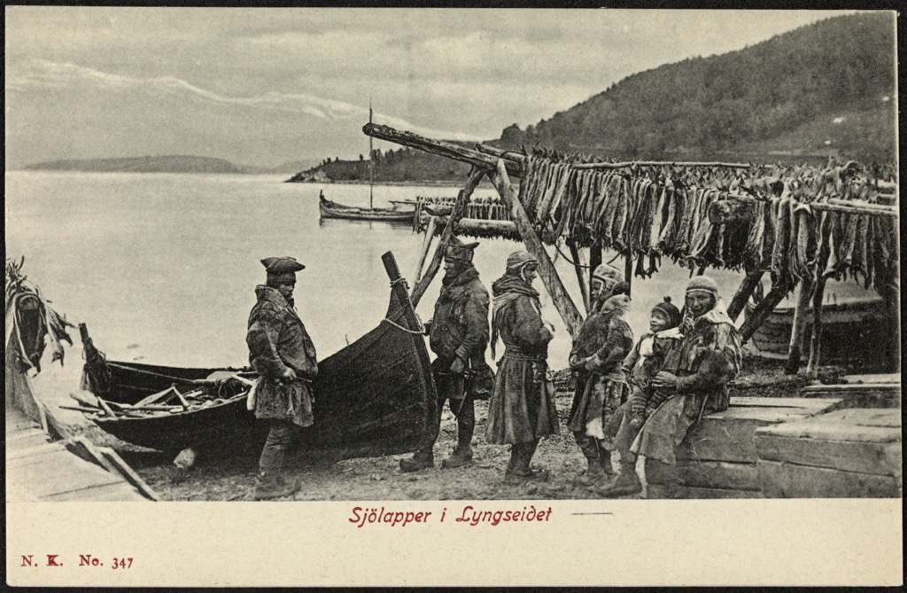
Meanwhile, Norse Scandinavians, who now dominate the population of Norway, Sweden, and Finland, are Germanic-speaking peoples who came later. During the Viking Age, these Norse settlers began influencing Norway’s coastline, where resources and livelihoods were most easily accessible. In the Middle Ages, the region was contested by Norway, Sweden, and Russia, each seeking to control trade routes and taxation rights.
The Lyngen Alps, though harsh, have always been a sanctuary of peace with one significant exception. In World War II, the German military constructed the “Lyngen Line” as a defensive barrier against Soviet advances. Remnants of bunkers and trenches can still be seen. Towards the war’s end, Finnmark and parts of Troms were devastated during the German retreat in 1944, when a scorched-earth policy destroyed towns and infrastructure, especially Tromsø.
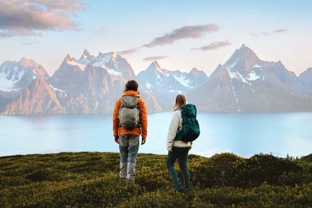
Today, the Lyngen Alps are a peaceful home to about 3,000 locals. On the other hand, they’re also a growing international tourist destination, especially for those seeking a wilderness experience you can’t find in the European Alps.
Lots of European IFMGA guides have started running ski touring trips up here. Snow conditions are probably reliable in April and May, and it’s something different. That’s how PeakVisor made our way over in April 2025!
Be prepared to journey to what seems like the world’s end in the Lyngen Alps. There are many established routes for the casual adventurer, but locals and serious tourists often find their up peaks by following terrain features, not established trails.
Why is that? For one, with about 3,000 people on the peninsula, there’s a labor shortage for maintaining trails over such a vast space. Moreover, the weather is harsh, with only a small window of snow-free days in the summer. Lastly, the terrain is conducive to bushwacking, or hiking off-trail. There is little vegetation besides sprawling alpine meadows, and many peaks are relatively gentle compared to the European Alps. As a result, you don’t need a trail to tag summits. Try to tramp carefully through the fragile alpine ecosystem!
All the usual hazards of mountain recreation exist, but be especially wary of exposure. Over 40% of summer days feature rainfall, and temperatures are perennially chilly. Even in the summer, temperatures will be in the single digits on the upper mountains (35-50℉). When you add a drenching rain into the equation, hypothermia is not out of the question for unprepared hikers.
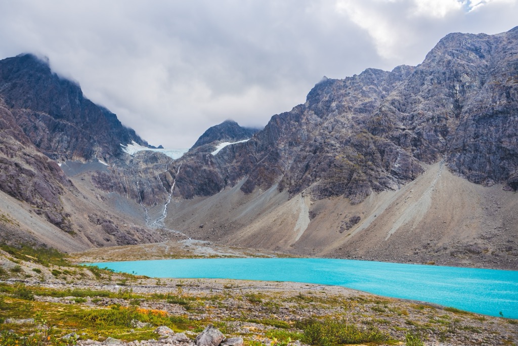
The most family-friendly option is Blåisvatnet—the Blue Lake—one of the most popular hikes in these mountains. It’s about 10 kilometers (6.2 miles) round-trip, with just 200 meters (660 ft) of elevation gain; most parties take about 3-4 hours, with time to stop and appreciate the turquoise waters of Blåisvatnet. Like other glacial lakes around the world, the water is turquoise due to the presence of rock flour, which is shaved off the mountain as glaciers slowly grind their way downhill.
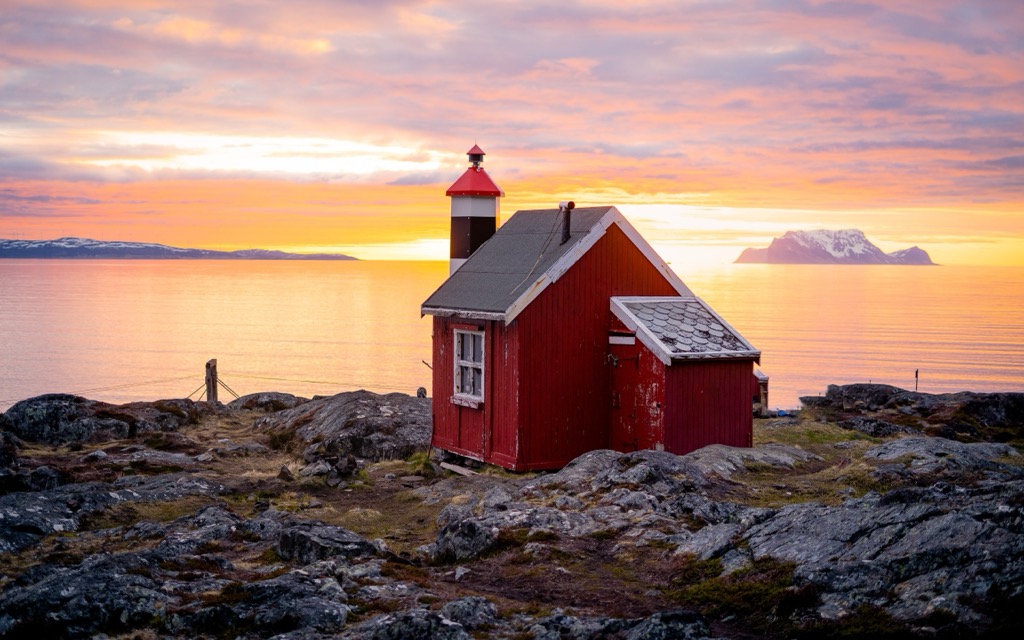
Lyngstuva is another accessible but rewarding hike that reaches the outermost point of the Lyngen Alps. Expect this 6-km (4-mile) hike to take about two hours. There’s a hut (with a fireplace) and a lighthouse at the finish, where you can stay overnight.
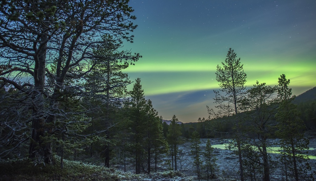
In winter, the hike is more challenging, but popular with those trying to see the northern lights. Imagine cozying up in the tiny refuge, wood stove a blaze, with the aurora borealis dancing overhead.
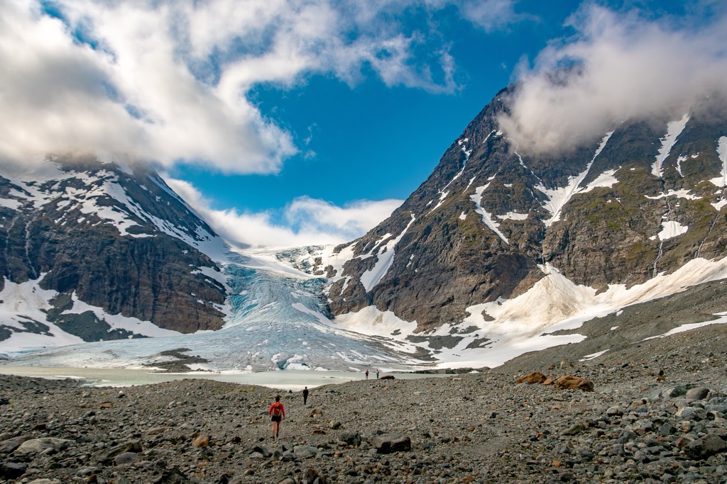
The Steindalsbreen Glacier is a fan favorite hike that offers some challenge and plenty of reward. Expect to take several hours for this 13 km (8.5 miles) trek to the foot of the flowing glacier. The hike starts from Route 868 between Oteren and Lyngseidet.
The impressive toe of the glacier terminates in a glacial lake at the top of the Steindalen Valley. Each passing summer sees an increase in the volume of this lake and more glacial recession; signposts depict its retreat over the years. The smooth canyon walls and presence of moraines also give a geological perspective of the former scale and grandeur of this glacier.
Rørnestinden (1,041 m / 3,415 ft) is an excellent option for those looking for an accessible hike with plenty of vertical. It’s especially popular for people staying in Lyngseidet village; the trail starts in town and quickly ascends 1,000 meters to the summit. You’ll often see reindeer grazing on this hike, which is one of the most popular in the Lyngen Alps. Being in the center of the peninsula, it also offers some of the range’s best views. You can also stop at the Rørneshytta mountain refuge.
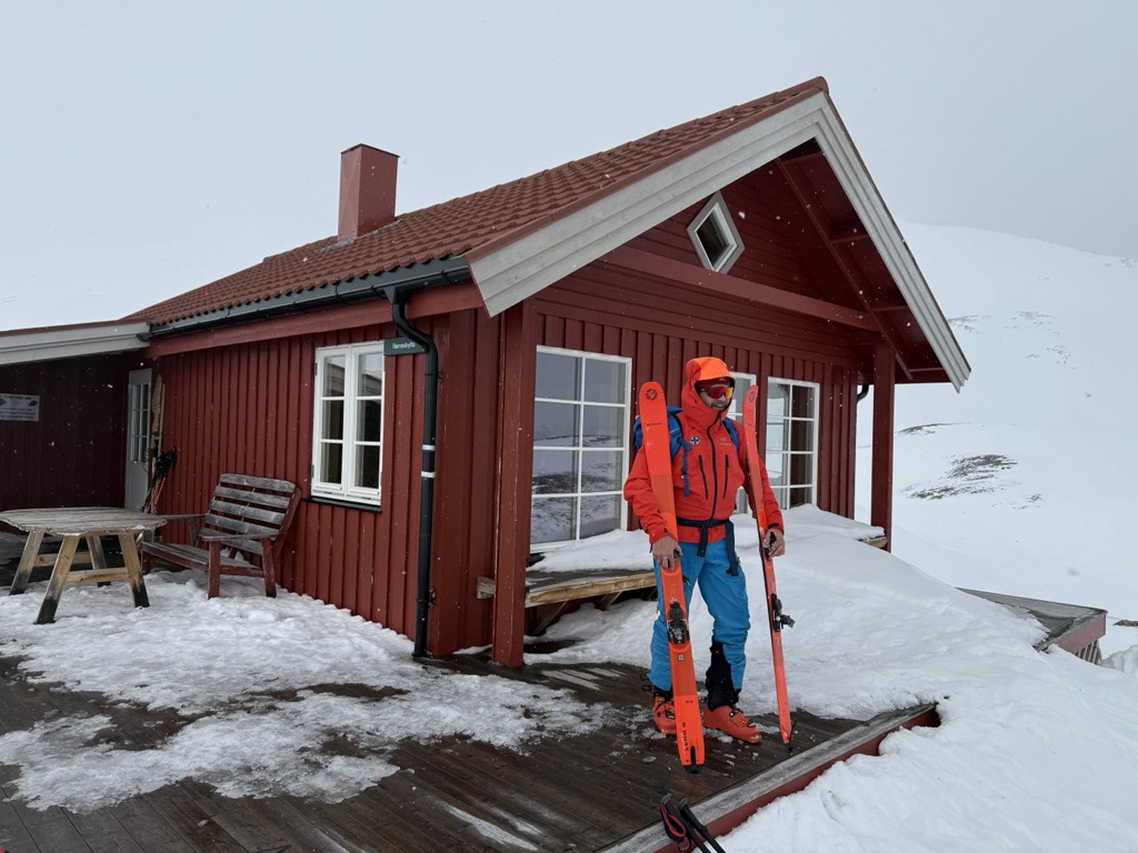
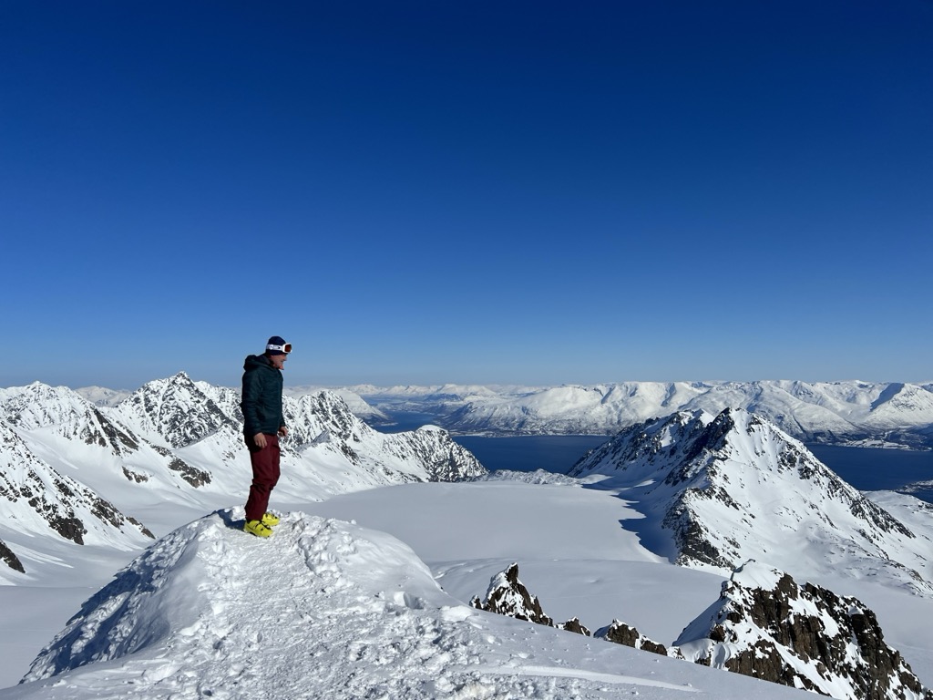
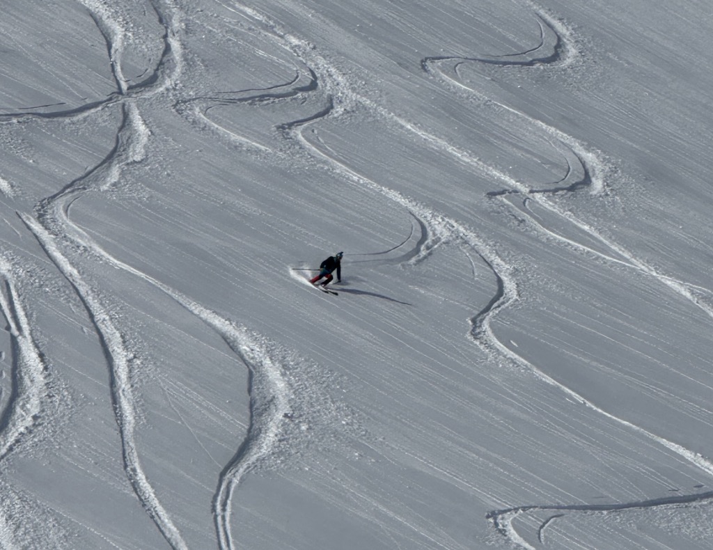
The Lyngen Alps are a popular ski touring destination for international visitors, especially from the European Alps. The Lingen Alps are also notably more serious than other regions of Norway. The mountains are steep, with Alaska-like spines and large cornices. Be sure to do your own research before heading out here, or connect with Tromsø Ski Guides. PeakVisor used these guys for our 2025 trip, and we highly recommend them!
Tafeltinden is one of the most popular classics. It’s a relatively easy tour but full value, with a long ascent along the vast Strupbreen and Koppangsbreen glaciers. The extensive glacier travel makes Tafeltinden the most technical tour in this list; you’ll want to have your harnesses and crevasse rescue systems dialed. But it’s not difficult, only reaching a moderate 35-degree slope angle just below the summit.
Another lesser-known highlight is Litletinden, just over a 30-minute drive from Tromsø. Due to the topography, the approach valley is highly protected from wind, which preserves soft snow for longer.
Daltinden (1,533 m / 5,030 ft) is among the highest non-technical peaks in the Lyngen Alps and is a fantastic summit for ski touring, as well as hiking during summer. This behemoth offers incredible views of glaciers and fjords. The route begins in the valley near Furuflaten and climbs 1,400 meters (4,593 ft). Expect to take at least 6-8 hours for this excursion.
If you’re coming in the summer, consider camping around the Lyngen Alps. Several paid campgrounds are spread throughout the peninsula; most communities offer one.
One thing any PeakVisor reader should know is that Norway has unique “right to roam” laws that allow visitors to camp anywhere as long as it is 150 meters (500 ft) from the nearest infrastructure (be respectful and don’t camp in somebody’s backyard). Visitors can legally stay at the same site for two days. It’s a great way to experience Norway’s natural beauty, as well as save some money in this expensive country.
Being nearly deserted, the Lyngen Alps are full of incredible potential campsites. Be sure to “leave no trace” and bury any bodily waste well away from waterways.
The biggest challenge of camping on the Lyngen Peninsula is undoubtedly the weather. About 40% of days during the warm season feature rainfall, so it’s nearly certain you’ll be dealing with it at some point.
Another great option is to stay in a mountain hut. We’ve already mentioned the Rørneshytta and the Lyngstuva hut, but dozens more huts populate the Lyngen Alps.
The huts vary; some are small, some large, some free, others paid and requiring reservations. The best resource for information on the different huts is Visit Lyngenfjord.
One of Northern Norway’s largest communities, Tromsø is located 350 km (217 mi) north of the Arctic Circle. The city has a population of about 65,000 people and is one of the largest fishing ports in the country. It’s about an hour from the Lyngen Alps and will serve as a stopping point for any international (or domestic) visitors coming to the region. However, it is also a great place to visit in its own right. PeakVisor spent a week here in 2025, in addition to a week in the Lyngen Alps.
Tromsø has a recently expanded international airport with direct connections to many European cities. Once you’ve arrived, the city is full of coffee shops and relaxed vibes; it’s often called the “Paris of the North.” The University of Tromsø – The Arctic University of Norway contributes to a youthful, college-town spirit. The Tromsøbadet is home to a swimming pool, fitness center, and climbing gym, among many other public amenities. The city has an otherworldly, “end of the Earth” feeling where strange phenomena are commonplace, like polar nights, endless summer days, and the Northern Lights.
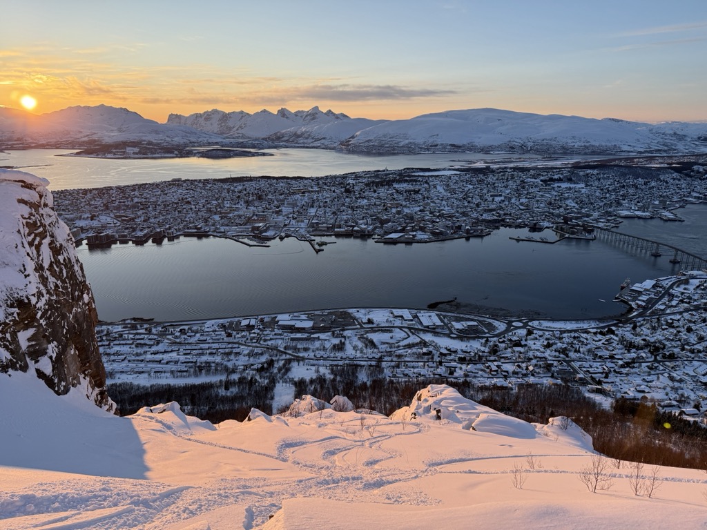
PeakVisor readers won’t want to miss the Fjellheisen Cable Car, which takes visitors about 400 meters (1,300 ft) above Tromsø. It’s more than just incredible views of the city and the surrounding fjords; the cable car’s long operating hours allow northern lights viewing during nighttime.
Last but not least are Tromsø’s unparalleled ski touring opportunities. As mentioned, the city has become a mecca for backcountry skiers worldwide. Local islands, like Kvaloya and Ringvassoya, provide easy access to touring. However, the big prize is the Lyngen Alps, which offer a lifetime of epic tours just an hour’s drive from Tromsø.
Lyngseidet is the largest settlement of Lyngen Municipality, encompassing the majority of the Lyngen Peninsula. With a population of around 700, the village has essential services including grocery stores, a pharmacy, and a library. It’s located roughly in the center of the Lyngen Peninsula and has great access to hiking and skiing.
Furuflaten is a small village on the southern Lyngen Peninsula with around 240 residents. Furuflaten is a gateway to adventure; the Lyngsdalen valley stretches inland from the village to access peaks like the aforementioned Daltinden. Historically, the valley is significant as part of the resistance fighter Jan Baalsrud’s WWII escape route.
This village is conveniently located at the southern end of the Lyngen Peninsula, making it the easiest to drive to from Tromsø. It’s about 30 minutes by car, and you don’t have to take any ferries.
The town is home to petrol stations, a brewery (Macks Ølbryggeri since 2012), a church, a bakery, a fitness center, and a campground, but most of all, it has a fantastic, cozy guesthouse—the Vollan Gjestestue—with a restaurant serving home-cooked traditional fare.
The mountain adventures from here are endless, with dozens of peaks over 1,000m in the vicinity. Store Russetinden reaches 1,405 meters (4,610 ft) and is popular for both hiking and ski touring.
At PeakVisor, we love reliable information. That’s why we write articles like this one.
PeakVisor has been a leader in the augmented reality 3D mapping space for the better part of a decade. We’re the product of nearly a decade of effort from a small software studio smack dab in the middle of the Alps. Our detailed 3D maps are the perfect tool for hiking, ski touring, biking, and alpinism.
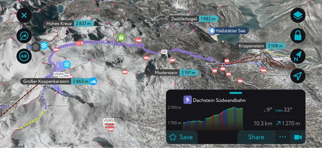
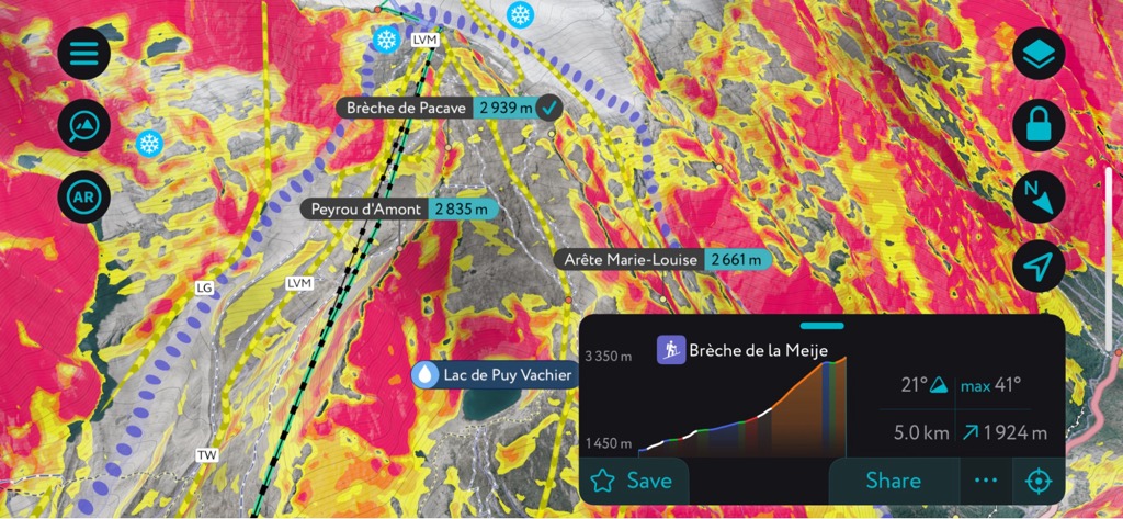
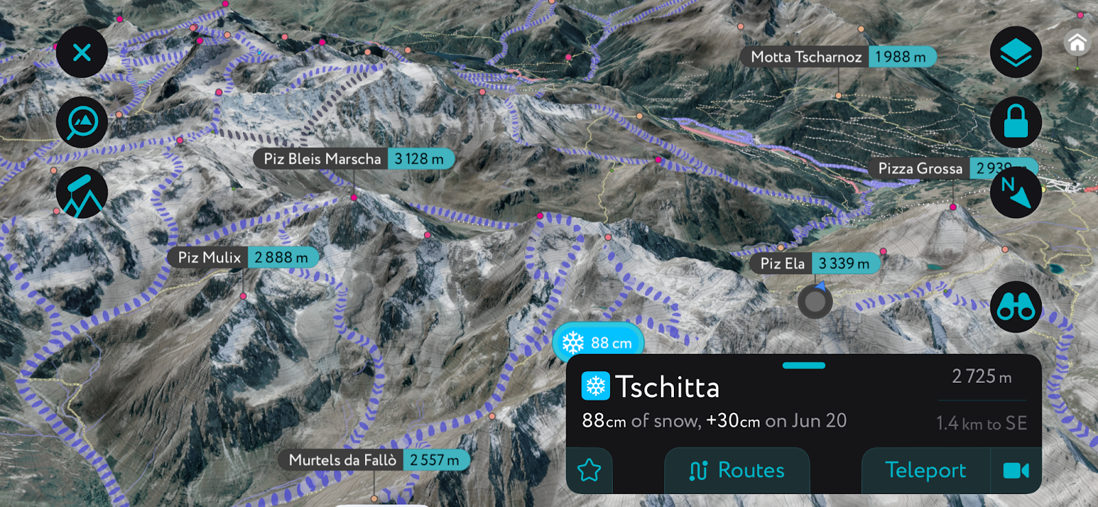
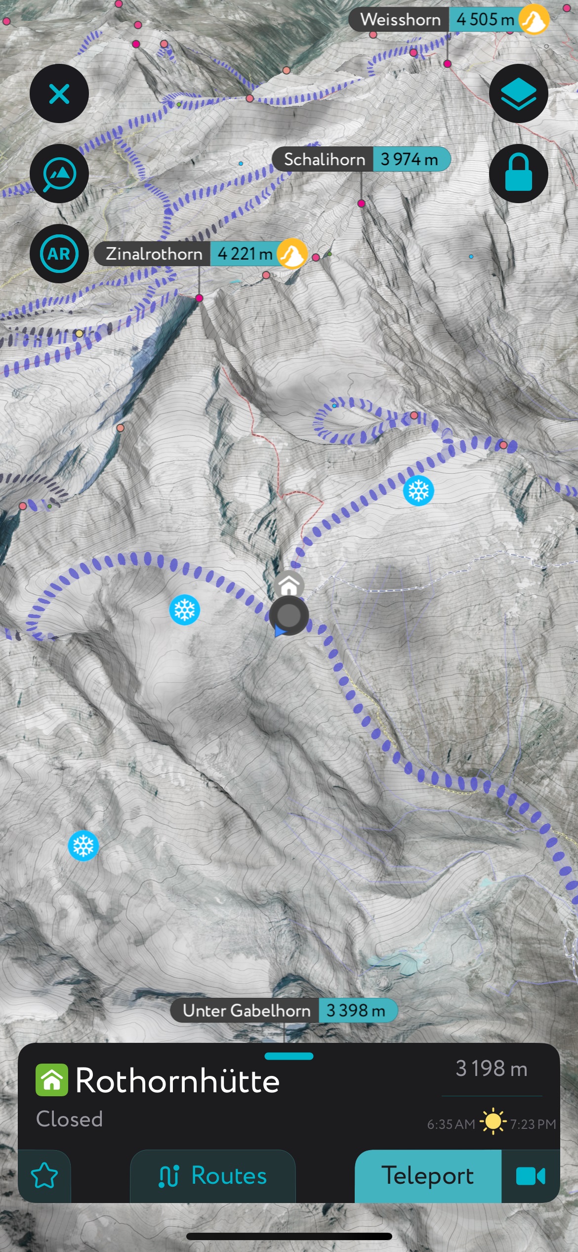
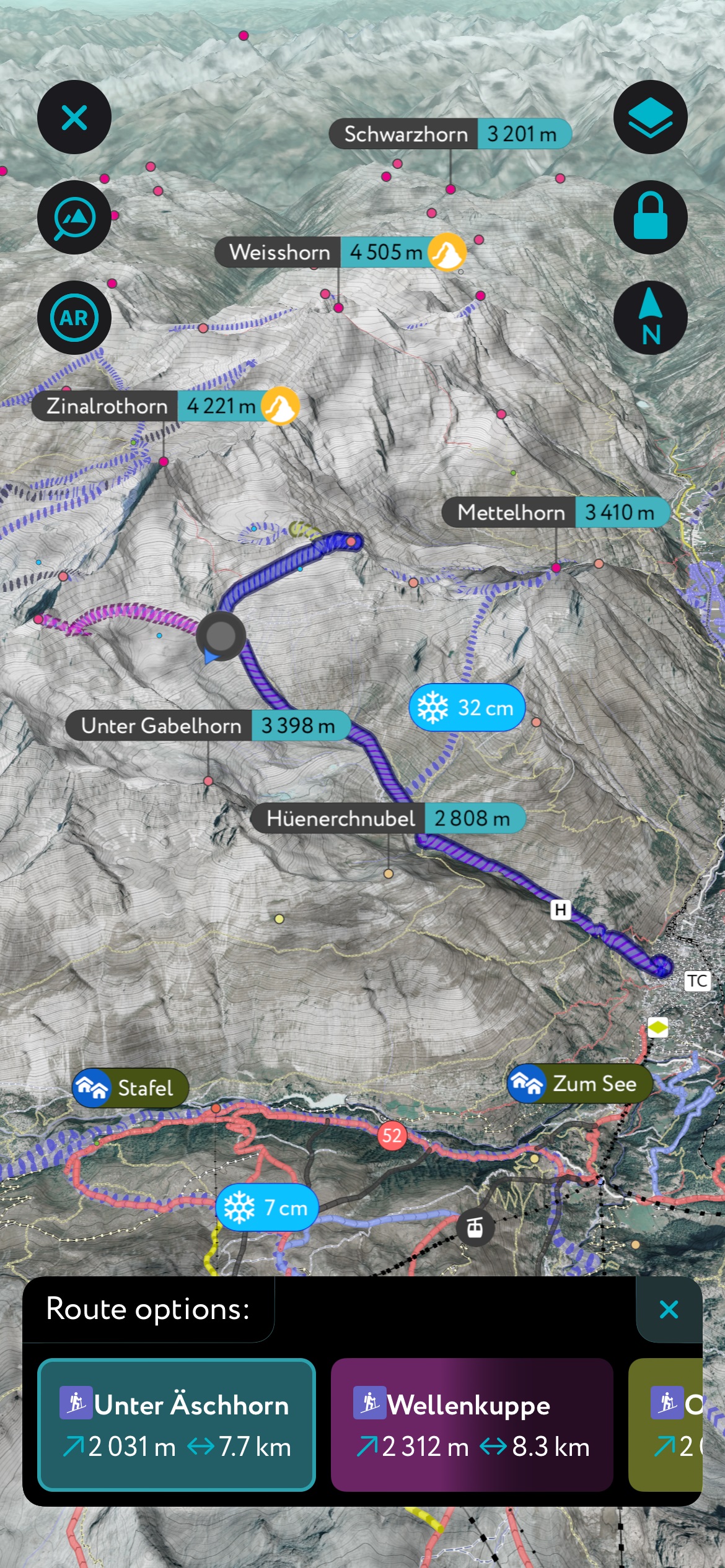
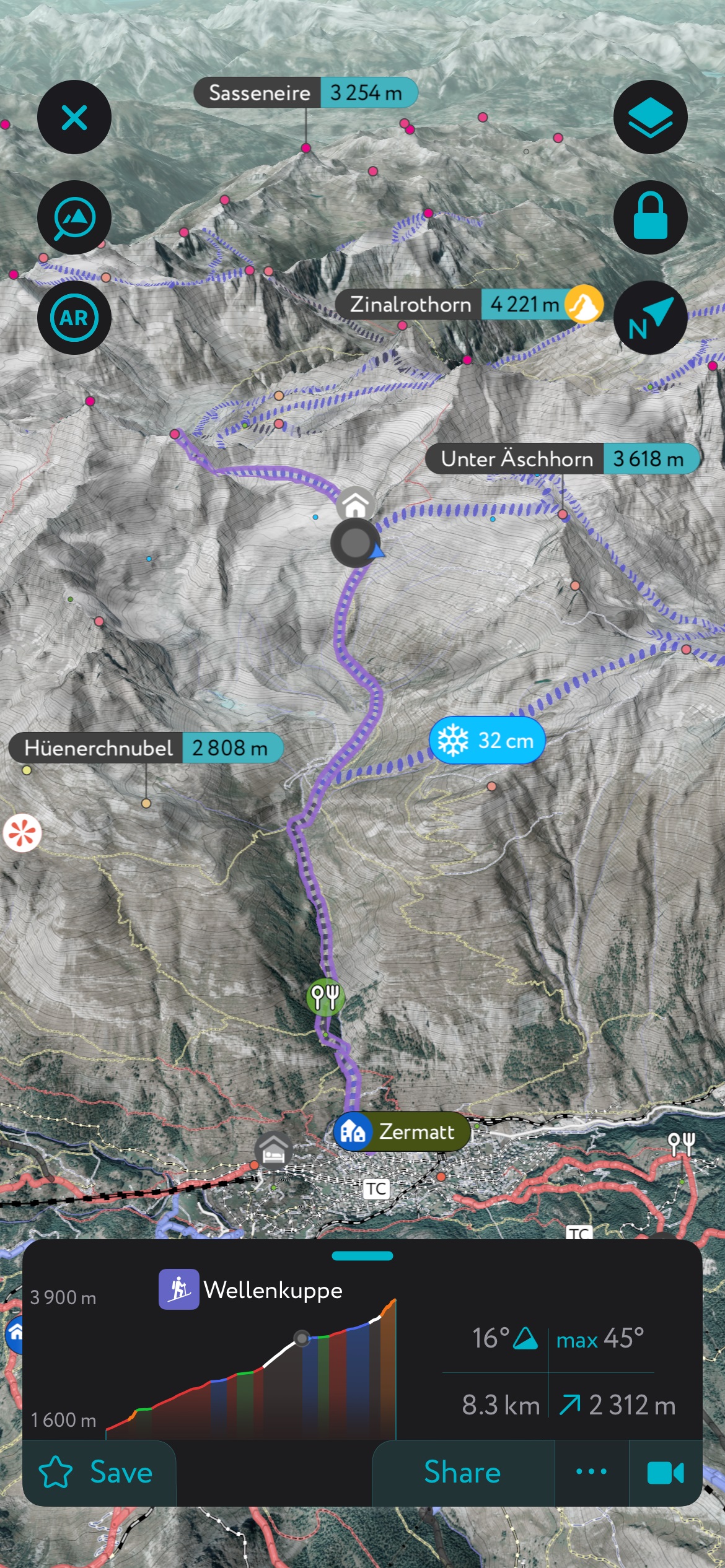
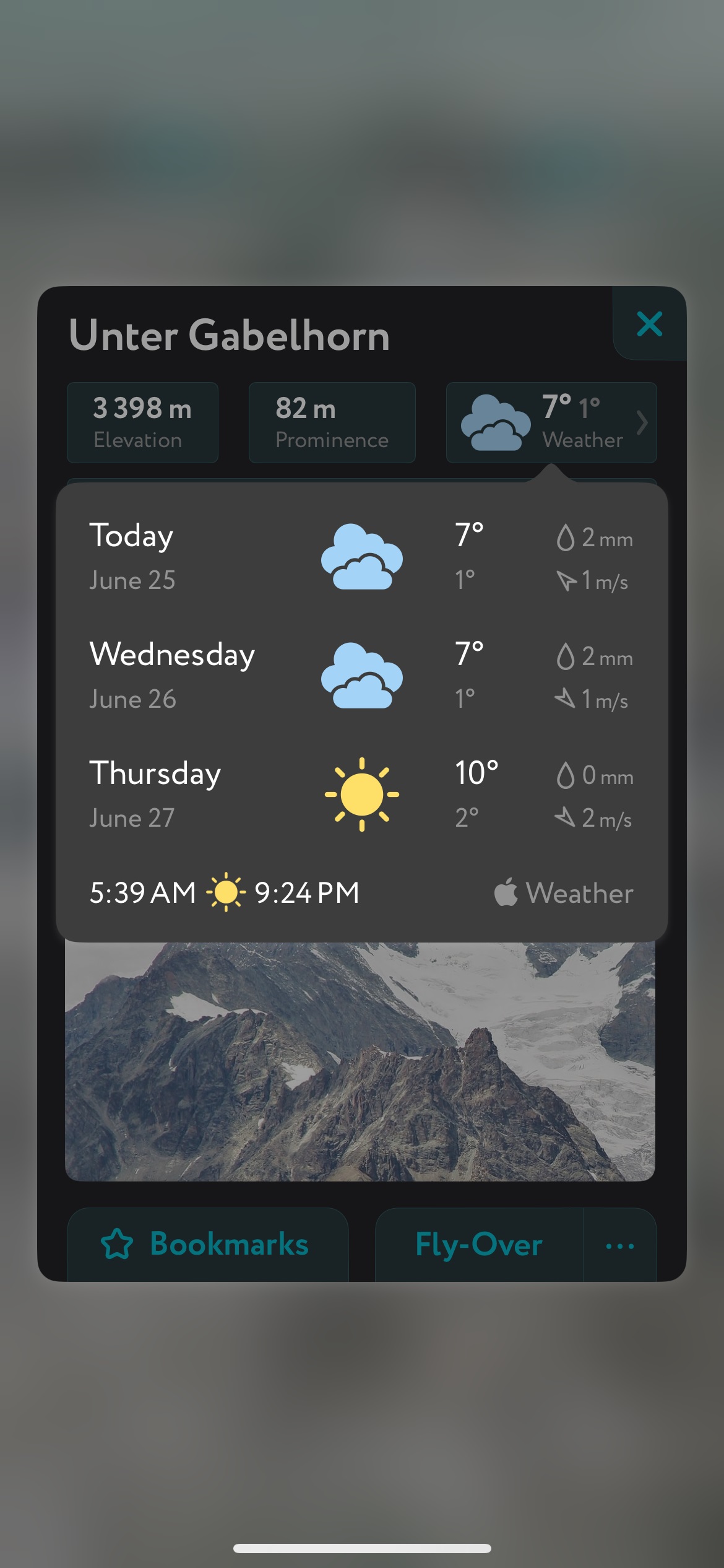
In addition to the visually stunning maps, PeakVisor's advantage is its variety of tools for the backcountry:


The highest peak in the Lyngen Alps is Jiehkkevárri, at 1,834 m.
The Lyngen Alps have 828 named peaks.


.jpg)