Scan the QR code and open PeakVisor on your phone
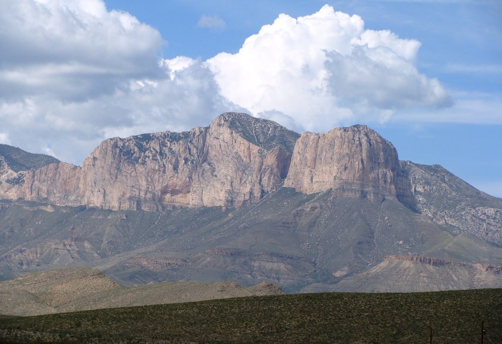
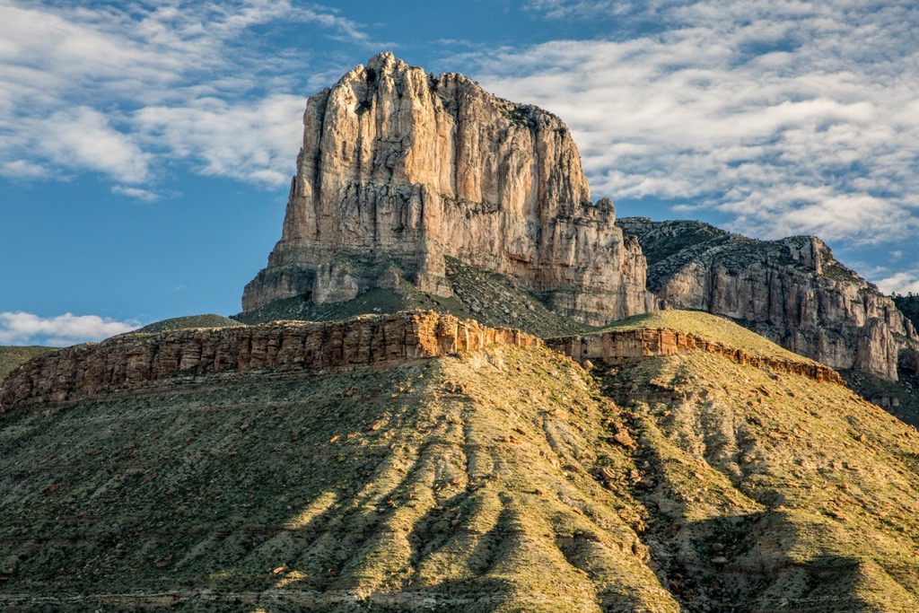
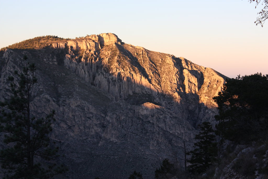
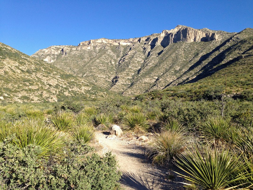
The Guadalupe Mountains are an impressive range made up of an ancient reef rising from the Chihuahuan Desert in southeastern New Mexico and western Texas in the United States. The range lies within Guadalupe Mountains National Park and Lincoln National Forest. There are 38 named mountains in the range. Guadalupe Peak is the highest with an elevation of 8,753 ft (2,668 m) and the most prominent (3,015 ft/919 m). One of the most distinct features is El Capitan – a peak rising strikingly from its surroundings.
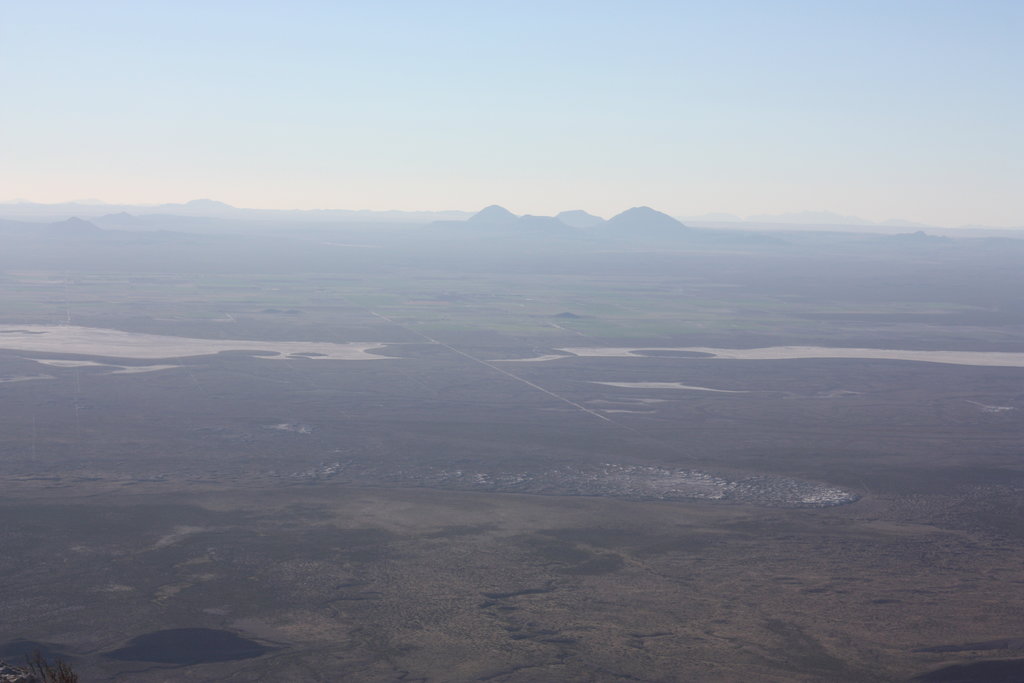
The Guadalupe Mountains lie in southeastern New Mexico and western Texas. Surrounded by the Chihuahuan Desert, the range is made up of an exposed ancient reef system that is more than 260 million years old.
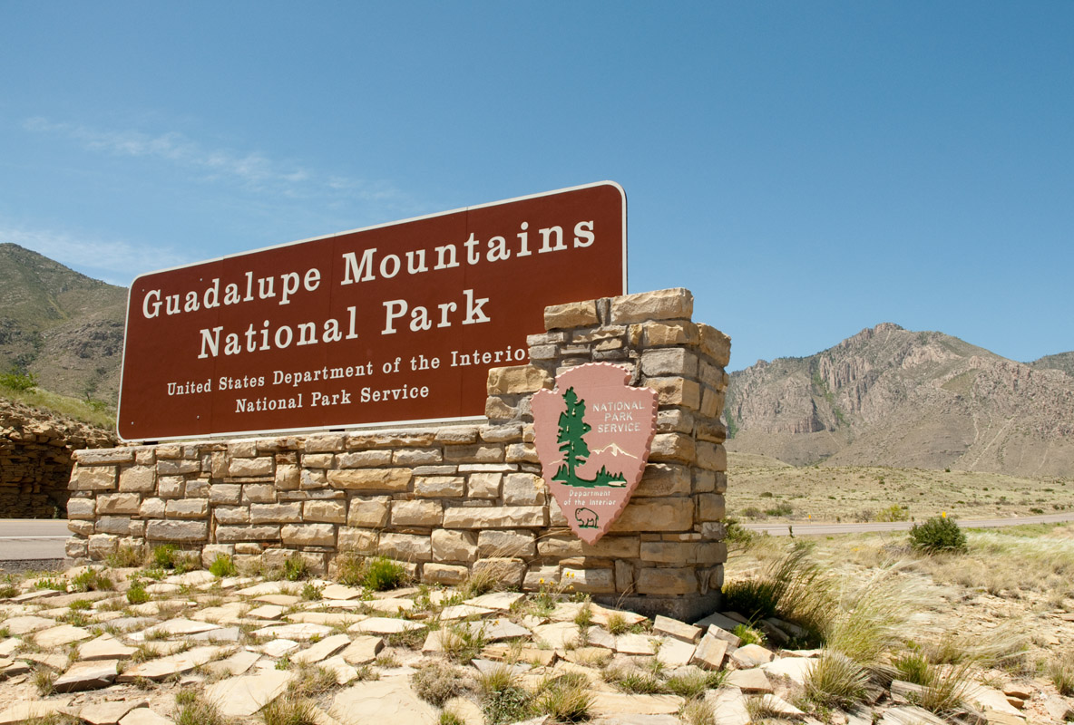
In Texas, Guadalupe Mountains National Park protects the range, spanning from gypsum dunes to rugged peaks. The park is a Class I Air Quality Area, receiving maximum protection to maintain high air quality. To the north, Lincoln National Forest encompasses a portion of the range.
Several wilderness study areas and a wilderness area exist within the range – the Lonesome Ridge Wilderness Study Area, the Guadalupe Escarpment Wilderness Study Area, and the Guadalupe Mountains Wilderness. It also neighbors the Carlsbad Caverns National Park.
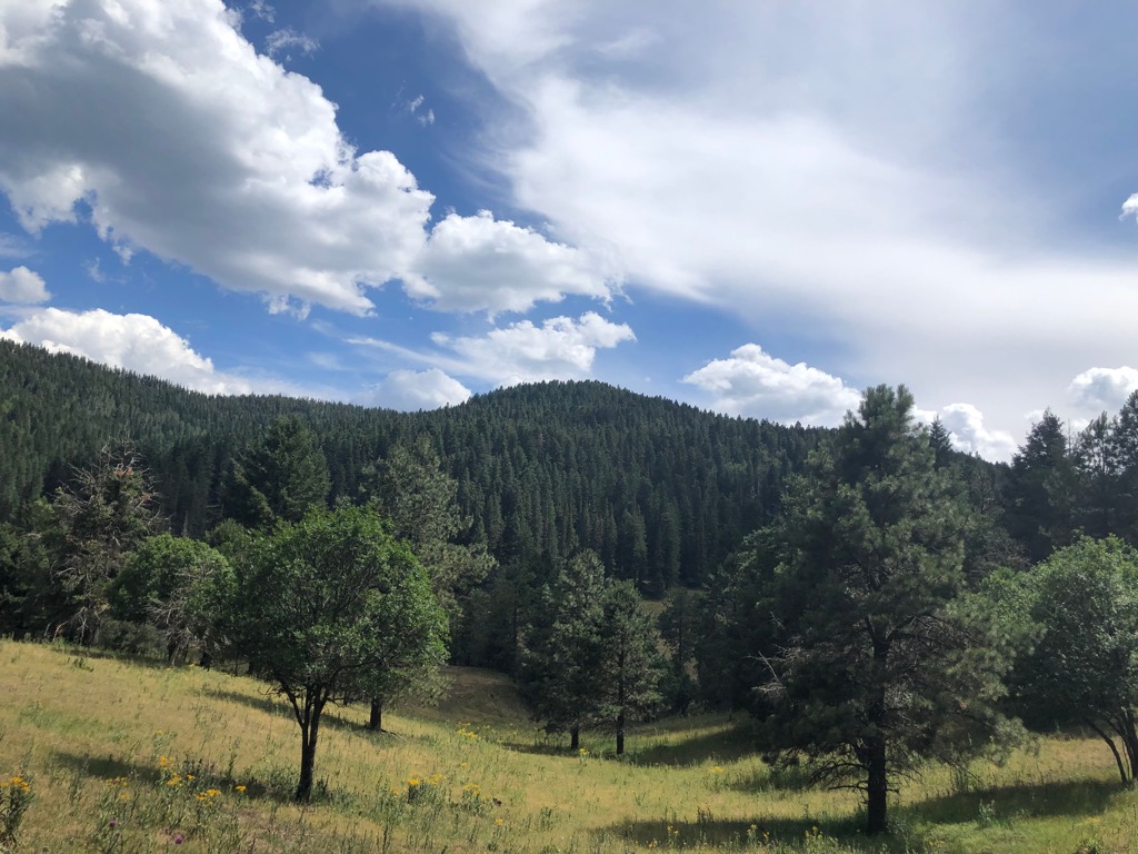
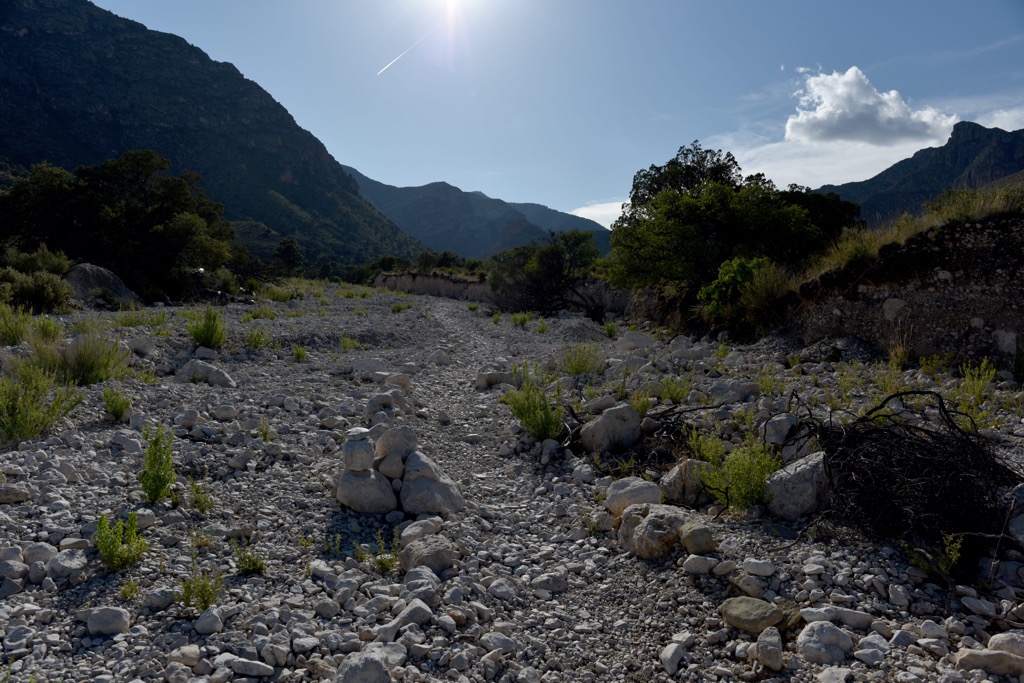
The mountains are in an arid and rugged region that saw very little non-Native human presence until the mid-1800s and followed shortly thereafter by a rail line. Despite the harsh and dry conditions, higher elevations and canyons contain forested patches.
The Guadalupe Mountains are part of a 400 mile (644 km) long, U-shaped fossil reef. Most of the reef, called Capitan Reef, remains buried today as it stretches through west Texas and southeast New Mexico. The reef is composed of ancient sponges, algae, and skeletal material that accumulated over five million years. Between 270 and 260 million years old, it is a prime example of an ancient reef system. The mountain strata containing fossils are associated with the oil patch in the west Texas’ Delaware Basin.
During the Permian epoch between 251 and 299 million years ago, the Earth’s land mass formed one supercontinent. The region around the Guadalupe Mountains lay on the continent’s western edge and was covered by a three-armed inland ocean. The Delaware Basin was the middle arm of the sea, spreading about 150 miles (241 km) long and 75 miles (121 km) wide.
Capitan Reef developed during the middle part of the Permian period. It lasted for about five million years until conditions changed around 260 million years ago. The channel connecting the inland sea to the ocean narrowed, leading to more evaporation than water flowing in. As water evaporated, the minerals that were left behind fell to the sea bottom in layers of mineral salts and mud.
Around 80 million years ago, tectonic compression caused uplift in the region. Between 20 and 30 million years ago, more tectonic activity formed steep faults on the west side of the basin. Eventually this movement caused part of the Capitan Reef to rise several thousand feet. Softer rock eroded and left only the hard fossil reef exposed.
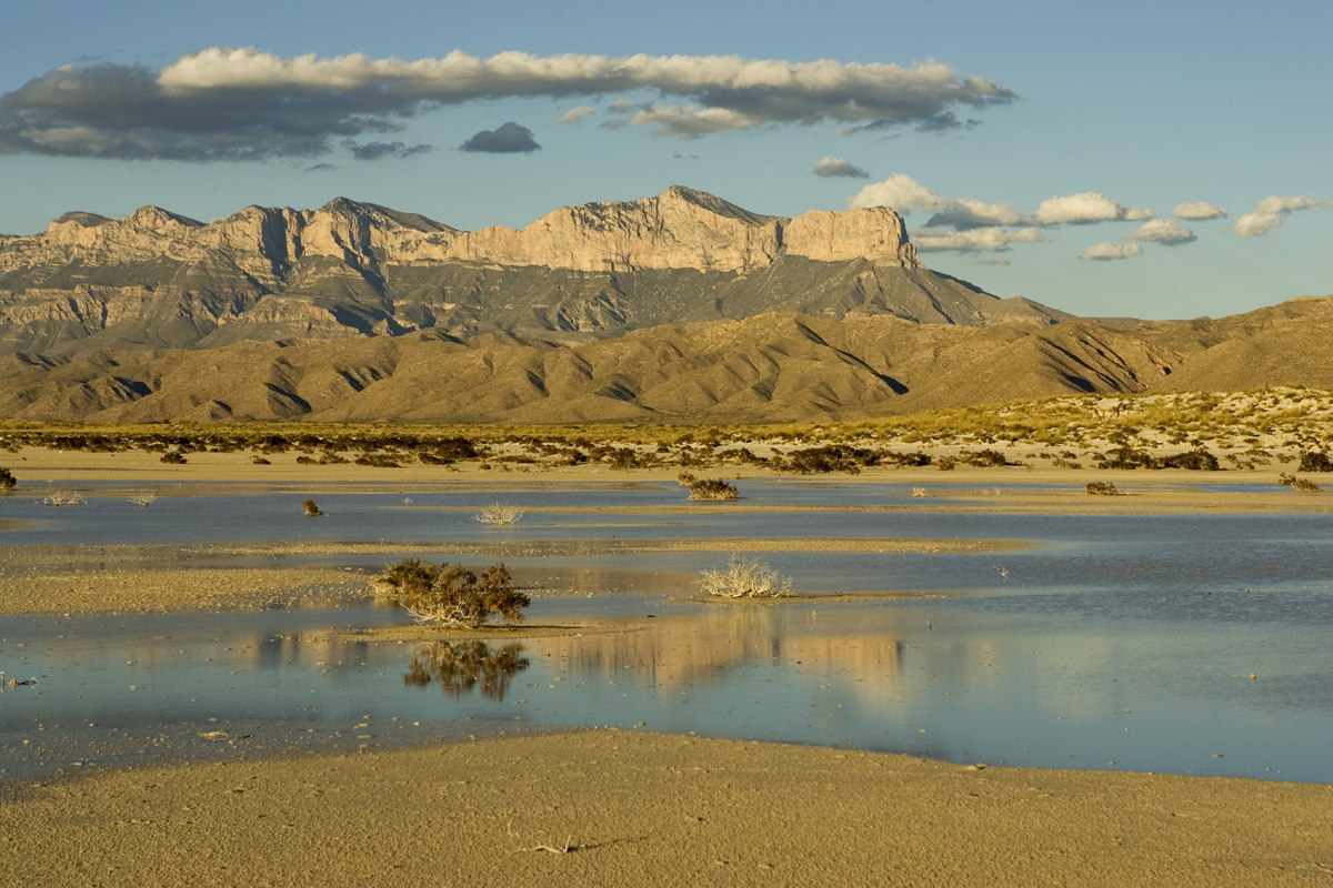
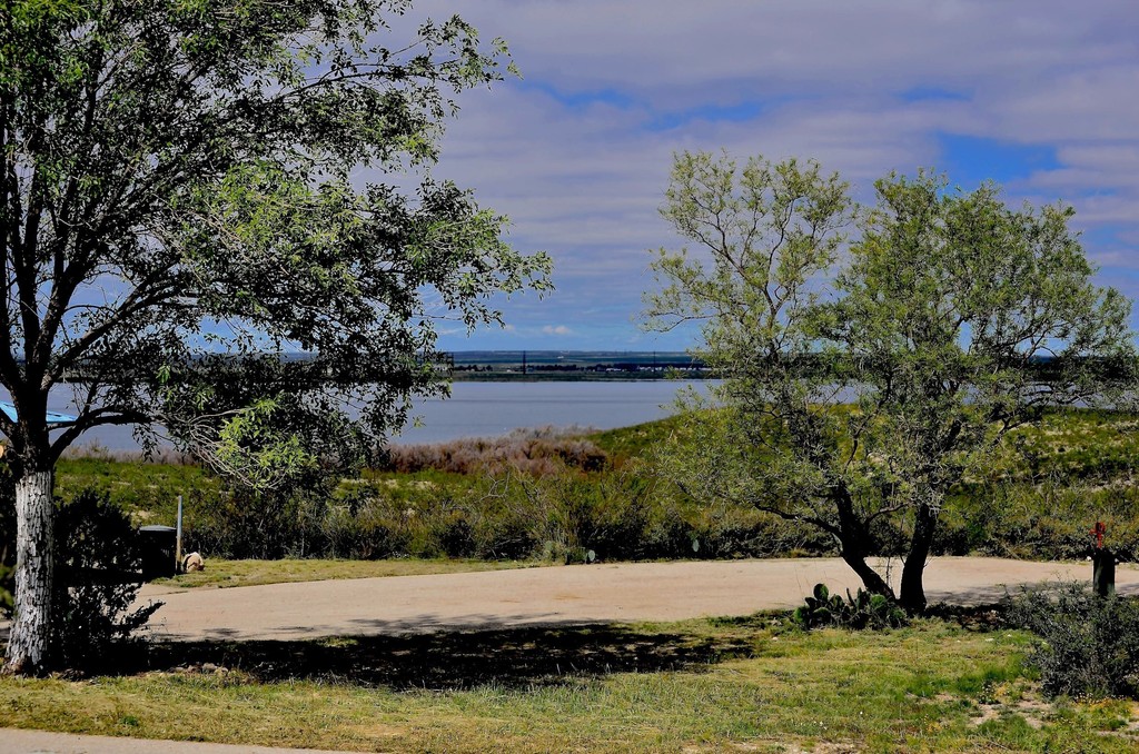
Despite being surrounded by desert and having scarce water resources, the range is home to a surprisingly wide variety of plants. Springs flow around the base of the eastern escarpment, creating small oases. The spring-fed stream in McKittrick Canyon flows year round. Conditions of steep canyon walls and high elevation slopes allow woodlands to remain where the rest of the region is too dry for forest. The mountain tops receive about double the rainfall of the desert base.
The vegetation present in and around the mountains is influenced by the Rocky Mountains, the Great Plains, and the Chihuahuan Desert. Plants have adapted to the dry conditions – some cactus have thick stems to store water, others have spikes to protect from predators and the glaring sun, and wildflowers experience a full lifecycle in the short span of the summer rainy season.
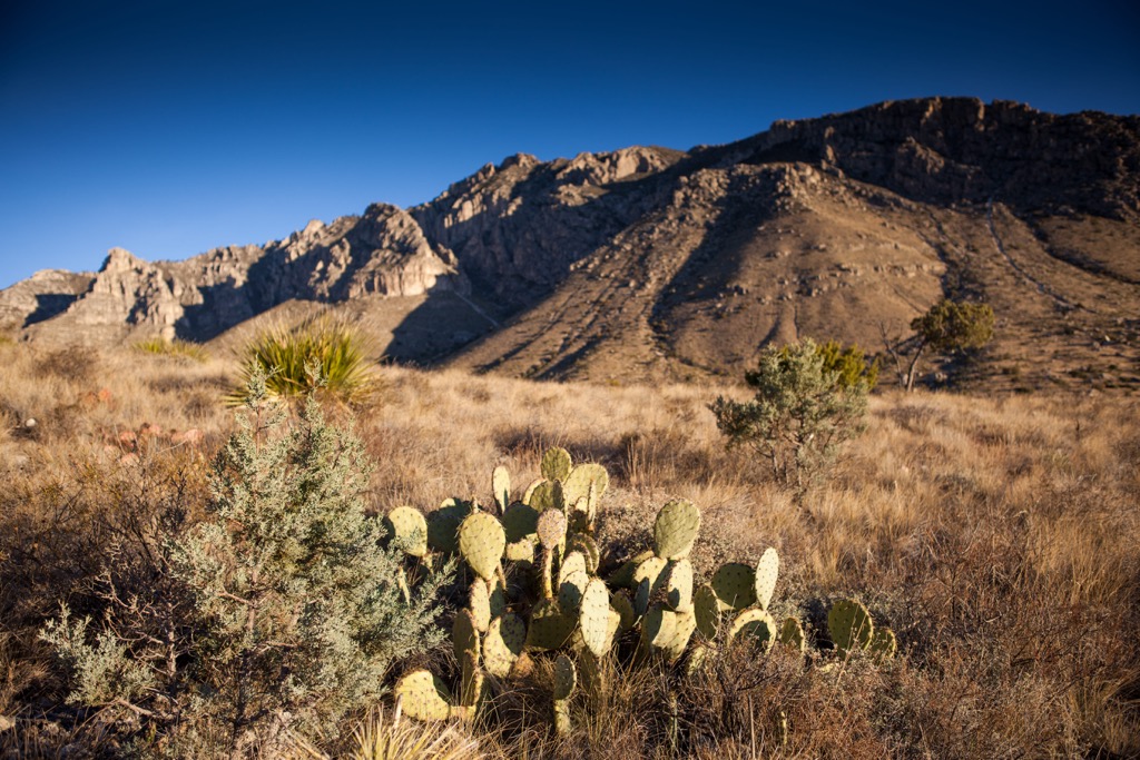
General habitat groupings include succulent and shrub desert present in the lowlands and south facing slopes, semiarid grasslands over 5,000 ft (1,524 m), mixed coniferous-deciduous woodlands, and coniferous forests higher up. The coniferous forests have Douglas fir, southwestern white pine, and ponderosa pine. One special plant to keep an eye out for is the endemic Guadalupe Mountains violet.
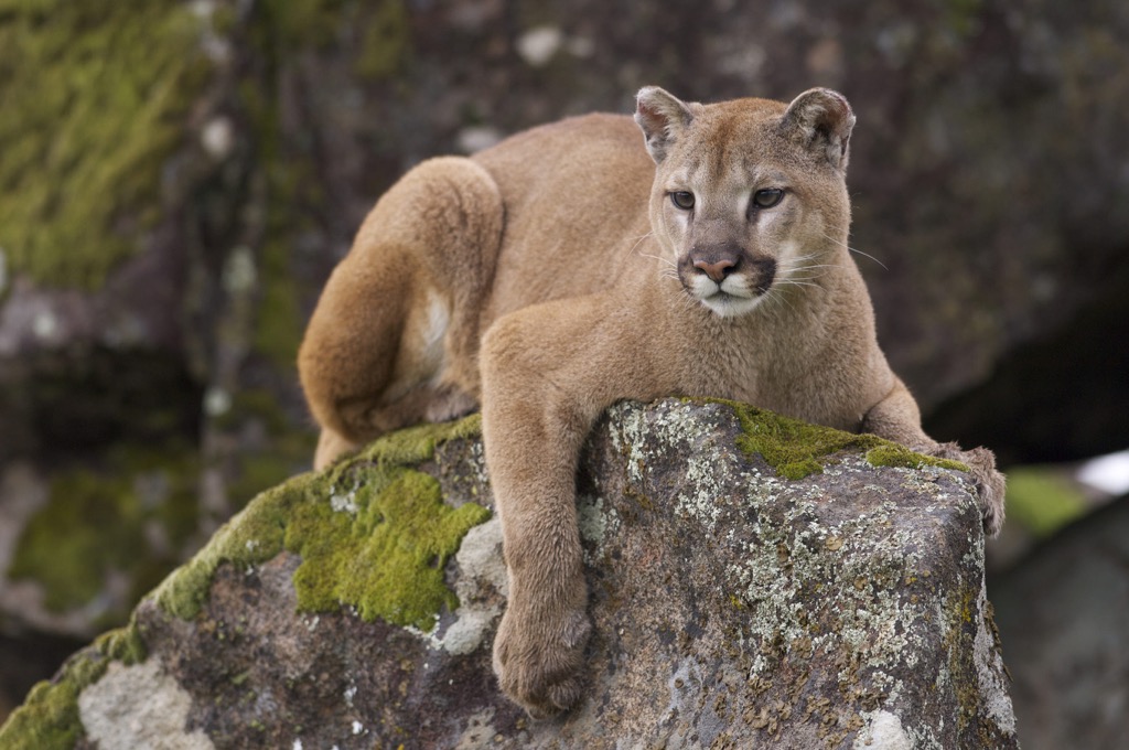
Just as plants have adapted to the hot and dry conditions, so have local wildlife. Many animals are nocturnal in the desert such as the kit fox, coyote, mountain lion, bobcat, badger, and Texas banded gecko. Mule deer, javelinas, and jack-rabbits are active at dawn and dusk.
Many reptiles thrive in the desert. These include the western diamondback rattlesnake, bullsnake, coachwhip snake, prairie lizard, collared lizard, crevice spiny lizard, and Chihuahuan spotted whiptail. Scorpions and centipedes come out at night. Tarantulas live here but are generally only seen in fall during mating season.
The high elevation pine forests are much cooler and house elk, black bears, gray foxes, skunks, porcupine, mule deer, mountain lions, and short-horned lizards. The stream in McKittrick Canyon provides habitat for long-ear sunfish and rainbow trout.
For centuries, the Guadalupe Mountains and surrounding area were occupied only by the Mescalero Apache Tribe. Although Spanish explorers crossed through in 1692, outsiders didn’t leave a significant impact on the area until the mid-1800s. The arid and remote conditions kept people away for a while. When explorers and settlers did begin arriving, the Guadalupe Mountains were a significant landmark guiding them.
The Butterfield Overland Stage Line arrived in 1858, carrying mail and people through the mountains along the country’s first transcontinental mail route. Within a few decades, ranchers began establishing themselves in the region, increasing conflict with the local Apaches.
The US Army carried out a campaign against Native Americans in the mid to late 1800s and the highlands of the Guadalupe Mountains was one of the Apache’s last safe retreats before ultimately being defeated. The majority of Mescalero Apaches were removed from the mountains by 1880.
In the 1920s and 1930s, J.C. Hunter consolidated a number of local properties. He built up his ranch, including implementing extensive watering systems. A petroleum geologist named Wallace Pratt bought land in McKittrick Canyon in the 1920s. He built two homes that remain in the national park today. Pratt donated his land to the National Park Service (NPS) in 1959. Later, the NPS purchased the neighboring properties belonging to J.C. Hunter, Jr. and others to form Guadalupe Mountains National Park.
The park received a Class 1 Air Quality Area designation in 1977. The park is constantly monitored and given maximum protection to maintain air quality. In 1978, the wilderness area was established in the park’s backcountry.
Guadalupe Mountains National Park is filled with opportunities to hike, backpack, go for scenic drives and go horseback riding. The park has both developed and wilderness campgrounds. There are also trails through the Guadalupe Mountains in Lincoln National Forest north of the national park.
Those planning backpacking trips should keep in mind that all water must be carried in as there are no reliable water sources in the mountains. Overnight permits in the park can be arranged between three months and two days prior to your trip. The national park has a list with detailed descriptions of trails.
The trailhead to reach Guadalupe Peak (8,753 ft/2,668 m) is located at Pine Springs. The trail is 8.4 mi (13.6 km) out and back with an elevation gain of 3,000 ft (914 m). From the trailhead, follow signs for the hiking trail. The horse trail is about one mile (1.6 km) longer, though less steep.
The steepest part of the hike occurs in the first 1.5 miles (2.4 km). Beyond these initial steep switchbacks, the trail crosses through a forest patch on the north facing slope with pinyon pine, white pine, and Douglas fir. Three miles (4.8 km) in, the trail hits a false summit. It continues on through patches of ponderosa pine and there is a backcountry campsite here. Continuing on, the final push to the summit will grant you views of El Capitan to the south. The vistas from the top are well-worth the effort.
The McKittrick Canyon Trail can be accessed from Pine Springs and Frijole Ranch. The length of the trail from the McKittrick Canyon Trailhead to the intersection with Tejas Trail is 10.9 mi (17.6 km). The breakdown of other distances along the trail include 2.3 mi (3.7 km) to Pratt Cabin, 1.1 mi (1.8 km) from Pratt Cabin to Grotto, 4 mi (6.5 km) from Grotto to McKittrick Canyon Wilderness Campground, and 3.5 mi (5.6 km) from the campground to the Tejas Junction.
The trail runs along the canyon floor for four mi (6.5 km) before ascending steeply to the northern ridge. This climb gains 2,380 ft (725 m) elevation over about two miles (3.2 km) with great views along the way. From the top, the trail continues along the ridge to a high point of 7,916 ft (2,413 m) and then drops to Tejas Trail.
The Tejas Trail is a main north-south route through the national park. The trail can be accessed from Pine Springs and Dog Canyon and measures 11.8 miles (19 km) in total. It is easy to access many other trails from the Tejas Trail to make longer loops.
Starting at Pine Springs, the trail ascends from the Pine Springs Canyon into the wilderness area. The middle section of the trail between Pine Top and the junction with McKittrick Canyon Trail passes through forest. It later goes through meadows as the trail descends from Lost Peak along the northern edge of the park.
Carlsbad is the closest city to the Guadalupe Mountains in New Mexico and El Paso is closest in Texas. The National Park and National Forest have campgrounds and wilderness camping.
Carlsbad is home to 32,000 people and less than an hour’s drive to the east. The small city is surrounded by natural beauty. A visit to Carlsbad Caverns National Park is a great day trip but if you stick around for sunset, you’ll get to see thousands of bats leaving to find food for the night. You can find trails around the caverns and at Brantley Lake State Park.
Dining options are somewhat limited in the city. You’ll find fast food, cafes, bars, diners, grills, American food, and Mexican restaurants. Accommodation options include motels, hotels, campgrounds, and RV parks.
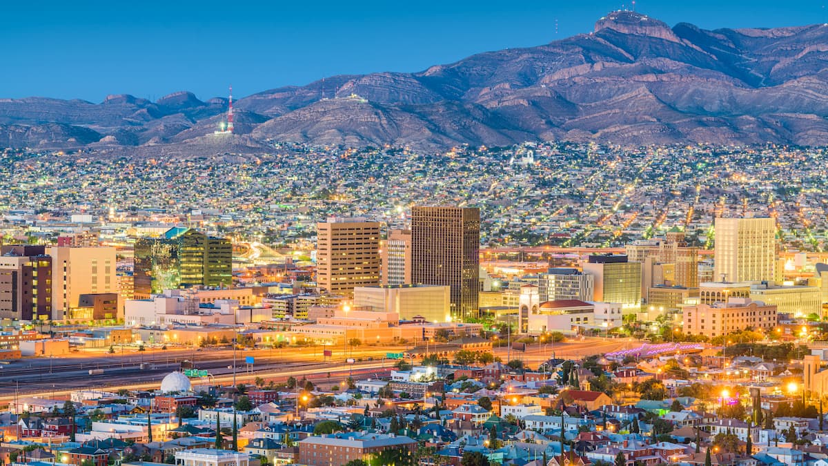
El Paso is just under two hours away to the west and has a population of 678,500. Whether you’re looking for strenuous or casual outdoor activities, you can find them around El Paso. The Franklin Mountains offer more challenging routes, while a trip to the Aztec Caves is leisurely. Explore the Hueco Tanks State Park & Historic Site with a guide or on your own to discover pictographs where humans have lived and sheltered for thousands of years.
The downtown offers sporting events, live music, and community events. The city has classic Texan and Mexican eateries such as steakhouses, grills, BBQ, and taquerias, including vegan Mexican options. The city has beautiful historic hotels, modern hotels, and budget options. Campgrounds and RV parks are available outside the city.