Scan the QR code and open PeakVisor on your phone
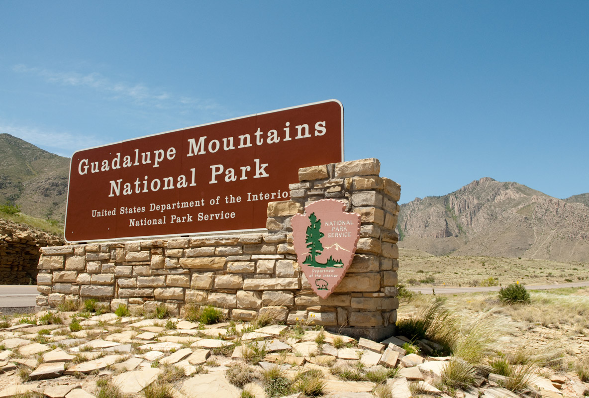
Guadalupe Mountains National Park spans 86,3670-acres of Texas desert and protects the world’s most extensive Permian fossil reef.
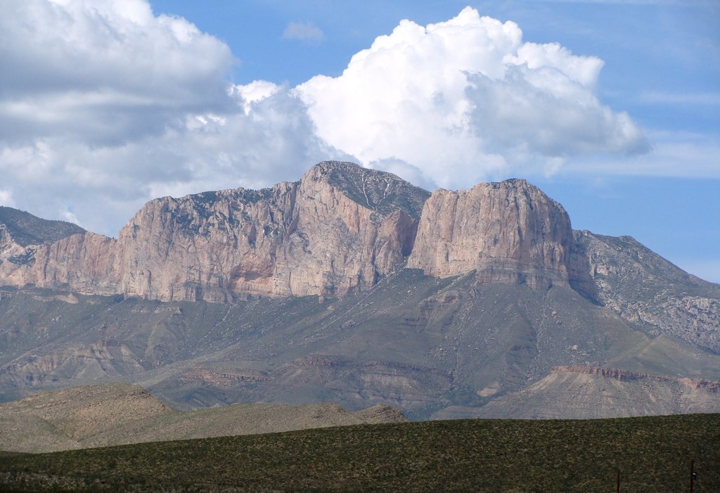
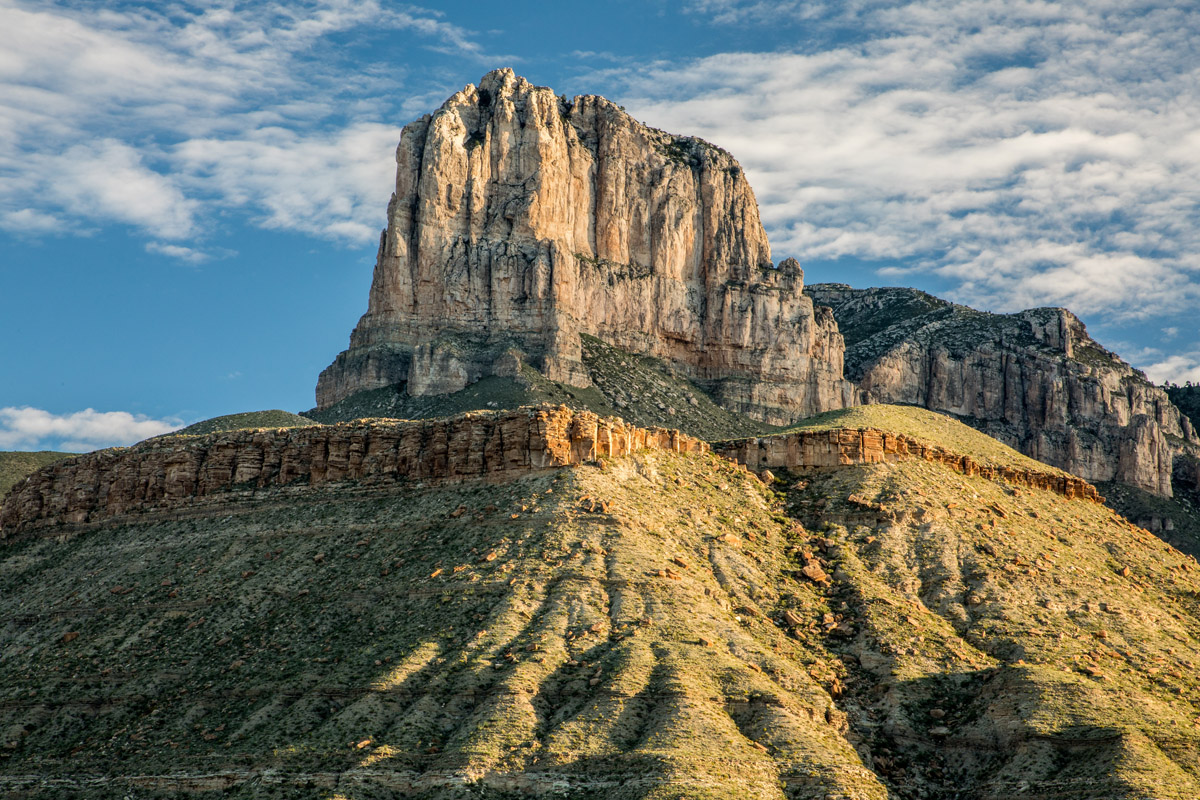
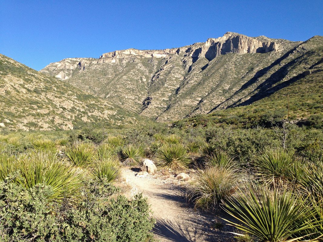
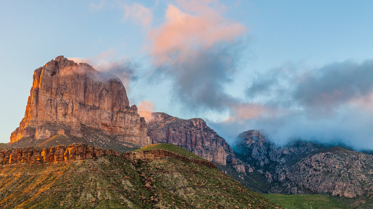
The park’s namesake mountain range is an extension of the Sacramento Mountains, a range that extends for 85 miles through parts of nearby New Mexico and protects the four highest peaks in Texas – Guadalupe Peak, Bush Mountain, Shumard Peak, and Barlette Peak. The park also contains the illustrious El Capitan, the most iconic peak in West Texas. El Capitan towers over the surrounding landscape - its imposing height and stark features have made it a prominent feature of Far West Texas, or ‘Trans-Pecos.’
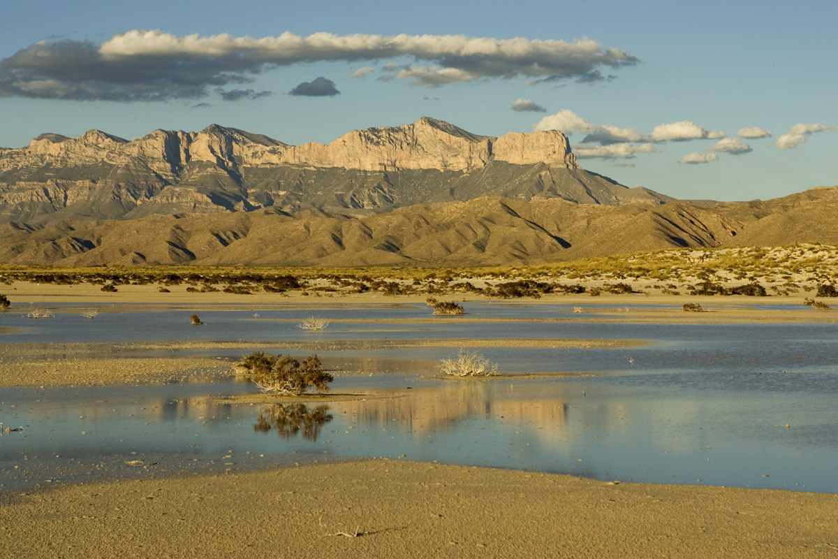
Though the Guadalupe Mountains appear to be unassuming, in comparison to the Rocky Mountains or North Cascades, these peaks are part of an incredible, ancient horseshoe-shaped Capitol Reef that formed more than 250 million years ago. Unbelievably, during Permian times, the entire landscape was underwater. As a result, the park contains a variety of rugged and exposed reefs, as well as striking sheer cliffs.
Archaeological evidence, including projectile points, baskets, and rock art, can be found within the park boundaries, representing the people that lived amongst the park’s summits, caves, and alcoves more than 10,000 years ago.
Exploring Guadalupe Mountains National Park is an exercise of extremes. This environmentally diverse landscape varies from gypsum dunes to coniferous forest, from succulent and shrub desert to semiarid grassland. The park preserves over 1,000 species of plants and four to five unique habitats. Despite being a harsh, desert landscape, the Guadalupe Mountains and surrounding Chihuahua desert provide habitat for 60 species of mammals, 289 species of birds, and 55 species of reptiles.
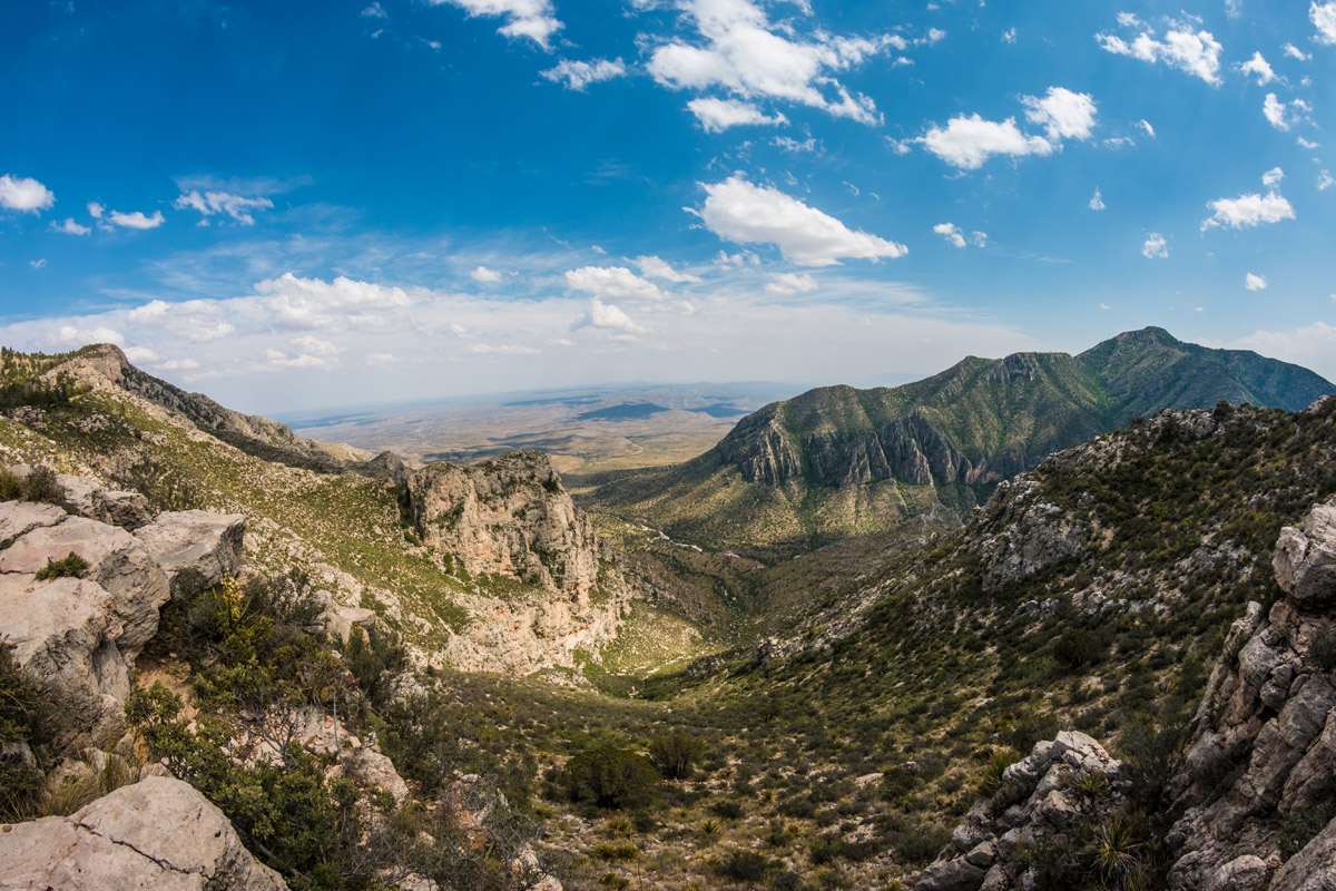
Known as the “Top of Texas,” the trail to the summit of Guadalupe Peak offers hikers sweeping views from the state’s tallest summit. The trail is an 8.5-mile, strenuous ascent, but features matchless views of the surrounding landscape as it wanders through several of the park’s ecosystems. The first part of the trek is the hardest, but don’t worry - the views continue to improve the higher you climb.
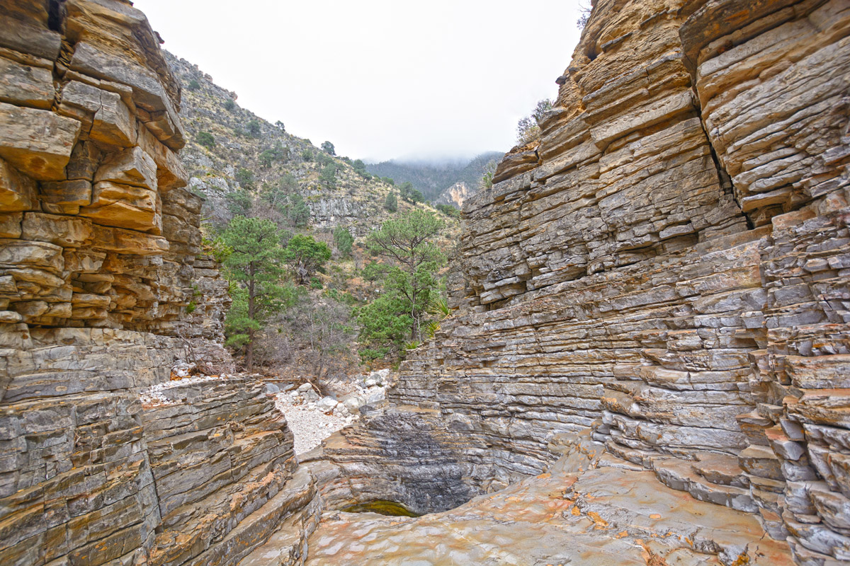
McKittrick Canyon is an incredible canyon tucked within the Guadalupe Mountains. The vertical, towering walls of McKittrick Canyon can be appreciated along the McKittrick Canyon trail or via the McKittrick Canyon Nature Trail. The nature trail is an easy, 1-mile walk, while the McKittrick Canyon trail is an adventurous 4.8-mile trek that requires stream crossing and hiking through the canyon. This trail also takes hikers to the Wallace Pratt Lodge, the former residence of the principal donor of the Guadalupe Mountains – Wallace Pratt.
The 4.2-mile (roundtrip) Devil’s Hall Trail is an excellent option for hikers looking to explore Pine Spring Canyon. This stunning footpath is relatively easy and is particularly popular in the fall when the big-toothed maple trees begin turning vibrant shades of red, orange, and yellow. In route to Devil’s Hall, hikers will also visit Hiker’s Staircase, a natural rock staircase.
There are no restaurants, service stations, stores, or overnight lodging within the park. The park does, however, house 2 primitive campgrounds – Pine Springs Campground and Dog Canyon Campground. It’s important to note that both campgrounds are first come, first serve.
The closest major city to the park is Dell City, which sits approximately 45 miles west of the park. Dell City offers a wide variety of accommodations and amenities, including campgrounds, bed and breakfasts, gas stations, hotels, showers, and various restaurants.
Van Horn, another nearby city, sits approximately an hour south of the park. The historic Hotel Capitan can be found in Van Horn, as well as a variety of restaurants, historic buildings, and shops. Van Horn also sits beside Red Rock Ranch, which offers guided driving and hiking tours through win-carved Precambrian rock formations.