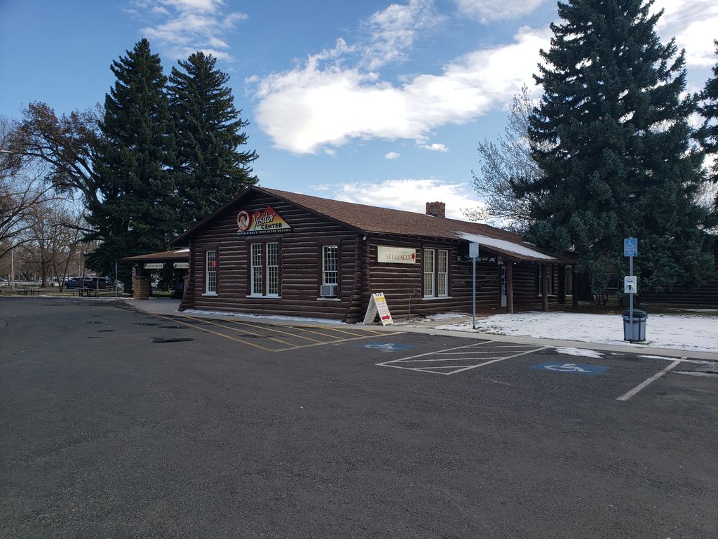
The Stock Center in Cody, Wyoming, United States, was built in 1927 as the original home of the Buffalo Bill Museum, serving in that purpose until the museum was relocated to a new complex across the street in 1969. The log structure is intended to suggest a stockman's log cabin, rendered on a large scale. The irregularly shaped one-story building was arranged with a small lobby leading to exhibit rooms intended to represent a living room, trophy room-library, dining room, kitchen and bedrooms in a rancher's house. These rooms housed the Buffalo Bill Museum's collections. The museum was built as a community project, using Buffalo Bill Cody's T E Ranch Headquarters as the basis for the design. After museum's move, the former museum was purchased by Paul Stock, a Cody-area oilman, rancher, and three-term mayor of Cody, who then passed the property on to the town of Cody for community use. The Stock Center was placed on the National Register of Historic Places in 1976.
We use GPS information embedded into the photo when it is available.
3D mountains overlay
Adjust mountain panorama to perfectly match your photos because recorded by camera photo position might be imprecise.
Move tool
Rotate tool
Zoom
More customization
Choose which peak labels should make into the final photo and what photo title should be.
Next
Photo Location
Coordinates work here too — paste them as 69.72728, 20.61890 and press Enter
Satellitte
Flat map
Relief map
Latitude
Longitude
Altitude
OR
Latitude
°'''
Longitude
°'''
Apply
Register Peak
Peak Name
Latitude
Longitude
Altitude
Register
Teleport
PeakVisor
This 3D model of Sagarmatha National Park in Nepal was made using the PeakVisor app topographic data. The mobile app features higher precision models worldwide, more topographic details, and works offline. Download PeakVisor maps today.
Download OBJ model
PeakVisor
The download should start shortly. If you find it useful please consider supporting the PeakVisor app.
PeakVisor for iOS and Android
Be a superhero of outdoor navigation with state-of-the-art 3D maps and mountain identification in the palm of your hand!