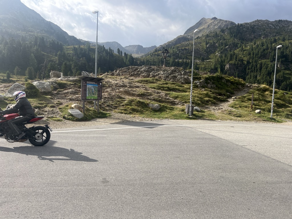
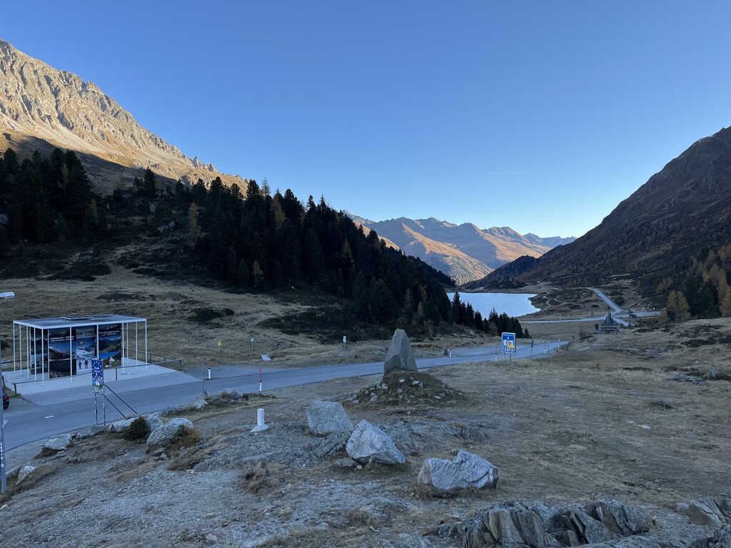
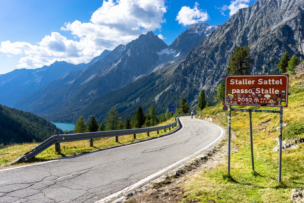
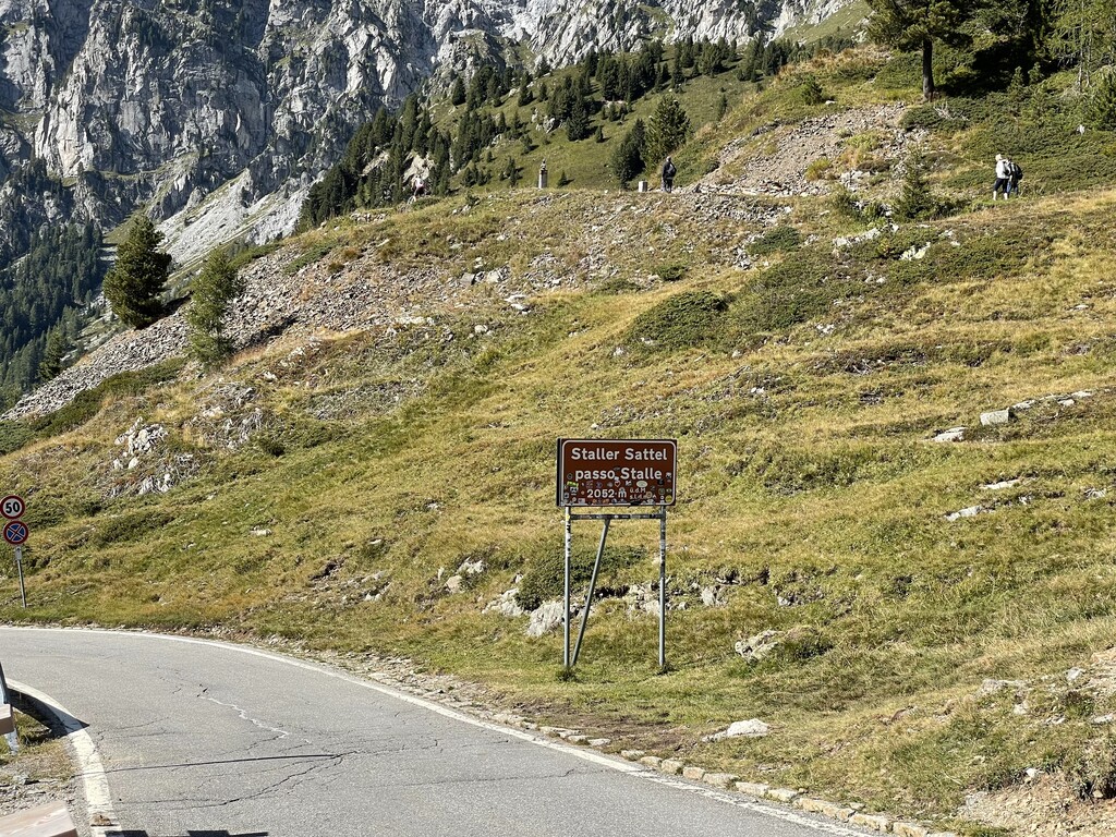
Staller Saddle (Bavarian: Schtolla Sottl; German: Staller Sattel; Italian: Passo Stalle), at 2,052 m (6,732 ft), is a high mountain pass in the High Tauern range of the Central Eastern Alps, connecting the Defereggen Valley in East Tyrol with the Antholz Valley in South Tyrol. The pass forms the border between Austria and Italy, it separates the Villgraten Mountains in the southeast from the Rieserferner Group in the northwest. The pass road is open only from May to October from 5:30 am to 22:15 and prohibited for trailers and caravans. On the Italian side it is very narrow, at points only one way, with traffic lights regulating the contraflow. Starting in 2007, a toll of 5 euros was planned for cars and motorcycles, the revenue to be split between Italy and Austria, but has not yet been implemented.
We use GPS information embedded into the photo when it is available.
3D mountains overlay
Adjust mountain panorama to perfectly match your photos because recorded by camera photo position might be imprecise.
Move tool
Rotate tool
Zoom
More customization
Choose which peak labels should make into the final photo and what photo title should be.
Next
Photo Location
Satellitte
Flat map
Relief map
Latitude
Longitude
Altitude
OR
Latitude
°'''
Longitude
°'''
Apply
Register Peak
Peak Name
Latitude
Longitude
Altitude
Register
Teleport
PeakVisor
This 3D model of Sagarmatha National Park in Nepal was made using the PeakVisor app topographic data. The mobile app features higher precision models worldwide, more topographic details, and works offline. Download PeakVisor maps today.
Download OBJ model
PeakVisor
The download should start shortly. If you find it useful please consider supporting the PeakVisor app.
PeakVisor for iOS and Android
Be a superhero of outdoor navigation with state-of-the-art 3D maps and mountain identification in the palm of your hand!


.jpg)
.jpg)
.jpg)


