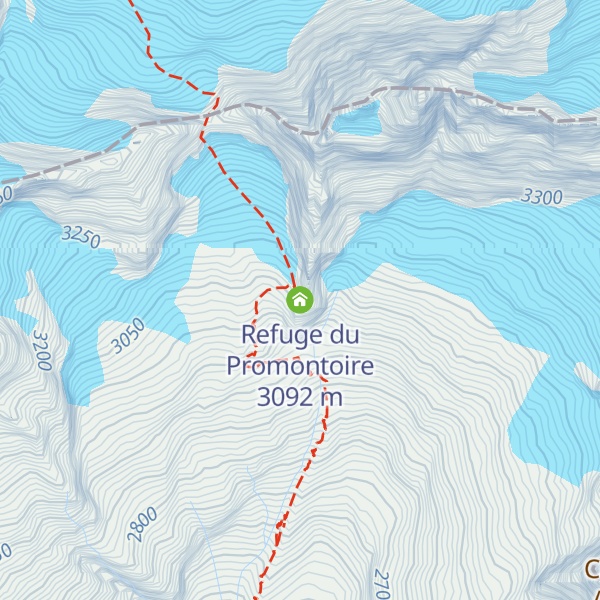
Refuge du Promontoire is a refuge in the Alps located in France in the massif des Ecrins, it is just build on rock in front of the South face of La Meije. It's the starting point of the famous crossing of La Meije, which is known to be one of the most beautiful mountain run into the Alps. The access is made from La Bérarde by le vallon des Étançons, or from La Grave by les Enfetchores and la brêche de la Meije. The shelter was first constructed in the 1920s out of wood. In 1966, this was demolished and replaced by an aluminium construction.
We use GPS information embedded into the photo when it is available.
3D mountains overlay
Adjust mountain panorama to perfectly match your photos because recorded by camera photo position might be imprecise.
Move tool
Rotate tool
Zoom
More customization
Choose which peak labels should make into the final photo and what photo title should be.
Next
Photo Location
Satellitte
Flat map
Relief map
Latitude
Longitude
Altitude
OR
Latitude
°'''
Longitude
°'''
Apply
Register Peak
Peak Name
Latitude
Longitude
Altitude
Register
Teleport
PeakVisor
This 3D model of Sagarmatha National Park in Nepal was made using the PeakVisor app topographic data. The mobile app features higher precision models worldwide, more topographic details, and works offline. Download PeakVisor maps today.
Download OBJ model
PeakVisor
The download should start shortly. If you find it useful please consider supporting the PeakVisor app.
PeakVisor for iOS and Android
Be a superhero of outdoor navigation with state-of-the-art 3D maps and mountain identification in the palm of your hand!