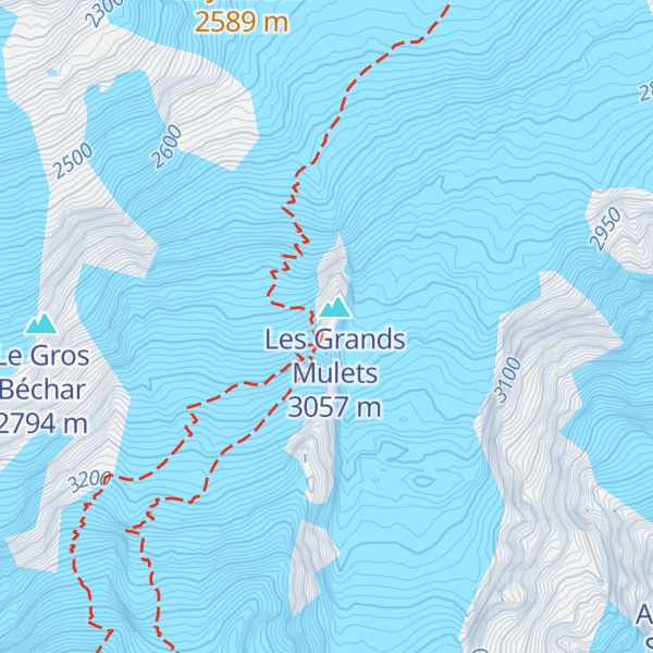
The Grands Mulets Hut (French: Refuge des Grands Mulets) is a mountain refuge in the Mont Blanc massif in the French Alps at an altitude of 3,051 m. It is owned by the Club Alpin Francais. The hut is located on a pyramidal rock island, at the junction of two streams of the Bossons Glacier on the north side of Mont Blanc. If the state of the glacier is not too severe, the hut is wardened in summer and can be used as an alternative route of ascent to the summit of Mont Blanc, following the original historic route by the first ascensionists. Nowadays the hut is used more frequently by ski-mountaineers in spring, or as a more sheltered and alternative route of descent from Mont Blanc than the much more popular Goûter route, though route-finding can be difficult in fog and requires prior knowledge of the crevassed state of the Bossons glacier below the hut.: 23 : 269 The first Grands Mulets hut was built in 1853, then replaced in 1896. The current refuge was built in 1960 and inaugurated on August 7 by Maurice Herzog.
We use GPS information embedded into the photo when it is available.
3D mountains overlay
Adjust mountain panorama to perfectly match your photos because recorded by camera photo position might be imprecise.
Move tool
Rotate tool
Zoom
More customization
Choose which peak labels should make into the final photo and what photo title should be.
Next
Photo Location
Satellitte
Flat map
Relief map
Latitude
Longitude
Altitude
OR
Latitude
°'''
Longitude
°'''
Apply
Register Peak
Peak Name
Latitude
Longitude
Altitude
Register
Teleport
PeakVisor
This 3D model of Sagarmatha National Park in Nepal was made using the PeakVisor app topographic data. The mobile app features higher precision models worldwide, more topographic details, and works offline. Download PeakVisor maps today.
Download OBJ model
PeakVisor
The download should start shortly. If you find it useful please consider supporting the PeakVisor app.
PeakVisor for iOS and Android
Be a superhero of outdoor navigation with state-of-the-art 3D maps and mountain identification in the palm of your hand!