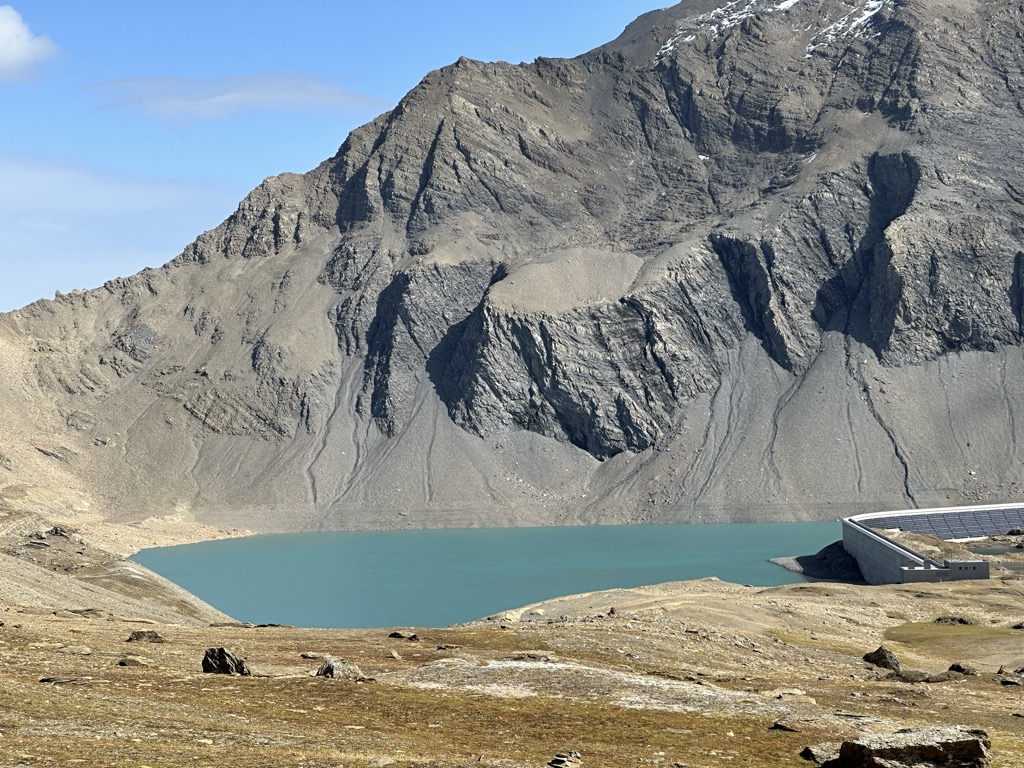
Muttsee is a reservoir in the Canton of Glarus, Switzerland. Its surface area is 42 ha (100 acres). It is used as the upper reservoir in the 1 GW pumped-storage hydroelectricity Linth–Limmern Power Stations. The 2.4 km high altitude permits a 2.2 MW solar farm to supply 3.3 GWh per year, more than average power, even in winter (as the high altitude prevents fog formation, and as the snow reflects the sunlight onto the solar panels). The 6,000 photovoltaic panels were installed on the containment wall of the artificial basin in 2021, covering approximately 10,000 square meters of concrete, and stretching over almost 1 km.
We use GPS information embedded into the photo when it is available.
3D mountains overlay
Adjust mountain panorama to perfectly match your photos because recorded by camera photo position might be imprecise.
Move tool
Rotate tool
Zoom
More customization
Choose which peak labels should make into the final photo and what photo title should be.
Next
Photo Location
Satellitte
Flat map
Relief map
Latitude
Longitude
Altitude
OR
Latitude
°'''
Longitude
°'''
Apply
Register Peak
Peak Name
Latitude
Longitude
Altitude
Register
Teleport
PeakVisor
This 3D model of Sagarmatha National Park in Nepal was made using the PeakVisor app topographic data. The mobile app features higher precision models worldwide, more topographic details, and works offline. Download PeakVisor maps today.
Download OBJ model
PeakVisor
The download should start shortly. If you find it useful please consider supporting the PeakVisor app.
PeakVisor for iOS and Android
Be a superhero of outdoor navigation with state-of-the-art 3D maps and mountain identification in the palm of your hand!