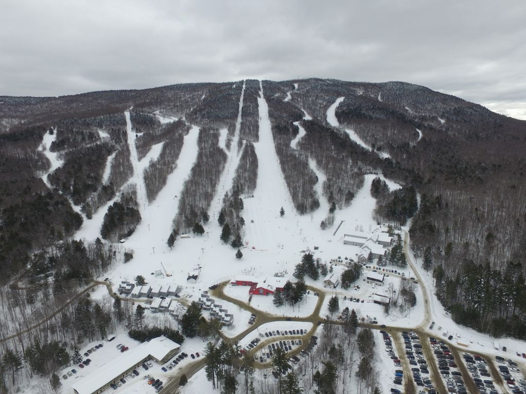
Magic Mountain is a ski resort located on Glebe Mountain in Londonderry, Vermont. It features a 1,500-foot vertical drop. The summit is at 2,850 feet and the base at 1,350 feet. Magic has a long history, dating from the 1960s when ski instructor and film-maker Hans Thorner founded the area as its terrain reminded him of his native Swiss Alps. Part of Vermont's original "Golden Triangle" of ski areas all within 10 miles of each other (Stratton Mountain Resort and Bromley Mountain the other two large areas), Magic thrived in the 1960s, 1970s, and early 1980s. Eventually, Magic was purchased by Boston Concessions, which also owned Bromley in the mid-1980s. After a downturn in the real-estate market starting in the late 1980s, Bromley decided to close Magic in 1991. The multi-year closure in the 1990s ended in 1997 and Magic reopened to the public and regained a small, but passionate following among ski enthusiasts because of its classic, challenging terrain. However, the ski area also struggled through multiple owners, operators, and aging infrastructure during the 2000s, even as it continued to slowly expand its customer base. With limited capital reserves and in danger of not opening in 2015 and 2016, the ownership group decided to look for a buyer. A group led by a local Magic skier then raised enough capital to purchase the property and invest over $2 million in significant snowmaking, lift, bar, and lodge improvements. This group, SKI MAGIC LLC, successfully closed on the purchase of Magic in November 2016 and reopened the ski area in late December. SKI MAGIC continues to operate Magic and invest in these critical infrastructure enhancements to improve and sustain the ski area.
We use GPS information embedded into the photo when it is available.
3D mountains overlay
Adjust mountain panorama to perfectly match your photos because recorded by camera photo position might be imprecise.
Move tool
Rotate tool
Zoom
More customization
Choose which peak labels should make into the final photo and what photo title should be.
Next
Photo Location
Satellitte
Flat map
Relief map
Latitude
Longitude
Altitude
OR
Latitude
°'''
Longitude
°'''
Apply
Register Peak
Peak Name
Latitude
Longitude
Altitude
Register
Teleport
PeakVisor
This 3D model of Sagarmatha National Park in Nepal was made using the PeakVisor app topographic data. The mobile app features higher precision models worldwide, more topographic details, and works offline. Download PeakVisor maps today.
Download OBJ model
PeakVisor
The download should start shortly. If you find it useful please consider supporting the PeakVisor app.
PeakVisor for iOS and Android
Be a superhero of outdoor navigation with state-of-the-art 3D maps and mountain identification in the palm of your hand!