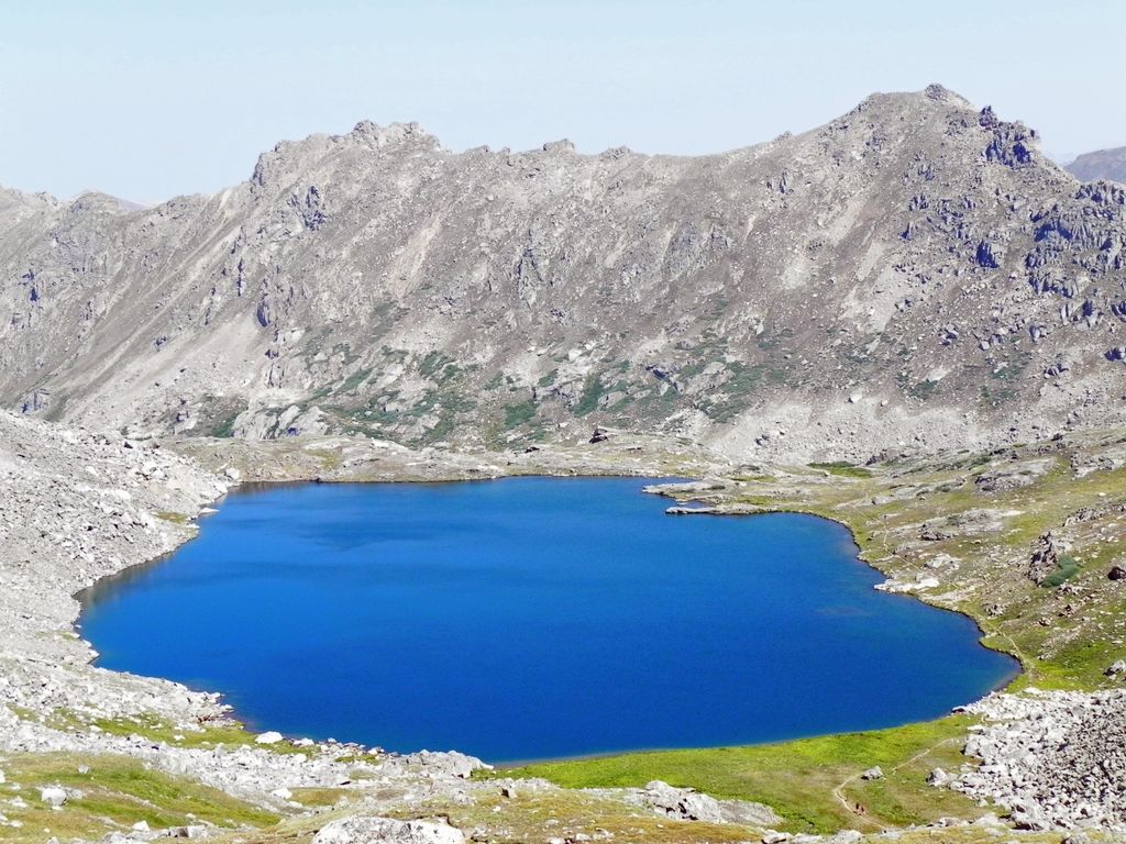
Lost Man Lake is an alpine lake in Pitkin County, Colorado, United States, located high in the Sawatch Range in the Hunter-Fryingpan Wilderness of White River National Forest. The lake is accessible via the Lost Man Loop Trail from State Highway 82 west of Independence Pass. The lake is over a pass and north of Independence Lake and northeast of Geissler Mountain. Lost Man Lake is larger than Independence, but only its east side is open. The trail continues by the lake into high alpine meadows in the upper valley, and to its west terminus at Lost Man Campground. Views down Lost Man Creek valley are worth a look, and a great place to scan high slopes and ridges for mountain goats, bighorn sheep and elk. It is a moderate half day hike. Depending on snowpack and weather, the lake may still be frozen in July.
We use GPS information embedded into the photo when it is available.
3D mountains overlay
Adjust mountain panorama to perfectly match your photos because recorded by camera photo position might be imprecise.
Move tool
Rotate tool
Zoom
More customization
Choose which peak labels should make into the final photo and what photo title should be.
Next
Photo Location
Satellitte
Flat map
Relief map
Latitude
Longitude
Altitude
OR
Latitude
°'''
Longitude
°'''
Apply
Register Peak
Peak Name
Latitude
Longitude
Altitude
Register
Teleport
PeakVisor
This 3D model of Sagarmatha National Park in Nepal was made using the PeakVisor app topographic data. The mobile app features higher precision models worldwide, more topographic details, and works offline. Download PeakVisor maps today.
Download OBJ model
PeakVisor
The download should start shortly. If you find it useful please consider supporting the PeakVisor app.
PeakVisor for iOS and Android
Be a superhero of outdoor navigation with state-of-the-art 3D maps and mountain identification in the palm of your hand!