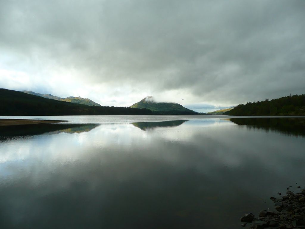
Loch Laggan is a freshwater loch situated approximately 6+1⁄2 mi (10.5 km) west of Dalwhinnie in the Scottish Highlands. The loch has an irregular shape, runs nearly northeast to southwest and is approximately 7 mi (11 km) in length. It has an average depth of 68 ft (21 m) and is 174 ft (53 m) at its deepest. The eastern end of the loch features the largest freshwater beach in Britain. Since 1934 Loch Laggan has been part of the Lochaber hydro-electric scheme. At the northeast end of the loch is the hamlet of Kinloch Laggan. The loch was surveyed on 2 and 3 of June 1902 by Sir John Murray, T.R.N. Johnston, James Parsons and James Murray and was later charted as part of the Bathymetrical Survey of Fresh-Water Lochs of Scotland 1897-1909. The A86 road from Spean Bridge to Kingussie follows the loch's north shore. The River Pattack flows into the head of the loch just below the road bridge at Kinloch Laggan. The boundary of the Cairngorms National Park wraps around the head of the loch. A short section of the River Spean connects the natural loch with the reservoir downstream and this river continues westwards below Laggan Dam. Two other substantial watercourses empty into the loch, the Allt Labhrach which drains Lochan na h-Earba which lies southeast of Loch Laggan and Allt Coire Ardair which rises beneath Creag Meagaidh. The remains of an island dwelling lie in the middle of the loch near Ardverikie. The loch featured in the popular BBC series Monarch of the Glen as Loch Bogle.
We use GPS information embedded into the photo when it is available.
3D mountains overlay
Adjust mountain panorama to perfectly match your photos because recorded by camera photo position might be imprecise.
Move tool
Rotate tool
Zoom
More customization
Choose which peak labels should make into the final photo and what photo title should be.
Next
Photo Location
Satellitte
Flat map
Relief map
Latitude
Longitude
Altitude
OR
Latitude
°'''
Longitude
°'''
Apply
Register Peak
Peak Name
Latitude
Longitude
Altitude
Register
Teleport
PeakVisor
This 3D model of Sagarmatha National Park in Nepal was made using the PeakVisor app topographic data. The mobile app features higher precision models worldwide, more topographic details, and works offline. Download PeakVisor maps today.
Download OBJ model
PeakVisor
The download should start shortly. If you find it useful please consider supporting the PeakVisor app.
PeakVisor for iOS and Android
Be a superhero of outdoor navigation with state-of-the-art 3D maps and mountain identification in the palm of your hand!