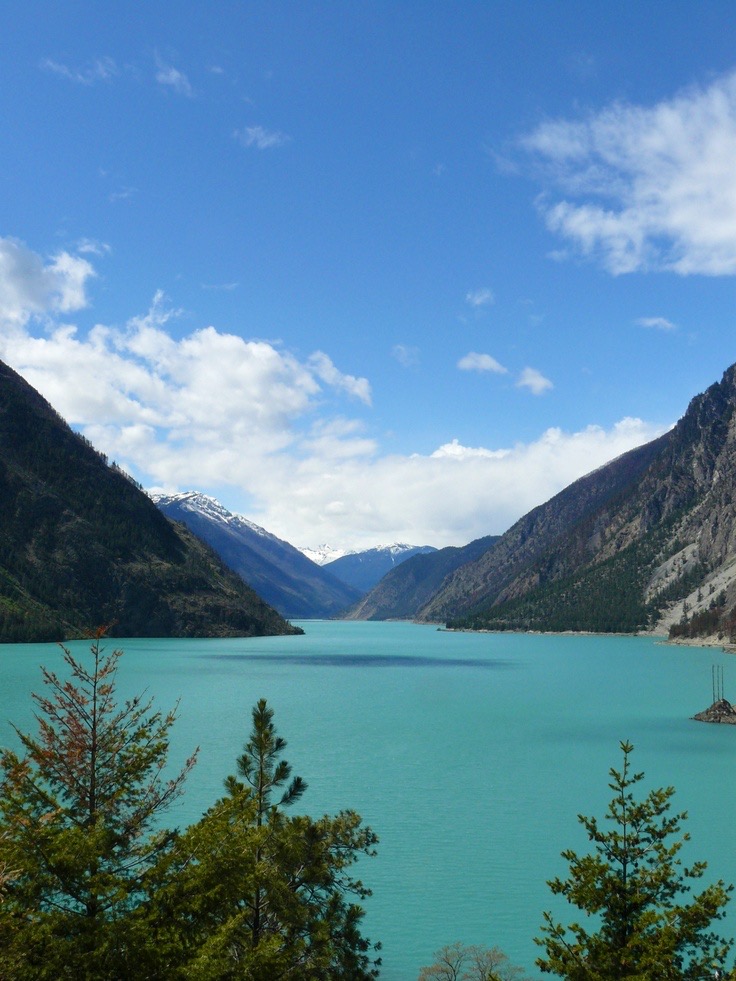
Lillooet Lake is a lake in British Columbia, Canada about 25 km in length and about 33.5 square kilometres (22 mi²) in area. It is about 95 km downstream from the source of the Lillooet River, which resumes its course after leaving Little Lillooet Lake, aka Tenas Lake (tenass in the Chinook Jargon means little). Immediately adjacent to the mouth of the upper Lillooet River is the mouth of the Birkenhead River and just upstream along the Lillooet is the confluence of the Green River, which begins at Green Lake in the resort area of Whistler. The community of Pemberton is about 12 km upstream from the head of Lillooet Lake, while the eastern edge of the Mount Currie Indian Reserve of the Lil'wat branch of the St'at'imc people is the lakeshore itself. The eastern ramparts of the mountain ranges of Garibaldi Provincial Park overlook Lillooet Lake from the west, while to the east are the northern reaches of the Lillooet Ranges which lie between the Lillooet-Harrison drainage and the Fraser River. Lillooet Lake was part of the "Lakes Route" or Douglas Road, once if only briefly the principal route between the Coast and the Interior during the days of the Fraser Canyon Gold Rush. Several steamers and innumerable smaller watercraft served the busy freight and passenger traffic in those days. The best-known and largest of these was the SS Prince of Wales, whose wreckage was visible on the shores of the lake near Mount Currie for many years.
We use GPS information embedded into the photo when it is available.
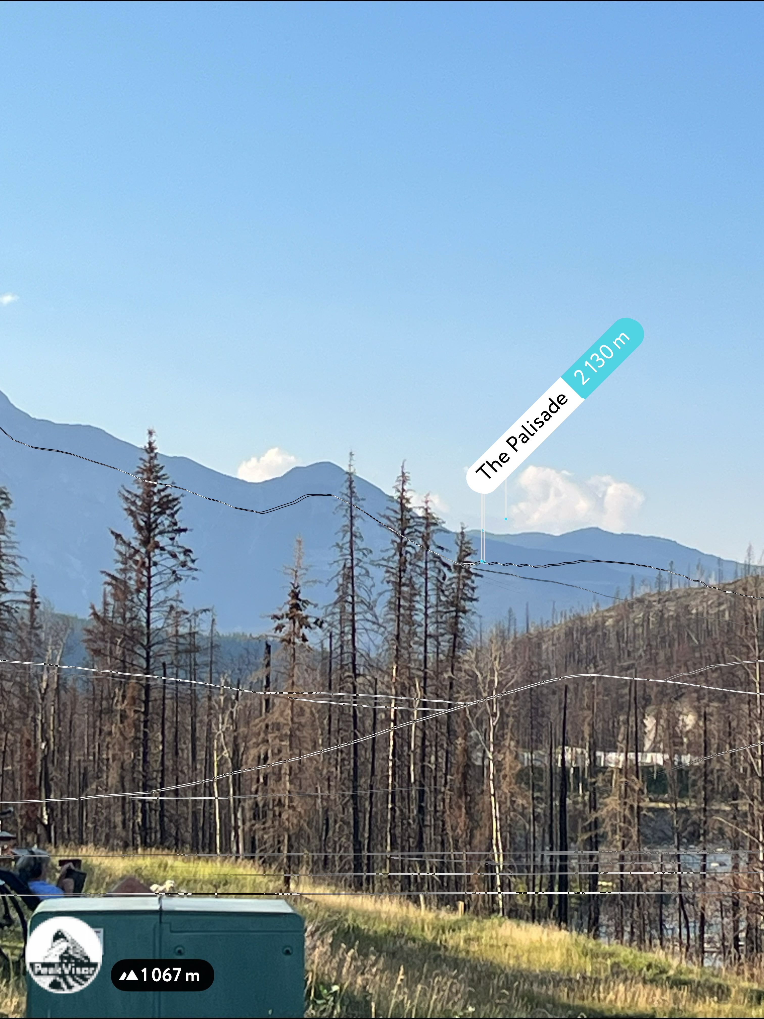
3D mountains overlay
Adjust mountain panorama to perfectly match your photos because recorded by camera photo position might be imprecise.
Move tool
Rotate tool
Zoom
More customization
Choose which peak labels should make into the final photo and what photo title should be.
Next
Photo Location
Satellitte
Flat map
Relief map
Latitude
Longitude
Altitude
OR
Latitude
°'''
Longitude
°'''
Apply
Register Peak
Peak Name
Latitude
Longitude
Altitude
Register
Teleport
PeakVisor
This 3D model of Sagarmatha National Park in Nepal was made using the PeakVisor app topographic data. The mobile app features higher precision models worldwide, more topographic details, and works offline. Download PeakVisor maps today.
Download OBJ model
PeakVisor
The download should start shortly. If you find it useful please consider supporting the PeakVisor app.
PeakVisor for iOS and Android
Be a superhero of outdoor navigation with state-of-the-art 3D maps and mountain identification in the palm of your hand!