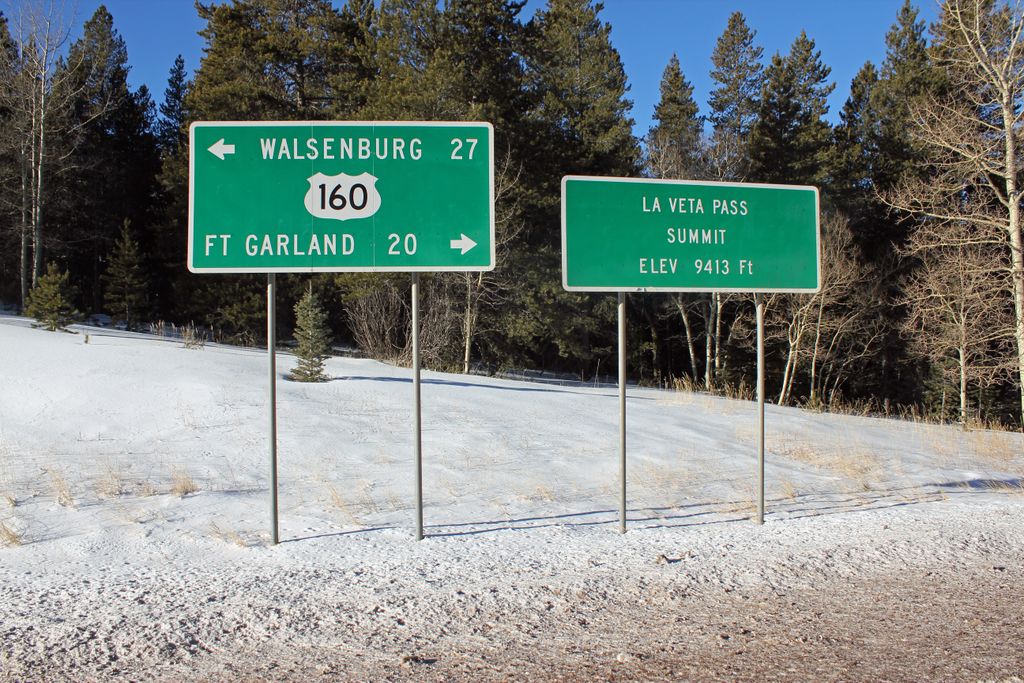
La Veta Pass is the name associated with two nearby mountain passes in the Sangre de Cristo Mountains of south central Colorado in the United States, both lying on the boundary between Costilla and Huerfano counties. Old La Veta Pass (officially La Veta Pass), elevation 9,380 ft (2,860 m), was at one time a main travel route between the San Luis Valley and Walsenburg, first on the narrow gauge Denver and Rio Grande Railway, and later on a wagon road and then highway following the same alignment. The route featured two tight curves on the eastern approach to the summit, making the grade feasible for railroad operation, but leaving the route less than satisfactory as a highway. It is now an unpaved and lightly traveled back road. New La Veta Pass (officially North La Veta Pass), elevation 9,413 ft (2,869 m), lies about 1.6 miles northeast of the old pass and is now the principal highway route through this part of the mountain range, carrying U.S. Highway 160. While this new route is slightly higher, it has no sharp curves and is thus better suited to modern highway traffic. These two passes should not be confused with yet another Sangre de Cristo crossing having a similar name: Veta Pass, elevation 9,220 ft (2,810 m), lies about 7.7 miles southeast of Old La Veta Pass. When the Denver and Rio Grande Railway decided to convert its line over the Sangre de Cristo from narrow gauge to standard gauge, it elected to follow a new route over Veta Pass, completing the project in 1899. In 2003 the San Luis and Rio Grande Railroad took over operation of the line. The Rio Grande Scenic Railroad operated steam excursion trains between Alamosa and La Veta over the pass before it went into receivership in 2019.
We use GPS information embedded into the photo when it is available.
3D mountains overlay
Adjust mountain panorama to perfectly match your photos because recorded by camera photo position might be imprecise.
Move tool
Rotate tool
Zoom
More customization
Choose which peak labels should make into the final photo and what photo title should be.
Next
Photo Location
Satellitte
Flat map
Relief map
Latitude
Longitude
Altitude
OR
Latitude
°'''
Longitude
°'''
Apply
Register Peak
Peak Name
Latitude
Longitude
Altitude
Register
Teleport
PeakVisor
This 3D model of Sagarmatha National Park in Nepal was made using the PeakVisor app topographic data. The mobile app features higher precision models worldwide, more topographic details, and works offline. Download PeakVisor maps today.
Download OBJ model
PeakVisor
The download should start shortly. If you find it useful please consider supporting the PeakVisor app.
PeakVisor for iOS and Android
Be a superhero of outdoor navigation with state-of-the-art 3D maps and mountain identification in the palm of your hand!