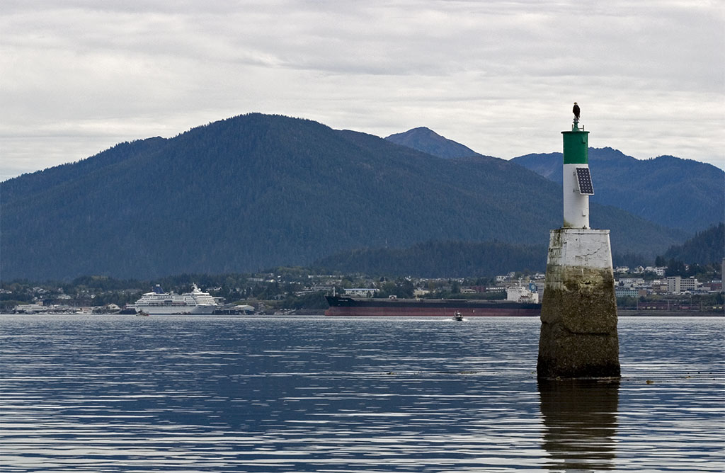
Kaien Island is a Canadian island on the coast of British Columbia, just north of the mouth of the Skeena River and to the south of the Alaska Panhandle. The island has an area of about 45 square kilometres (11,000 acres), is roughly oval, and about 11 kilometres (6.8 mi) long along its long axis. The island consists of a central mountain ridge, surrounded by coastal lowlands, the dominant central peak is Mount Hays reaching 708 metres (2,323 ft), with a secondary peak, Mount Olfield reaching 555 metres (1,821 ft) to the northeast. Located within the Hecate Depression of the Coastal Trough, Kaien Island is a subdivision of the Coast Mountains geomorphic region. The island's bedrock consists of metasedimentary amphibolite, which dips towards the east at about 35 degrees. The island is contained within the Skeena-Queen Charlotte Regional District and are part of the North Coast region. Tidal waters surrounding the island have a wide range which results in extensive exposure of mud flats and rock shoals that are prime habitat for invertebrates and intertidal fish. Kaien Island is central to the traditional territories of the Tsimshian First Nations, and has been permanently settled for more than 5,000 years. The city of Prince Rupert, British Columbia is situated on the island. Casey Point is located on the western extremity of the island, facing Digby Island, was the site of one of the coastal defence installations to protect the BC Coast during World War II. Another such installation was at Seal Cove on the island's northern tip.
We use GPS information embedded into the photo when it is available.
3D mountains overlay
Adjust mountain panorama to perfectly match your photos because recorded by camera photo position might be imprecise.
Move tool
Rotate tool
Zoom
More customization
Choose which peak labels should make into the final photo and what photo title should be.
Next
Photo Location
Satellitte
Flat map
Relief map
Latitude
Longitude
Altitude
OR
Latitude
°'''
Longitude
°'''
Apply
Register Peak
Peak Name
Latitude
Longitude
Altitude
Register
Teleport
PeakVisor
This 3D model of Sagarmatha National Park in Nepal was made using the PeakVisor app topographic data. The mobile app features higher precision models worldwide, more topographic details, and works offline. Download PeakVisor maps today.
Download OBJ model
PeakVisor
The download should start shortly. If you find it useful please consider supporting the PeakVisor app.
PeakVisor for iOS and Android
Be a superhero of outdoor navigation with state-of-the-art 3D maps and mountain identification in the palm of your hand!