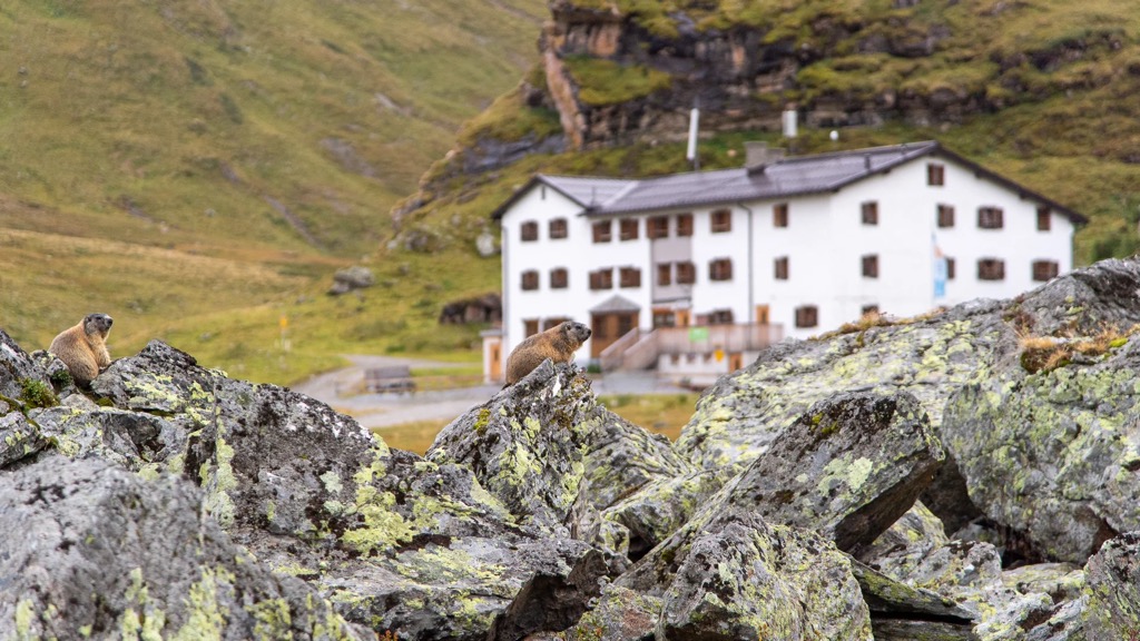
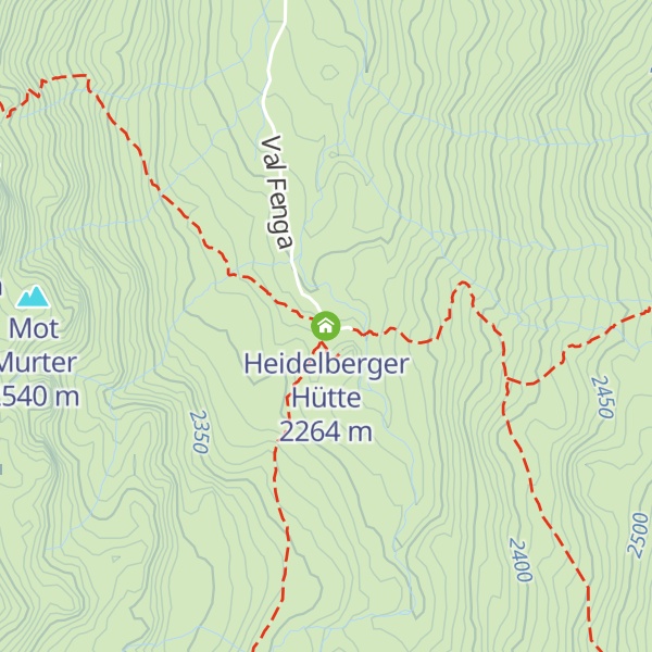
The Heidelberger Hut (German: Heidelberger Hütte) is a mountain hut located in the Silvretta in the Swiss canton of Graubünden. It lies at an altitude of 2,264 metres above sea level in the Val Fenga. The hut was built between 1887 and 1889 by the Heidelberg division of the German Alpine Club (DAV), which has operated it since. Since 1910, the hut has been a popular destination for winter sports as well. Major expansions were finished in 1963 and again in 1979. Heidelberger hut is easily accessible from Ischgl, Austria, by a road through the Fimbatal, which south of the Austrian-Swiss border is named Val Fenga. On the other hand, the quickest routes from a Swiss settlement are about 5 hour hikes from either Ramosch via the 2,608 m Cuolemn de Fenga/Fimberpaß or from Samnaun via the 2539 m Zeblasjoch and 2752 m Fuorcla da Val Gronda. The hut is therefore supplied from Ischgl and staffed by Austrians.
We use GPS information embedded into the photo when it is available.
3D mountains overlay
Adjust mountain panorama to perfectly match your photos because recorded by camera photo position might be imprecise.
Move tool
Rotate tool
Zoom
More customization
Choose which peak labels should make into the final photo and what photo title should be.
Next
Photo Location
Satellitte
Flat map
Relief map
Latitude
Longitude
Altitude
OR
Latitude
°'''
Longitude
°'''
Apply
Register Peak
Peak Name
Latitude
Longitude
Altitude
Register
Teleport
PeakVisor
This 3D model of Sagarmatha National Park in Nepal was made using the PeakVisor app topographic data. The mobile app features higher precision models worldwide, more topographic details, and works offline. Download PeakVisor maps today.
Download OBJ model
PeakVisor
The download should start shortly. If you find it useful please consider supporting the PeakVisor app.
PeakVisor for iOS and Android
Be a superhero of outdoor navigation with state-of-the-art 3D maps and mountain identification in the palm of your hand!