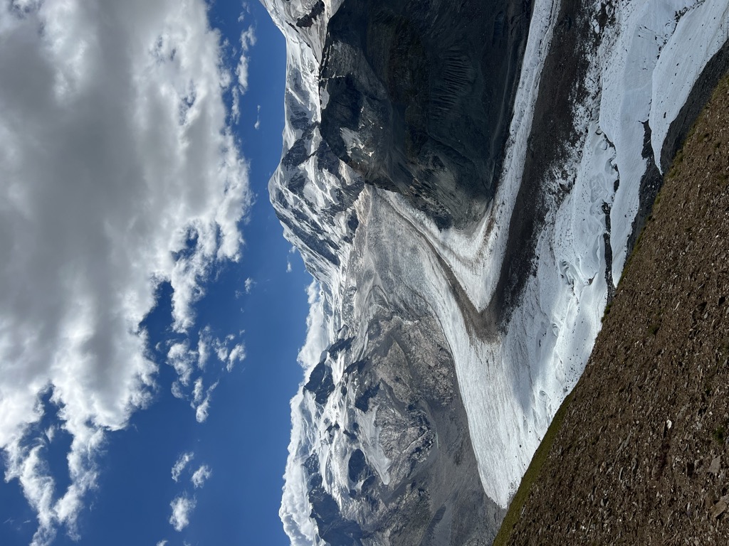
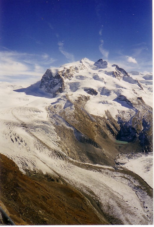
The Gorner Glacier (German: Gornergletscher) is a valley glacier found on the west side of the Monte Rosa massif close to Zermatt in the canton of Valais, Switzerland. It is about 12.4 km (7.7 mi) long (2014) and 1 to 1.5 km (0.62 to 0.93 mi) wide. The entire glacial area of the glacier related to Gorner Glacier is 53 km2 (20 sq mi) (2007), which makes it the second largest glacial system in the Alps after the Aletsch Glacier system; however, in length it ranks third behind the Aletsch and Fiescher Glaciers. Numerous smaller glaciers connect with the Gorner Glacier. Its (former) tributaries are (clockwise on this map) the Gorner Glacier (after which the whole system is named, although the upper part is now disconnected from the lower part), Monte Rosa Glacier, Grenzgletscher (nowadays by far its main tributary, now disconnected from the Gorner Glacier proper), Zwillingsgletscher, Schwärzegletscher, Breithorngletscher, Triftjigletscher, and Unterer Theodulgletscher (the last three now disconnected). The Grenzgletscher (English: Border Glacier) between the central Monte Rosa massif and the Liskamm to the south is nowadays the main contributor to the lower Gorner Glacier. The Gorner Glacier's upper part is almost already disconnected from its lower part. The former tributaries Breithorngletscher, Triftjigletscher, and Unterer Theodulgletscher lost their connections to the Gorner Glacier during the twentieth century; the Unterer Theodulgletscher became disconnected in the 1980s. A notable feature of this glacier is the Gornersee, an ice marginal lake at the confluence area of the Gorner Glacier and Grenzgletscher. This lake fills every year and drains in summer, usually as a glacial lake outburst flood. This is one of only a few glacial lakes in the Alps exhibiting this behavior. There are also notable surface features including crevasses and "table top" forms where large surface boulders have been left stranded above the glaciers surface. These tabular rocks are supported by ice that the boulder has sheltered from melting that has affected the more exposed surrounding ice. The glacier is the source of the river Gornera, which flows down through Zermatt itself. However, most of its water is captured by a water catchment station of the Grande Dixence hydroelectric power plant. This water then ends up in the Lac des Dix, the main reservoir of Grande Dixence. The glacier as well as the surrounding mountains can be seen from the Gornergrat (3,100 m or 10,200 ft), connected from Zermatt by the Gornergrat Railway.
We use GPS information embedded into the photo when it is available.
3D mountains overlay
Adjust mountain panorama to perfectly match your photos because recorded by camera photo position might be imprecise.
Move tool
Rotate tool
Zoom
More customization
Choose which peak labels should make into the final photo and what photo title should be.
Next
Photo Location
Satellitte
Flat map
Relief map
Latitude
Longitude
Altitude
OR
Latitude
°'''
Longitude
°'''
Apply
Register Peak
Peak Name
Latitude
Longitude
Altitude
Register
Teleport
PeakVisor
This 3D model of Sagarmatha National Park in Nepal was made using the PeakVisor app topographic data. The mobile app features higher precision models worldwide, more topographic details, and works offline. Download PeakVisor maps today.
Download OBJ model
PeakVisor
The download should start shortly. If you find it useful please consider supporting the PeakVisor app.
PeakVisor for iOS and Android
Be a superhero of outdoor navigation with state-of-the-art 3D maps and mountain identification in the palm of your hand!