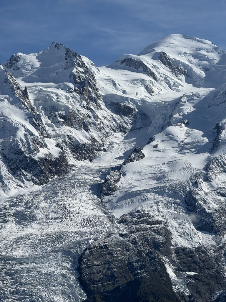
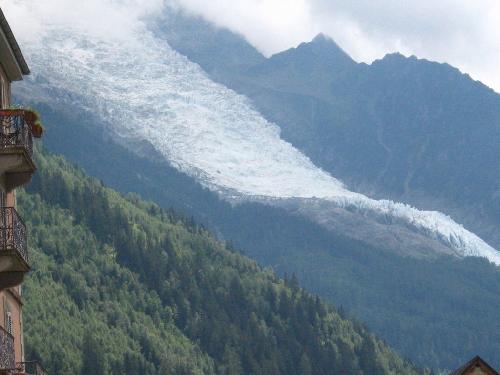
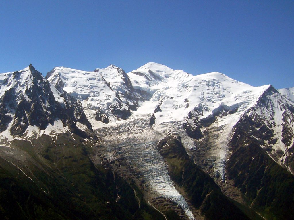
The Bossons Glacier is one of the larger glaciers of the Mont Blanc massif of the Alps, found in the Chamonix valley of Haute-Savoie département, south-eastern France. It is fed from icefields lying on the northern side of Mont Blanc, and descends down close to the Aiguille du Midi and ends on the southern side of the Arve valley, close to the town of Chamonix. It has the largest altitudinal drop of all the alpine glaciers in Europe, and formerly extended much further down the valley than it does today. It is now approximately 7.5 km long, with a surface area of approximately 10 km2. In the 17th century the Bossons glacier extended right down into Chamonix, reaching the settlement of Le Fouly, engulfing farmland, barns and houses. Local bishops were called upon to exorcise the demons within the glacier. In 1777 the traveller and correspondent, William Coxe, observed in his letters that "we mounted by the side of the glacier of Bosson, to les Murailles de Glace, so called from their resemblance to walls: they form the large ranges of ice of prodigious thickness and solidity, rising abruptly and parallel to each other. Some of these ranges appeared about a hundred feet high. Near them were pyramids and cone of ice of all forms and sizes, shooting to a very considerable height, in the most beautiful and fantastic shapes." He then noted that, on his return in 1785, "these murailles de glace no longer existed".: 781 By around 1784 the glacier had started to retreat, although there was a renewed surge around 1815 and the frightened community erected a cross in front of its snout, which served as a marker for glacial retreat for the next 100 years. In 1900 the snout of the glacier was still reaching down into the valley bottom at an altitude of 1,050 metres above sea level. By 1980 the snout only reached down to about 1,200 metres, and by 2008 it had melted backwards even further backwards, ended at around 1,400 metres, albeit still well below the treeline. A series of paintings from the early 19th century and modern day photographs reveal the extent of the glacier's recession as the climate has warmed, as well as revealing evidence of glacial moraines showing its past extent down to the valley bottom.
We use GPS information embedded into the photo when it is available.
3D mountains overlay
Adjust mountain panorama to perfectly match your photos because recorded by camera photo position might be imprecise.
Move tool
Rotate tool
Zoom
More customization
Choose which peak labels should make into the final photo and what photo title should be.
Next
Photo Location
Satellitte
Flat map
Relief map
Latitude
Longitude
Altitude
OR
Latitude
°'''
Longitude
°'''
Apply
Register Peak
Peak Name
Latitude
Longitude
Altitude
Register
Teleport
PeakVisor
This 3D model of Sagarmatha National Park in Nepal was made using the PeakVisor app topographic data. The mobile app features higher precision models worldwide, more topographic details, and works offline. Download PeakVisor maps today.
Download OBJ model
PeakVisor
The download should start shortly. If you find it useful please consider supporting the PeakVisor app.
PeakVisor for iOS and Android
Be a superhero of outdoor navigation with state-of-the-art 3D maps and mountain identification in the palm of your hand!