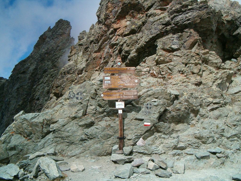
The Col de la Traversette (Italian: Colle delle Traversette) is a bridle pass with an altitude of 2,947 metres (9,669 ft) in the Cottian Alps. Located between Crissolo and Abriès, it lies on the border between Italy and France and separates the Monviso (3,841 m (12,602 ft)) from the Monte Granero (3,171 m (10,404 ft)). The Blue Trail of the Via Alpina and the Giro di Viso cross the pass. The 75-metre-long (246 ft) Monte Viso Tunnel (French: Tunnel de la Traversette, Italian: Buco di Viso) is a pedestrian tunnel constructed between 1478 and 1480 to bypass the Col.
We use GPS information embedded into the photo when it is available.
3D mountains overlay
Adjust mountain panorama to perfectly match your photos because recorded by camera photo position might be imprecise.
Move tool
Rotate tool
Zoom
More customization
Choose which peak labels should make into the final photo and what photo title should be.
Next
Photo Location
Satellitte
Flat map
Relief map
Latitude
Longitude
Altitude
OR
Latitude
°'''
Longitude
°'''
Apply
Register Peak
Peak Name
Latitude
Longitude
Altitude
Register
Teleport
PeakVisor
This 3D model of Sagarmatha National Park in Nepal was made using the PeakVisor app topographic data. The mobile app features higher precision models worldwide, more topographic details, and works offline. Download PeakVisor maps today.
Download OBJ model
PeakVisor
The download should start shortly. If you find it useful please consider supporting the PeakVisor app.
PeakVisor for iOS and Android
Be a superhero of outdoor navigation with state-of-the-art 3D maps and mountain identification in the palm of your hand!