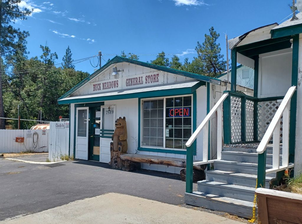
Buck Meadows (formerly Hamilton's and Hamilton's Station) is a census-designated place in Mariposa County, California, United States. It is located 2 miles (3 km) east-northeast of Smith Peak, at an elevation of 3,015 feet (919 m). The population was 21 at the 2020 census. Buck Meadows lies just south of the Tuolumne County line. It is on State Route 120, 11 miles (18 km) east of Groveland. The ZIP Code for this community is shared with Groveland (95321), and wired telephones work out of Groveland's telephone exchange with numbers following the format (209) 962-xxxx. The official U.S. Geological Survey coordinates for the community are 37°48′46″N 120°03′52″W. The area is named for Buck's Meadow 37°48′43″N 120°07′07″W which lies at the corner of SR120 and Smith Station Road. According to The Big Oak Flat Road, a variant name for the area was Hamilton's Station. This may have referred to the name of a stagecoach stop. 2.5 miles (4.0 km) east of U.S.F.S. Buck Meadows Fire Station, "Rim of the World" overlooks the canyon containing the South Fork of the Tuolumne River. Further east, visitors on hot summer days can cool off at a Stanislaus National Forest picnic area called "Rainbow Pool". The area is on the south side of SR120 2.25 miles east of U.S.F.S. Buck Meadows Fire Station. This community is home to Lucky Buck Restaurant on SR120. Southwest of town, the U.S. Forest Service, Stanislaus National Forest fire lookout at Smith Peak overlooks the area. A U.S.F.S. campground and fire station are also present in the community. The Pines campground is located at 37°49′05″N 120°05′36″W.
We use GPS information embedded into the photo when it is available.
3D mountains overlay
Adjust mountain panorama to perfectly match your photos because recorded by camera photo position might be imprecise.
Move tool
Rotate tool
Zoom
More customization
Choose which peak labels should make into the final photo and what photo title should be.
Next
Photo Location
Satellitte
Flat map
Relief map
Latitude
Longitude
Altitude
OR
Latitude
°'''
Longitude
°'''
Apply
Register Peak
Peak Name
Latitude
Longitude
Altitude
Register
Teleport
PeakVisor
This 3D model of Sagarmatha National Park in Nepal was made using the PeakVisor app topographic data. The mobile app features higher precision models worldwide, more topographic details, and works offline. Download PeakVisor maps today.
Download OBJ model
PeakVisor
The download should start shortly. If you find it useful please consider supporting the PeakVisor app.
PeakVisor for iOS and Android
Be a superhero of outdoor navigation with state-of-the-art 3D maps and mountain identification in the palm of your hand!