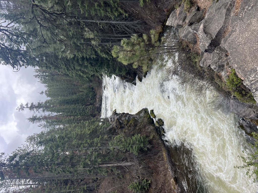
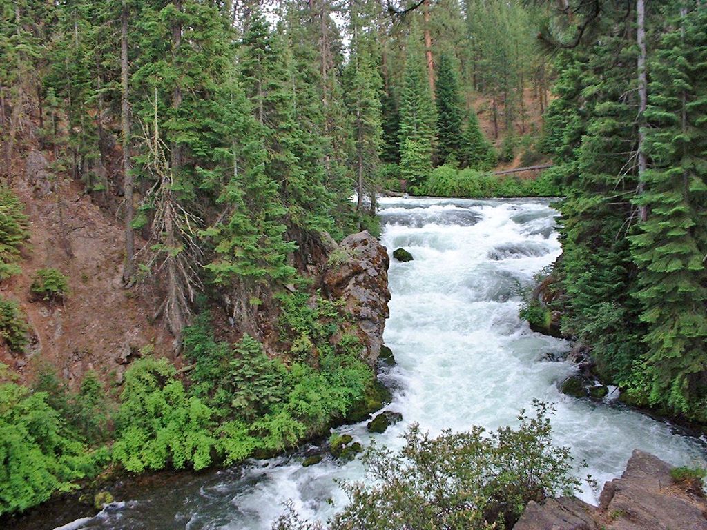
Benham Falls are rapids of the Deschutes River located between Sunriver and Bend, Oregon, United States. With a pitch of 22.5°, they are rated Class 5 for watercraft, and are the largest falls on the upper Deschutes. The falls were created by the eruption of nearby Lava Butte approximately 6,000 years ago, as the lava flow dammed the Deschutes, forming a lake known as Lake Benham. The river eventually flowed over the dam, draining the lake and thus forming Benham Falls. Around 1885, J. R. Benham attempted and failed to file a land claim near the falls, though they were later named for him. Today, there are forest roads connecting Benham Falls to Lava Butte, Lava River Cave, and Sunriver Resort. A footbridge connects the forest road to an easy-to-navigate trail near the river and falls. The shady area has much wildlife and flowers. Because of this, the area also has mosquitoes. Additionally, the United States Forest Service has established a few lookouts over the gorge for viewers. Hikers and mountain bikers who continue on this trail pass Dillon Falls and Lava Island Falls, and eventually, the city of Bend. Benham Falls is relatively easier to see compared to the falls downstream, because it is not surrounded by lava flow from Lava Butte, but surrounded by forest. Because of its location, it is also much more popular. Benham Falls is also in the Deschutes National Forest and the Newberry National Volcanic Monument. Benham Falls Recreation Site and Benham Falls West Recreation Site are located nearby.
We use GPS information embedded into the photo when it is available.
3D mountains overlay
Adjust mountain panorama to perfectly match your photos because recorded by camera photo position might be imprecise.
Move tool
Rotate tool
Zoom
More customization
Choose which peak labels should make into the final photo and what photo title should be.
Next
Photo Location
Satellitte
Flat map
Relief map
Latitude
Longitude
Altitude
OR
Latitude
°'''
Longitude
°'''
Apply
Register Peak
Peak Name
Latitude
Longitude
Altitude
Register
Teleport
PeakVisor
This 3D model of Sagarmatha National Park in Nepal was made using the PeakVisor app topographic data. The mobile app features higher precision models worldwide, more topographic details, and works offline. Download PeakVisor maps today.
Download OBJ model
PeakVisor
The download should start shortly. If you find it useful please consider supporting the PeakVisor app.
PeakVisor for iOS and Android
Be a superhero of outdoor navigation with state-of-the-art 3D maps and mountain identification in the palm of your hand!