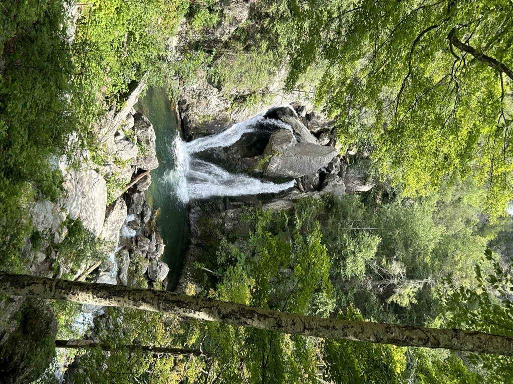
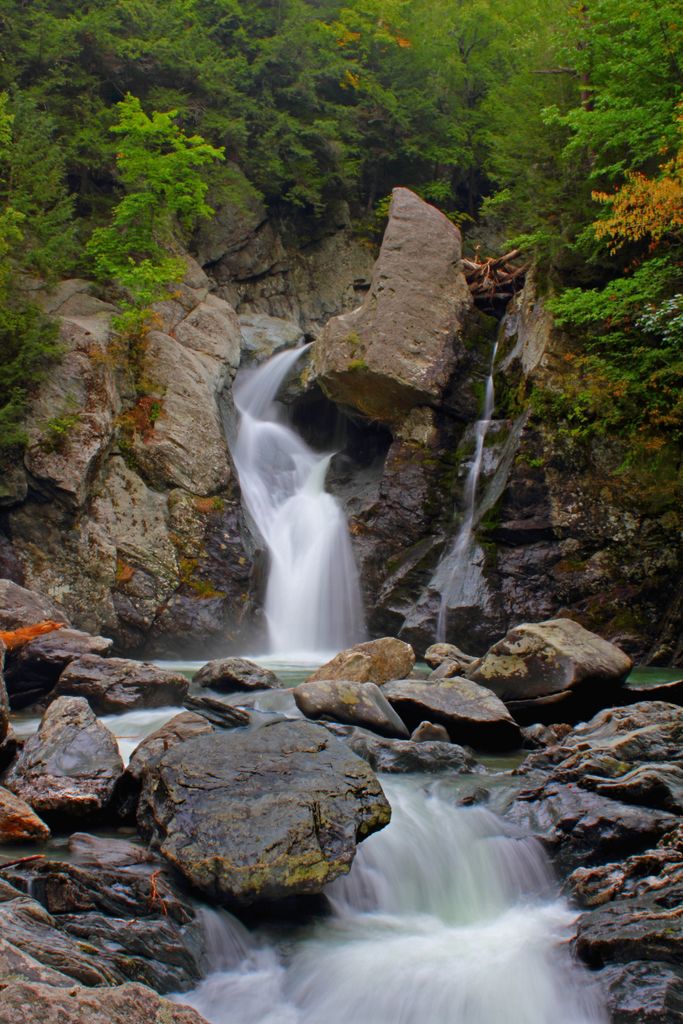
Bash Bish Falls, a waterfall in Bash Bish Falls State Park in the Taconic Mountains of southwestern Massachusetts (Berkshire County), is the highest waterfall in the state. The falls are made up of a series of cascades, nearly 200 feet (61 m) in total. The final cascade is split into twin falls by a jutting rock, dropping in a 59-foot (18 m) "V" over boulders to a serene pool below. The waters of Bash Bish Falls begin at a spring in Mount Washington and after the falls, Bash Bish Brook has cut a 1,000 -foot deep valley on its way westward to adjacent New York State. The brook cuts between Bash Bish Mountain (elevation 1890) and Cedar Mountain (elevation 1883) creating a dramatic gorge that frames the falls. Bash Bish Falls State Park is located next to both Massachusetts' 4,000-acre (16 km2) Mount Washington State Forest and New York's 5,000-acre (20 km2) Taconic State Park.
We use GPS information embedded into the photo when it is available.
3D mountains overlay
Adjust mountain panorama to perfectly match your photos because recorded by camera photo position might be imprecise.
Move tool
Rotate tool
Zoom
More customization
Choose which peak labels should make into the final photo and what photo title should be.
Next
Photo Location
Satellitte
Flat map
Relief map
Latitude
Longitude
Altitude
OR
Latitude
°'''
Longitude
°'''
Apply
Register Peak
Peak Name
Latitude
Longitude
Altitude
Register
Teleport
PeakVisor
This 3D model of Sagarmatha National Park in Nepal was made using the PeakVisor app topographic data. The mobile app features higher precision models worldwide, more topographic details, and works offline. Download PeakVisor maps today.
Download OBJ model
PeakVisor
The download should start shortly. If you find it useful please consider supporting the PeakVisor app.
PeakVisor for iOS and Android
Be a superhero of outdoor navigation with state-of-the-art 3D maps and mountain identification in the palm of your hand!