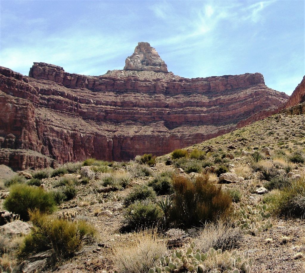
Zoroaster Temple is a 7,123-foot-elevation (2,171-meter) summit located in the Grand Canyon, in Coconino County of Arizona, USA. It is situated 5.5 miles (8.9 km) northeast of the Yavapai Point overlook on the canyon's South Rim, from which it can be seen towering over 4,600 feet (1,400 meters) above the Colorado River and Granite Gorge. Its nearest higher neighbor is Brahma Temple, less than one mile to the north-northeast. Zoroaster Temple is named for Zoroaster, an ancient Iranian prophet. This name was used by George Wharton James and Clarence Dutton. Dutton began the tradition of naming geographical features in the Grand Canyon after mythological deities. This geographical feature's name was officially adopted in 1906 by the U.S. Board on Geographic Names.
The first ascent of the summit was made by Rick Tidrick and Dave Ganci in September 1958 via the NE Arete (class 5.9+). Other climbing routes include Screaming Sky Crack (class 5.11a FA 1994), and SE Face, a challenging class 5.11+ route that was first climbed in 2012. The 1958 Zoroaster ascent was the first technical climb in the Grand Canyon, transforming the Grand Canyon into a climbing mecca and setting off a rush to climb the many summits. According to the Köppen climate classification system, Zoroaster Temple is located in a Cold semi-arid climate zone.
By elevation Zoroaster Temple is
# 79 out of 280 in Grand Canyon National Park # 98 out of 203 in the Kaibab Plateau
By prominence Zoroaster Temple is
# 64 out of 875 in Coconino County # 31 out of 280 in Grand Canyon National Park # 22 out of 203 in the Kaibab Plateau
We use GPS information embedded into the photo when it is available.
3D mountains overlay
Adjust mountain panorama to perfectly match your photos because recorded by camera photo position might be imprecise.
Move tool
Rotate tool
Zoom
More customization
Choose which peak labels should make into the final photo and what photo title should be.
Next
Photo Location
Satellitte
Flat map
Relief map
Latitude
Longitude
Altitude
OR
Latitude
°'''
Longitude
°'''
Apply
Register Peak
Peak Name
Latitude
Longitude
Altitude
Register
Teleport
PeakVisor
This 3D model of Sagarmatha National Park in Nepal was made using the PeakVisor app topographic data. The mobile app features higher precision models worldwide, more topographic details, and works offline. Download PeakVisor maps today.
Download OBJ model
PeakVisor
The download should start shortly. If you find it useful please consider supporting the PeakVisor app.
PeakVisor for iOS and Android
Be a superhero of outdoor navigation with state-of-the-art 3D maps and mountain identification in the palm of your hand!