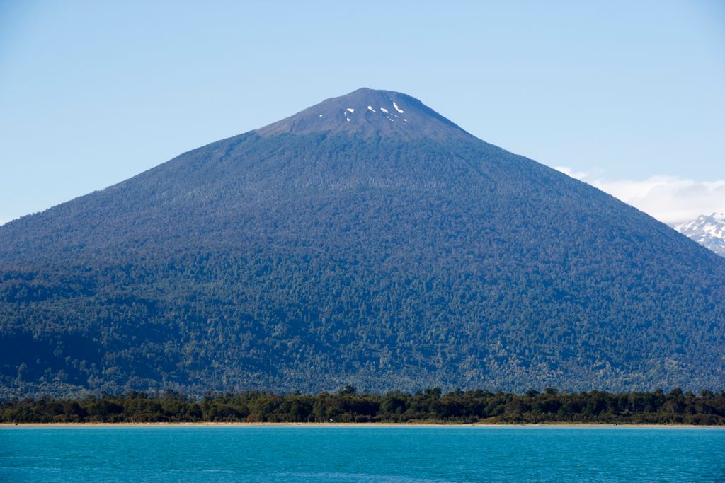
Hornopirén (Spanish pronunciation: [oɾnoˈpiɾen]) is a stratovolcano located in the Andes, in Los Lagos Region of Chile, south of Yate Volcano and east of Apagado or Hualiaque pyroclastic cone. Hornopirén lies on the major regional Liquine-Ofqui Fault. The volcano is said to have erupted in 1835, although no details are known. The name of the volcano derives from the Spanish word for oven, horno and the native Mapudungun word for snow pirén, thus Hornopirén means snow oven.
The town of Hornopirén is 10 kilometres (6.2 mi) south of the volcano, on an inlet off the Gulf of Ancud.
By elevation Volcán Hornopirén is
# 48 out of 178 in Provincia de Palena
By prominence Volcán Hornopirén is
# 17 out of 178 in Provincia de Palena # 30 out of 507 in Región de Los Lagos
We use GPS information embedded into the photo when it is available.
3D mountains overlay
Adjust mountain panorama to perfectly match your photos because recorded by camera photo position might be imprecise.
Move tool
Rotate tool
Zoom
More customization
Choose which peak labels should make into the final photo and what photo title should be.
Next
Photo Location
Satellitte
Flat map
Relief map
Latitude
Longitude
Altitude
OR
Latitude
°'''
Longitude
°'''
Apply
Register Peak
Peak Name
Latitude
Longitude
Altitude
Register
Teleport
PeakVisor
This 3D model of Sagarmatha National Park in Nepal was made using the PeakVisor app topographic data. The mobile app features higher precision models worldwide, more topographic details, and works offline. Download PeakVisor maps today.
Download OBJ model
PeakVisor
The download should start shortly. If you find it useful please consider supporting the PeakVisor app.
PeakVisor for iOS and Android
Be a superhero of outdoor navigation with state-of-the-art 3D maps and mountain identification in the palm of your hand!