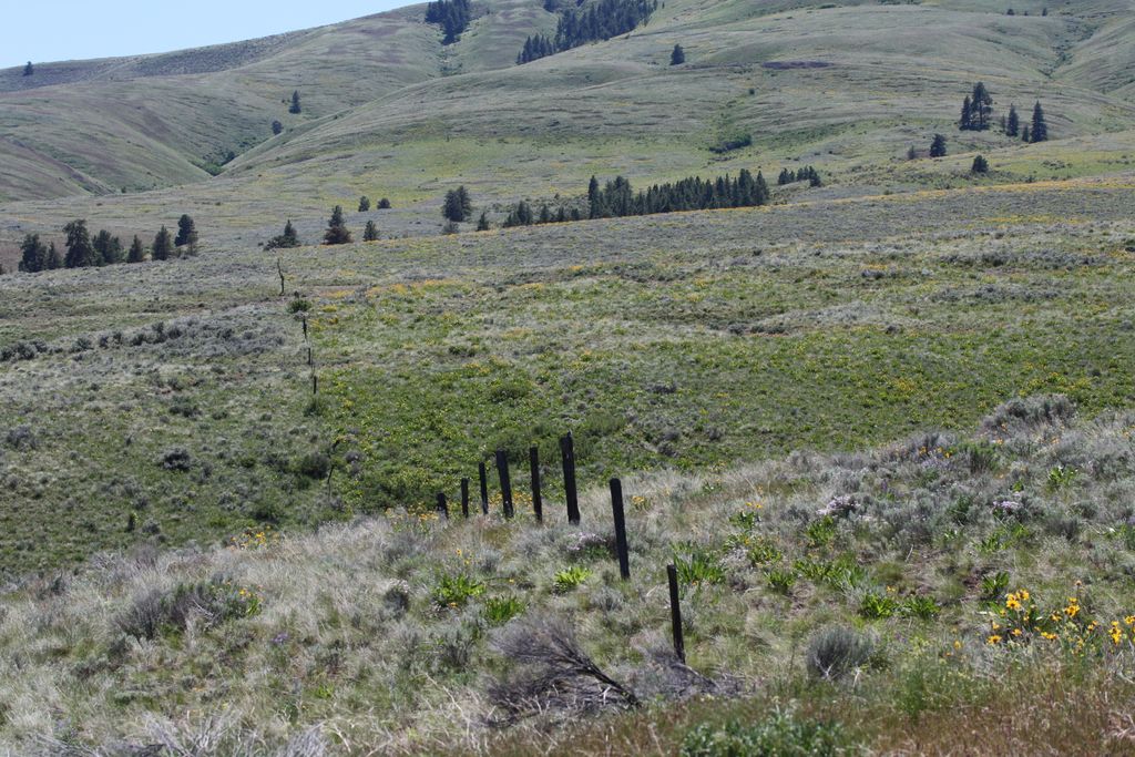
Umtanum Ridge is a long anticline mountain ridge in Yakima County and Kittitas County in the U.S. state of Washington. It runs for approximately 55 miles east-southeast from the Cascade Range, through the Yakima Training Center to the edge of the Columbia River at Priest Rapids Dam and Hanford Reach. The eastern end of Umtanum Ridge enters Hanford Reach National Monument and the Hanford Site. Umtanum Ridge is paralleled on the north by Manastash Ridge and on the south by Yakima Ridge. The Yakima River cuts through the ridge at the Umtanum Ridge Water Gap.
The name Umtanum comes from Sahaptin, probably /ɨmtanam/, possibly meaning "taste" or "mouth full", from the root /ɨm/, "mouth".
Umtanum Ridge is part of the Yakima Fold Belt of east-tending long ridges formed by the folding of Miocene Columbia River basalt flows.
We use GPS information embedded into the photo when it is available.
3D mountains overlay
Adjust mountain panorama to perfectly match your photos because recorded by camera photo position might be imprecise.
Move tool
Rotate tool
Zoom
More customization
Choose which peak labels should make into the final photo and what photo title should be.
Next
Photo Location
Satellitte
Flat map
Relief map
Latitude
Longitude
Altitude
OR
Latitude
°'''
Longitude
°'''
Apply
Register Peak
Peak Name
Latitude
Longitude
Altitude
Register
Teleport
PeakVisor
This 3D model of Sagarmatha National Park in Nepal was made using the PeakVisor app topographic data. The mobile app features higher precision models worldwide, more topographic details, and works offline. Download PeakVisor maps today.
Download OBJ model
PeakVisor
The download should start shortly. If you find it useful please consider supporting the PeakVisor app.
PeakVisor for iOS and Android
Be a superhero of outdoor navigation with state-of-the-art 3D maps and mountain identification in the palm of your hand!