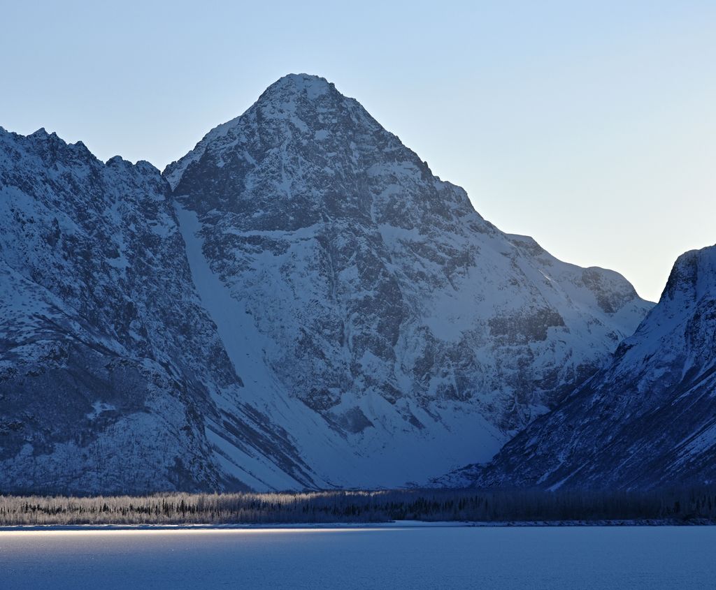
The Mitre is a 6,651-foot (2,027 m) mountain summit located in the western Chugach Mountains, in Anchorage Municipality in the U.S. state of Alaska. The mountain is situated in Chugach State Park, 30 mi (48 km) east of Anchorage, three miles (4.8 km) northeast of Bellicose Peak, and 5.5 mi (9 km) south-southeast of Eklutna Lake. The nearest higher peak is Benign Peak, 2.4 mi (4 km) to the west-northwest, on the opposite side of the Eklutna Glacier. Although modest in elevation, relief is significant since the western aspect of the mountain rises 4,000 feet above this glacier in approximately half a mile. In Europe, "mitre" is the term used for a sharp, symmetrical rocky peak such as this one. The Mitre's descriptive name was submitted for consideration by the Mountaineering Club of Alaska as suggested by Dr. Rodman Wilson (1921–2003) of Anchorage after he returned from a European vacation. The Mitre name was officially adopted in 1966 by the U.S. Board on Geographic Names. In the Denaʼina language, this mountain is known as Idlu Bena Dghelaya, meaning Mountain of Plural Objects Lake.
We use GPS information embedded into the photo when it is available.
3D mountains overlay
Adjust mountain panorama to perfectly match your photos because recorded by camera photo position might be imprecise.
Move tool
Rotate tool
Zoom
More customization
Choose which peak labels should make into the final photo and what photo title should be.
Next
Photo Location
Satellitte
Flat map
Relief map
Latitude
Longitude
Altitude
OR
Latitude
°'''
Longitude
°'''
Apply
Register Peak
Peak Name
Latitude
Longitude
Altitude
Register
Teleport
PeakVisor
This 3D model of Sagarmatha National Park in Nepal was made using the PeakVisor app topographic data. The mobile app features higher precision models worldwide, more topographic details, and works offline. Download PeakVisor maps today.
Download OBJ model
PeakVisor
The download should start shortly. If you find it useful please consider supporting the PeakVisor app.
PeakVisor for iOS and Android
Be a superhero of outdoor navigation with state-of-the-art 3D maps and mountain identification in the palm of your hand!