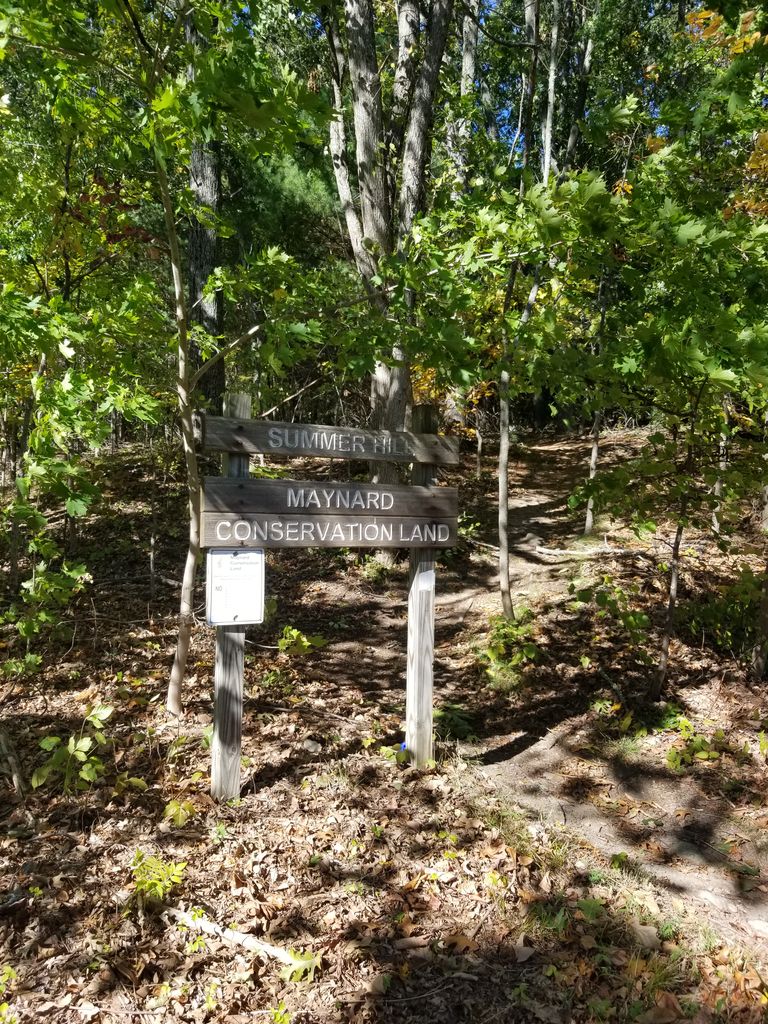
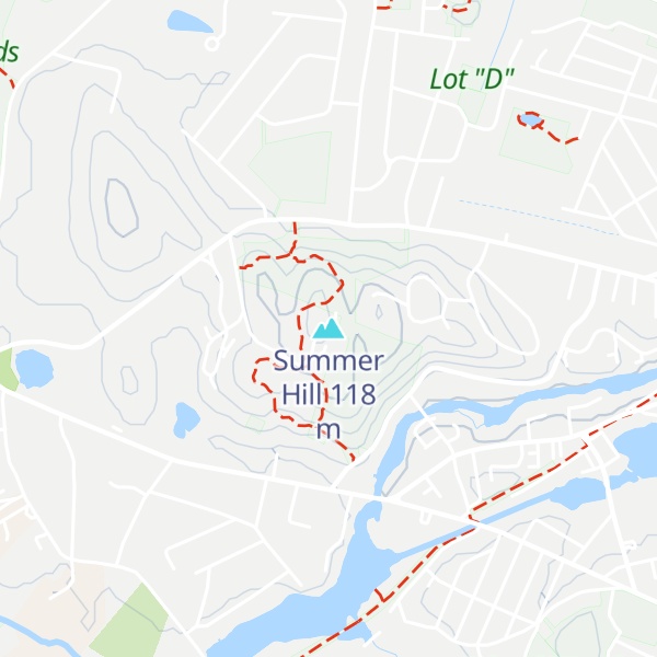
Summer Hill (also known as Pompasitticut or Pomciticut) is a 351-foot (107 m) hill overlooking the Assabet River in Maynard, Massachusetts "with a gradual slope to the north and west". Today the hill is largely conservation land with 24 acres of public hiking trails, and the summit of the hill also contains a radio tower and the town's steel and concrete water tanks. It is the highest point in Maynard.
There's a trail called Tower Road leading to the summit.
By elevation Summer Hill is
# 1 out of 1 in Tower Rd. & Summer St. # 1 out of 1 in Summer Hill # 1 out of 1 in Summer Hill (North Slope) # 1 out of 1 in Mailett/Wilson # 98 out of 366 in Middlesex County
By prominence Summer Hill is
# 1 out of 1 in Tower Rd. & Summer St. # 1 out of 1 in Summer Hill # 1 out of 1 in Summer Hill (North Slope) # 1 out of 1 in Mailett/Wilson # 29 out of 366 in Middlesex County
We use GPS information embedded into the photo when it is available.
3D mountains overlay
Adjust mountain panorama to perfectly match your photos because recorded by camera photo position might be imprecise.
Move tool
Rotate tool
Zoom
More customization
Choose which peak labels should make into the final photo and what photo title should be.
Next
Photo Location
Satellitte
Flat map
Relief map
Latitude
Longitude
Altitude
OR
Latitude
°'''
Longitude
°'''
Apply
Register Peak
Peak Name
Latitude
Longitude
Altitude
Register
Teleport
PeakVisor
This 3D model of Sagarmatha National Park in Nepal was made using the PeakVisor app topographic data. The mobile app features higher precision models worldwide, more topographic details, and works offline. Download PeakVisor maps today.
Download OBJ model
PeakVisor
The download should start shortly. If you find it useful please consider supporting the PeakVisor app.
PeakVisor for iOS and Android
Be a superhero of outdoor navigation with state-of-the-art 3D maps and mountain identification in the palm of your hand!