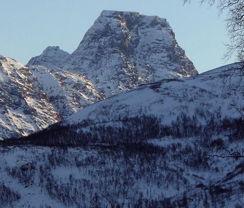
Store Fornestinden is a mountain in Tromsø Municipality in Troms county, Norway. The highest peak of any mountain in the eastern part of the municipality. The 1,477-metre (4,846 ft) tall mountain lies about 40 kilometres (25 mi) east of the city of Tromsø and about 11 kilometres (6.8 mi) west of the village of Lyngseidet in the neighboring Lyngen Municipality. The mountain is on the southern shore of the Kjosen fjord, an arm of the large Ullsfjorden.
The mountain consists of two peaks, the highest being Store Fornestinden at 1,477 metres (4,846 ft). The second peak named Litle Fornestinden, is slightly more northerly with a height of 1,050 metres (3,440 ft). The mountain is located in the Lyngen Alps, part of the Scandinavian Mountains.
Media related to Store Fornestinden at Wikimedia Commons
We use GPS information embedded into the photo when it is available.
3D mountains overlay
Adjust mountain panorama to perfectly match your photos because recorded by camera photo position might be imprecise.
Move tool
Rotate tool
Zoom
More customization
Choose which peak labels should make into the final photo and what photo title should be.
Next
Photo Location
Satellitte
Flat map
Relief map
Latitude
Longitude
Altitude
OR
Latitude
°'''
Longitude
°'''
Apply
Register Peak
Peak Name
Latitude
Longitude
Altitude
Register
Teleport
PeakVisor
This 3D model of Sagarmatha National Park in Nepal was made using the PeakVisor app topographic data. The mobile app features higher precision models worldwide, more topographic details, and works offline. Download PeakVisor maps today.
Download OBJ model
PeakVisor
The download should start shortly. If you find it useful please consider supporting the PeakVisor app.
PeakVisor for iOS and Android
Be a superhero of outdoor navigation with state-of-the-art 3D maps and mountain identification in the palm of your hand!