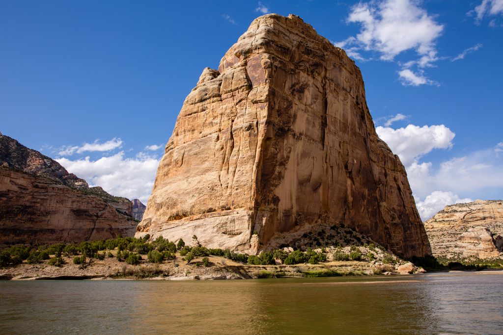
Steamboat Rock, reaching an elevation of 6,074 ft (1,851 m) is a promontory located in the eastern Uinta Mountains, in Moffat County of northwest Colorado, United States. This iconic landmark of Dinosaur National Monument is situated at the confluence of the Green River and Yampa River. Precipitation runoff from this feature drains into the Green River. This geographical formation was originally named "Echo Rock" in John Wesley Powell's 1875 report, The Exploration of the Colorado River and Its Canyons. The Steamboat name first appeared on a 1941 United States Geological Survey map of Dinosaur National Monument. The area around it still retains the Echo Park name applied by Powell during the Powell Geographic Expedition of 1869.
By elevation Steamboat Rock is
# 22 out of 32 in Dinosaur National Monument
By prominence Steamboat Rock is
# 67 out of 135 in Moffat County # 14 out of 32 in Dinosaur National Monument
We use GPS information embedded into the photo when it is available.
3D mountains overlay
Adjust mountain panorama to perfectly match your photos because recorded by camera photo position might be imprecise.
Move tool
Rotate tool
Zoom
More customization
Choose which peak labels should make into the final photo and what photo title should be.
Next
Photo Location
Satellitte
Flat map
Relief map
Latitude
Longitude
Altitude
OR
Latitude
°'''
Longitude
°'''
Apply
Register Peak
Peak Name
Latitude
Longitude
Altitude
Register
Teleport
PeakVisor
This 3D model of Sagarmatha National Park in Nepal was made using the PeakVisor app topographic data. The mobile app features higher precision models worldwide, more topographic details, and works offline. Download PeakVisor maps today.
Download OBJ model
PeakVisor
The download should start shortly. If you find it useful please consider supporting the PeakVisor app.
PeakVisor for iOS and Android
Be a superhero of outdoor navigation with state-of-the-art 3D maps and mountain identification in the palm of your hand!