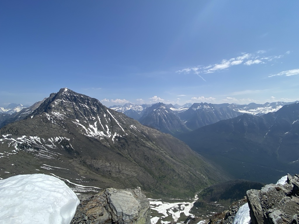
Stanton Mountain is a 7,750 feet (2,360 m) mountain summit located in the Livingston Range, of Glacier National Park in the U.S. state of Montana. Stanton Mountain rises more than 4,500 feet (1,400 m) above the northern shore of Lake McDonald. The mountain's name refers to Mrs. Lottie Stanton who lived near the west side of the park in the late 1800s, and with her husband operated a livery stable in historic Demersville. She was a pioneering woman who followed the construction camps during the railroad building days. The mountain's name was officially adopted in 1929. In the late 1800s it was known as Mt. Lottie Stanton. The nearest higher peak is Mount Vaught, 1.38 miles (2.22 km) to the northeast. Precipitation runoff from the mountain drains into tributaries of the Flathead River.
We use GPS information embedded into the photo when it is available.
3D mountains overlay
Adjust mountain panorama to perfectly match your photos because recorded by camera photo position might be imprecise.
Move tool
Rotate tool
Zoom
More customization
Choose which peak labels should make into the final photo and what photo title should be.
Next
Photo Location
Satellitte
Flat map
Relief map
Latitude
Longitude
Altitude
OR
Latitude
°'''
Longitude
°'''
Apply
Register Peak
Peak Name
Latitude
Longitude
Altitude
Register
Teleport
PeakVisor
This 3D model of Sagarmatha National Park in Nepal was made using the PeakVisor app topographic data. The mobile app features higher precision models worldwide, more topographic details, and works offline. Download PeakVisor maps today.
Download OBJ model
PeakVisor
The download should start shortly. If you find it useful please consider supporting the PeakVisor app.
PeakVisor for iOS and Android
Be a superhero of outdoor navigation with state-of-the-art 3D maps and mountain identification in the palm of your hand!


.jpg)


