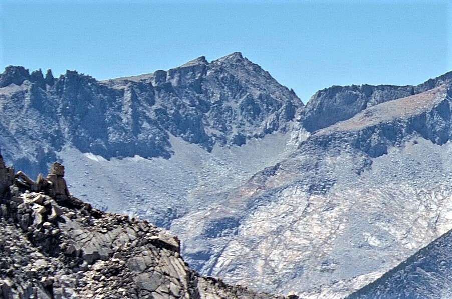
South Guard is a remote 13,232-foot-elevation (4,033-meter) mountain summit located near the northern end of the Great Western Divide of the Sierra Nevada mountain range, in Tulare County of northern California. It is situated in Kings Canyon National Park, 1.63 miles (2.62 km) south of North Guard, and one mile south of Mount Brewer, which is the nearest higher neighbor. Topographic relief is significant as the west aspect rises 4,600 feet (1,400 meters) above Cloud Canyon in 3.5 miles, and the east aspect rises 3,200 feet (980 meters) above Lake Reflection in two miles. South Guard ranks as the 103rd highest summit in California, and the third-highest point of the northern Great Western Divide.
By elevation South Guard is
# 51 out of 183 in Kings Canyon National Park # 53 out of 349 in Tulare County
We use GPS information embedded into the photo when it is available.
3D mountains overlay
Adjust mountain panorama to perfectly match your photos because recorded by camera photo position might be imprecise.
Move tool
Rotate tool
Zoom
More customization
Choose which peak labels should make into the final photo and what photo title should be.
Next
Photo Location
Satellitte
Flat map
Relief map
Latitude
Longitude
Altitude
OR
Latitude
°'''
Longitude
°'''
Apply
Register Peak
Peak Name
Latitude
Longitude
Altitude
Register
Teleport
PeakVisor
This 3D model of Sagarmatha National Park in Nepal was made using the PeakVisor app topographic data. The mobile app features higher precision models worldwide, more topographic details, and works offline. Download PeakVisor maps today.
Download OBJ model
PeakVisor
The download should start shortly. If you find it useful please consider supporting the PeakVisor app.
PeakVisor for iOS and Android
Be a superhero of outdoor navigation with state-of-the-art 3D maps and mountain identification in the palm of your hand!