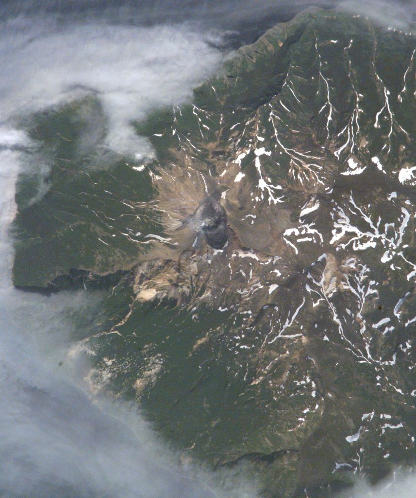
Sinarka (Russian: Синарка) is a stratovolcano located at the northern end of Shiashkotan Island, Kuril Islands, Russia. Most eruptions occurred during the 17th and 18th centuries, although there has been some recent activity, mostly steam and thermal activity. A large eruption would not affect large populations; only three people are located within 10 km. The main structure of the volcano consists of the main peak, and two sub-peaks with a mellow ridge descending to the southwest. The larger sub-peak could be considered its own peak, due to its 540 feet (160 m) of prominence.
By elevation Sinarka is
# 45 out of 184 in Severo-Kurilsky District
By prominence Sinarka is
# 12 out of 184 in Severo-Kurilsky District # 29 out of 1891 in Sakhalin Oblast
We use GPS information embedded into the photo when it is available.
3D mountains overlay
Adjust mountain panorama to perfectly match your photos because recorded by camera photo position might be imprecise.
Move tool
Rotate tool
Zoom
More customization
Choose which peak labels should make into the final photo and what photo title should be.
Next
Photo Location
Satellitte
Flat map
Relief map
Latitude
Longitude
Altitude
OR
Latitude
°'''
Longitude
°'''
Apply
Register Peak
Peak Name
Latitude
Longitude
Altitude
Register
Teleport
PeakVisor
This 3D model of Sagarmatha National Park in Nepal was made using the PeakVisor app topographic data. The mobile app features higher precision models worldwide, more topographic details, and works offline. Download PeakVisor maps today.
Download OBJ model
PeakVisor
The download should start shortly. If you find it useful please consider supporting the PeakVisor app.
PeakVisor for iOS and Android
Be a superhero of outdoor navigation with state-of-the-art 3D maps and mountain identification in the palm of your hand!