
Scan the QR code and open PeakVisor on your phone
The Kuril Islands include 375 named peaks. The highest is Alaid at 2,339 m. Other notable peaks include Pik Bokovoy, Vulkan Alaid and Pik Tsentral’nyy.
The 75-year-old bone of contention between Russia and Japan is an irresistible temptation for any hardcore traveller. Few are the places on Earth that are so hostile to human presence. Nature goes rampant here. There are massive earthquakes on land and under the water, storms, typhoons, the strongest winds that can knock you off your feet before you say Quidditch.
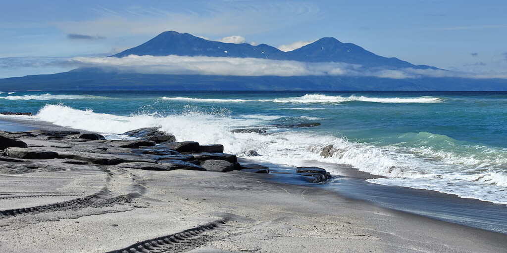
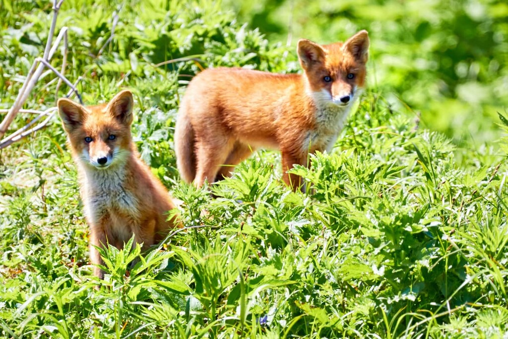
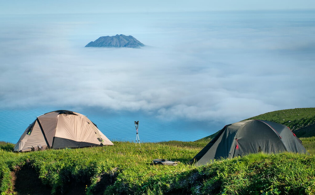
Yet, despite the toughness of the elements and the iffy issues of the humans, the Kuril Islands are a feast for the eye and a must-visit for the body and soul. The nature here is rich and mesmerizing in its uniqueness, it leaves no one indifferent to its charms. The wildlife is rare and features species listed in the Red Book of Russia. The 68 majestic volcanoes, 36 of which are active, with menacingly smoking gas jets neighbour here with picturesque serene waterfalls, clear rivers, beautiful coastal rocks and bays, unusual flora and strange sea inhabitants. The variety of ethereal landscapes and national parks create a real paradise for photographers and other fans of beautiful views. There is practically no infrastructure on the islands, don’t expect good transport, lavish hotels and luxury catering, but the unique nature and scenery make up for all the inconveniences.
The structure of the Kuril Islands
The Kuril islands are an archipelago between the Kamchatka Peninsula and Hokkaido Island, they separate the Sea of Okhotsk from the Pacific Ocean in a slightly convex arc. Despite the fact that the southern islands are located approximately at the 44th latitude, which is considered to be the ‘happy mean’ between the North Pole and the equator, the same latitude for Florence. Toronto, legally the Kuril Islands belong to the areas of the Far North.
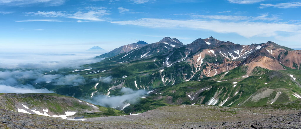
Most of the islands are mountainous. The highest elevation is Alaid Volcano (2,339 m) on Atlasov Island. The Kuril Islands are situated in the Pacific volcanic fire ring in a zone of high seismic activity. Out of the 68 volcanoes, 36 are active and there are many hot mineral springs. About 12% of volcanic craters in the Kuril Islands have lakes. Large tsunamis are not uncommon. The best known are the Paramushir tsunami of November 5, 1952 and the Shikotan tsunami of October 5, 1994. The most recent large tsunami occurred on 15 November 2006 in Simushir.
There are 56 islands which stretch over 1,200km. The islands form two parallel ridges: the Greater Kuril and the Lesser Kuril. The Greater Ridge is in turn traditionally divided by Kruzenshterin and Bussol Straits into
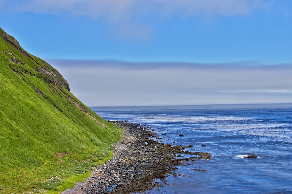
The Lesser Kuril Ridge consists of six islands - Shikotan, Polonsky, Zeleny, Yuri, Anuchina, Tanfiliev - and 2 groups of rocks. The shores of Kuril islands are mainly precipitous or terraced, while the isthmuses have low sandy beaches. There are few well sheltered bays.
After World War II, the Kuril Islands have become part of the Sakhalin region of Russia. Ownership of the southern islands of the archipelago - Iturup, Kunashir, Shikotan and the Habomai group - is disputed by Japan, which includes them in Hokkaido prefecture.
Most of the islands are uninhabited. People live only on Iturup, Shikotan, Kunashir and Paramushir. The largest settlements are Yuzhno-Kurilsk (Kunashir island), Kurilsk (Iturup island) and Severo-Kurilsk (Paramushir island).
The fuming lands of the Kurils can boast of mind-blowing diversity of climate zones and thus the terrains. The lavish greenery can turn into mucky impassible bogs, the black shores can be walled by snow-white cliffs,
Ebeko (1,156m) is one of the most active volcanoes on the Kuril Islands, it is sputtering lava, steam and gases even now, the last big eruption happened in 2020 but Ebeko started to show his nasty temper in 2016 and is still puffing on. Ebeko is just 7 km away from Severo-Kurilsk.
At the southern tip of the island, stretching from north to south lies the Karpinsky Ridge. It is formed by such major peaks as Chikurachki volcano - the highest point of the island (up to 1,817m), Mount Lomonosov (1,681m), Arkhangelsky mountain (1,463m), Topor mountain (1,199 meters), Karpinsky volcano (up to 1,345m), Barkov mountain ( 1,314 meters).
The southern part of the island hosts the best volcanic landscapes. Numerous peaks create breathtaking panoramas. West of the Karpinsky ridge, on the Fussa peninsula, there is Fussa Volcano (1,772 m) which forms the westernmost point of the island, Cape Neprokhodenny.
When you start climbing Fussa Peak, it feels as if you are walking in a land of fairies since there are plenty of rose hips, crowberry, reindeer mosses, blueberries and honeysuckle at the base of the volcano. Once you climb over 600m, there open mind-blowing scenery with views of Alaid Mountain (2,339m) on Atalsov Island and the surrounding ranges. Here begins a belt of alder which grows up to 5-6m tall. Above 1370 m, there is no vegetation, only volcanic bombs and cinder colour the landscape into awesomely rich greys.
Bogdan Khmelnitsky (1,585.3 m) and Stokap Volcano (1,634 m) are the signature mounts on Iturup, they are visible from any spot on the island. Baransky volcano on Iturup lures with its hot springs, much favoured by the locals and the tourists alike.
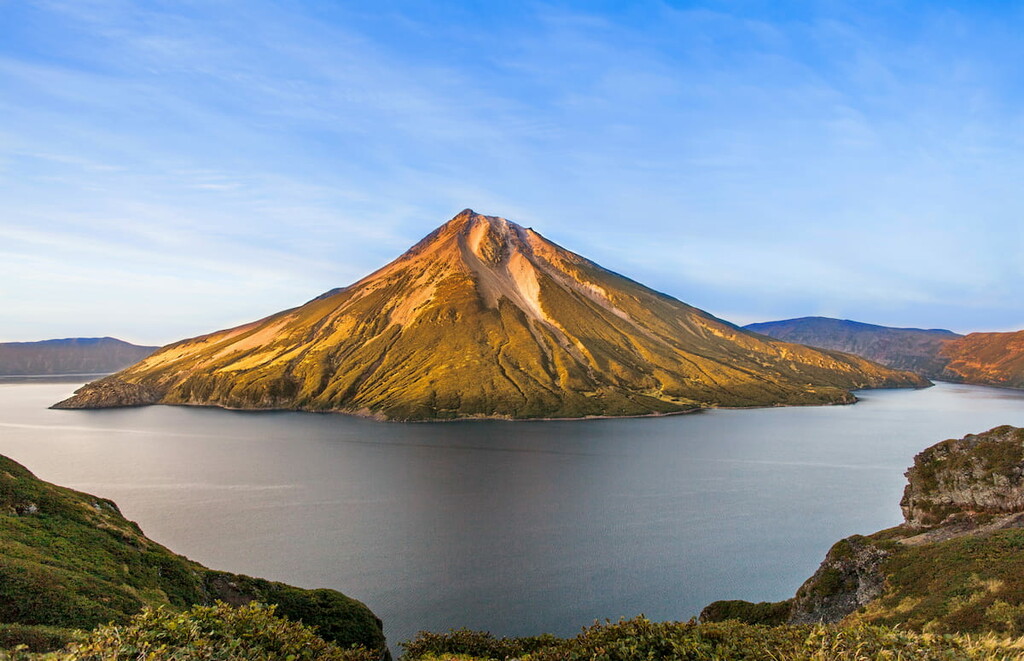
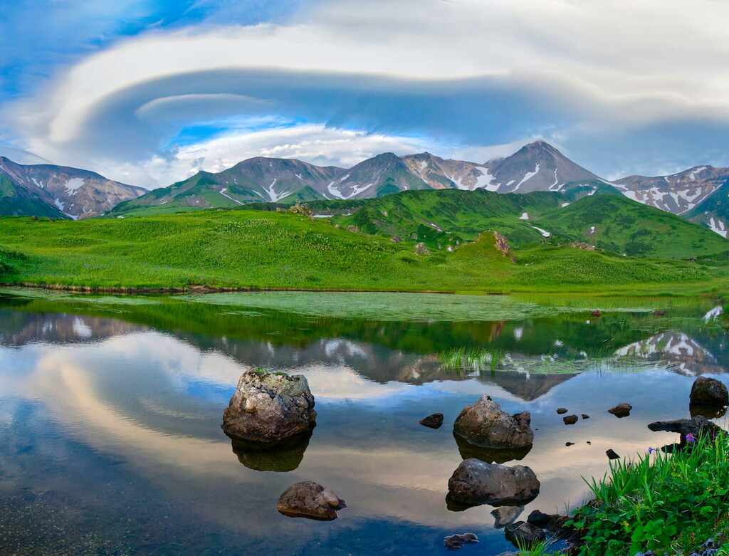
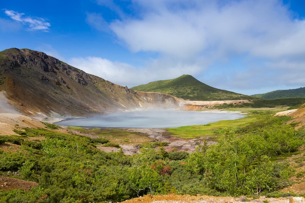
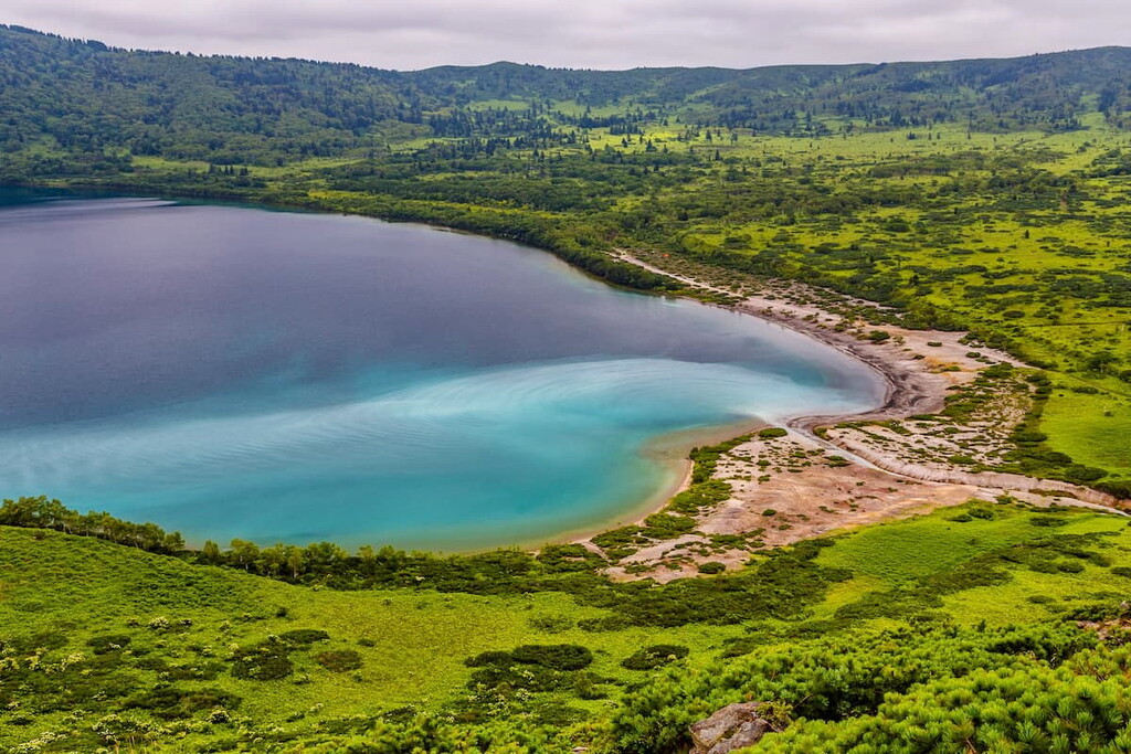
Lakes are as stunning as the mountains. Among ethereal beauties is the mountain lake Osen on Onekotan Island. It is round, the shores are framed by 600-700 meter cliffs. On Kunashir, there is a boiling lake called Ponto. The water here is boiling, bubbling, with gas and steam hissing near the shores of the lake.
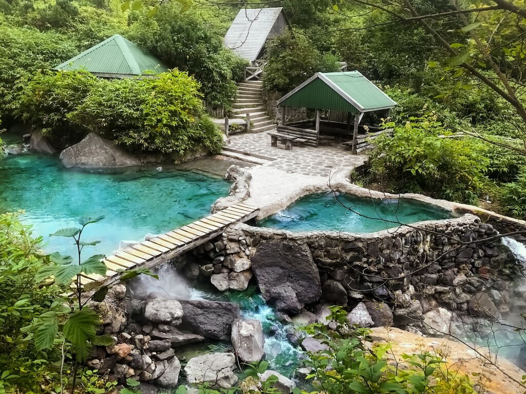
On the slopes of Baransky volcano, there are unique thermal springs and reservoirs, and on the rocky plateau, there's a whole geothermal station producing electric power. There are geysers, lakes, sulfurous streams and pools with boiling mud. The most famous hot lake is the Emerald Eye, its temperature reaches 90C (194F). Out of it flows the River Boiling with hot acid water, which in one place breaks off and falls from a height of 8 meters in a hot waterfall.
Water in the sea around the islands is crystal clear, and the bottom is covered with vegetation, where fish and other sea creatures graze. In addition to natural marine life, divers can see sunken Japanese ships and other military equipment lying on the bottom of the ocean.
The uniqueness of the island nature, overlapping habitats of boreal and subtropical species of flora and fauna, large accumulations of marine mammals and colonial birds, active volcanism determined quite a developed network of protected areas.
There are two national parks on the territory of the Kuril Islands.
The Kuril (Kurilsky) Nature Reserve is usually subdivided into the Kuril Reserve per se and the Maly (Lesser) Kuril Wildlife Sanctuary, which administratively belongs to the Kuril Nature Reserve. The Maly Kuril Wildlife Sanctuary spreads over several small islands of the Kuril Ridge and partially on Shikotan Island.
The Kuril Reserve ‘Major’ consists of three main clusters. Two parts, the North Kunashir section (49,899 ha) and the South Kunashir section (15,366 ha), are located on Kunashir Island, in the very south of the Kuril Ridge. The third part is called the Maly (Lesser) section of the Kuril Ridge (100 ha in total) stretches over Demina and Oskolki islands. Marine protected area of the reserve is 33 thousand hectares.
The Kuril Nature Reserve was established in 1982 to preserve the population of rare birds and animals, mostly sea animals. Seals, northern fur seals, gray dolphins, humpback whales and other animals live here.
The Iturup Island Sanctuary, the name in Russian is Ostrovnoy, is located on Iturup Island. It hosts lavish forests with many mushrooms and berries, intricate bamboo thickets and large lakes. Here grows a unique Sakhalin mushroom, and one of the lakes is home to salmon runs. Majestic volcanoes with menacingly smoking gas jets neighbor here with picturesque serene waterfalls, clear rivers, beautiful coastal rocks and bays, unusual flora and strange sea inhabitants. It is supposed to be annexed to the Kuril Nature Reserve in the near future, which will make it possible to create a unified environmental scientific and educational complex consisting of the neighboring territories of the Kuril Reserve.
Apart from the two state natural reserves, the Kuril Islands have some protected marine areas as well.
Please mind, that you must not
If you want to see the flora and fauna of several natural zones in one place, the Kurils are the right place for you. Moving from island to island, you can see the taiga, tundra, and subtropics. Many relict and red-listed plants grow here.
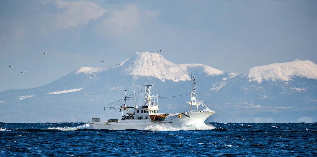
The good news for fans of sea fishing - around the islands there are many commercial species of fish, shellfish and marine animals. If you are interested in diving, the local crystal clear waters allow you to see the remains of sunken ships, and even the Japanese military equipment of the early 20th century.
Most of all, people are attracted to thermal springs. They are found practically on every island, but most of them are on Kunashir, Shikotan, Ushishir, etc. The temperature of the water is usually 35-70C (95-158А). Sometimes, they come out in fractures of lava rocks and form small pools in which it is convenient to bathe. It is important to remember that this water is not suitable for drinking, but it has healing properties and can prolong the youth of your body.
The most visited islands in the Kuril Ridge are Iturup, Kunashir, Raikoke, Shikotan, Ekarma, Paramushir and Ushishir. Volcanic activity in the Kuril Islands proceeds in different ways. Some volcanoes go through a full cycle of activity and first deliver an alarming murmur from the bowels of the earth and then erupt violently. Others have lava that erupts quietly and unobtrusively.
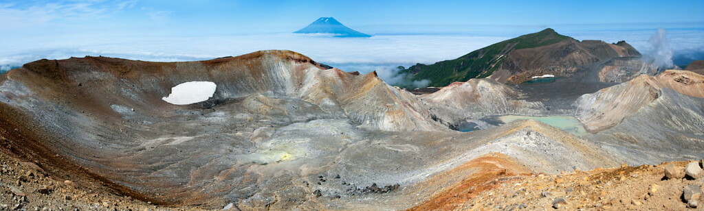
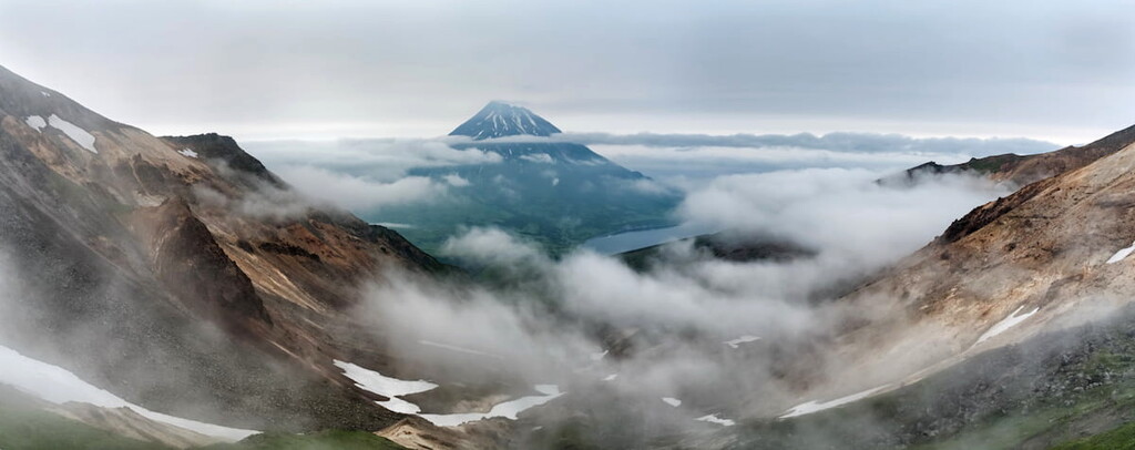
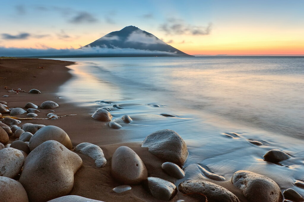
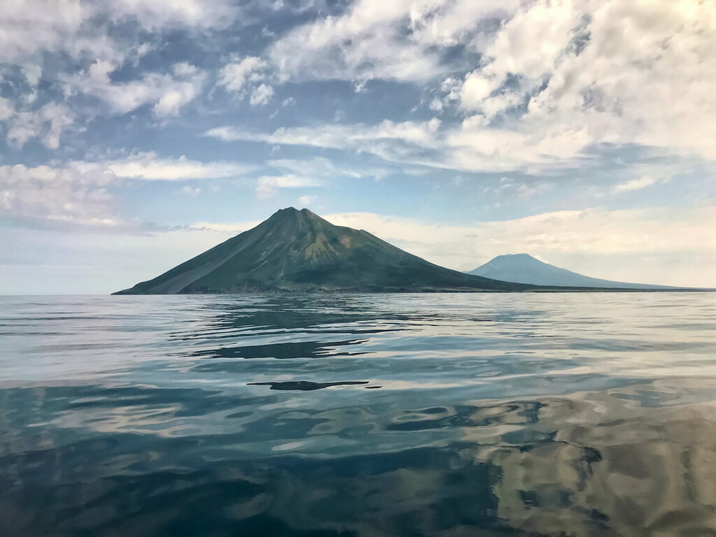
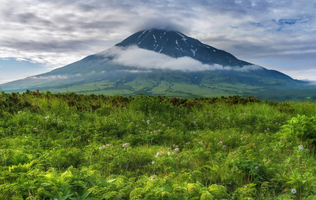
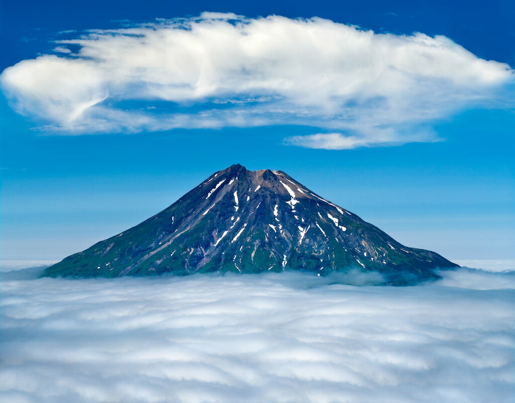
The highest active volcano is Alaid on Atlasova Island, 30 km from the island of Paramushir in the Northern Kurils. Its height is 2,339 m and its regular conic shape resembles Japan's volcano Fuji. Among other beauties is Chirinkotan volcano. It is an island which is almost inaccessible due to very rocky coastline. The volcano is constantly smoking, and the island itself is notable for hundreds of birds gathering here.
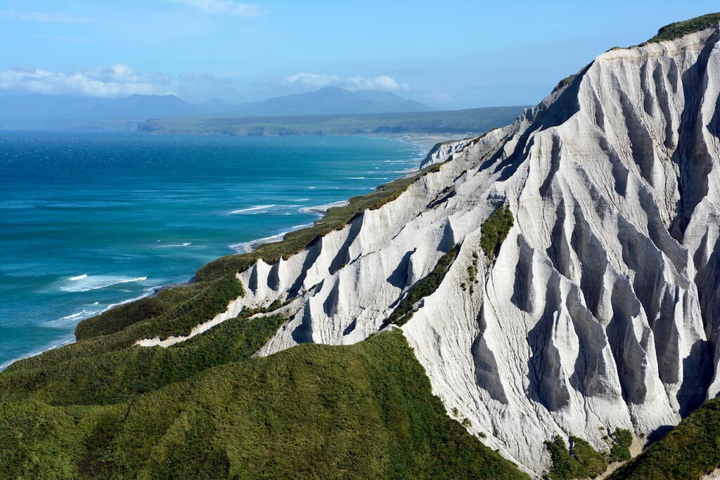
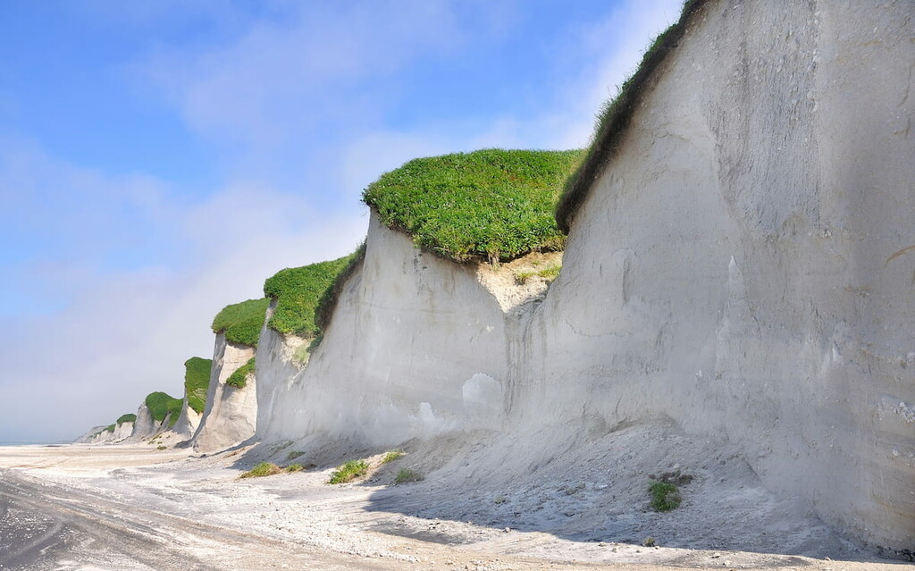
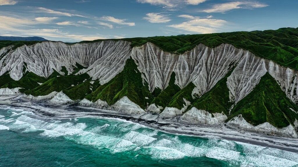
In the northern part of the island of Iturup you can see the White Cliffs - the porous ridges of volcanic origin that stretch for 28 km and feature picturesque canyons. The coast near the rocks is covered with white quartz and black titanomagnetite sand.
For the history aficionados, the Kuril Islands are a true treasure trove. You can have a historical tour on Paramushir island, walk to the Soviet coastal defense battery on Cape Kurbatov. There is a Japanese pillbox, which was exploded by Major Kurbato. You can visit the open-air museum on heights 171 and 165. If you want, you can go to the Japanese airfield Kashiwabara and the Japanese naval fortress Keith Chishima. Sometimes historical tours are accompanied by fishing and sea animal watching.
There is a quaint attraction on the island of Kunashir, a partially ruined warehouse of Japanese left boots. In the Japanese army, left and right boots were stored separately to prevent theft on the one hand and to prevent the enemy from using boots if they found the warehouse on the other hand.
Iturup is the largest island of all. It has an area of 3,200 sq.km, it is almost 200km long and varies in width from 6.5 to 27km. In the language of the indigenous people, the Ainu, the word Iturup means ‘jellyfish aka medusa’. There are 20 volcanoes, and 9 of them are active. The main volcanoes are the giant Bogdan Khmelnitsky (1,585.3 m), which is visible from anywhere on the island, and Stokap Volcano (1,634 m).
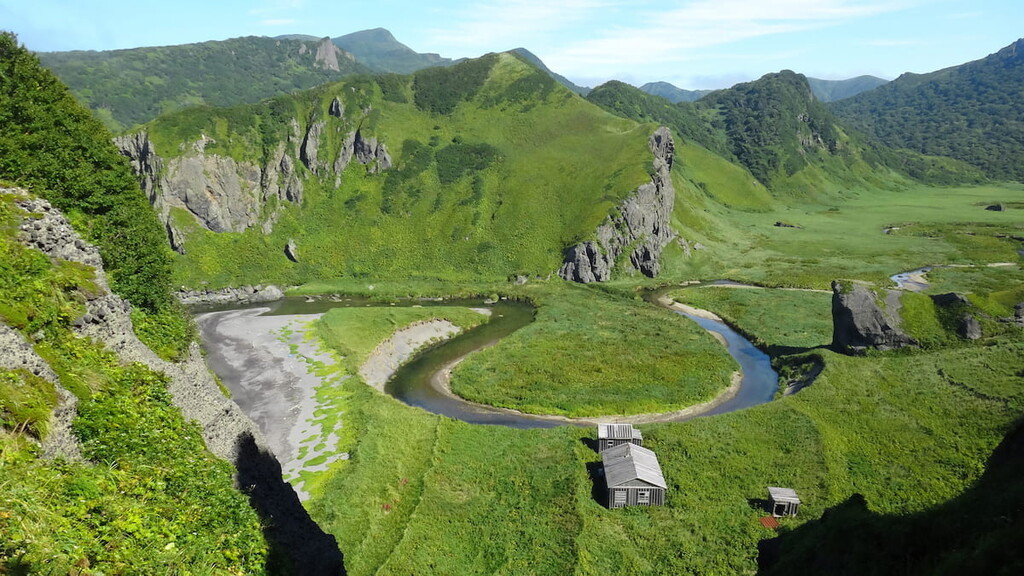
The local bays, the most popular of which are the Lion's Mouth and the Good Start (Dobroe Nachalo), are very colourful. The northern part of the island has predominantly mid-mountain relief with volcanic formations. In the north of the Medvezhiy Peninsula, there is a vast volcanic caldera with two cones that host the Ilya Muromets waterfall (141 m high), one of the highest in Russia. Slightly to the south lies the Medvezhy volcano caldera. This volcano is considered the most ancient and has a height of 1,124 m.
In general, the island's terrain is mountainous and wooded, and difficult to traverse off-road. The surface of the isthmuses is either hilly or flat. Rivers on Iturup Island are rather short and have a predominantly mountainous character. Many of the rivers and lakes are spawning rivers. There are many hot springs with healing waters. One of the most popular among tourists are thermal springs at the foot of Baransky volcano.
The capital of the Kuril Islands, the town of Kurilsk is located here. There are many thermal springs scattered all over the island, as well as lava plateaus and cliffs, beautiful bays and coves and amazing landscapes. It is simply impossible not to admire the local nature. One of the main attractions of the island is the 28-km long White Cliffs, the glittering snow-white rocks standing against the lavish green background of the woods are really astounding.
Apart from natural wonders, those interested in military history can find many fields with abandoned armored vehicles - tanks and fighter jets with variable geometry of the wing, those were left here in the 1990s. Also, there are Japanese tunnels left from WW2 near the Orca Bay (Kasatka bay). And the airfield of modern airport on Iturup used to be the starting point for the Japanese bomber planes to fly to Pearl Harbour.
The ancient name of Kunashir is Black Island. Its color is associated with the shade of soil, dark green forest and gloomy volcanoes. In total, there are four volcanoes on the island. Tyatya Volcano is Kunashir's calling card. It is a perfectly shaped volcano with a large round crater. Mendeleev Volcano attracts with thermal springs at its foot, and Golovnin Volcano lures tourists by picturesque lakes in its caldera.
Kunashir Island is a nature reserve. Here there is a lot of unique flora and fauna and the local nature is practically untouched by human presence. It is worth going here because you can enjoy excellent views of Japan. In addition to the volcanos, the island's gem is a unique Pillar (Stolbchaty) Cape which looks like the pipes of a giant organ. There are similar landscapes in several other places on the planet, but they are also hard to reach.
Shikotan is the largest of the islands of the Lesser Kuril Ridge. It is called the land of dormant volcanoes because the local volcanic vents have long been extinct. Shikotan's landscape is a combination of rocky massifs and low hills. Tourists come here to enjoy nature, watch sunsets and sunrises, and relax in the cozy and incredibly beautiful bays. Shikotan has the most delicious crabs, and experienced travelers say that its landscapes are very similar to those of New Zealand. Here is a unique place - the Cape called the End of the World with a lighthouse. Standing on the cape, you feel the vast expanse of the Pacific Ocean in front of you. Only California is looming far ahead.

The name Urup means ‘salmon’ in Ainu language. The island is 120km long and 17-20km wide. It has an area of 1430sq.m.
The surface of the island is mountainous and consists of a chain of volcanic ridges. Surprisingly, 25 volcanoes seem to merge at their foot. The highest are Mount Vysokaya (1,426m) and Mount Bell (1,328m). The only drop in height happens at the isthmus of the island. The mountains rise up on the very shore, occasionally receding to form a narrow strip of beach. The coastline is full of reefs, rocks and stones of all kinds. The rivers and streams on Urup Island are so small that you can wade through them all. There are lakes and waterfalls which can reach heights of 10 - 75 m. The wetlands are rich in peat soils. There are hot and sulphurous springs.
Simushir means ‘a vast Island’ in Ainu language. The area is more than 340 sq.km. The island is 59km long and 4-15km wide. The terrain is also mountainous and difficult to traverse off-road. There is a whole group of volcanoes: the active volcano Prevo (1б360 m), volcano Zavaritsky (625 m) with volcanic lake Turquoise, volcano Burning Hill (890 m). Nearby is Uratman Mountain (678м) with the beautiful Broughton Bay. Steep precipitous rocky shores seem to plunge into the ocean. There are no rivers on the island, only several small streams and lakes. Please mind that the water in the largest lake of the island - Lake Turquoise - is unfit to drink (it is impotable). Lake Turquoise is rather big (6 sq.km) and deep (27m), There are also springs and sulphur springs on Simushir due to boisterous volcanoes.
Broughton Island is named after the famous English naval officer William Broughton. The Black Brothers islands consist of Chirpoi Island, Chirpoi’s Brother Island and the adjoining rocks as well as small Sea Otter Island. These groups of islands are the overlying part of volcanic massifs with two active and constantly smoking volcanoes, Black and Snow. The slopes of the volcanoes are very steep, heavily dissected by scour holes, the terrain is massively covered with frozen lava flows and scattered rocks of various bizarre shapes and sizes. There are several hot springs and water springs on the islands. None of the islands are inhabited. Wandering across these uninhabited islands can feel like a real Robinson Crusoe’s adventure!
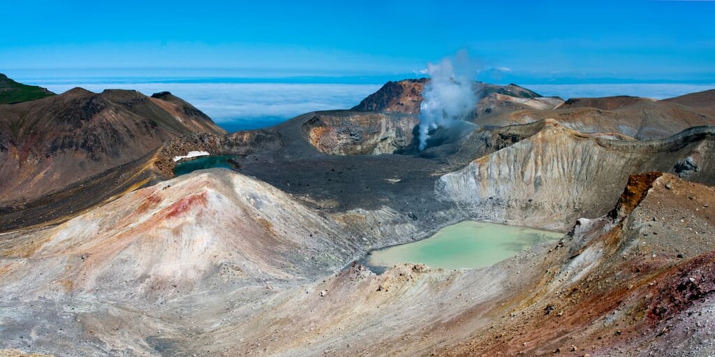
Paramushir is an ultimate fitness test, most common pleasures are accessible only to people in a good physical shape, unless we are talking about unlimited travel budgets that can cover expensive trips by boats and helicopters. Hiking programmes in this part of the Sakhalin Region are characterized by high complexity of routes. Not every person can cover the trails to see the crater of Bogdanovich Volcano, Malovodny Lake, the caldera of Karpinsky Volcano, the hot springs in the upper reaches of the Yuriev River, Lake Emerald and Glukhoe (Outlandish) Lake or visit the peaks of Ebeko (1,156m) and Chikurachki (1,817m).
Onekotan is an uninhabited island that often features in tours to Paramushir. It is worth visiting because of Koltsevoye Lake (Ring Lake). Being 369m deep, it is the deepest lake of the Far East. The lake is situated in Krenitsin volcano caldera, and has a perfect round shape with a kind of an island in the middle. Onekotan is the second largest island of the North Kurils.
The most comfortable weather for traveling in the Kuril Islands is from mid-June to mid-September which enjoy the lion's share of all local tourist programs. In June and July it rains the least, and August is considered the hottest month by the local standards - it is about +15°С (59F). The Southern Kurils are cooler than the Northern ones which enjoy warm currents and monsoons - in August the temperature is about +10-12C (50-54F), and in the Northern Kurils at the same time it is up to +16-18°C (60-65F).
September and October are the rainiest months with around 200mm of precipitation per month, and the air temperature in October seldom rises over +10°С (50F). The humidity in this region is quite high all year round, which contributes to the chills you feel.
In winter in the south, there are frosts down to -25°С (+13F), in the north it is a little warmer -16 or -18°С (3-0F).
Plant diversity is astounding. The Kurils can be compared to a botanical garden of enormous size, where spruce and vines, birch and yew and acacia, fir and hydrangea coexist side by side. Magnolias grow in the wild here. The gigantism of the local plants is mind-blowing, making you feel like you're in a sci-fi movie.
The richness and diversity of the flora is due to the peculiarities of the archipelago terrain: the presence of volcanoes and rugged terrain, large water areas, currents with water of different temperatures, as well as a variety of climatic conditions. On Iturup alone, there have been officially registered 741 plant species. Forests cover about 80% of the island, of which deciduous trees make up 50%, cedar forests account for 42% and conifers for 8%. The background plants are bamboo and cedar shrubs.
On the whole, the islands of the Large Kuril Ridge are dominated by dark coniferous forests made of fir and spruce. But the islands of the Lesser Kuril Ridge are covered only with mixed grass meadows and have no other vegetation.
The southern faunas of East Asia (Japan, China and the Amur Region) have influenced the fauna of the area. The wild animals include bear, fox, wolverine, sable, hare, squirrel, chipmunk, ermine, otter, European mink and even reindeer. By the way, minks did not appear in the region by themselves. They were released on the island of Iturup in 1981-1988 during the establishment of the natural reserves. Hopefully, they won’t become new rabbits of Australia.
Foxes can be found everywhere and in great numbers. The blue fox inhabits the island of Simushir, while the sable has taken a fancy to Iturup. In the last 20 years, such animals as spotted deer, muskrat and the Ussuri raccoon have become acclimatized on the Kuril Islands. Musk deer and Manchurian deer have also been registered.
Bears are not found on all the islands, but there are plenty of them in the northern Kurils. They are not at all afraid of humans and can easily be found near fishing camps and on the coasts. Usually, they are so keen on hunting fish that they may not pay any attention to humans. But you should be careful and carry bear repellent in case. For more rules of behaviour when you see a bear, check out our article on Paramushir.
There are great seal rookeries here. Nature itself provides plenty of opportunities to observe the life of different species of seals (sea lion, largha, insular seal and others). The jewel of the crown is the sea otter (Enhydra lutris), the largest among otters, which is a very valuable fur-bearing animal (it is on the verge of extinction).

Bird watching is very popular. There is a great diversity among birds: 100 species of nesting birds on Iturup Island alone. Some of them are listed in the Red Book. Sometimes you can even see auklets 'swarming' in the air in search of small crustaceans. These are small birds, the size of quail, gathering in huge flocks. It is an amazing sight!
The local rivers and lakes are simply swarming with fish: there is a wide variety of salmon, crucian carp, pike, wild carp, great Siberian sturgeon and others.
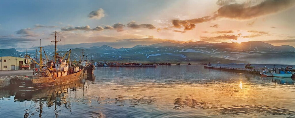
The Kurils remind of the Hotel California song: you can get in, but you cannot get out. It is not easy to get to the Kuril Islands, but it is even more difficult to get out. All Kuril transport - planes and ferries - hugely depends on the weather conditions, and they are far from being favorable in the Sea of Okhotsk. Flights are delayed not for hours, but for days, so, while planning your trip, it is always worth allowing for some reserve days for possible delays.
You can get to the Northern Kurils, Paramushir Island and the town of Severo-Kurilsk to be exact, from Petropavlovsk-Kamchatsky in Kamchatka by boat or by helicopter. Whereas the Southern Kuril Islands, Iturup Island and the town of Kurilsk, are usually reached from Sakhalin by plane from Yuzhno-Sakhalinsk airport Khomutovo to either Burevestnik or Iturup airport (both are located on Iturup Island) or by ferry from Korsakov port in Sakhalin to Kitoviy (Whale) port in Iturup.
Flights from Yuzhno-Sakhalinsk to Yuzhno-Kurilsk on Kunashir Island and to Kurilsk on Iturup Island are operated by Aurora Airlines. According to the schedule, the planes depart every day, but in reality depend on the weather. Travel time is 1 hour and 20 minutes one way and tickets usually start from 400 USD round trip. Keep in mind that you should buy tickets in advance, because sometimes they are sold out several months before your planned arrival time.
In 2019, the government of the Sakhalin Region began subsidizing helicopter flights. The prices are quite reasonable, from 2,300 rubles to 3,100 rubles (25-35USD approx.) one way. According to the local people, flying between the islands by helicopter is a tricky business and much depends on your luck. Flights are often postponed, sometimes they do not take off at all. I do not know how things will work out in 2021, but there is already some progress - you can see the schedule and buy tickets for helicopter flights online on the Aurora website.
A sea voyage is the most reliable way to get to and from the Kuril Islands, the ship's voyages are rarely cancelled or rescheduled. The schedule is published on the website of the Sakhalin Region administration. As of March 2021, tickets to the islands cost from 3613 rubles for accommodation in a four-bed cabin without amenities to 8127 rubles for a deluxe cabin and from 1376 to 3080 rubles for a ticket between islands.
The boat Igor Farkhutdinov departs from Korsakov port in Sakhalin twice a week to the islands of Kunashir, Shikotan and Itupur, this is the same route with several stops. There is a very likelihood you will be able to buy tickets online in advance. Tickets are usually sold at the Korsakov port office in Yuzhno-Sakhalinsk, you cannot buy them in the port itself. Departure times may vary from a few hours to a day. The boat voyage lasts about 20 hours. Don’t expect the luxury conditions but still, the ferry is quite decent. There are four- and two-bed cabins and suites with private facilities, on board there is a cheap restaurant and a bar (the prices are higher than on the land), as well as a small library.
You can only buy a one-way ticket, the return tickets are sold after the departure of the ship that is why you have to register to buy them.
When crossing from Sakhalin to Kunashir many passengers complain of sea sickness, so have some pills to quench that sensation just in case.
To visit the Kuril Islands, you need a border zone pass which is issued by the Sakhalin branch of the FSB Coast Guard in Yuzhno-Sakhalinsk. The application may be submitted on workdays from 9:30 to 10:30 a.m. (you need only your passport and its photocopy, which can be made on site), the next morning the pass will be ready, there are usually no problems with obtaining it.
If you try to go to the Kurils without a pass, the least punishment is a fine of about 500 RUR, and the maximum is you will be sent back to Sakhalin by the same flight. The pass is issued only for the islands specified in the application, so you need to specify all the places you are going to visit.
When planning a trip to Iturup, you should consider getting a border zone permit a few days (or better a week) before the departure date, and getting a photo and video shooting permit. You can apply for these documents in Yuzhno-Sakhalinsk at the address: 63a Pobedy Ave. Tel.: +7 424 249 21 04.
Finding a place to stay is a hardcore quest. The tourist infrastructure can hardly be called developed. There are several small hotels on Kunashir, one on Iturup, three or four hostels on Paramushir. The total hotel stock is about 70 rooms, there are no large hotels, and all the buildings are low-rise because of the high seismicity of the region.
It is not possible to book a room through popular online booking systems - these hotels are not represented there. One must book directly by telephone (not every hotel has online booking forms and even their own website) or through a travel agency.
The average cost of living is about 3,000 rubles per night for a room for two. The conditions are rather Spartan, but there is a bed and a bathroom in the room.
Travelling to Sakhalin and the Kuril Islands is an expensive treat. When traveling with a tour operator, it is important to consider:
If you are going on your own, take into account the hotel accommodation in hotels of Sakhalin and Kuril Islands (from 3000 rubles - approx. 40USD per night).
Meals from 1000 rubles (15USD) for dinner at the cheapest restaurant, from 3000 rubles (40USD) at a medium-class restaurant. Prices for products in supermarkets are higher than in other Russian regions. For example, 10 eggs or a kilo of bananas cost about 200 rubles (3USD).
Tours to Sakhalin and the Kuril Islands are not only for experienced tourists and those who love extreme, they are for all nature lovers and inquisitive people looking for unusual experiences. The main business is of course designed for rather robust outdoor activities. However, since some programs of tours are only one-day trips to nature with a return to the hotel, trips to the Kuril Islands are suitable for families with children and the elderly.
People go to the Kuril Islands for the spectacular scenery, to feel the energy of pristine nature and to stock memories to last a lifetime. Another irresistible temptation for tourists is food. Crab, fish, caviar, seafood - everything in the Kuril Islands is fresh and plentiful.
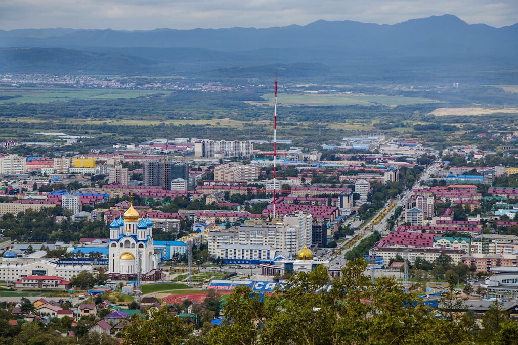
Kurilsk is considered to be the capital of the Kuril Islands, administratively it is a town in the Sakhalin Region, located on the island of Iturup in the Great Kuril Ridge. The town is situated at the mouth of the Kurilka River on the shore of the Kuril Bay in the Sea of Okhotsk.
The history of the town goes back to ancient times. At the end of the 18th century Russian explorers founded a new settlement on the site of the Ainu natives, who had existed here since the 2nd millennium BC. At the time of the arrival of Russian explorers, the village was called Shana, which in Ainu means ‘a large village on the lower reaches of the river’. In 1800, it was occupied without declaration of war by Japanese troops and in 1807 it was recaptured by Russians. In 1855. Iturup Island was ceded to Japan under the Treaty of Shimoda ("Japanese-Russian Treaty of Friendship"). Later, the settlement was renamed into Syana and the settlement was given the status of a town. In 1945, Iturup island was captured by the Red Army and incorporated into the USSR, and in 1947 the town of Syana received its present name, Kurilsk City.

The town is one of the smallest in Russia in terms of population, but it stands in an extremely rich area and impresses with the beauty of the surrounding landscape. It is home to a seaport, a pink salmon spawning factory, a seismic station, a weather station, and a tsunami warning station which can be visited with a guided tour. Fans of gastronomic tours can visit the fish factory where they can see the breeding of humpback salmon. Kurilsk even has its own museum of local history, with a collection of archaeological and ethnographic materials.
The Commander Islands are located in Kamchatka Region, but their visit is often included in tours to the Kuril Islands. The archipelago consists of two large islands: Medny (Copper) Island, Bering Island and many smaller ones.
The Commander Islands is a nature reserve which has 12 species of animals, 150 species of birds and 383 species of plants, protected by the state. The main reason why tourists come here is to see the northern fur seals. The more inaccessible southern part of Bering Island is home to reindeer. You can also see Pacific salmon here.
Tell us about your adventures on the Kuril Islands, we appreciate your feedback.


The highest peak in the Kuril Islands is Alaid, at 2,339 m.
The Kuril Islands have 375 named peaks.


