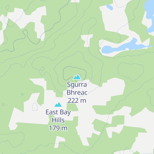
Sgurra Bhreac (alternative spelling 'Sgurra Breac'), sometimes referred to as the Big Rock, is a Canadian peak in the East Bay Hills of Cape Breton Island, an extension of the Appalachian mountain chain in the province of Nova Scotia. Sgurra Bhreac is a prominent rock outcrop, rising 50 m (160 ft) from the northern edge of The Big Barren, between the Breac Brook and Glengarry Valleys, and is the highest point on Cape Breton Island south of the Bras d'Or Lake with its summit at 222 m (728 ft).
By elevation Sgurra Bhreac is
# 3 out of 205 in Cape Breton Regional Municipality
By prominence Sgurra Bhreac is
# 15 out of 2294 in Nova Scotia # 2 out of 205 in Cape Breton Regional Municipality
We use GPS information embedded into the photo when it is available.
3D mountains overlay
Adjust mountain panorama to perfectly match your photos because recorded by camera photo position might be imprecise.
Move tool
Rotate tool
Zoom
More customization
Choose which peak labels should make into the final photo and what photo title should be.
Next
Photo Location
Satellitte
Flat map
Relief map
Latitude
Longitude
Altitude
OR
Latitude
°'''
Longitude
°'''
Apply
Register Peak
Peak Name
Latitude
Longitude
Altitude
Register
Teleport
PeakVisor
This 3D model of Sagarmatha National Park in Nepal was made using the PeakVisor app topographic data. The mobile app features higher precision models worldwide, more topographic details, and works offline. Download PeakVisor maps today.
Download OBJ model
PeakVisor
The download should start shortly. If you find it useful please consider supporting the PeakVisor app.
PeakVisor for iOS and Android
Be a superhero of outdoor navigation with state-of-the-art 3D maps and mountain identification in the palm of your hand!


_1.jpg)