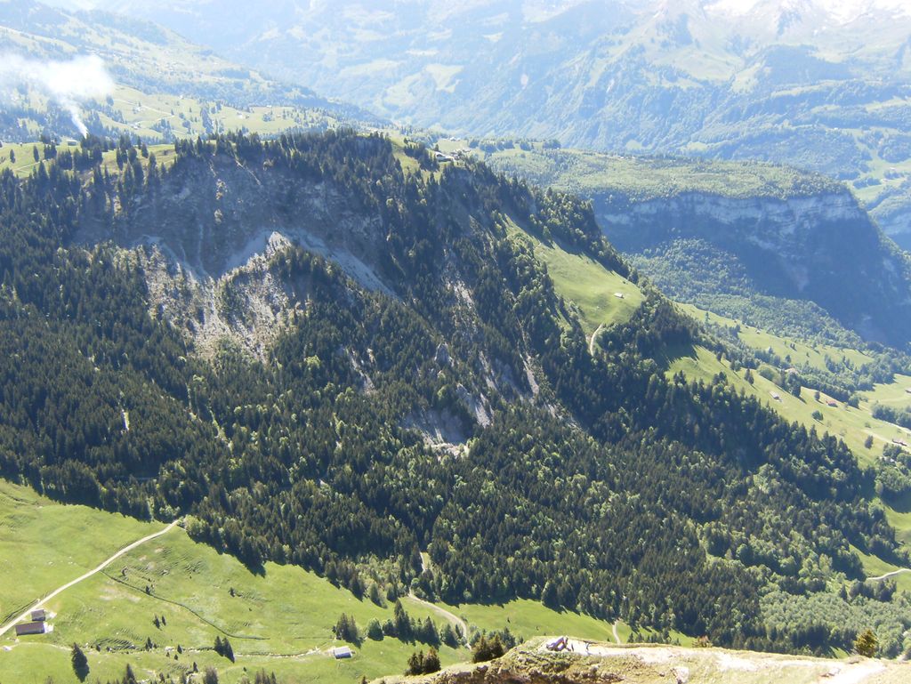
The Rotenfluh (also spelled Rotenflue) is a mountain in the Swiss Prealps, located east of Schwyz in Central Switzerland. It is part of the range surrounding the valley of Alpthal, culminating at the Gross Mythen. The Rotenfluh is a popular vantage point over the Lake Lucerne region.
The mountain is part of a ski area and is easily accessible from Rickenbach near Schwyz by the Rotenfluebahn, a gondola lift. Unlike the previous cable car, which culminated at an elevation of 1,527 metres, the current facility reaches a higher elevation, the upper station being within a few metres from the top. Several restaurants lie in the summit area.
There's a trail leading to the summit. Rotenflue is one of the 3 peaks along the Mythenweg.
The nearest mountain hut is Berggasthaus Rotenfluh located 388m/1 273ft SW of the summit.
By prominence Rotenflue is
# 45 out of 300 in Schwyz # 33 out of 212 in Schwyz
We use GPS information embedded into the photo when it is available.
3D mountains overlay
Adjust mountain panorama to perfectly match your photos because recorded by camera photo position might be imprecise.
Move tool
Rotate tool
Zoom
More customization
Choose which peak labels should make into the final photo and what photo title should be.
Next
Photo Location
Satellitte
Flat map
Relief map
Latitude
Longitude
Altitude
OR
Latitude
°'''
Longitude
°'''
Apply
Register Peak
Peak Name
Latitude
Longitude
Altitude
Register
Teleport
PeakVisor
This 3D model of Sagarmatha National Park in Nepal was made using the PeakVisor app topographic data. The mobile app features higher precision models worldwide, more topographic details, and works offline. Download PeakVisor maps today.
Download OBJ model
PeakVisor
The download should start shortly. If you find it useful please consider supporting the PeakVisor app.
PeakVisor for iOS and Android
Be a superhero of outdoor navigation with state-of-the-art 3D maps and mountain identification in the palm of your hand!