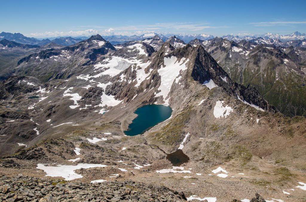
Piz Vatgira (2,982 m (9,783 ft)) is a mountain of the Lepontine Alps and part of the extended Saint-Gotthard Massif, located south of Sedrun in the canton of Graubünden. The mountain lies between the valleys of Nalps and Medel, about halfway between Lai da Nalps and Lai da Sontga Maria. On its east side is a small glacier ending in the lake named Lai Verd (2,702 m).
Piz Vatgira, or more precisely a lower 2,981 metre-high summit 350 metres south of the main summit, lies exactly above the Gotthard Base Tunnel, at its deepest point. The tunnel, the longest and deepest in the world, runs 2,450 metres (8,040 ft) below the ground. Piz Vatgira is the highest of the three main peaks above the base tunnel, the other two being the Chrüzlistock and Pizzo dell'Uomo.
We use GPS information embedded into the photo when it is available.
3D mountains overlay
Adjust mountain panorama to perfectly match your photos because recorded by camera photo position might be imprecise.
Move tool
Rotate tool
Zoom
More customization
Choose which peak labels should make into the final photo and what photo title should be.
Next
Photo Location
Satellitte
Flat map
Relief map
Latitude
Longitude
Altitude
OR
Latitude
°'''
Longitude
°'''
Apply
Register Peak
Peak Name
Latitude
Longitude
Altitude
Register
Teleport
PeakVisor
This 3D model of Sagarmatha National Park in Nepal was made using the PeakVisor app topographic data. The mobile app features higher precision models worldwide, more topographic details, and works offline. Download PeakVisor maps today.
Download OBJ model
PeakVisor
The download should start shortly. If you find it useful please consider supporting the PeakVisor app.
PeakVisor for iOS and Android
Be a superhero of outdoor navigation with state-of-the-art 3D maps and mountain identification in the palm of your hand!