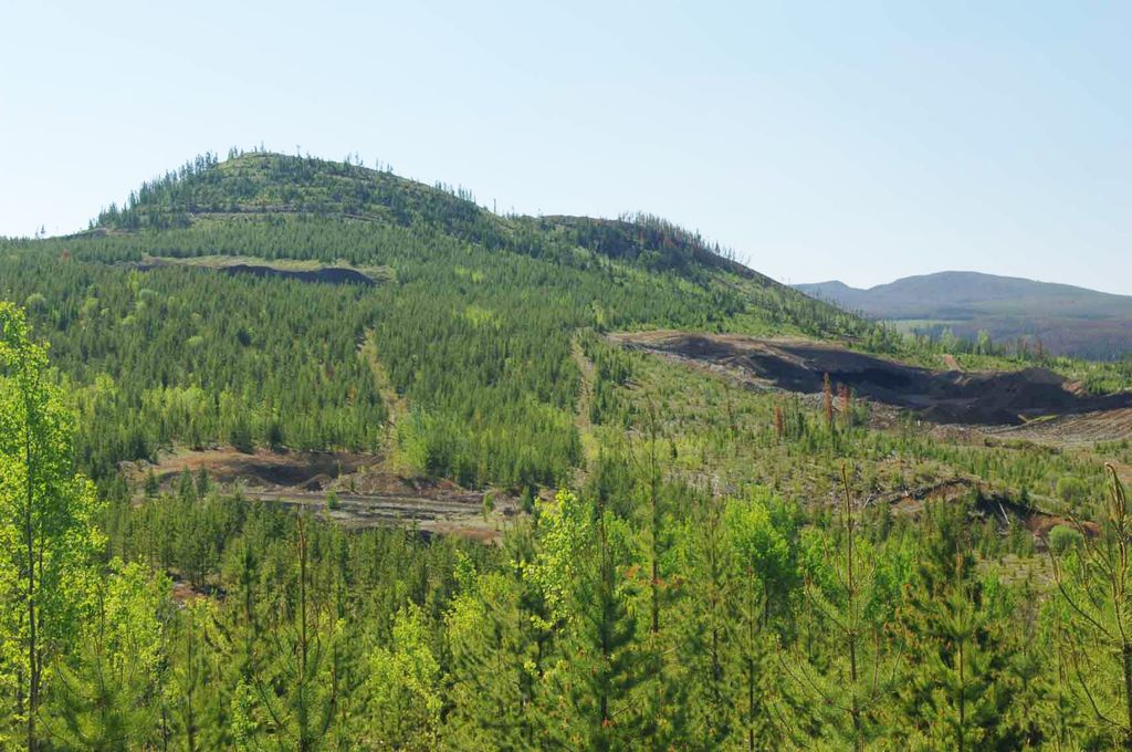
Nazko Cone is a small potentially active basaltic cinder cone in central British Columbia, Canada, located 75 km west of Quesnel and 150 kilometers southwest of Prince George. It is considered the easternmost volcano in the Anahim Volcanic Belt. The small tree-covered cone rises 120 m above the Chilcotin-Nechako Plateau and rests on glacial till. It was formed in three episodes of activity, the first of which took place during the Pleistocene interglacial stage about 340,000 years ago. The second stage produced a large hyaloclastite scoria mound erupted beneath the Cordilleran Ice Sheet during the Pleistocene. Its last eruption produced two small lava flows that traveled 1 km to the west, along with a blanket of volcanic ash that extends several km to the north and east of the cone.
We use GPS information embedded into the photo when it is available.
3D mountains overlay
Adjust mountain panorama to perfectly match your photos because recorded by camera photo position might be imprecise.
Move tool
Rotate tool
Zoom
More customization
Choose which peak labels should make into the final photo and what photo title should be.
Next
Photo Location
Satellitte
Flat map
Relief map
Latitude
Longitude
Altitude
OR
Latitude
°'''
Longitude
°'''
Apply
Register Peak
Peak Name
Latitude
Longitude
Altitude
Register
Teleport
PeakVisor
This 3D model of Sagarmatha National Park in Nepal was made using the PeakVisor app topographic data. The mobile app features higher precision models worldwide, more topographic details, and works offline. Download PeakVisor maps today.
Download OBJ model
PeakVisor
The download should start shortly. If you find it useful please consider supporting the PeakVisor app.
PeakVisor for iOS and Android
Be a superhero of outdoor navigation with state-of-the-art 3D maps and mountain identification in the palm of your hand!