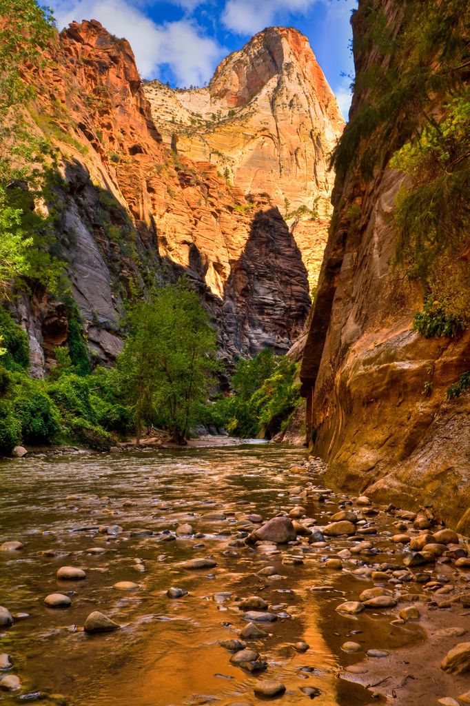
Mountain of Mystery is a 6,565-foot (2,001 m) Navajo Sandstone summit located in Zion National Park, in Washington County of southwest Utah, United States. Mountain of Mystery is situated above The Narrows, towering over 2,100 feet (640 meters) above the floor of Zion Canyon and the North Fork Virgin River which drains precipitation runoff from this mountain. This peak rises above Orderville Canyon on its north side, and Mystery Canyon on the south. Its neighbors include Mount Majestic, Cathedral Mountain, Observation Point, Cable Mountain, Angels Landing, and The Organ. This feature's name was officially adopted in 1934 by the U.S. Board on Geographic Names. The first ascent via the Northeast Buttress was made 15 September 2001, by Brian Cabe and Tom Jones.
By elevation Mountain of Mystery is
# 58 out of 92 in Zion National Park
By prominence Mountain of Mystery is
# 27 out of 236 in Washington County # 13 out of 92 in Zion National Park
We use GPS information embedded into the photo when it is available.
3D mountains overlay
Adjust mountain panorama to perfectly match your photos because recorded by camera photo position might be imprecise.
Move tool
Rotate tool
Zoom
More customization
Choose which peak labels should make into the final photo and what photo title should be.
Next
Photo Location
Satellitte
Flat map
Relief map
Latitude
Longitude
Altitude
OR
Latitude
°'''
Longitude
°'''
Apply
Register Peak
Peak Name
Latitude
Longitude
Altitude
Register
Teleport
PeakVisor
This 3D model of Sagarmatha National Park in Nepal was made using the PeakVisor app topographic data. The mobile app features higher precision models worldwide, more topographic details, and works offline. Download PeakVisor maps today.
Download OBJ model
PeakVisor
The download should start shortly. If you find it useful please consider supporting the PeakVisor app.
PeakVisor for iOS and Android
Be a superhero of outdoor navigation with state-of-the-art 3D maps and mountain identification in the palm of your hand!