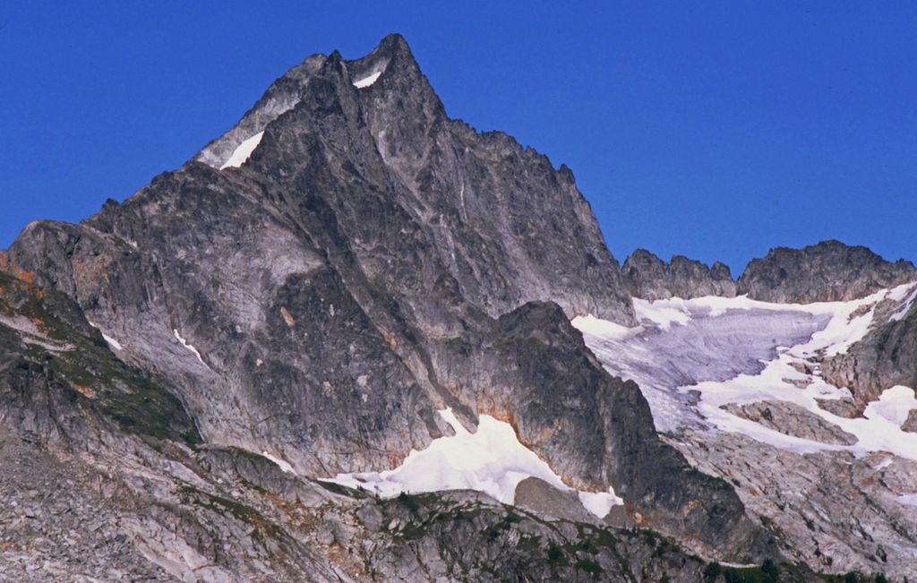
Mount Torment is a 8,120+ -foot (2,470+ m) high peak in the North Cascades of Washington in the United States. It is located approximately 65 miles (105 km) northeast of the city of Everett. First ascended on August 23, 1946, its name originates from the first ascent party, because of "the torture of a hot day with only one orange for quenching thirst." Since then, Mount Torment has gained popularity because of the Torment-Forbidden Traverse to neighboring Forbidden Peak, an exposed alpine route.
The North Fork Cascade River rises in a basin below Mount Torment and flows several miles west to the Cascade River. Numerous waterfalls are found in this valley.
By elevation Mount Torment is
# 32 out of 137 in Skagit County # 45 out of 123 in North Cascades National Park
We use GPS information embedded into the photo when it is available.
3D mountains overlay
Adjust mountain panorama to perfectly match your photos because recorded by camera photo position might be imprecise.
Move tool
Rotate tool
Zoom
More customization
Choose which peak labels should make into the final photo and what photo title should be.
Next
Photo Location
Satellitte
Flat map
Relief map
Latitude
Longitude
Altitude
OR
Latitude
°'''
Longitude
°'''
Apply
Register Peak
Peak Name
Latitude
Longitude
Altitude
Register
Teleport
PeakVisor
This 3D model of Sagarmatha National Park in Nepal was made using the PeakVisor app topographic data. The mobile app features higher precision models worldwide, more topographic details, and works offline. Download PeakVisor maps today.
Download OBJ model
PeakVisor
The download should start shortly. If you find it useful please consider supporting the PeakVisor app.
PeakVisor for iOS and Android
Be a superhero of outdoor navigation with state-of-the-art 3D maps and mountain identification in the palm of your hand!