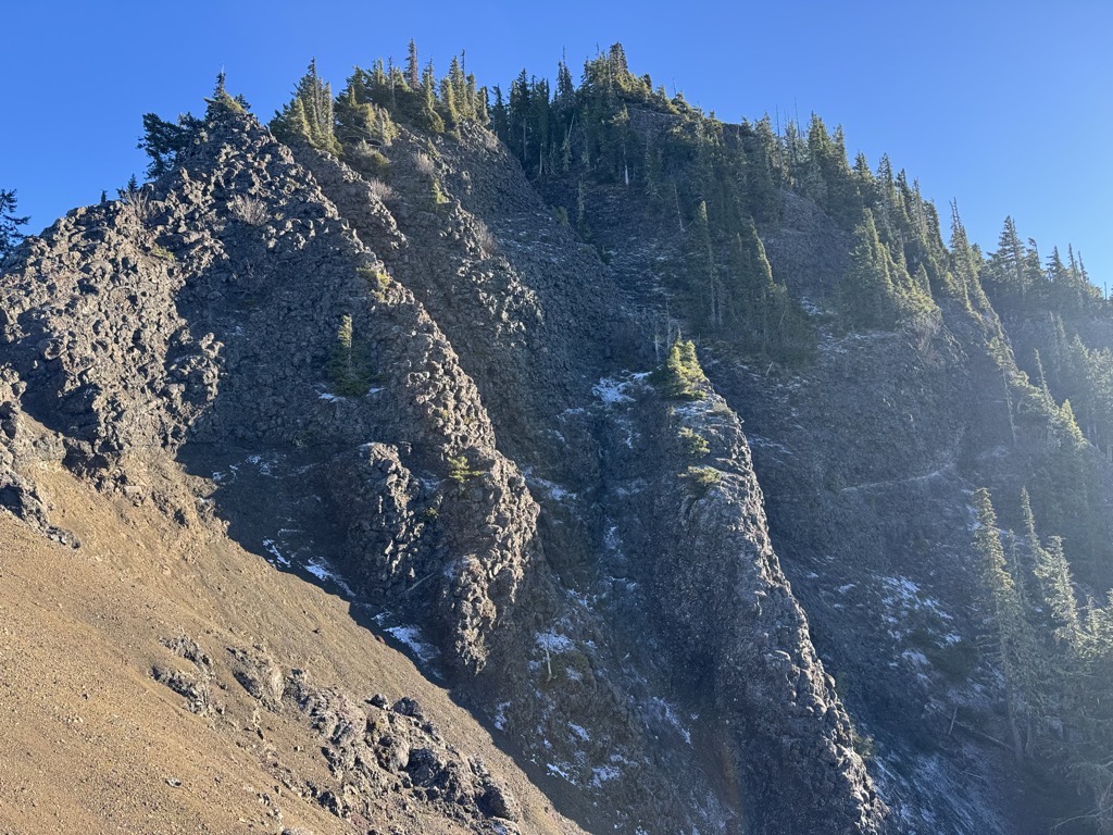
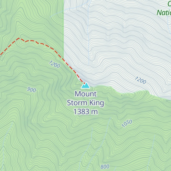
Mount Storm King is located within the Olympic National Park about 20 miles west of Port Angeles, Washington. The mountain is located on the south side of Lake Crescent near Barnes Point, and has an elevation of 4,500+ feet (1,370+ m).
The trail to the summit starts near the Storm King Ranger Station, and initially follows the trail to Marymere Falls but branches to the north after a short distance. The first 1.9 miles (3.1 km) is on maintained trail but the rest of the climb involves scrambling on loose rock with some exposure.
By elevation Mount Storm King is
# 48 out of 125 in Clallam County # 40 out of 100 in Olympic National Forest
By prominence Mount Storm King is
# 32 out of 125 in Clallam County # 37 out of 100 in Olympic National Forest # 49 out of 144 in Olympic National Park # 95 out of 284 in the Olympic Mountains
We use GPS information embedded into the photo when it is available.
3D mountains overlay
Adjust mountain panorama to perfectly match your photos because recorded by camera photo position might be imprecise.
Move tool
Rotate tool
Zoom
More customization
Choose which peak labels should make into the final photo and what photo title should be.
Next
Photo Location
Satellitte
Flat map
Relief map
Latitude
Longitude
Altitude
OR
Latitude
°'''
Longitude
°'''
Apply
Register Peak
Peak Name
Latitude
Longitude
Altitude
Register
Teleport
PeakVisor
This 3D model of Sagarmatha National Park in Nepal was made using the PeakVisor app topographic data. The mobile app features higher precision models worldwide, more topographic details, and works offline. Download PeakVisor maps today.
Download OBJ model
PeakVisor
The download should start shortly. If you find it useful please consider supporting the PeakVisor app.
PeakVisor for iOS and Android
Be a superhero of outdoor navigation with state-of-the-art 3D maps and mountain identification in the palm of your hand!