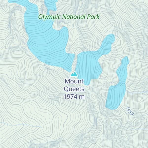
Mount Queets is a 6,476-foot (1,974-metre) mountain summit located deep within Olympic National Park in Jefferson County of Washington state, United States. With a good eye and clear weather, the top of the mountain can be seen from the visitor center at Hurricane Ridge. The nearest higher peak is Mount Meany (6,695 ft), 0.8 mi (1.3 km) to the south. Due to heavy winter snowfalls, Mount Queets supports the Queets Glacier in a cirque on its north slope, despite its modest elevation. Precipitation runoff from the mountain drains into the headwaters of both the Elwha River and Queets River. There are scrambling routes ranging from class YDS 2 via the North Ridge, class 3 via the ridge from Mt. Meany, and class 4 via the Queets Glacier.
By elevation Mount Queets is
# 41 out of 113 in Jefferson County # 45 out of 144 in Olympic National Park # 49 out of 284 in the Olympic Mountains
By prominence Mount Queets is
# 67 out of 113 in Jefferson County # 85 out of 144 in Olympic National Park
We use GPS information embedded into the photo when it is available.
3D mountains overlay
Adjust mountain panorama to perfectly match your photos because recorded by camera photo position might be imprecise.
Move tool
Rotate tool
Zoom
More customization
Choose which peak labels should make into the final photo and what photo title should be.
Next
Photo Location
Satellitte
Flat map
Relief map
Latitude
Longitude
Altitude
OR
Latitude
°'''
Longitude
°'''
Apply
Register Peak
Peak Name
Latitude
Longitude
Altitude
Register
Teleport
PeakVisor
This 3D model of Sagarmatha National Park in Nepal was made using the PeakVisor app topographic data. The mobile app features higher precision models worldwide, more topographic details, and works offline. Download PeakVisor maps today.
Download OBJ model
PeakVisor
The download should start shortly. If you find it useful please consider supporting the PeakVisor app.
PeakVisor for iOS and Android
Be a superhero of outdoor navigation with state-of-the-art 3D maps and mountain identification in the palm of your hand!